----------------------------------------------------------------------------------------------------------------------------------------------------------------------------------
A Trip Through The Middle
----------------------------------------------------------------------------------------------------------------------------------------------------------------------------------
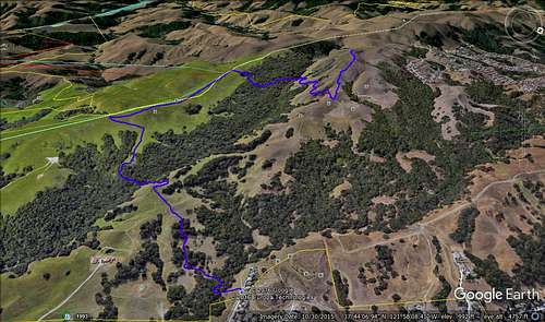
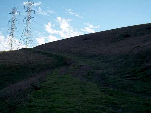
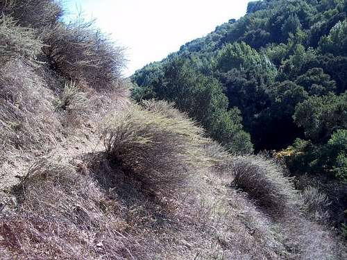
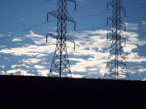
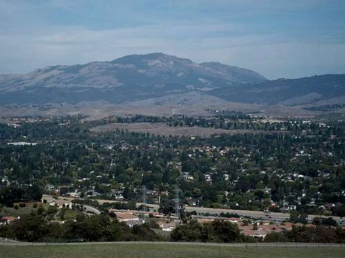
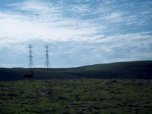
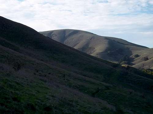
Today i would like to share a trip from a couple years ago, i would have posted this if i knew about the site at the time. Not really to sure what i would call the area as my path cuts right up between Dublin Hills Regional Park and Bishop Ranch Regional Open Space. My ultimate goal was to reach Harlen Hill, neighboring with Wiedemann Hill. I remember once i moved to Dublin and looking into local hiking areas such as Dublin Hills, Pleasanton Ridge, Las Trampas but the only thing i had on my mind was "i wanna go to Harlen Hill". The location its self is sadly not accessible to public and is pretty tricky to get to as there are almost constant obstacles i encountered from MY path. So the day i set out to complete the trip began for me at 10am at the end of a street called Winding Creek Way from which then i went south down a large slope into a woodsy creek that would greet me with a rusted gate like barbed fence that led me away from civilization. That gate is iconic to me and that area i swear hahaha, wish i had a picture of it. My plan on to reaching Harlen Hill was to follow the 4 power lines to the summit of the ridge and find the service trail that led there. After i got out of the first creek i proceeded to the first power line trying to stay as hidden as possible knowing that the whole area and the area around is a very active farm land. When i came across the first pair of power lines i found a safe place to catch my breath and prepare for the next stage. After my break i came up to power line number 2 and this is where things became alot more challenging. To reach power line number 3 i had to descend one of the steepest hills i have ever faced, it was to the point where it was almost completely vertical, only options of descent was a little gulch that ran down the hill into a cliff and the faded cattle trails that provided SO MUCH help. At the very bottom was a rather large creek with barley any water. Looking at my next climb above me is power line number 3 this climb is by far the hardest, scariest part of the trip because not only is it almost as bad as the one i had just descended it is also in a deep and damp part of the woods that made the mud and grass incredibly slippery. To get past this climb i used any cattle trail i found, i also used my switchblade to dig into the ground to keep from slipping. After the climb i made it to power line number 3 and stopped for a good while and had lunch all that was left was to hit the old service trail to power line number 4 on the summit ridge. When i made it to power line number 4 i was completely blown away by the view of the east bay and parts of the bay area, after taking it all in i proceeded north west along the ridge where i came across a large group of cattle that had baby caff and bulls. While walking by them a large black bull was ever so slowly following me until i made it to a small group of trees, then it started to charge at me. I immediately ran behind all the trees that were near me then when i was out of its sights i went down a little bit of the ridge and continued to follow it north west knowing that i was on a much to steep of slope for it to actually charge again. Other than that i found the service trail that led to Harlen Hill, so long that i keep my head down it was smooth sailing the rest of the way. Once i made it to the summit of Harlen Hill i just felt satisfaction and accomplishment. The whole trip took a total of 7 hours with multiple stops some of which were 15-20mins long. One last thing to note is that the whole trip was on private land (not accessible to the public). For any info regarding this area feel free to email me at bhollow10@hotmail.com or private message. THANKS FOR THE READ AND SAFE TRAVLES :D
----------------------------------------------------------------------------------------------------------------------------------------------------------------------------------
-Wildlife/Ranged animals seen: Cattle, Horses, Deer, Fox, many various wild birds including red tailed hawks
-Interesting landscapes: Cliffs, lush old farmlands, vast array of rolling hills, dark dense woods, a LARGE amount of creeks
-Time: Starting time was 10am. Ending time was 5pm
-Difficulty: Strenuous, With dangerous areas
----------------------------------------------------------------------------------------------------------------------------------------------------------------------------------PICTURES (sorry their is not alot of pics i didnt think i was gonna be posting about this back then hahaha)
Comments
No comments posted yet.