
-
 10295 Hits
-
 88.6% Score
-
 27 Votes
|
|
Mountain/Rock |
|---|---|
|
|
34.27230°N / 118.0143°W |
|
|
Los Angeles |
|
|
Hiking |
|
|
Spring, Summer, Fall, Winter |
|
|
5408 ft / 1648 m |
|
|
Overview
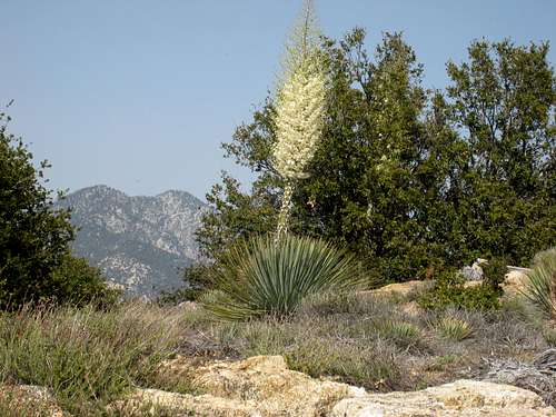
This little peak along the Angeles Crest Highway is hiked via firebreak along either east or west ridges and affords excellent views of Mt. Baldy to the east and the main Mt. Wilson crest to the southwest. There are conflicting stories of which Sally the peak is named after. According to the Sierra Club’s HPS peak list site, one, Sally Neuman, was on the staff of then Angeles National Forest Supervisor Mendenhall’s staff. A friend put her name on a map as a joke and the name stuck. A competing story is that another Sally, Sally Henry, a hiking lady and a striking lady, set hearts aflutter among Forest Service males. Upon her passing, the same Supervisor Mendenhall approved the naming of the peak after her.
 Summit of Mt. Sally looking NE
West Ridge Route
 Sally's summit looking east from west ridge
 1-mile long west ridge from TH to summit
The west ridge route begins from the Silver Moccasin/Rincon Road trailhead. From the trailhead (4780’), hike about 100 meters up (east) Angeles Crest Highway where you will see on your right a firebreak entry onto the ridge. Hike east on the firebreak. After about ½ mile, you will by-pass a bump from which Mt. Sally is visible. The total distance to the summit is about 1 mile with 600 feet of gain.
 Mt. Markham from low on west ridge
East Ridge Route This ridge has an entry point right off of the Angeles Crest Highway exactly 1.7 miles beyond (east of) the Silver Moccasin/Rincon Road trailhead. The entry point is on the south side of the highway. Get onto the low ridge, go right, and hike west (and slightly south) to the summit. The total distance is about ¾ miles with 400 feet of gain. The bump you see to the west from the summit is lower than Mt. Sally.
 Looking down east ridge from near summit
 Summit from east ridge
Driving Directions
West Ridge Route
 Trailhead sign and part of west ridge
From the 210 Freeway, exit at Angeles Crest Hwy (SR 2) and go north. At 9.5 miles, you will come to the Clear Creek Information Station and junction with Angeles Forest Highway. Continue straight and in 4.5 more miles you will come to the junction with the Mt. Wilson Road at the Red Box Ranger Station and trailhead. From here, continue straight on SR2 for 5 miles more to the signed Silver Mocassin/Rincon Road trailhead. Walk about 100 meters up the road and you find the firebreak entry to the ridge.
 Looking northeast along west ridge
East Ridge Route Follow the driving directions as above except that, from the Silver Mocassin/Rincon Road trailhead, proceed 1.7 more miles where you will encounter a pull-out on the right with enough space for parking. Alternatively, you will spot places to park on the north side of the highway. At the east end of the pull-out/parking area, you will see a faint trail entry point that will get you onto the low ridge
Red Tape
You will need an Adventure Pass or Golden Eagle Pass (see link below) to park your vehicle anywhere within the Angeles National Forest, including the trailhead and parking area mentioned here. These passes are currently sold at the Clear Creek Information Station and the Red Box Ranger Station ($5 per day or $30 for a yearly pass), which stations you pass on the way to the trailhead. Otherwise, Adventure Passes are also sold at most sporting good stores in Southern California. No permits are required for hiking.
Camping
There are no nearby camping facilities.
When to Climb/Mountain Conditions
All year round. However, equip yourself appropriately when there is snow cover in the winter. Check forecast information in local newspapers or internet weather services during the winter months. Check with Cal Trans (see link below) on road conditions and closures
Other Information
USGS Topos Chilao Flat 7.5
External Links
Angeles National Forest Adventure Pass information California Dept. of Transportation