
|
|
Area/Range |
|---|---|
|
|
54.17254°N / 5.95559°W |
|
|
Hiking, Trad Climbing, Sport Climbing, Bouldering, Scrambling |
|
|
Spring, Summer, Fall, Winter |
|
|
2789 ft / 850 m |
|
|
Overview
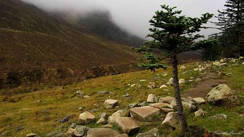
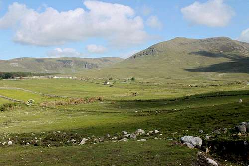
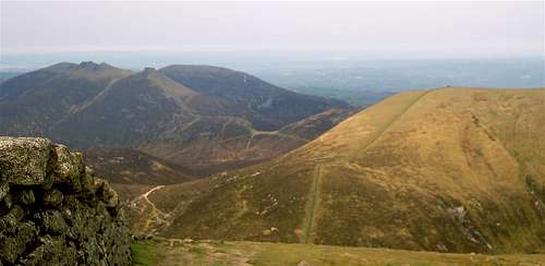
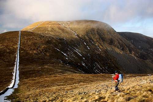 Hiking in the Mournes by Tomek Lodowy | 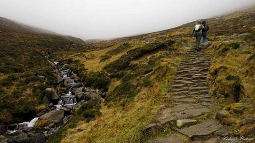 On the Trail to Slieve Donard |
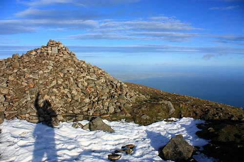
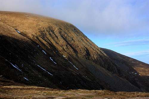
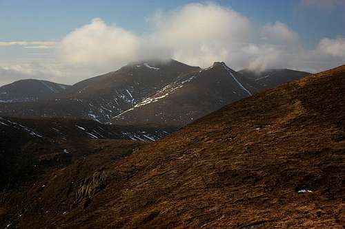
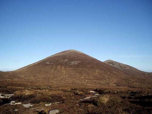
The Mourne mountains are not your average mountain range, this place is quite famous to say the least. John Lennon sang about it in his song The luck of the Irish. The Mournes influenced C.S. Lewis to write the Lion, the witch and the wardrob. Parts of the popular series Game of Thrones are recorded here and the Mournes are often referred to in the hit series Boardwalk Empire.. These things alone are already quite something, and this is just the tip of the iceberg…The Mourne Mountains are a mountain range in County Down, southeast Northern Ireland. This granite mountain range is also referred to as ‘the Mountains of Mourne’ or just ‘The Mournes’. The Mourne mountains are home to the highest mountains of Northern Ireland with Slieve Donard being the highest at 850 meters above sea level (2790 ft).
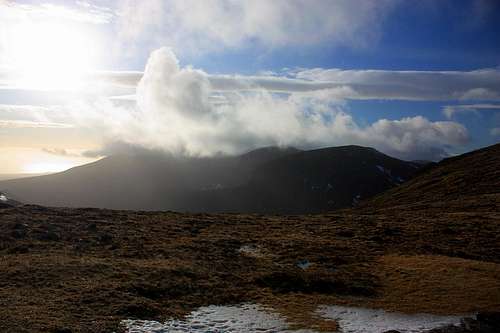
The name Mourne is derived from the name of a Gaelic clann (Group) called the Mughdhorna. The Mournes is a very popular hikers destinations seeing many visitors each year. It is a place of wild beauty, with rugged granite peaks with grassy slopes. The granite outcrops are often covered by mosses, a sign of the wet climate present. Besides wet, the Mourne mountains are a windy place. It is common to have strong winds on the higher summits in the area. Also thick layers of mist and rain showers are very likely to be encountered here. Even though these weather factors might not look so appealing, they certainly add to the rugged beauty of this area. The Mournes are located directly to the west of the Irish Sea. This means that from the summit of Slieve Donard and Slieve Commedagh, you have beautiful views over this wild Sea.
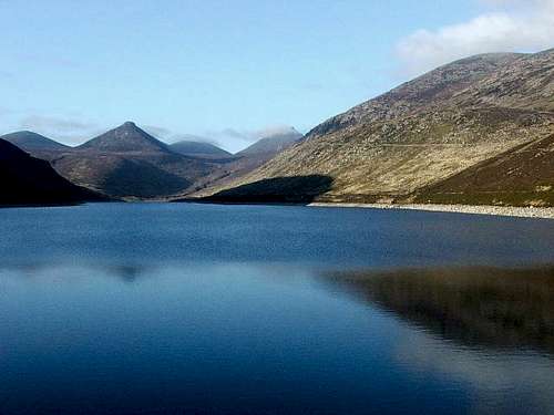 Silent Valley Reservoir by WoundedKnee | 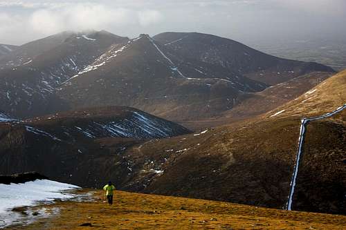 Slieve Bearnagh & Slieve Meelmore by Tomek Lodowy |
The Mournes are home to many rock climbing routes. The many granite cliffs and other outcrops make it an ideal place for rock climbing. It is the number 1 rock climbing spot in Northern Ireland and has 26 separate crags, with a total of 900 routes in all grades.
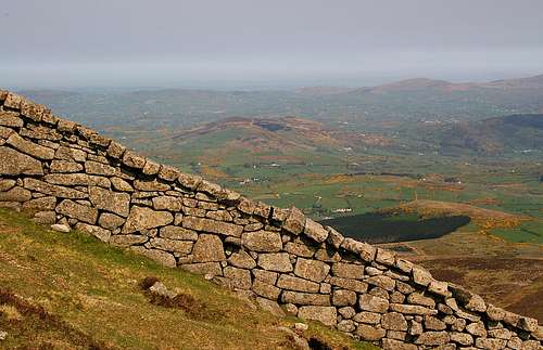
The Mournes is famous for its unique rugged looks, but even more famous for its huge wall: The Mourne Wall. This wall was built in the 19th century, construction took almost 18 years to complete. This stone wall leads over many of the summits in the Mournes, including the highest ones: Slieve Donard and Slieve Commedagh. It is a beautiful sight to say the least. The wall was originally constructed to serve as a watershed. More about the wall is the section below. The Mourne mountains have been proposed as the first National Park of Northern Ireland. The area is partly owned by the Nation Trust of Northern Ireland, making the discussion controversial.
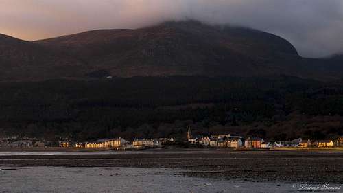
 Glen River Path with Slieve Donard | 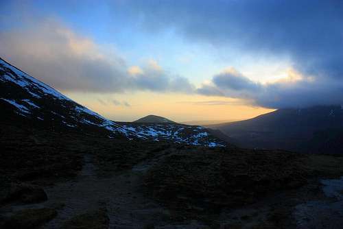 Evening time above Annalong river valley by Tomek Lodowy |
The Mournes are a perfect destination for a week of hiking and enjoying nature, but even in a single day it is possible to ‘experience the Mournes. From Newcastle, you can make day trips to for example Slieve Donard, Rocky Mountain or Slieve Commedagh. But remember, even though the highest peak is only 850 meters above sea level, you still have to climb every single vertical meter, since the ascents start literally at sea level, in this case at Newcastle Beach. Hiking in the area is possible all year long. I climbed Slieve Donard myself in winter, which was great. In summer the area is a little busier, but the chance of good weather is of course, higher as well.
Hiking
“The Mourne Mountains have a varied and complex character which means you can walk there for a lifetime and still discover new places yet compact enough to allow you to climb many mountains in a single day.” Dawson Stelfox, first Irishman to summit Everest.
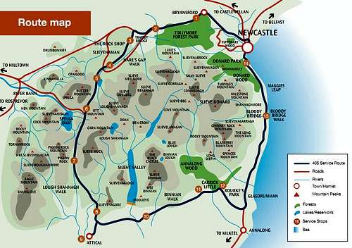 Mourne Mountains Map |  Mourne Mountains Topgraphical Map |
The Mourne Mountains are filled with an unrivalled network of paths and tracks, providing hikers with an enormous amount of possibilities in the area. Many of the hiking trails are located in the higher parts of the Mournes and are graded T2 ,T3 and some above. But there are also easy hiking paths to be found in the lower parts of the Mournes, for example in the Silent Valley or the Tolleymore Forest Park. From a hikers point of view, there is something to enjoy here for everyone.
Some of the more interesting hikes, involving summiting one or more of the peaks are described here:
Conquer the peaks (23.4 miles, 3 days)
This 3 day journey scales the six highest peaks of theMournes: Donard, Commedagh, Binnian, Bearnagh, Meelbeg and Meelmore. It takesabout 5 to 6 hours of walking each day. This tout is suitable for experienced hikers with a high level of fitness.
See the links below for a detailed day to day route description:
Day 1: slieve donard, commedagh and bearnagh
The best of the Mournes (15.3 miles, 2 days)
This is your best option when you only have a short time to visit the Mournes and want to see and enjoy as much as possible during your stay: A 2 day itinerary summiting Slieve Binnian and Slieve Bernagh. These two peaks are widely regarded as two of the best mountain hikes in the Mourne Mountains. This is a very beautiful, reasonably strenuous option suitable for experienced hikers. Last but not least it is also possible to scale Slieve Donard within these two days.
The Mourne Wall Challenge (22 miles, one day)
This is the most awesome of the hiking options in the Mournes. The Mourne wall challenge follows the Mourne Wall along its total lengths of 22 miles. Along the way, you will climb 7 of the 10 highest mountains of the Mournes. (Slieve Binnian,Slieve Muck, Carn Mountain, Slieve Loughshannagh, Slieve Meelbeg, SlieveMeelmore, Slieve Bearnagh, Slieve Commedagh, Slieve Donard.) In the late 1980’s hostellers in the area started an annual challenge walk, following the Mourne Wall along the mountain peaks in a single day. Over the years this event grew in popularity and the local hostels used it as a fundraising event. It eventually grew from 50 or 60 people taking part to 3 to 4000 bringing thousands of supporters with them along the route. However, this event was eventually cancelled due to very severe erosion along the route. It is still possible however to take part in this challenge in your own small groups (no more than 12 people). As you can imagine, this route is only for those who are very fit and have enough hiking experience.
Day 1: The Mourne wall challenge
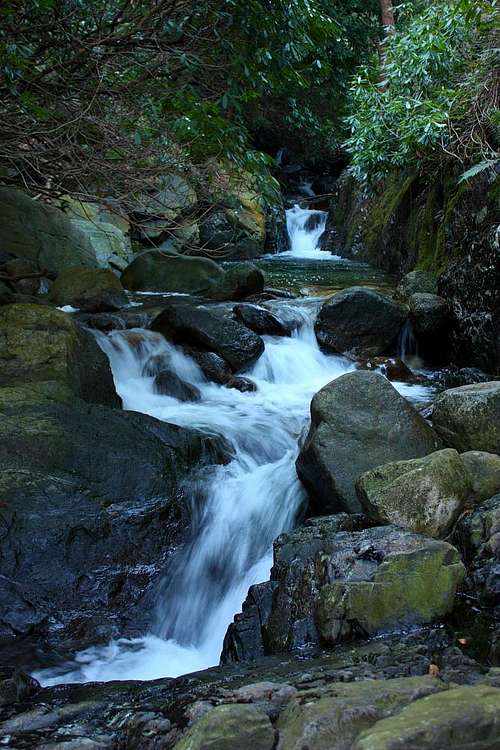 | 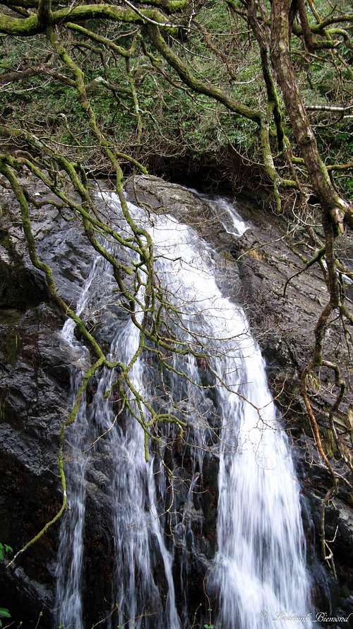 Glen River Falls |  |
Rock Climbing
The Mourne mountains are home to a huge amount of rock climbing possibilities, with nearly a 1000 Routes spread over 26 different crags. The Mournes are the number 1 rock climbing destination in Northern Ireland. Routes of all different difficulty levels are present here. The longest route (165m) in the Mournes is Called FM,a rather easy multi-pitch, 45 degrees climb on the south face of Slieve Lamagan. It is also one of the most well-known routes here. It was named by Ray Johnston, the first person to climb it in the late forties.
The Mournes rock climbing area is considered one of the most quiet rock climbing areas in the UK that offer such a variety and quality of climbs as wellas easy access. There is a great book written about the rock climbing called ‘Rock Climbs in the Mourne Mountains’’ by Simon Moore, Craig Hiller and Ricky Bell (see section Maps and Books)
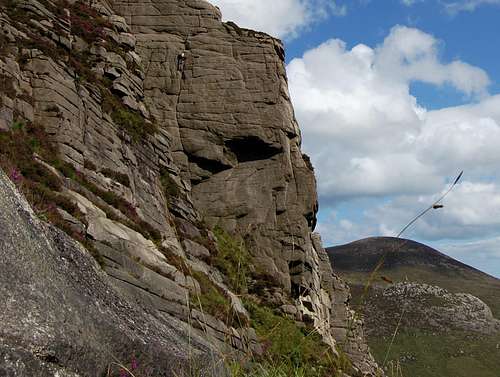 Rock Climbing in the Mournes | 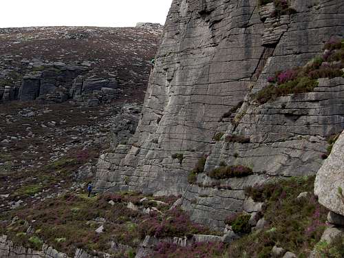 Lower Cove Rock Climbing |
Here is a description of some of the popular crags in the area:
Lower Cove
Climbs: 108 – Rocktype Granite – Altitude 429m a.s.l – Faces S
Crag features: The extensive buttresses of Lower Cove are among the steepest and best in the Mournes, better and more continuous than they appear from a distance, with excellent routes at every grade from Severeto E8. Mostly single pitch (15-45m). Don't miss out on the entertaining cave scramble!
Lower Cove Routes - By UKclimbing.com
Ben Crom
Climbs: 92 –Rocktype: Granite – Altitude: 398m a.s.l – Faces: SE
Crag features: Ben Crom is situated high at the end of Silent Valley, and boasts some of the best crags in the Mournes. The Main Face offersmany fine climbs mainly in the HVS-E3 range while other buttresses lower downgive numerous shorter routes. Single and multi pitch (10-90m).
Ben Crom Routes - By UKclimbing.com
Binnian North Tor
Climbs: 82 –Rocktype: Granite – Altitude: 636m a.s.l – Faces: all
Crag features: The best of the Binnian tors, home to some desperate slab lines as well as good climbs in the lower to middle grades. Alsothe best concentration of bouldering in the Mournes.
Binnian Routes - By UKclimbing.com
A very detailed description of every crag and every route can be found here: Mournes Crags and Routes - By UKclimbing.com
The Mountains
|
The Mourne Wall
 Mourne Mountains Wall by ZachStone | 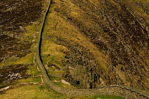 Mourne Wall by ZachStone |
The most famous thing about the Mournes is probably its wall: The Mourne Wall. The wall was originally constructed to serve as a watershed. The wall is 22 miles (35.5 km) long, enclosing 9000 acres of land all of which drains into the Silent Valley and Ben Crom reservoirs. The wall was built from 1904 until completion in 1922, resulting in a construction time of almost 18 years. The wall itself spans over 9000ft (2743m) of ascent, rising and falling over 15 of the highest peaks in the Mournes. These peaks are: (listed clockwise from the Kilkeel River):
Slievenaglogh 445 m (1,460 ft), Slieve Muck 674 m(2,211 ft), Carn Mountain 587 m (1,926 ft), Slieve Loughshannagh 619 m (2,031ft), Slieve Meelbeg 708 m (2,323 ft), Slieve Meelmore 684 m (2,244 ft), SlieveBearnagh 727 m (2,385 ft), Slievenaglogh 586 m (1,923 ft), Slieve Corragh 691 m(2,267 ft), Slieve Commedagh 765 m (2,510 ft), Slieve Donard 850 m (2,790 ft), RockyMountain 525 m (1,722 ft)*, Slieve Binnian 747 m (2,451 ft), Wee Binnian 460 m (1,510 ft) and Moolieve332 m (1,089 ft).
The wall was made from natural granite stone using dry stone walling techniques. On average the wall is about 1.5 metres high and 0.9 metres thick. The Silent Valley Reservoir was created to hold the water in the catchment and is used to supply Belfast with water. It was argued back in the days that the wall was quite useless as it fences off 22 miles of barren and desolate mountains. However, at the time, it brought a lot of very welcome employment, and the main purpose of enclosing the area was to isolate the catchment area from the effects of cattle on the water quality. Northern Ireland Water is owning and managing it nowadays.
How to get there
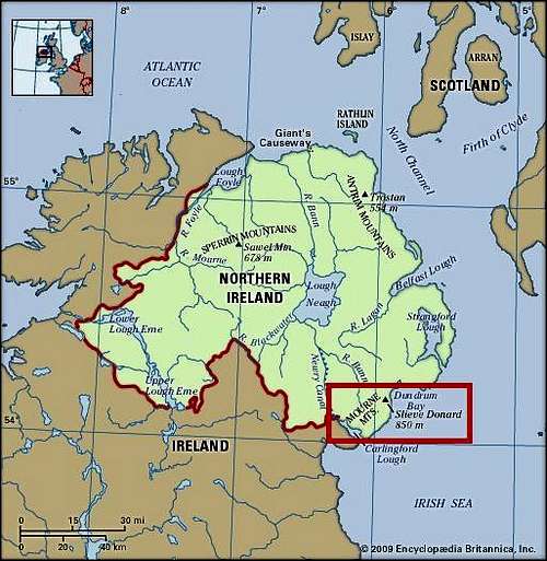
Mourne Mountains: Location Map
Starting point for most climbs/hikes is Newcastle. Newcastleis located 35 Miles south of Belfast. Mostpeople visiting Northern Ireland arrive at the airport in Belfast. Itis an hour drive from Belfast to Newcastle.
If you are travelling to the Mourne Mountains from Dublin by car you can expect to reach Newry in around 90 minutes. If you are planning on basing yourself in Newcastle, from Newry, simply follow the A25 to Rathfriland and continue on to Castlewellan. Drive through Castlewellanand take the A50 signposted Newcastle.
For a more scenic drive through the Mournes you may wish to take the B8 Hilltown and B180 Bryansford roads to Newcastle. Similiarly, the A2 Coast Road follows Carlingford Lough and passes through the quaint coastal villages of Greencastle, Kilkeel and Annalong before reaching Newcastle, although this route will take considerably longer.
Maps and Books
The best map for walking in the Mournes is the OSNI Mourne Activity Map 1:25 000 available from Ordnance Surveyof Northern Ireland (OSNI) website www.osni.gov.uk.Also available is the OSNI Sheet 29 1:50000 Both these maps can be purchased in most Tourist Information Centres. Further walk descriptions, images and downloadabledetailed maps are available free of charge from www.walkni.com
The Mournes Walks – Paddy Dillon
ISBN-13: 978-1847171412
Northern Ireland, A walking Guide – Helen Fairbairn
ISBN-13: 978-1848891500
Mournes: A Rock-climbing Guide to the Mourne Mountains– Robert Bankhead
ISBN-13: 978-0902940147
Rock Climbs in the Mourne Mountains - Simon Moore,Craig Hiller and Ricky Bell
ISBN: 978-0902940-29-1.
 |  |  |
Vegetation and Wildlife
Grasses are most dominant in the Mournes. Aside from that the most common plants found in the Mournes are heathers. Three species of heathers are found: the cross-leaved heath (erica tetralix), the bell heather (erica cinerea), and the ling (calluna vulgaris). Other plants which grow in the area are: bog cotton, roseroot (Rhodiola rosea), harebell (Campanula rotundifolia), marsh St John's wort, wild thyme (Thymus serpyllum), wood sorrel and heath spotted orchids.
Sheep are often to be seen in the Mourne mountains, they graze high up in the mountains. The range is also home to birds, including the common raven, peregrine falcon, wren, buzzard, and native meadow pipit, grey wagtail, stonechat and snipe. The golden eagle, a former inhabitant, has not been seen in the Mournes since 1836.
 The Mourne Wall & Mournes | 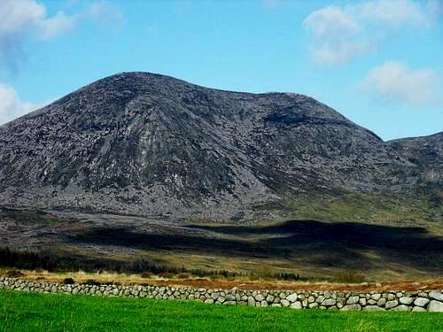 Slievelamagan |
Hotels
|
Camping
|
Leave no Trace
 Slieve Donard from the North @ Newcastle Beach | 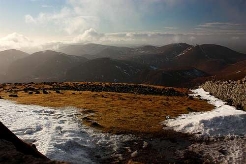 Donard summit view by Tomek Lodowy |
Leave No Trace is an Outdoor Ethics Programme designed to promote and inspireresponsible outdoor recreation through education, research, and partnerships.As increasing numbers of people seek the beauty and exhilaration of outdoor recreation, our collective mark on the environment and its natural processes, increases. Litter, disturbance to vegetation, water pollution, wildlife, livestock and other people are all indicators of the need to develop a national ethic that protects both natural andcultural heritage. Techniques designed to minimise the social and environmental impacts to these areas are incorporated into the Leave No Trace Outdoor Ethics Education Programme as seven principles.
The Seven Principles of Leave No Trace
1. Plan Ahead and Prepare
2. Be Considerate of Others
3. Respect Farm Animals and Wildlife
4. Travel and Camp on Durable Ground
5. Leave What You Find
6. Dispose of Waste Properly
7. Minimise the Effects of Fire
Practising a Leave No Trace ethic is very simple: Make it hard for others to see or hear you and LEAVE NO TRACE of your visit. For more information on Leave No Trace, please visit www.leavenotraceireland.org
Tourist Information Centres
|
Walking Guides
|
Using a walking guide will give you unparalleled access to local knowledge, history and insight as to how and why the Mournes have inspired so many over the years. Below is a list of walking guides for the Mournes, a full list of walking providers in Northern Ireland can be found at www.walkni.com/useful-info/walking-providers