Toggle navigation
Mountains
Routes
Images
Trip Reports
Forum
What's New
People
Areas & Ranges
Articles
Trailheads
Canyons
Huts & Campgrounds
Albums
Logistical Centers
Fact Sheets
Lists
Custom Objects
Gear
Plans & Partners
WELCOME TO SUMMITPOST
SIGN IN
REGISTER
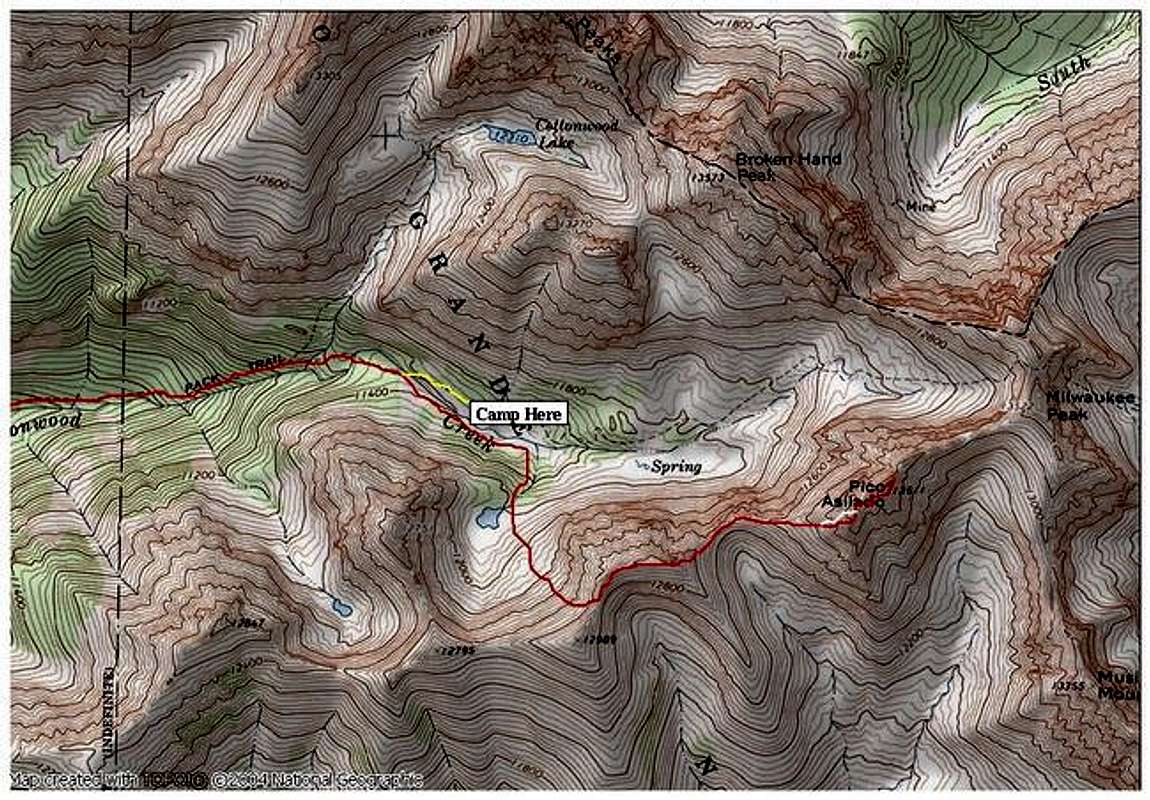
The yellow portion is where...
View High-Resolution Image
The yellow portion is where...
The yellow portion is where the topo shows the trail but we couldn't locate it and followed the red route on the south side of the creek. The white route is class 3 and 4 variation on solid rock to the wide gully. TOPO by National Geographic
« PREV
NEXT »
Kane
on
Jun 29, 2005 5:43 pm
Comments & voting
Other parents
Lat/Lon:
37.94440°N / 105.5584°W
Image ID:
112693
3264 Hits
79.04
% Score
10
Votes
Log in to vote
Comments
No comments posted yet.
to post!
Don't have an account?
Pico Aislado
(Mountain/Rock)
You are at
the First
Image
Viewing
#1 of 1
GALLERY
You are at
the Last
Image
Kane's Image Gallery
« PREV
Viewing
#530 of 1853
GALLERY
NEXT »
Pico Aislado
(Mountain/Rock)
Loading....
×
You need to login in order to vote!
User Name
Password
Remember me
Forgot your password?
Log me out when I close my browser.
Keep me logged in all the time.
sign in as a user
Don't have an account?
Register now for FREE
Rating available
Suggested routes for you
People who climb the same things as you
Comments Available
Create Albums
Register Here


