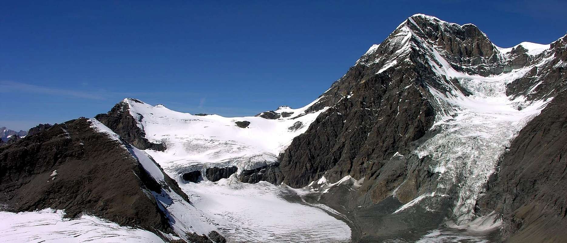
Big mountain just close to the Grande Tête de By, very popular for ski-mountaneering and hiking. Sited on the border line between Italy and Switzerland. As all the summits of the ridge it overhangs the Glacier du Mont Durand, but is vanishing in the big himalayan shape of Combins on which it gives a wonbderful view.
Montagna massiccia parallela alla Grande Tête de By molto frequentata per l'escursionismo e lo sci-alpinismo. Situata sull'asse della cresta di confine italo-elvetica, domina, come tutte le altre vette della costiera, il Glacier du Mont Durand, ma scompare davanti alla massa himalayana dei Combins sui quale proietta una splendida vista.
First Ascents
First on the summit: F. W. Jacomb and J. B. and Michel Croz, (Aug 07th, 1861).
In winter: Unknown.
W Arête: Paolo Ferrario and Carlo Semenza, (Aug 13th, 1913).
N-NW Wall: Edmondo Deffeyes and Pier Luigi Falcoz, (Aug 15th, 1935).
Getting There
BY CAR:
From Torino, Milano, etc: Motorway A5. Exit at Aosta Est.
From Switzerland: through the Grand Saint Bernard Tunnel or the namesake pass.
From France: through the Mont Blanc Tunnel or Petit Saint Bernard Pass. It is not necessary to take Motorway A5: you can drive on SS.26, in the direction of Aosta.
BY PLANE:
Aeroporto "Corrado Gex" Saint Christophe (Aosta).
Itinerary
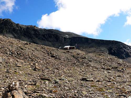
From Aosta East exit of the motorway, follow along the SS.27 for the Gran San Bernardo Tunnel After about ten KM turn to the right toward Valpelline (964m), creoss it and turn to the left to get Ollomont (1.335m) and the small built area of Glacier (1.549m), where you must start walking. Enter the mule track to By before the bridge and follow up to Farinet House where you must take the left branch toward Franco Chiarella-Amiante Refuge (2.979m, 4h'00/4h'30).
Dall'uscita del Casello Autostradale di Aosta Est, proseguire sulla SS.27 in direzione del tunnel del Gran San Bernardo; dopo circa un decina di chilometri svoltare sulla destra verso il Paese di Valpelline (964 m). Dopo averlo superato svoltare sulla sinistra e raggiungere il Paese di Ollomont (1.335 m); proseguire sino alla Frazione di Glacier (1.549 m), dove inizia l'itinerario a piedi. Da Glacier prendere la mulattiera prima del ponte, che sale a By, seguendola sino alla Casa Farinet, ove si prende il ramo di sinistra per il Rifugio Franco Chiarella-Amiante (2.979 m4h'00/4h'30).
Route
From the Refuge Franco Chiarella-Amiante, to go back eastward between debris and until to reach the large blocks of the rocky banconata that comes down from north, to surpass these blocks on the right hand above an I stand out (3.130m about), dominating the Gabelou Pass (3.020m). To continue the ascent on returning not very obvious until the peak (1h'15/1h'30 from the refuge).
Descent: from the same route.
Dal Rifugio Franco Chiarella-Amiante, risalire verso est tra detriti e sfasciumi fino a raggiungere i grandi blocchi della bancata rocciosa che scende da nord, superare questi blocchi sulla destra sopra un risalto (3.130 m circa), dominante il Colle di Gabelou (3.020 m). Continuare la salita su tornanti non molto evidenti sino alla vetta (1h'15/1h'30 dal rifugio).
Discesa: lungo la via di salita.
Difficulty
This route can be considered E/BSA.
L'itinerario è classificato E/BSA.
Equipment
Standard mountaineering or ski mountaineering equipment.
Parents refers to a larger category under which an object falls. For example, theAconcagua mountain page has the 'Aconcagua Group' and the 'Seven Summits' asparents and is a parent itself to many routes, photos, and Trip Reports.

 9463 Hits
 83.1% Score
 16 Votes