
-
 309 Hits
-
 0% Score
-
 0 Votes
|
|
Mountain/Rock |
|---|---|
|
|
38.96550°N / 106.48358°W |
|
|
Hiking |
|
|
Spring, Summer, Fall |
|
|
13088 ft / 3989 m |
|
|
Overview
Elevation:13,088'
CO Rank: 579
CO 13er Rank: 526 of 584
Range: Sawatch
Lat/Lon: 38.96526, -106.48304
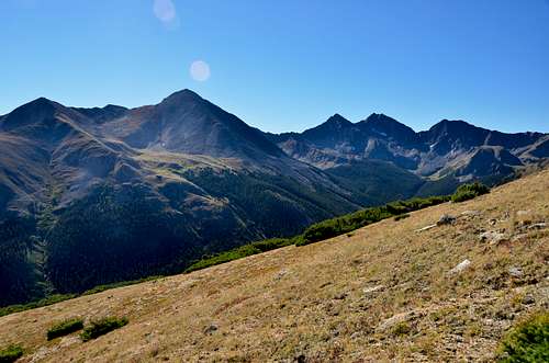
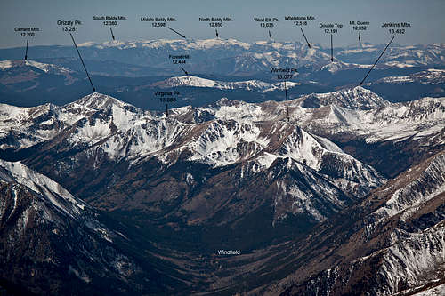
Virginia Peak can be climbed alone or in combination with four other 13er summits in a single day and still get back in time for dinner. This is one of those rare setups where you can easily bag five summits in a single day, and do it with relative ease. The trailhead is accessible by either 4WD or vehicles with good ground clearance. The same trailhead is used as the one for climbing Huron Peak from the west side. Passenger vehicles can easily make it to Winfield, but attempting the full five-peak circuit from Winfield will add nearly 4 more miles to the day. If planning on completing the full circuit, nothing will exceed Class 2 and the overall terrain is easy with a good chance to spot some wildlife. Lidar increased the elevation of this summit from 13,088 ft. to 13,094 ft.
|
|
|
Getting There
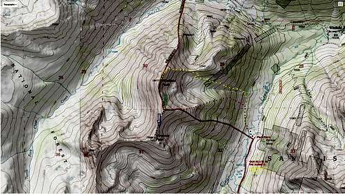
Virginia Peak is sequenced with four other summits for a five-summit day. There are two ways this hike may be started.
- From the vicinity of the Banker Mine, there is a single-lane vehicle track that heads SW down toward the creek, cutting through some willows. Cross the creek and pick up the trail on the other side. The trail makes two switchbacks up the hillside, then heads SW to cross the broad SE ridge of Virginia Peak down low, before gaining much elevation.
- Drive to the end of the road and the trailhead parking. Walk about 100 yards south along the old roadbed/trail and look for an opening in the forest on the right (west). Depart the trail heading west and work through willows and marshy areas to cross the creek just below the confluence of the main branch and the SW fork coming in from Silver Basin. Once across, head NE some to intersect the trail mentioned in #1 above and from there, you should be on the broad SE ridge of Virginia Peak. This way of getting across the creek is more challenging with some willow-bashing involved.
|
|
|
|
|
|
|
|
|
|
|
|
Route
|
|
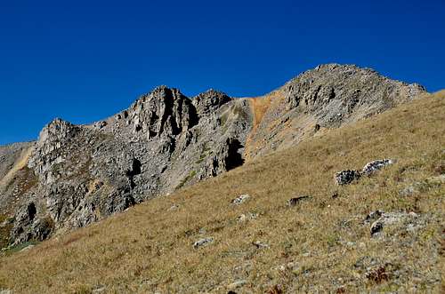
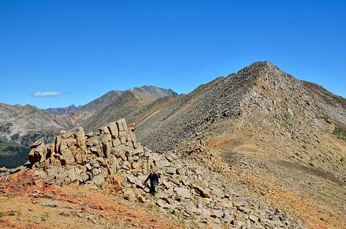
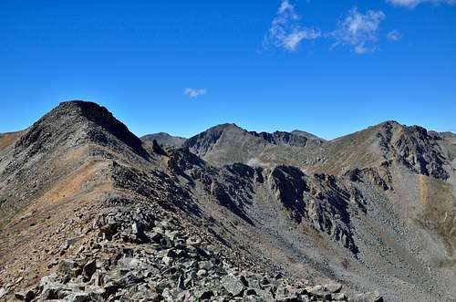
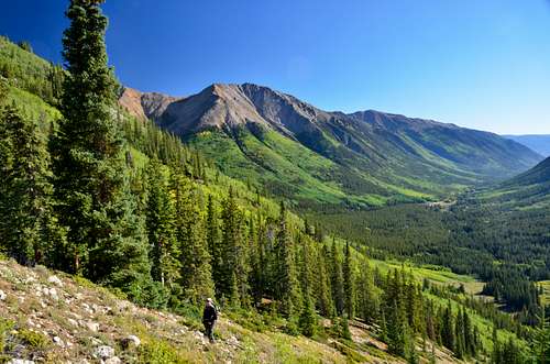
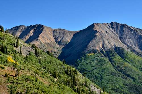
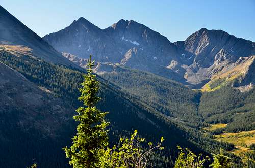
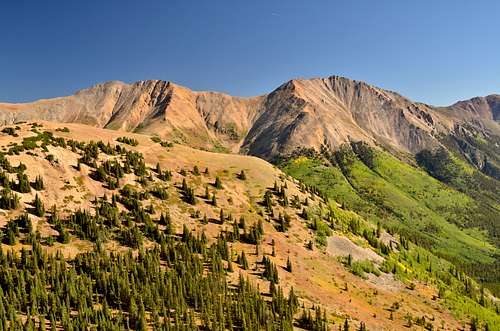
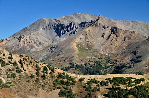
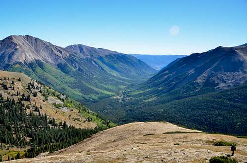
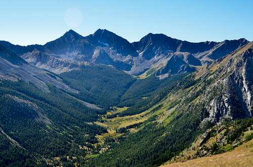
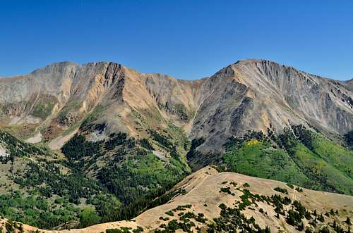
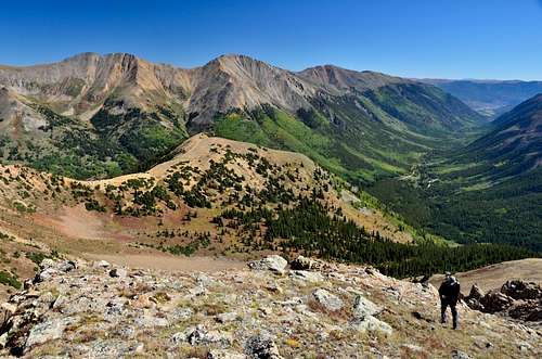
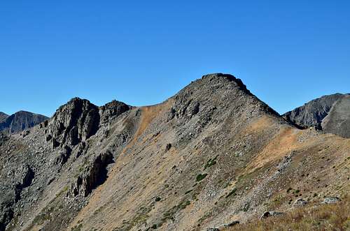
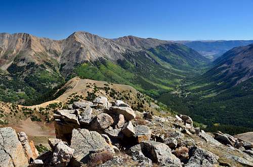
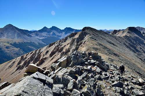
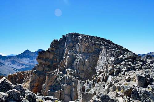
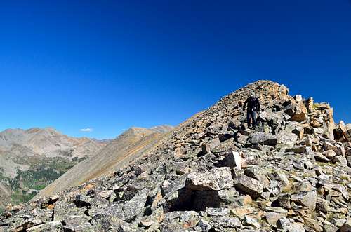
Once you've located the broad SE ridge, pick one of two open slopes, filled with summer wildflowers that will lead up to the ridge proper. It's fairly steep initially. The hike up Virginia Peak offers one of the nicer views around. You can look south down the valley toward the Ice Mountain complex (or Three Apostles), poised in stunning array of rock and snow with a beautifully clear blue sky as backdrop. As you ascend the SE ridge on the grassy slopes, you may frequently stop for photos. We encountered some bench-like areas with diminutive trees that offered nice foregrounds. As we hiked higher, climbing out of the trees, we began to see numerous Old-Man-On-the-Mountain, all with their yellows heads turned toward the morning sun. Other summer flowers spotted the landscape as we ascended on diminishing tundra to the first summit of the day – Virginia Peak. From the township of Winfield, Winfield Peak is the more noticeable summit, but technically, it is not ranked and Virginia Peak is, being about 11 feet taller. Pause at this nice summit and enjoy the stunning view. In 2009, there was a register to sign. Enjoy the low, alpine flowers. Overall, reaching this summit is a pleasant hike of moderate steepness that can be completed in about 2.5 hours. Most of the terrain is grass & tundra with plenty of wildflowers, and increasing embedded rock and minor talus as you approach the summit.
|
|
|

|
|
|
Red Tape
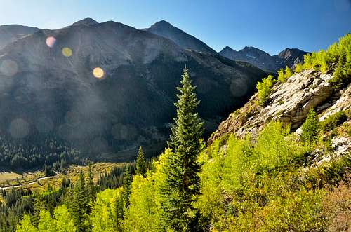
With eight "fourteeners" (peaks exceeding 14,000 feet in elevation), Collegiate Peaks Wilderness probably possesses the highest average elevation of any Wilderness in the Lower 48. You can climb Mounts Yale, Oxford, Columbia, and Harvard (the state's third highest point), as well as Huron Peak, Missouri Mountain, Mount Belford, and La Plata Peak (the state's fifth highest point).Climbing these peaks is a very popular activity, making opportunities for solitude very elusive. Expect to be inundated by people and their dogs on any "fourteener" trail. As you travel through the area, you might notice unusual and deep indentations in the boundary line. These are a legacy of man's hunt for gold and other valuable metals that are still sought just outside. More than a dozen trailheads create a situation in which no one ever stands more than five miles from a road. About 40 miles of the serpentine Continental Divide snake across the area, and this expansive Wilderness lies in parts of three national forests. The beauty of this place and its ease of access ensure torrents of visitors, especially on weekends. Please help keep Wilderness wild by following Leave No Trace practices. In particular, please refrain from having camp fires near treeline. The dwarfed Krummholtz trees that grow there are taking a beating from insensitive campers.
LEAVE NO TRACE
How to follow the seven standard Leave No Trace principles differs in different parts of the country (desert vs. Rocky Mountains). Click on any of the principles listed below to learn more about how they apply in the Collegiate Peaks Wilderness.
- Plan Ahead and Prepare
- Travel and Camp on Durable Surfaces
- Dispose of Waste Properly
- Leave What You Find
- Minimize Campfire Impacts
- Respect Wildlife
- Be Considerate of Other Visitors
When to Climb
Spring, Summer, Fall
Camping
Free camping is available along the left side of County 390 from highway 24 to the trailhead. There is no formal campground- just available primitive campsites. Many have fire rings and are near a creek. If you have a 4WD drive I would recommend camping along the 4WD road between the South Winfield Trailhead and the closure gate. This road is 2 miles long and the last mile of it is where there are some extremely nice free campsites. The sites are on the right side of the road, quite spacious, and have a creek and tremendous views. Even if you dont have a 4WD it might be worth it to park at the South Winfield TH and pack your camping gear a mile or so up the road to get these primo campsites.