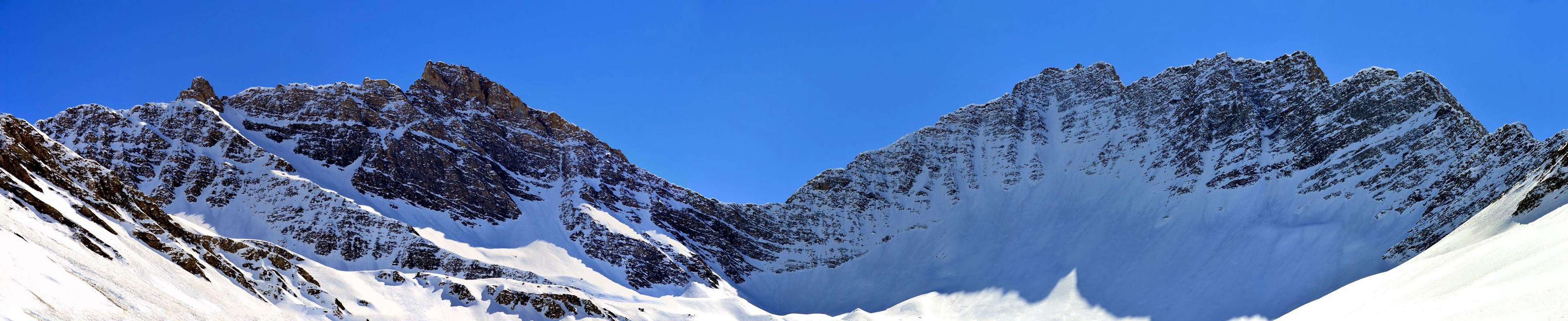
Small but acute and elegant Summit in the shape of a rocky turret (3.142m) positioned between the Aiguille d'Artanavaz or also d'Artereva (3.071m) to the North-Northeast and the Aiguille de Bonalé or also of Bonalex (3.201m) to South-southwest, all contained in the small Sub-group of Grande Rochère (3.326m). Probably its placename derives from "Malus Attratcus", a Latin word indicating a scarcely sunny and not too inviting place (Kurz I, 53 and "ALPS PENNINE VOLUME I", page 113 by Gino Buscaini Edit CAI / TCI 1971. Very rarely climbed (the first ascent is in July 1892) lately it has been "rediscovered" thanks to a ski-mountaineering itinerary that from Lavachey (1.642m) in Ferret Valley (at the feet of Mont Blanc/Grandes Jorasses Range) goes up the Vallone di Malatrà and with final route on the Southwest Slope.
Piccola ma acuta ed elegante Sommità a forma di torretta rocciosa (3.142 m) posizionata tra l'Aiguille d'Artanavaz od anche d'Artereva (3.071 m) a Nord-nordest e l'Aiguille de Bonalé od anche di Bonalex (3.201 m) a Sud-sudovest, tutte sommità contenute nel piccolo Sottogruppo della Grande Rochère (3.326 m). Probabilmente il suo toponimo deriva da "Malus Attratcus", termine latino indicante un luogo scarsamente soleggiato e non troppo invitante (Kurz I, 53 ed "ALPI PENNINE VOLUME I", pag. 113 di Gino Buscaini Edit. C.A.I./T.C.I. 1971. Cima molto raramente salita (la prima ascensione è del Luglio 1892) ultimamente è stata "riscoperta" grazie ad un itinerario sci-alpinistico che da Lavachey (1.642 m) in Val Ferret (ai piedi della Catena Monte Bianco/Grandes Jorasses) risale il Vallone di Malatrà e con percorso finale sul Versante Sudovest.
First Ascents
First on the Summit: unknown hunters, but surely by Alfred George Topham with the mountain guide Jean Maitre, (July 16th, 1892) with traverse to Aiguille de Bonalé.
In winter: Unknown.
North-northeastern Crest (from the Artanavaz/Malatrà Collar about 3070/75 meters): Alfred George Topham and mountain guide Jean Maitre, (July 16th, 1892).
West-southwest Couloir and Southwest Ridge in the final part (Standard Via from Val Ferret; ski-mountaineering route): unknown.
South-southeast Face (directly from Bonalex Cabin): Osvaldo Cardellina and Marco Cossard; in the mid-seventies, starting from Planaval.
Southwest Crest (East Face Aig. de Malatrà with crossing to Artanavaz): Osvaldo Cardellina, Emilio Bertona and Gianfranco Vicentini; from Planaval Hamlet, Bonalé Alp, Eastern Face of Aig. de Malatrà and traverse towards Aig. of Artanavaz through North-northeast Crest in descent and Southwest in ascent, (Jul 29th, 2001).
Getting There
BY CAR:
From Torino, Milano, etc: Motorway A5. Exit at Morgex or Courmayeur.
From Switzerland: through the Grand St. Bernard Tunnel or the homonym pass.
From France: through Mont Blanc Tunnel or Petit St. Bernard Pass.
BY PLANE:
Aeroporto "Corrado Gex" Saint Christophe (Aosta).
Specific Road
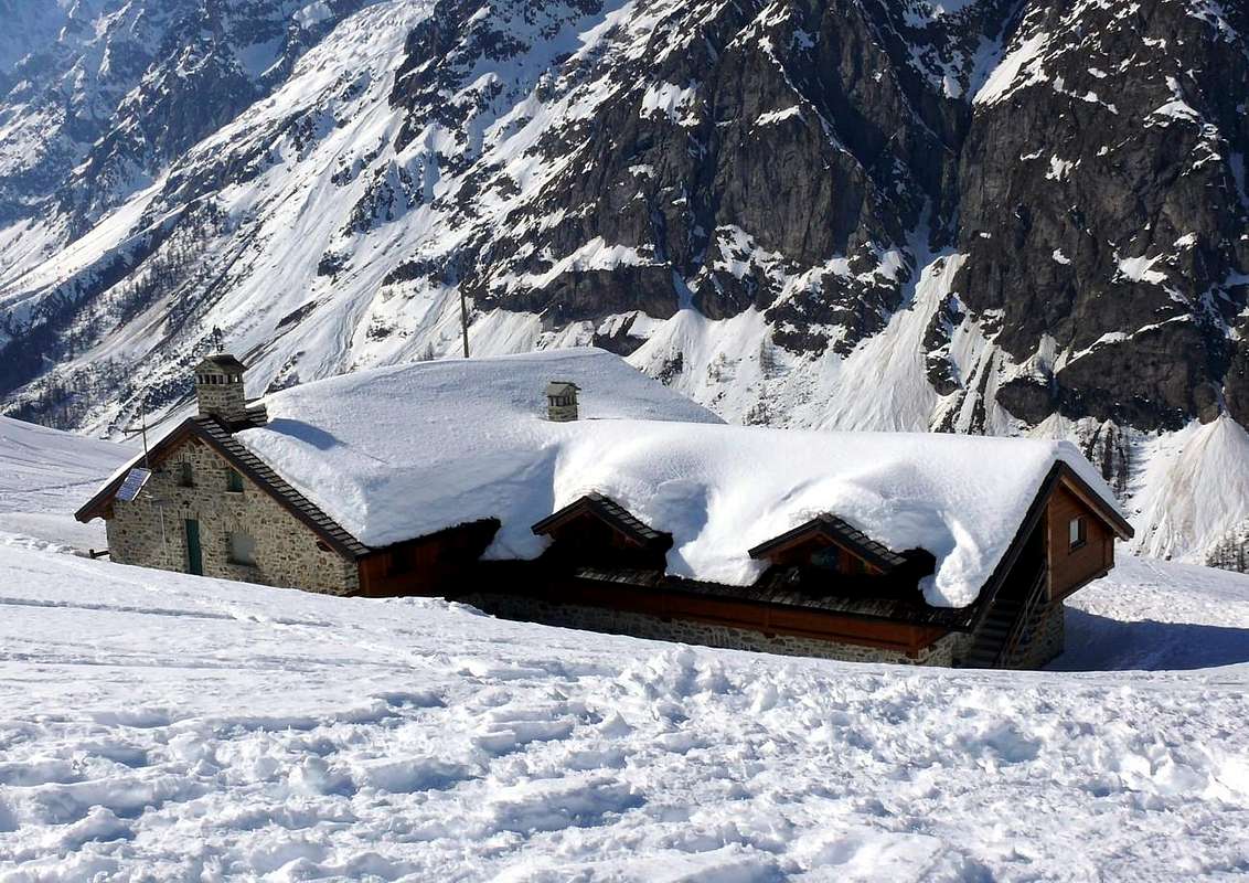
From Courmayeur towards the Val Ferret. From Courmayeur-la Palud (1.370m), towards Montitaz, Planpincieux (1.593m) Villages, Tronchey (1.620m), Praz Sec du Milieu, Lavachey (1.640m), Arnouva Dèsot (1.769m) Villages, through Municipal Road, to Malatrà Vallon and Walter Bonatti Refuge nearby Malatrà Low Pasture (2.056m), below Malatrà Upper Alp (2.213m).
Approach and Route
From Lavachey (1.640m) to about half of the Val Ferret continue for a short stretch on the Regional Road reaching the junction 1.695 meters at the Dora di Ferret; cross the same on a small bridge over which the unmarked path towards the Alpe di Giué Desot (2.007m) leaves towards the East. From this continue with the same direction through the path n° 28742 / Alta Via n° 1 going up the Vallone di Malatrà. After crossing the Alpe di Malatrà Damon (2.213m), leave the path n° 42 towards the Pas entre deux Sauts (2.524m) on the right or South and continue on the bottom of the valley, just above the Torrent homonymous name at about 2.300 meters; abandoning the path and heading to the Southeast you arrive at the base of the Southwest Slope of the Aiguille at an altitude of 2.635 meters. From this point go up the same (pay close attention to the snow conditions) through a small channel-gully that starts near the remains of a snowfield; reached a higher branching bend to the right (South) arriving on the easy South-Southwest Ridge, which in a short time leads easily to the Summit (I°/II°-; 4h'00/4h'30).
Da Lavachey (1.640 m) a circa metà della Val Ferret proseguire ancora per breve tratto sulla Strada Regionale raggiungendo il bivio 1.695 metri presso la Dora di Ferret; attraversare la medesima su di un ponticello oltre il quale parte verso Oriente il sentiero non numerato verso l'Alpe di Giué Desot (2.007 m). Da questa continuare con la stessa direzione tramite il sentiero n°28742/Alta Via n° 1 risalendo il Vallone di Malatrà. Oltrepassata l'Alpe di Malatrà Damon (2.213 m), si abbandona sulla destra o Sud il sentiero n° 42 verso il Pas entre deux Sauts (2.524 m) e proseguendo sul fondo del vallone, appena al di sopra dell'omonimo Torrent, si giunge a quota 2.300 metri circa; abbandonando il sentiero ed indirizzandosi a Sudest si arriva alla base del Versante Sudovest dell'Aiguille in altitudine di 2.635 metri. Da questo punto risalire il medesimo (fare molta attenzione alle condizioni della neve) tramite un canalino che inizia presso i residui di un nevaio; raggiunta un ramificazione più in alto piegare verso destra (Sud) raggiungendo la facile Cresta Sud-sudovest, che in breve tempo porta facilmente alla Sommità (I°/II°-; 4h'30/4h'30).
Difficulties
From F to (in winter for BSA= good skiers-mountaineers) F+.
Da F ad (in inverno per BSA o buoni sciatori-alpinisti) F+.
Equipment
For Hiking or with snowshoeing also by ski.
Da Escursionismo o con racchette da neve oppure sci.
Parents refers to a larger category under which an object falls. For example, theAconcagua mountain page has the 'Aconcagua Group' and the 'Seven Summits' asparents and is a parent itself to many routes, photos, and Trip Reports.

 3439 Hits
 78.27% Score
 9 Votes


")


