
Comments
No comments posted yet.
|
|
Trip Report |
|---|---|
|
|
37.10323°N / 8.67379°W |
|
|
Feb 22, 2024 |
|
|
Hiking |
|
|
Spring, Summer, Fall, Winter |
The first time I visited the Algarve in Portugal was in the mid-1970s, I cannot remember the exact year. I was a teenager on holiday with my family and I know it was after the military coup in 1974 but otherwise, I am not sure.
Things were very different then. I think the area was quite undeveloped, as far as tourism went, I remember there were only a few hotels and apartments in the town of Alvor, where we stayed. What I do remember were the miles of wide and very quiet beaches, backed by lonely sand dunes. I used to spend the mornings wandering up and down the beaches, paddling in the water as it lapped upon the shoreline. I remember that I had recently discovered the music of American musician, David Crosby. I used to wander along singing the lines of one of his songs called “The Lee shore”, at that time the song was new to me. Although it was inspired by his sailing adventures in the Caribbean, I thought the imagery he described was very similar to the Algarve coast. Quiet, sandy beaches with shells, winking in the sunlight as the waves passed over them. That was my enduring memory of the Algarve.
Fifty years later, many things have changed. I, of course, am that much older. I didn’t think I would ever return to the beaches I had visited as a teenager.
The whole area is far more developed now. There are a lot of hotels and villas. The beaches are still there but more crowded and the dunes are now a protected natural haven, covered with raised boardwalks so as not to disturb the wildlife and the environment.
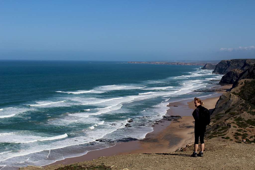
Marie and I were not there however, for the beaches but to explore the many hiking possibilities along the cliff tops, that the area further west has to offer.
David Crosby passed away, just over a year ago but – as they say – the more things change, the more they stay the same. I still listen to his music and it only took a walk along the shore to see the waves, the sand and the shells winking in the sunlight, to bring all those memories back.
Would the cliff tops be any less memorable?
The Algarve is an area in the south of Portugal. It has around 200 km of coastline along its southern and western Atlantic coast. It is most well known as a holiday destination for its sunshine, beaches, golf and its “Mediterranean” way of life. However, it also has many kilometers of footpaths, through hill farms and on sea cliffs.
We were there to explore as many of the hiking routes as we could in our two weeks stay at the end of February – beginning of March. It has rough sea cliffs, spectacular views over the wild Atlantic Ocean and an interesting array of birdlife to admire along the way.
Marie had carried out a lot of research for the area and decided that the city of Lagos was the best place for us to stay, for its accommodation and ease of travel and transport links. The weather at this time of the year was pleasantly warm (compared with the UK) approximately 14 – 18 degrees centigrade, a mixture of full sun, cloud and the odd rain shower but usually, very windy!
On our first day in Lagos, we visited the tourist information centre and purchased a really useful hiking map (for 15 Euros) published by the Rota Vicentina.
Rota Vicentina
This is the name of the organisation set up to manage the walking and cycling trail network in the Algarve and Alentejo regions of southern Portugal. There is around 750 km of well-marked hiking trails through towns, countryside and coastal regions in the south and west of Portugal.
Trilho Dos Pescadores – The Fishermen’s trail
This is the jewel in the crown of the Rota Vicentina, a 227 Km signposted footpath which runs from Sines on the west coast of the Alentejo region, southwards down the coast to Cabo de Sao Vicente, then eastwards along the south coast to the city of Lagos.
Caminho Historico – The Historical way
These are signposted routes that take in areas and items of particular historical interest. Sometimes the routes overlap with each other.
Percursos Circulares – Circular routes
These are signposted, circular hiking routes which start and finish in the same place. They often take in parts of the main hiking routes as well as being separate routes in their own right.
Via Algarviana
This is a long-distance footpath (GR 13) which passes through the Algarve region from Alcoutim – on the border with Spain, down to Cabo de Sao Vicente on the southwestern tip of Portugal (and mainland Europe!).
We had wanted to walk as much of The Fishermen’s trail as possible and as many of the sections would be done as A – B walks, we would use the local buses as transport. I ought to say at this point, there are three bus companies (Onda, Vamus and Redexpress), timetables and tickets are separate and at weekends, the services are greatly reduced, so it takes a lot of planning to ensure you do not get stranded, late afternoon in some quiet Portuguese town!
For one reason and another, we did this section over two days although, it could also be done as one day.
Our first day, we were quite tired, started slowly and having found the nearby bus station, we decided it was easier to catch the local bus run by the Onda company the short distance to Praia da Luz. Luz is a small, quiet town around 11 Km west of Lagos.
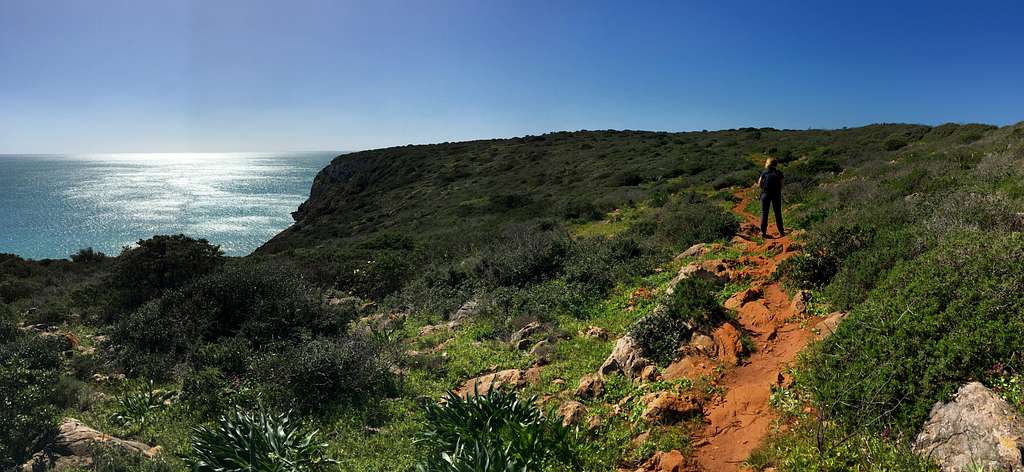
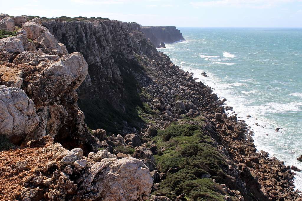
We headed back east along the trail, up onto the Atalaia, a clifftop viewpoint with a concrete tower to mark it. Then, we continued along the top of the cliff on broad, worn paths. This stretch of the trail is the closest part to major built up areas – Lagos and to a lesser extent, Luz – so is easily the most frequented part of the route.
The whole trail is well marked with green and blue flashes on a mixture of in situ rocks, trees and purpose-built signposts, making it easy to follow.
Having said that, we enjoyed many quiet moments and ate our lunch in a grassy area of the Atalaia. A sunny spot with birds in the bushes, butterflies on the flowers and the aromatic smell of wild herbs around us.
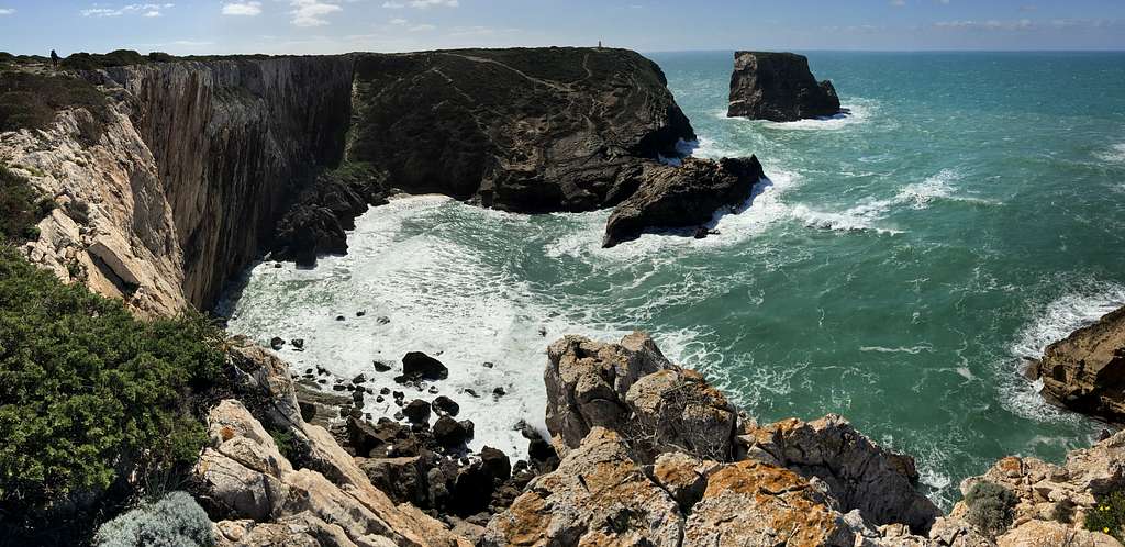
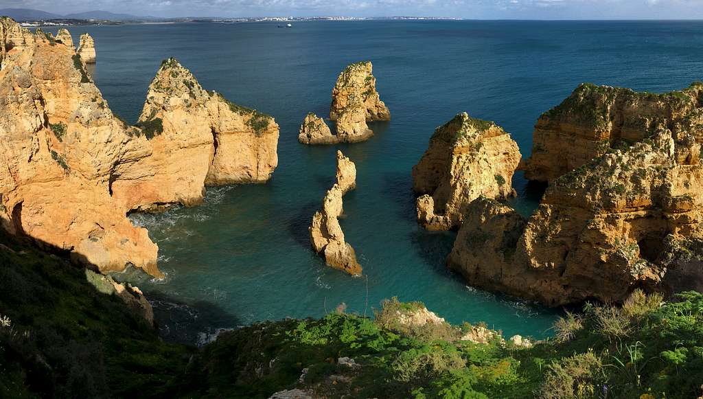
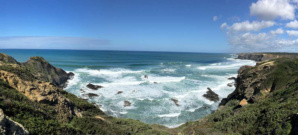
We continued eastwards, towards Lagos and the Ponta da Piedade. This dramatic headland is made up of many dramatic Limestone towers and sea stacks. Chances are, if you have seen any pictures of the Algarve coast, it will be of this area.
As this is such an attraction, the authorities have erected many kilometres of wooden boardwalk. This attracts even more people and causes more erosion. Although, it’s a stunning clifftop view, it was probably our least favourite part of the whole trail.
We finished by returning to Lagos itself where, we were caught in our first rain shower and caught our first glimpse of the Iberian Azure – winged Magpies – an exotic bird – which we were to see regularly during the trip.
It was several days later that we got the Vamus bus further west to the small town of Salema and set off back eastwards towards Luz.
The town was smaller and quieter than Luz, there were only a few people from our bus walking the route and the weather was a mix of sunshine and showers.
Again, we climbed out of the town – a feature of this trail – and onto a hillside of grass, Rock Roses (Cistus) and small trees. We headed towards a descent into the Boca do Rio and a heavy shower. We sheltered in the ruins of an old building, then as the rain lessened, we set off again up towards the Forte de Alamadena, a ruined fort high on the cliffs.
We descended and ascended around the Ponta de Alamadena quite quickly and descended again, through the charming town of Burgau for lunch on the beach.
By now, the showers had passed through so, we continued on along the cliffs towards Luz. There were a few people around walking the open, grassy, but broken cliff tops and everywhere, we spotted birds we were familiar with – Stonechat, Kestrels – as well as the more unfamiliar ones – the Azure-winged Magpies and Crested Larks.
We returned to Luz in sunshine – another 12 km done – and our bus back to Lagos. At this point, we were enjoying the walking, although there were quite a few other people around, some good paths and pleasant views and the weather was not too bad. It didn’t feel as wild as I had hoped but was enjoyable.
Any reservations we may have had about the Fishermen’s trail were completely blown away by this section.
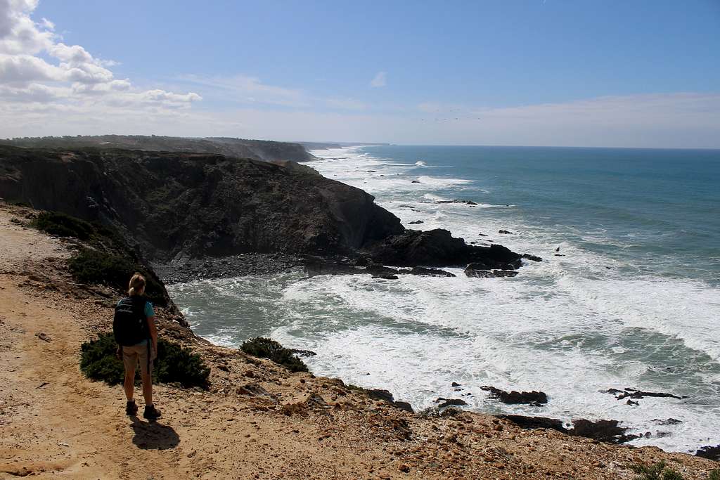
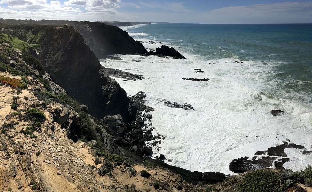
We got to Salema by 9.30 and headed west up and out of town. Once we had left the villas behind, we were soon on wild and deserted cliff tops. The trail wound its way through the Maquis – Rock Rose, Thyme, Asphodel, wild Salvia and Lavendar – amongst the thorny bushes.
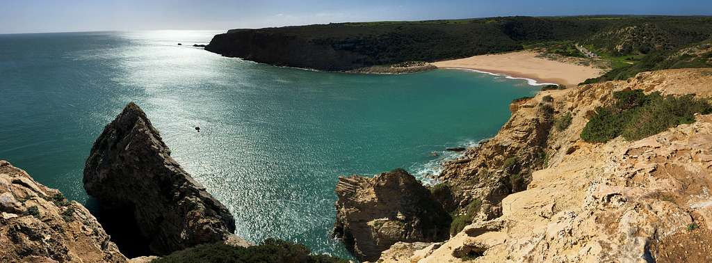
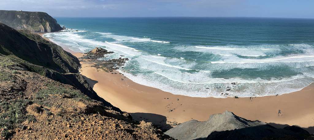
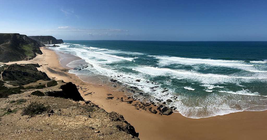
As we walked along, the trail would rise to a viewpoint of blue water lapping against pristine sands and craggy, amber rocks, all under a blue, sunny sky. Then, we would drop to the next bay and start the climb again. There were only a few people around, mostly on the beaches. So, we had the cliffs to ourselves.
After a while, we followed the trail inland towards the town of Figueira, then back out to the Praia das Furnas, one of the few road access points along this section.
Our trail continued with a scramble up the rocky cliffside, which left most of the tourists down on the beach. Once we were back on our own, we stopped for lunch in the grass. I tried to identify the plants and the many different birds which flitted from bush to bush.
It was a beautiful and peaceful spot in the sunshine. Very much removed from the built-up tourist areas further to the east, which form most people’s impressions of the Algarve.
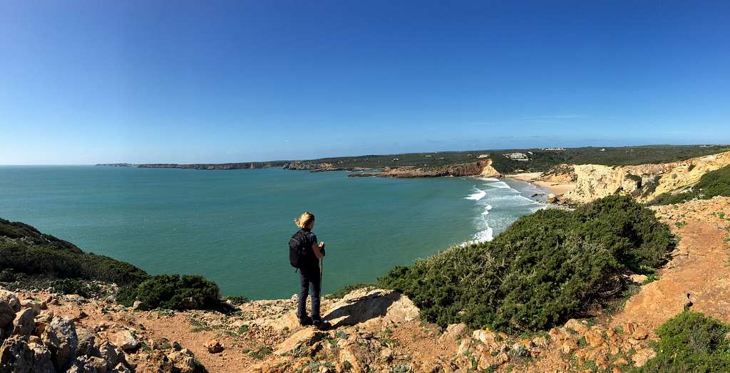
We continued along the lonely cliff tops for another 30 minutes, until we reached the viewpoint at Ponta da Torre around 12.45 pm. We admired the view across the Praia do Zavial and watched the surfers trying to stay on their boards in the waves.
Praia do Zavial and nearby Praia da Ingrina both have road access, so for a while there were a few other people around but soon we were once again on our own.
More deserted clifftop pathways followed the rugged coastline in and out of bays, as we gradually headed towards the distant town of Sagres. I wanted to stop and explore each deserted bay but we had to keep going.
Around 3.00 pm, we reached a viewpoint overlooking the Praia do Barranco and stopped for a drink and a chocolate bar to eat. We knew our bus was leaving Sagres at 5.00 pm and we were starting to worry that we wouldn’t make it in time!
As we sat there, a large party of Brits arrived – they had been following a similar route to us – so we had a chat for a while. They were here for the Winter, staying in their campervans!
Marie and I started off again, trying to make good time for our bus. We descended to the beach but for once, couldn’t find the green/blue route markers. Instead of checking the map, we walked across the beach looking for a way back up.
We were still looking when the group caught us up and started up a path we had already dismissed. Thinking that they knew the way, we followed them for a while before after a chat, we realised they were on a different route from the one we wanted!
Time ticked on and we spent some of it casting around for the Fishermen’s trail. Eventually, we sorted it out and regained the trail near some ruined buildings at Peniche.
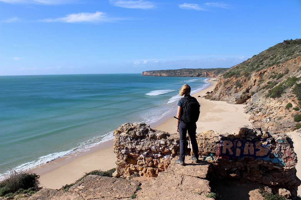
We hurried on, following the beautiful coast in the afternoon sun. The sea lapped against the cliffs quite gently, considering that this was the Atlantic Ocean, The south coast seems to be a little more protected. Soon, we realised we were going fast enough to make it and could slow down a bit!
We descended into Praia do Martinhal, on the edge of the town of Sagres and back into civilization.
The way continued into the town and we reached the bus stop in plenty of time.
A lovely clifftop traverse in a wild and beautiful landscape. Certainly, the highlight of the trip up to that point.
The bus journey further westwards to the town of Villa do Bispo was not too bad in the morning although, it was quite cloudy and the strong breeze from the northwest, made it quite cool.
We stopped at a trail signpost to check the map and a couple asked if we needed help.
We chatted to them, they were Canadian and were going our way for a short distance, so we walked together.
They were here for a few months from Canada but knew the UK very well. They knew Malta well too, the guy had lived in Leadville, Colorado and climbed Mt Elbert around 50 times – Marie and I met on a trip which stayed in Leadville and climbed Mt Elbert, 20 years ago – it’s amazing the people you sometimes meet in these quiet places.
The four of us headed west along the trail through farms and they enthused about the day we had ahead of us.
Then, they turned north, into a forest to follow the circular walk towards Cordoama, whilst we continued westwards along the edge of the forest and out into wide, flat moorland. Low growing bushes and wildflowers caught the breeze. Here, closer to the still invisible ocean, the wind really started to pick up.
Luckily for us, the sun came out and the clouds started to break up. We passed near a white, concrete marker, signposted as Torre de Aspa. The high point in a very flat landscape, our route didn’t turn up to it, so we followed our trail as it turned southwards. Later, I wished we had visited it for the view northwards, perhaps next time?
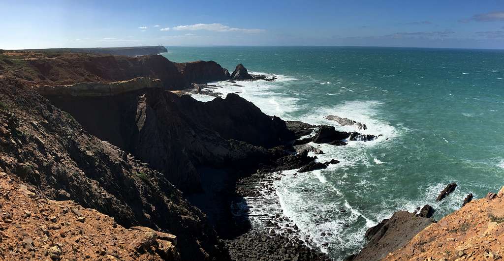
Our trail descended gradually southwesterly, towards the coast until we reached Ponta Ruiva and a northwards view of the Atlantic Ocean west coast.
Approaching the cliff top, the wind really hit us. We stopped to put on windproof jackets and I had to hold our packs down to stop them from blowing away.
I ventured to the edge to take photos and was battered.
“Don’t go too near the edge,” was Marie’s constant instruction. Luckily, with the force of the wind, I was being pushed away from the cliff edge.
The sea boiled and crashed into the broken cliffs and rocky beach, it was exhilarating and a little frightening to see.
The trail continued southwards along the coast, I stopped continually to take photos of the wild and crashing seacoast. When we walked, it was gently downhill and the wind was behind us, so we made up some time lost to photography.
We reached the dunes overlooking the Praia de Telheiro and could see we would need to climb a little to reach the lighthouse at Cabo de Sao Vicente, which had appeared on the horizon, so we stopped for lunch.
Out of the wind, it was warm in the sunshine and watching the waves battering the coast was endlessly interesting as each waves seemed unique!
After lunch, we set off again, we had to descend to a rocky low point along the trail, before following the clifftop as it started upwards again.
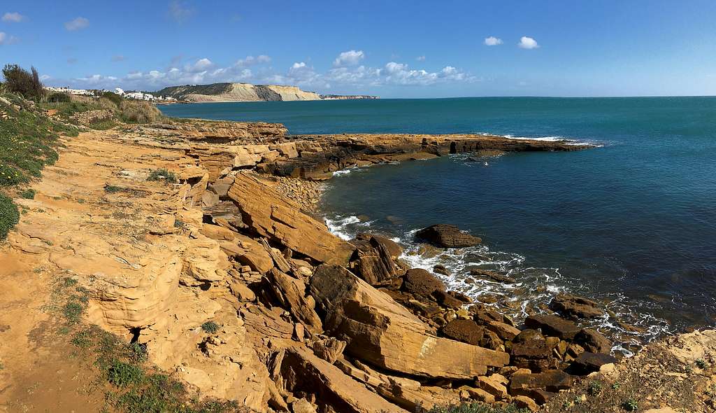
The green/blue flashes on rocks and posts began to be replaced by rock cairns, charting a way through the Rock Rose and Junipers bushes growing out of the rock. The way was sandy in places but gave way to limestone Karst pavement in other places, which was really difficult to walk on.
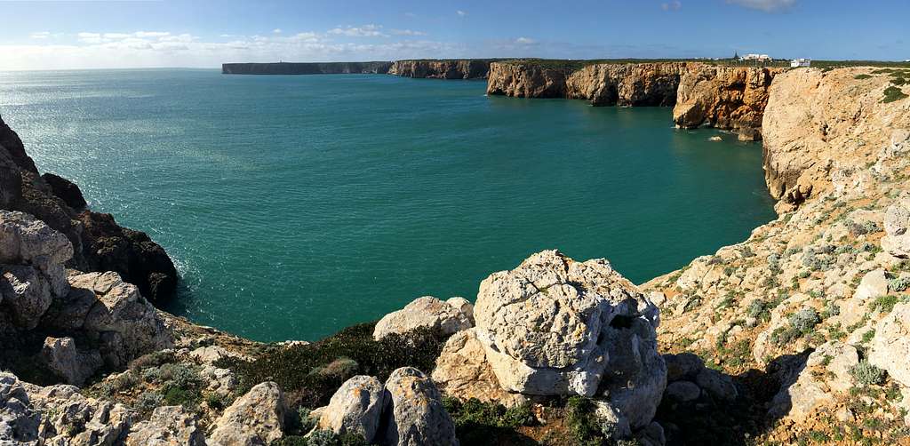
We had fantastic views of Petra das Gaivotas – the enormous sea stack just off the coast – with the lighthouse dwarfed nearby.
We followed the trail inland to meet the tarmac road and car park which leads up to the lighthouse. It was a bit of an anti-climax to be once again around lots of people and traffic but on the wind battered cliff tops, it was easy to see why, up until the 15th century, it was referred to as “the land at the end of the world.”
The trail continued down the tarmac road for a while before heading to the south coast again. Sheltered from the force of the wind, this was calm and sedate in comparison to earlier. The west coast had a completely different atmosphere to the south coast.
We followed our trail – a mixture of clifftop hiking and road walking - into the town of Sagres and a bus at 4.00 pm.
A really fantastic day in a wild and amazing landscape.
As well as the main Fishermen’s trail, the Rota Vicentina signpost circular routes that take in nearby scenic walking routes. We decided to try the circular walk from Villa do Bispo out towards the long beach at Cordoama and northwards along the coast.
We repeated the route westwards from the town then, headed north through the forest on our circular trail. It was a cool and cloudy morning and again, the wind blew from the northwest. It was quiet and sheltered amongst the Pine and Eucalyptus trees and we gradually made some height as we walked along the wide dirt track.
We came up alongside the M1265 road and crossed it to continue along the dirt track on the opposite side of the road. This crossed an open hillside towards the sea in the distance and as we walked, the clouds started to break up and the sun came out.
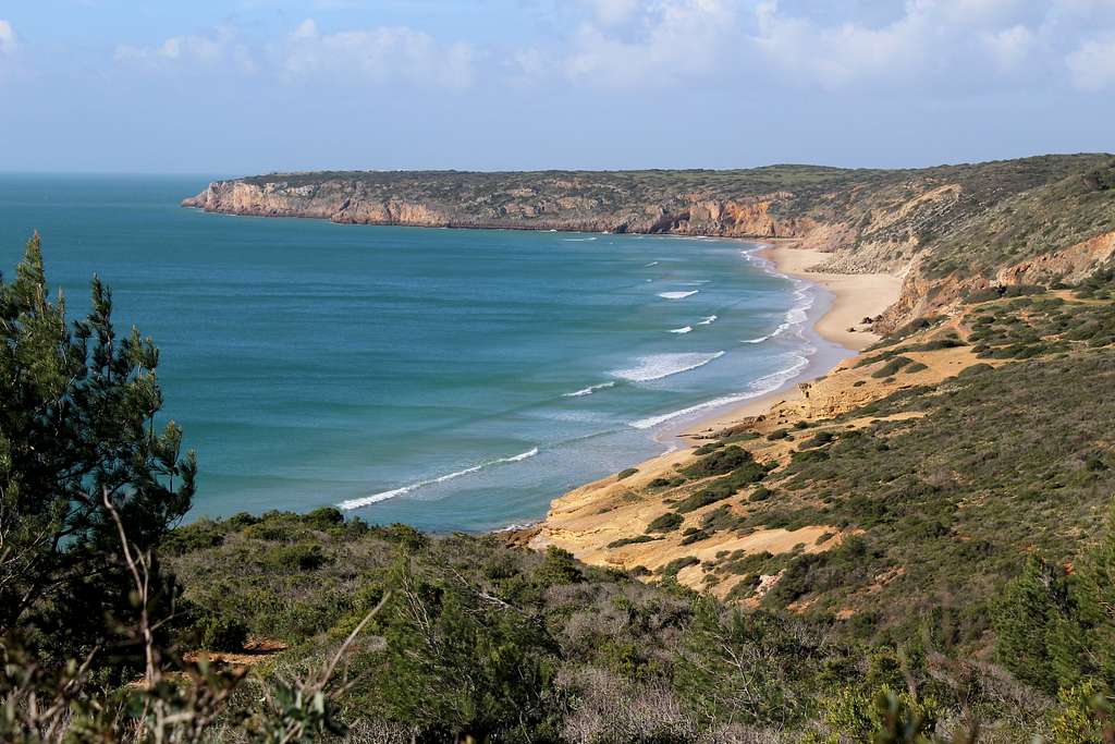
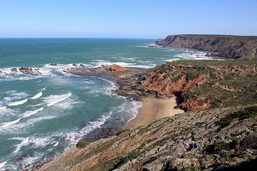
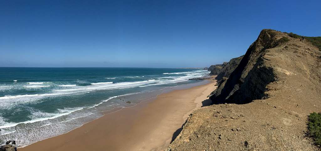
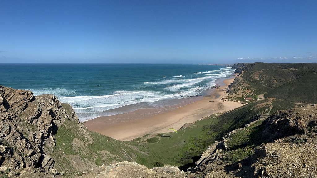
We quickly reached the Miradouro do Castelego and were greeted with spectacular views of the Praia da Cordoama in both directions.
Thankfully, the wind was not as forceful as the previous day but the surf was still really dramatic. Our guidebook describes this as one of the best views in the country and I can understand why they say that.
We descended northwards and onto the beach. There were a couple of paragliders trying to fly and a few others walking along the miles of flat, sandy beaches. We headed straight back up the cliff path for more fabulous coastal views.
After a while, our route turned southeast and headed inland, through more of the dense Maquis growth. We crossed a ridge and started descending back towards the coast on a long dirt track. It was warm in the sun, sheltered from the coastal breezes, like a perfect early summer day in this magical place.
We reached sea – level once again at Praia da Barriga and wandered out to see yet another amazing beach. Here, we found some sheltered rocks to sit on while we ate our lunch in the sunshine.
Two cyclists and two other walkers arrived but otherwise, we had it to ourselves.
After lunch, we continued on our route back inland on the dirt track which climbed the hills above our lunchtime beach and enjoyed more great sea views.
The track headed inland to a crossroads where, our circular path met up again with the Fishermen’s trail. We decided to detour westwards again to get a view over the Praia dos Mouranitos – just because it was there!
Back at our crossroads, we headed southeast on the Fishermen’s trail across the green, maquis covered hillsides. We saw Stonechat and Goldfinches in the bushes with the odd Crested Larks in the short grass.
The route passed close to the main road and then joined it for a while as we passed through farmland.
The Fishermen’s trail descended from the hillsides back into Villa do Bispo in plenty of time for our afternoon bus back to Lagos.
“I think they must have been the best beaches I’ve ever seen.” Marie decided. I agreed, I haven’t been able to think of any that are better anywhere in the world.
Our longest bus journey took us to the northern borders of the Algarve. North of the Rio Seixe lies the Alentejo region. We found ourselves outside the town of Odeceixe on the banks of the aforementioned river.
We headed into town, found our bus stop for the return trip and the start of our circular route in the middle of the town.
We followed the signposts and headed westwards out of town, alongside the river on a path across a farmer’s field. Straight away, I spotted group of Waxbills on a wire fence. These are small, mainly brown birds with a smear of bright red “lipstick” across their bills and face – very exotic!
We continued along a quiet road into the small seaside town of Praia Odeceixe and another great view of “the best beach in Portugal” – according to the sign!
It certainly was spectacular (again) with long flat sands and crashing waves under the now clear, sunny skies.
“Why is no-one surfing?” I asked Marie, knowing that she didn’t know why.
To me, it looked perfect but maybe it was too rough?
We headed south along the clifftops in the wind and sunshine and admired yet more fantastic views.
As we got further from the town, we saw fewer people and noticed that the sea stacks standing just separate from the cliffs, had White Storks nesting on the top of them – apparently one of the few places in the world where this happens.
We continued southwards along the trail. Trying to describe the fantastic scenery from the clifftops, the thundering sea and the feel of the sunshine and sea spray, seems a little redundant. I have already done my best to do this on the descriptions of previous days and I am running out of superlatives.
The clifftops plunged down to a small bay and our trail headed inland towards the village of Monte Novo. We sat on the clifftops to admire the view southwards and enjoy our lunch.
When we finally headed inland along the trail, the sea quickly became a distant sound of thunder. It was strange to be walking in such quiet after such a long time just above the roar of the ocean. We soon became accustomed to hearing the birds again!
The route is well signposted and we followed the quiet roads through fields and past small farms. We saw some Azure-winged Magpies and a few Stonechats. The trail followed a canal through the edges of fields, we heard frogs croaking in the marshes and saw a wild Terrapin in the canal.
The trail headed north, back towards Odeceixe and we rejoined another quiet road near Joao Roupeiro. We saw 7 Little Egrets flying, then 5 Cattle Egrets in a field with some sheep. Most surprising of all (probably only to us) 5 White Storks in a boggy field at the side of the road! Portugal is a surprising place.
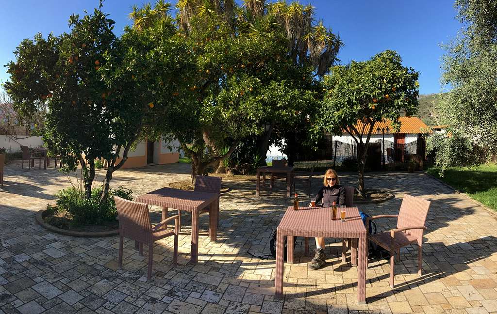
We returned to the town in plenty of time to get a drink and something to eat. We found a lovely bar/restaurant which had a beautiful courtyard with tables set underneath Orange trees. We were the only customers.
We sat in the sunshine with a beer and a toasted sandwich, watching the huge White Storks wheeling overhead and reminiscing over such a great day.
“This is how I imagined my retirement!” Marie said.
The Algarve is a destination with many faces.
There are the beaches, the bars and hotels in crowded towns along the southeastern coast, a pre-requisite of many tourist brochures. There are the golf courses and theme parks which are also popular.
However, travel further west and the south coast becomes rockier and lonelier. You may see more wet suits than bikinis and away from the bays, fewer people altogether.
The coast becomes wilder and the wildlife becomes more common.
At Cabo de Sao Vicente, the coast heads northwards and the full force of the Atlantic Ocean turns it into a completely different environment. One of broken cliffs and crashing seas with huge bays of flat, sandy beaches.
We were lucky that we did the south coast routes first – they are really good - but the west coast routes are all stunning and just get better the more you see. It may have been an anticlimax to do the stages the other way around but the days were all really memorable.
We think we did around 75 - 80 km of the Trilho dos Pescadores but there is still a lot of the route left for us to walk, along with many adjoining paths. There are also inland routes for us to explore – we tried a couple with varying degrees of success. Of course, we can always repeat some of the routes we have already done or come up with our own versions.
The Algarve is a beautiful place and a place to make great lifetime memories, from the high clifftop paths to the seashells scattered in the sand.