
-
 49260 Hits
-
 88.34% Score
-
 27 Votes
|
|
Area/Range |
|---|---|
|
|
44.30000°N / 107°W |
|
|
Hiking, Mountaineering, Trad Climbing, Ice Climbing, Aid Climbing, Big Wall, Mixed, Scrambling, Skiing |
|
|
Spring, Summer, Fall, Winter |
|
|
13167 ft / 4013 m |
|
|
Overview
The Big Horn Range is a member of the Central Rocky Mountain Chain. It sits almost entirely in Wyoming with it's northernmost foothills descending into Montana. The range runs parallel to, but nearly 100 miles east of, the Continental Divide. It is bound on the west by the Bighorn Basin, one of the lowest in Wyoming, and on the east by the Powder River Basin. The Bighorns are the northernmost range in the Rocky Mountain chain to surpass the elevation of 13,000' (3962m).
The defining feature of the range is Cloud Peak, which lies right in the center of the range. The entire crest of the range is managed as the Cloud Peak Wilderness and this area is where backpackers and mountaineers set most of their goals. Sport Climbing is well developed in Ten Sleep Canyon, along US 16 just west of Tensleep, Wyoming. There has also been route activity on Tongue River Canyon, Story Canyon, and Crazy Woman Canyon near Buffalo. The Big Horns range from arid desert at the base of the range east of Lovell, to the Cloud Peak Galcier, and cold alpine environments above timberline.
Like the Wind River and Beartooth Mountains off to the west, the big Horns are home to many hundreds of alpine lakes, most of which are surrounded by nice meadows, offer great fishing and have clear water. It's very typical to find moose and other big game here as well, since there are no roads anywhere near the heart of the mountain chain. Long approaches and extensive off trail hiking is to be expected here regardless as to what your objective would be. For parties interested in climbing Cloud Peak, the standard route normally takes 2-3 days, however very fit hikers can make the summit and back in one long day.
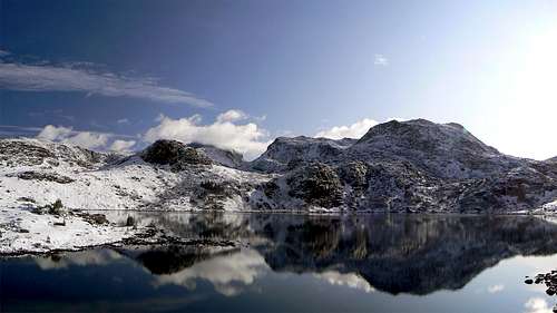 Cloud Peak from Misty Moon Lake
Getting There
All trailheads are reached from either US Highway 14 (Greybull to Sheridan via Granite Pass) or US Highway 16 (Worland to Buffalo via Powder River Pass). The most popular trailhead is probably the West Tensleep Creek Trailhead, which is the standard approach for Cloud Peak via Mistymoon Lake. This is accessed by Highway 16 by turning onto FS Road 27 just west of Meadowlark Lake, and following this well graded dirt road all the way to its end. The Deer Haven Lodge and Cabins is located where FS Road 27 meets Highway 16 and offers some snacks and has a restaurant.
Another option is the Woodrock Road (FS Road 26) which connects the small town of Big Horn just south of Sheridan, WY with Highway 14 about 5 miles south of the Alt Highway 14 junction. This road, although slower than the paved Highway 14, is a little shorter than driving all the way north to Ranchester if trying to drive across the range from the south.
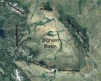 Bighorn Mountains Overview
Camping/Red Tape
The majority of the alpine peaks are inside the area managed as the Cloud Peak Wilderness of the Bighorn National Forest. Outside of a few restrictions for wilderness areas outlined below, you can camp wherever you want for free with no required permits. It's a good idea to always get the self-registration permit, obtained at trailhead before camping overnight. Many people disregard this though, and few rangers are ever out there. Please do not build any fires, possess, store, or transport any part of a live or dead tree, or camp within 100 feet of a lake or stream. Also, do not leave anything behind including wrappers, tent pegs, tethers or any trash. Always leave no trace! Group sizes are limited to a maximum of 10 people and it's prohibited to have a wagon, cart, bicycle, or any wheeled/motorized device including paragliders!
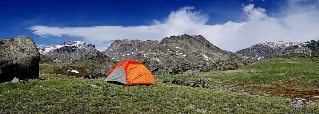 Mistymoon Camp
Peak List
There are a good list of peaks offering all types of outdoor climbing and hiking opportunities. Technical alpanists can have an amazing time exploring the climbing potential on the big walls of Cloud Peak and the surrounding areas, while backpackers will enjoy the solitude and alpine splendor the Big Horns have to offer. Fisherman and horseback riders are also very commonly found here. Most of the peaks listed below have a non-technical scramble or walk-up route to their summits.
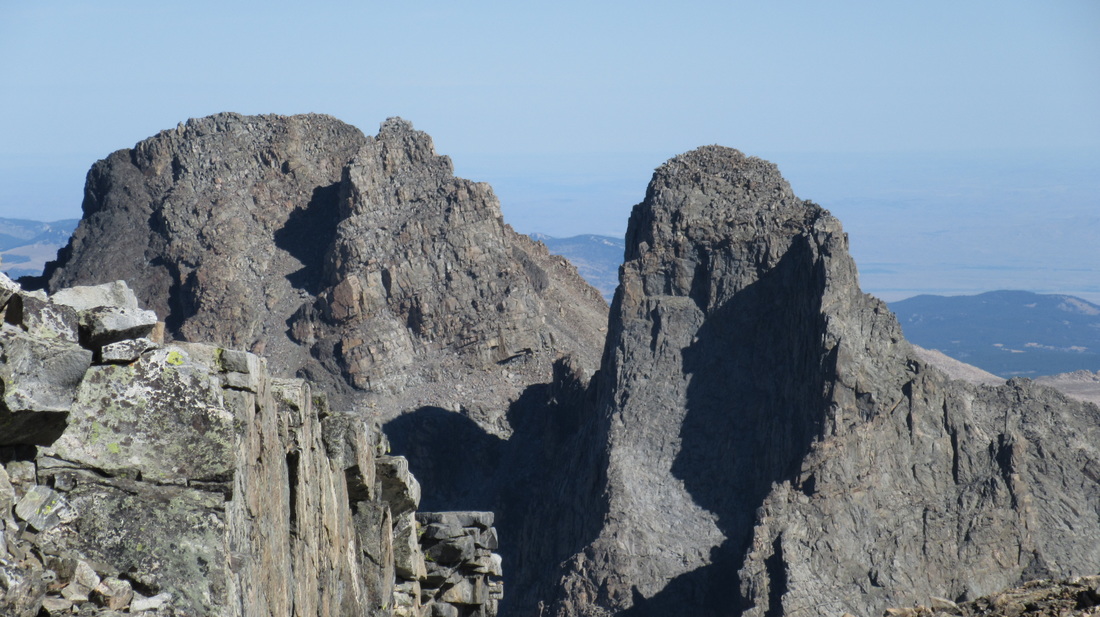 Black Tooth Mountain from Cloud Peak
| Ten Highest Peaks | ||||
| Rank | Peak Name | ft | m | Range5 |
| 1. | Cloud Peak | 13,167 | 4013 | Central Bighorn Mountains |
| 2. | Black Tooth Mountain | 13,005 | 3964 | Central Bighorn Mountains |
| 3. | Mount Woolsey | 12,978 | 3956 | Central Bighorn Mountains |
| 4. | Bomber Mountain | 12,840+ | 3914+ | Central Bighorn Mountains |
| 5. | The Innominate | 12,761 | 3890 | Central Bighorn Mountains |
| 6. | Peak 12590 | 12,590 | 3837 | Central Bighorn Mountains |
| 7. | Mather Peaks | 12,400+ | 3780+ | Central Bighorn Mountains |
| 8. | Bighorn Peak | 12,324 | 3756 | Central Bighorn Mountains |
| 9. | Darton Peak | 12,275 | 3741 | Central Bighorn Mountains |
| 10. | Loaf Mountan | 11,722 | 3573 | Central Bighorn Mountains |
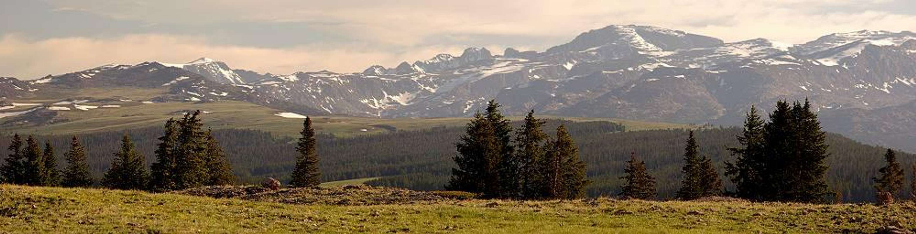 Bighorn Mountains Panorama
Rock Climbing
There are many areas that offer incredible rock climbing in the Bighorn Mountains, including the sport climbing mecca of Tensleep Canyon, and the various areas along the Eastern Bighorns. The vast majority of the climbing is limestone sport climbing, which is a very common rock type found in the Bighorns, as well as further west along the front of the Wind River Range. Most of the climbing areas in Tensleep have been recently developed, and are known to be closely bolted with easier grades. Only a few of the original crags have longer runouts between bolts. Small finger crimps and pockets are common, and while cracks can be found, they are rarely very continuous.
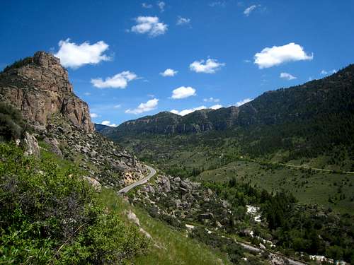 Ten Sleep Canyon Ten Sleep Canyon |
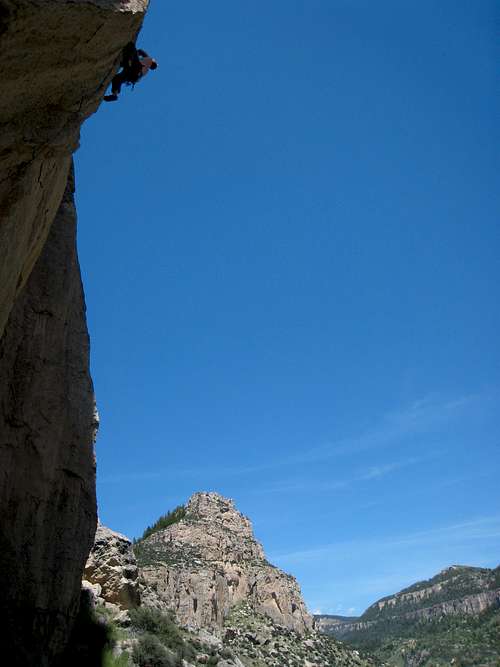 Climber at Ten Sleep Climber at Ten Sleep |
See the recently updated (2015), very informative yet witty "Lies and Propaganda from Ten Sleep Canyon" climbing guide for all the route beta you could ever need plus some silliness for your amusement.
Geology
The Bighorns were uplifted during the Laramide Orogeny, beginning approximately 70 million years ago. The method of uplift is known to be a fault-block type similar to the Tetons and the Sierra Nevada. The flanks of the range consist of over 9,000 feet of sedimentary rock strata initially deposited well before mountain-building began, are only now seen on the fringes of the central Gneiss and Granite uplift core comprising the large canyons the highways pass through, such as Ten Sleep Canyon. Predominantly marine and near-shore sedimentary layers which dip away from the center of the uplift, range from the Cambrian to Lower Cretaceous, and often contain fossils. During and following the uplift, much of these older sedimentary rock layers were eroded away to expose the basement rocks that make up the high peaks seen today. Large volumes of eroded deposits were deposited in the adjoining Big Horn and Powder River basins. Extensive glaciation formed many cirques, U-shaped valleys and large cliffs, however the only remaining active glacier in the range is the Cloud Peak Glacier which is located on the east slope of Cloud Peak. The alpine rock is a mix of Gneiss and Granite with associated outcrops of Quartz monzonite, while the rock in the canyons is Big Horn Dolomite and limestone.
External Links/Guidebooks
Excellent Article about the Geology of the Big Horns
Big Horn Mountains on Peakbagger
Huge Crack Opens up in Bighorn Mountains
Bonney, O.H. (1977). The Big Horn Range, 3rd Ed.; Swallow Press. Chicago, IL.
Huey, Aaron (2006). Mondo Beyondo: Tensleep Canyon Rock Climbing.
Molvar, Erik (1999). Hiking Wyoming's Cloud Peak Wilderness; Falcon/Globe Pequot Press. Guilford, CT.
MarkDask - Sep 27, 2009 8:14 am - Hasn't voted
Front country amenitiesYou can get a shower for $2 at the YMCA of the Bighorns, which is located on rt 16 on the east side of the mountains roughly a dozen miles out of Buffalo. Very clean.