
-
 4800 Hits
-
 78.45% Score
-
 10 Votes
|
|
Mountain/Rock |
|---|---|
|
|
46.61900°N / 112.212°W |
|
|
Trad Climbing, Sport Climbing, Toprope |
|
|
Spring, Summer, Fall |
|
|
5284 ft / 1611 m |
|
|
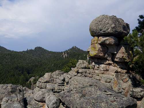
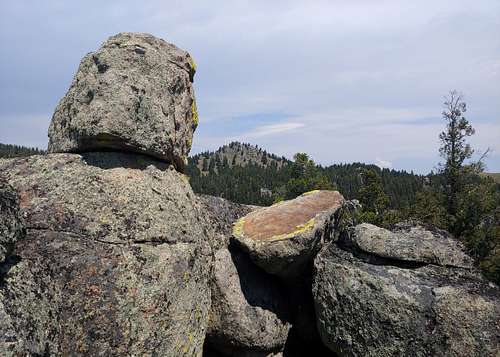
Overview
Close to Helena but feeling really far away, Blue Could is an island of excellent granite and has a number of trad and sport climbs. It's mostly single-pitch, but there is Dos Amigos, a two-pitch 5.6 sport route, that gets you to the top of the formation and is what I went out to climb on a day I was sampling easier stuff while solo-leading at three different Helena-area crags.
There are more routes here than are listed on Mountain Project, and I don't own an area guidebook, so I won't try to make some definitive listing of routes. Mostly, I am posting this page to bring the site to SP members' attention and to put up a route page for Dos Amigos.
Getting There
The main MP page has conflicting information, and a comment there seems to currently be more accurate than the Getting There Information is.
About 5 miles west of Helena, on U.S. 12, turn onto Baxendale Drive in Baxendale at the Baxendale Fire Department. It's pretty hard to miss this.
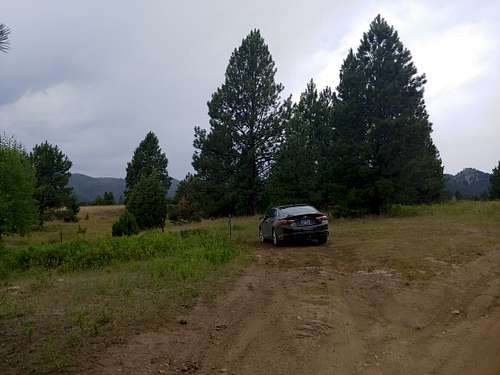
Drive a short way and turn right onto Blue Cloud Road. From here on out, you will be passing through private land on a road open to the public, so respect boundaries. 3.8 miles from the fire department, after crossing a third creek bottom and going up an incline, notice a short track and a pullout on the left. Park.
The first picture below should help.
The road was completely dry when I was there, and I had no trouble in a regular car, but this is not a road you would want to drive on when wet unless you have 4wd, and even that might not be sufficient.
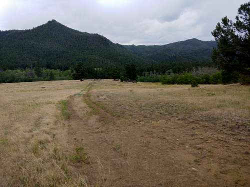
Hike along a closed two-track road to a gate, pass through the gate, and continue on. Eventually, the road bottoms out and turns into more of a trail, and that trail leads to the main buttress at the base of Dos Amigos.
|
|
Routes
The MP pages cover sport and trad routes from 5.6 to 5.10. Because there are more routes than are listed there, there could be easier and harder routes. Please use the link in the Overview to help navigate the specific routes.
Red Tape
Almost all the land along the drive, and some of the land on the approach, is private property. Whatever you personally think when it comes to property-rights issues, please respect the boundaries if for no other reason than not wanting to jeopardize access for other climbers.
When to Climb
Late spring through early fall.
Camping
No camping along the road. Around the crag, there are obvious camping options that are on public land. However, I do not know if it is okay to leave a car parked overnight, so I would plan any climbing here as a day trip.