|
|
Area/Range |
|---|---|
|
|
33.0121°S / 69.4466°W |
|
|
Hiking, Mountaineering |
|
|
19472 ft / 5935 m |
|
|
Introduction
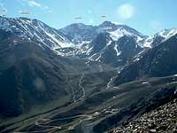
Cordon del Plata (CdP) is a little sub range to Los Andes. It's conveniently located along the highway which also takes you to Aconcagua, the giant of the South American peaks. The area has gained a lot of popularity in the last couple of years and many climbers use it as an acclimatization ground for the higher peaks. The easy access, the short distances in between the peaks and beautiful views has also contributed to CdP's positive reputation. There are lots of peaks within a few day's walk and even if most of them are easy scrambles along the normal routes, also more experienced climbers go here for some challenges.
The area attracts most of its visitors in peak season for climbing, i.e. in December, January and Febraury. In the winter time CdP is supposed to have excellent snow climbing. There's also a small ski resort at Vallecitos and in the hotter periods it's a hiking area for the people of Mendoza.
How to get there
- Most travellers arrive in Mendoza either directly by plane or by bus from Buenos Aries or Santiago de Chile.
- From Mendoza you can arrange with transport from your hostel/hotel or go by local bus to Potrerillos. If you do the latter, you'll have to rent a car from there or hitch hike to the Vallecitos Ski Station. The bus company which serves Potrerillos is called Uspallata Express and has its own little "box" in the central bus station of Mendoza.
- There are plenty of expedition companies which can arrange guided or non-guided tours and expeditions to Cordon del Plata. Aconcagua X-perience is one of many.
The peaks in the central valley
A huge majority of climbers/visitors only go to the central valley in Cordon del Plata and the below list is dealing with those peaks plus one in the next valley. I have choosen to list the peaks in order of appearance when entering the valley.
Peaks in other valleysPlanning & ServicesBefore going to CdP you better stock up with food, even if there's some available in the mountains. Best is to buy all the goodies in Mendoza, which has a good selection of food. Potrerillos has a small food shop, but you'll only find the basics here. At Vallecitos Ski Station there's a small restuarant and a gear shop, which can come in handy if you've forgotten your favorite gloves back home.Note that the gear shop in the ski station is closed and the "tent restaurant" in Camp Salto is closed since a storm destroyed it in 2008.Info from Janice and Jason Wilcox.A few things we learned that others might find useful:1. You can leave gear at the refugios for free as long as you've spent at least one night there2. From Mendoza it costs AR$ 80-85 pesos (Dec 2010) one way for the transfer to Refugio San Antonio (2500m, www.cordondelplata.com to book or for more info). If you choose to stay the night at San Antonio, the transfer is offered at a discount, AR$ 60 one way (Dec 2010).3. Cheaper refugios could be found further up from San Antonio - (as of Dec 2010 from AR$ 30 - 55 pesos per night for a dorm room. San Antonio cost $55 for a dorm). These other refugios are also higher elevation (up to about 2800m)4. Better water supply and nice campsites were found above Campo Salto de Agua, and these also make for a shorter summit day on Vallecitos and Plata.5. Hoyada was a good place to set up a high camp (Dec 2010) but could be over-crowded in the high season in January.6. Buy a map in Mendoza at a gear shop, but if you don't, you can buy a map at Refugio San Bernardo for AR$50 (Dec 2010).7. Take some immodium diarrhea medication with you as there are many minerals in the water and some people develop intestinal reacctions to the minerals.8. If this is your first time at altitude, plan to spend about 7 days in the area to summit Vallecitos or Plata. Some people try to do it in 4 days but 7 is better and safer, especially for those with little altitude experience.Weather and mountain conditions![Cloud drift]()
Cloud drift on Vallecitos long summit ridgeUnfortunately Cordon del Plata is plagued by two annoying features - the katabatic winds and clouds. The latter is more a nuisance which can make your experience a not-see-a-thing-experience, but the winds of the area are dangerous and infamous for its ferocity.The highest risk of encounter them is in Camp Salto (4200m) and Camp Hollada (4700m). These to camps are well situated, but as the winds are katabatic there's no real way to avoid them, when they come crushing straight down the mountain sides. The word katabatic comes from the Greek language and means something like "riding downhill".See this trip report for more details about how it can be when unlucky.Apart from the katabatics, the higher peaks and especially the saddle in between Vallecitos and Plata can be extremely windy. That said, most days are nothing but nice, calm and sunny and when the weather is nice in CdP, it's usually really nice!For rock climbers CdP doesn't count for much as the rock is often rotten and not to be trusted. Stonefalls occurs with high frequency on the steeper faces. All of the normal routes on the main peaks are very safe though.Red TapeThere's no red tape, but you have to register in the Vallecitos Ski Station upon arrival and sign out when you leave. This is for your safety. Bring your passport.Maps![The map shows you the...]()
A map of the area. Places of interest are marked with blue boxes.- The map to the left has all the relevant details for locating Cordon del Plata.
- A good map of the Mendoza Province.
Look for the name Potrerillos to find Cordon del Plata, which is located just WSW of the small town. - Meridies sells a good SRTM compliant map of Cordon del Plata. This map can also be bought in well sorted book shops or alpinist shops in central Mendoza.
- There's a book about the area, which includes a lot of route maps and other useful information. Here's the cover of the book, so you know what to look for. It can also be bought in some alpinist shops in Mendoza and in the Vallecitos Ski Station.
GPS elevations
Monkeypike sent me the following elevation information.
Height of the camps:
Las Veguitas - 3,220m
Piedra Grande - 3,567m
El Salto - 4,282m
La Hoyada - 4,658m
Other heights:
Col between Lomas Amarillas and Pico Plata - 4,917m
Col between Pico Plata and Cerro Vallecitos - 5,218m
Summit of Stepanek - 4,114m
Summit of Adolfo Calle - 4,269m
Summit of Cerro Plata - 5,962m
San Bernardo - 4142m
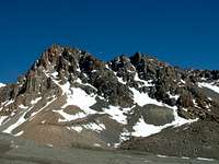
This little peak is probably the first peak you see when arriving at the lush meadows of Las Veguitas. It's an easy scramble (class 3) to its summit and the altitude gain from camp is about 900m. It can easily be climbed in a day if reasonably acclimatized. The path to its summit is most of the way very clear and in some spots you can even follow orange paint on the rocks. The views to the lowlands far below are stunning.
Franke - 4880m
Franke is not much more than a rock tower on the long ridge which continues to Lomas Amarillas. It's a popular acclimatization option for those who want to camp low, but day trek to a high elevation. The altitude gain from Las Veguitas meadows is a stunning 1650m and it's a very long day from there. A more reasonable ascent it to start from Piedras Grandes at 3550m, then it's only 1300m of elevation gain. The route to its summit is mostly on loose gravel and most people find it a bit rough. From Franke's summit you have very good views of Platita's large face and the valley of Cerro Negro.
Adolfo Calle - 4220m
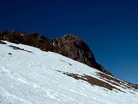
When you walk up the valley towards Camp Piedras Grandes you'll see some impressive looking peaks on your right. These are Adolfo Calle and Stepanek. The first reaction may be: "Wow, I need some serious rock climbing gear to climb those". No, you don't. There are easy routes up both of them. Adolfo Calle is the one to the left and is about 150 meters higher than Stapanek. The south face is an impressive sight, but the normal route is an easy scramble up a couloir, which in the early season is quite a nice ice climb. The peak's summit give you good views of both the central valley and the highest peaks in the end of it.
Stepanek - 4080m
The little brother of Adolfo Calle is Stepanek. They are facing each other and in between there's a wide valley, locally called the "football field". The approach is the same as to Adolfo Calle, but when at the top of the couloir, head right towards a little rocky tower on a ridge. From its summit you have excellent views of the next valley where for example Parra can be seen. Stepanek is regarded as one of the easiest climbs in Cordone del Plata.
Lomas Amarillas - 5100m
The peak is the highest point on the long ridge running on the east side of the central valley. The summit can be hard to detect from below, but looking down on the mountain from a higher mountain, you'll realize it's a very well defined summit. It has gotten its name from the yellow band of gravel running on the west slopes. Its summit can most easily be reached from Camp Hollada at 4700m, from where it's a semi-technical scramble. From its summit you have excellent views of all the higher peaks in the Cordon del Plata range.
Vallecitos - 5461m
The east face of Vallecitos is quite an impressive sight and it's completely dominating the valley. It's possibly the most popular peak in the area, as it has some valuable ingredients that a climber has difficulties to resist. An altitude which is high enough to satisfy, an airy summit and at least a short part of "climbing". In addition to this, you can see Aconcagua in the distance and a rugged chain of rock peaks on the other side of a river far below in the west. The peak have some hard routes on the face, which is popular in winter. The true summit of the peak very few reach. It's located about a hundred meters further on the ridge, but is difficult and dangerous to reach.
Rincon - 5318m
The "other end of Vallecitos ridge" terminates in the impressive peak of Rincon. It may look abominable to climb, but is as most of the other peaks in the area and easy scramble to its bulky summmit pyramid. There are some interesting variations of the normal route and when snowy it also offers a place to use your crampons, which isn't common in Cordon del Plata. It has a lofty summit from where you can the the long, sharp ridge to Vallecitos.
Pico Plata - 5827m
The sub peak of Plata has a stunning south face which is a very popular challenge in the winter time. It can't be seen unless you climb Franke or Lomas Amarillas. The elevation drop in between Plata and Pico Plata is not more than 150 meters, but it can make an interesting target on its own, even if not going for a winter climb of the south face. The ridge leading straight for the peaks summit is walk with lots of views and plenty of air.
Plata - 5930m
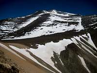
The highest peak in Cordon del Plata is naturally also the main target for most climbers. It's located in the far end of the central valley the summit can't be seen until you arrive on approximately 5500m. It's a long walk on high altitude and even if it's nothing but a walk, it can be a very taxing venture. The long stretches of footpaths are often windy and cold. Just below the summit you can find a wreck of a helicopter. The peak was long regarded as the easiest 6000 meter peak in the world, but recent surveys have proven the peak be some 50 meters below the magical 6000 meter mark. Three large crosses marks the summit.
Parra - 4300m
Parra is one of the few peaks on Summitpost which isn't located in the central valley of Cordon del Plata. The Colorado Valley is easy to access from the main valley's entrance. The surroundings are a bit different as you here walk on moraine instead of grassy meadows. As with all the other peaks described on the page, Parra is an easy scramble.
Cerro Platita - 4216m
Cerro Platita [NOT to be confused with Pico Plata] is located far to the south of the main valley. The access is from the town Valle de Sol. - The map to the left has all the relevant details for locating Cordon del Plata.


