
-
 4892 Hits
-
 81.18% Score
-
 13 Votes
|
|
Mountain/Rock |
|---|---|
|
|
37.36093°N / 80.17374°W |
|
|
2842 ft / 866 m |
|
|
Overview
In my second year in Pandemic-bound Chicago, and still unwilling to fly, I struggled to find a location to vacation within driving distance. My strategy during Covid has been drives within 10-12 hours of Chicago, staying in a remote cabin and fixing my own meals. But where to in March that I have never been?
Southwestern Virginia was just within range – but was there anything worth doing? One google search later, I had the Virginia tourism board’s Virginia Bucket List Hikes, and a picture of the Dragon’s Tooth, a rocky projection near the crest of Cove Mountain.
I was sold.
Getting There
The Trailhead is in Southwestern Virginia, north of the town of Catawba, Virginia a few miles, on the west side of highway 311. A parking lot that can handle about two to three dozen cards or more speaks to this hike’s popularity. Trail starts at the large kiosk at the rear of the lot.
Route
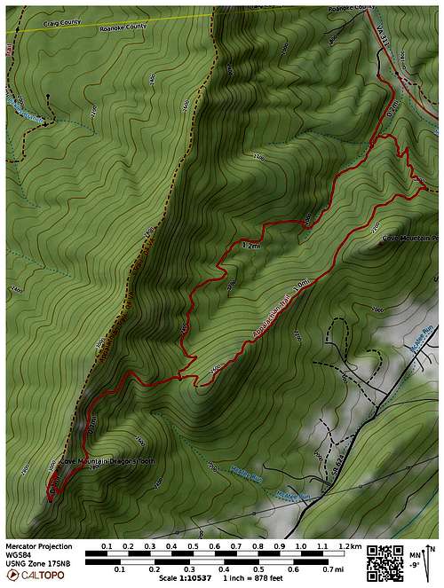
The trail ambles through the forest briefly before it splits into two options, both will get you to Lost Spectacles Gap (1.4 miles one way). The right hand (Dragon’s Tooth) trail is longer with no views save forest - but easier, and the surface is smooth for the most part – and thus it is much more popular. The left hand option (Boy Scout Trail), connecting to the Appalachian Trail going south) is steeper and rockier, but is overall wilder and has several rocky outcrops with stunning views to the east and south. It has much to recommend it. But it costs nothing to do a loop of the Dragons Tooth Trail going up to the Gap on the Dragon's Tooth trail and returning on the AT/Boy Scout Trail (which is what I did). I will follow that route in this write-up. Total is 4.2 miles round trip, 1200 feet of elevation gain.
Things get a lot more interesting once at Lost Spectacles Gap, where both trail options disgorge you. This is a major trail interchange but very well signed (the whole trail system is well blazed as well). Locate the Dragon’s Tooth trail and head further up, now more steeply. The trail passes through clumps of rock intermittently at first, then with more and more frequency until it is entirely rock bound. Large parts of the trail have been formed by artfully placed rock steps that also make use of the tilted, layered bedrock of the mountain itself. At several points the trail approaches class 3 as it makes use of cracks and striations in the rock itself to overcome a rock band.
Well…I was thinking one wall was class 3 at one point until I saw two fellows come down, one with a guitar and the other carrying an ice chest. So – Class 2 maybe in spots. The routes through these small obstacles are well blazed (maybe a bit too well) but the trail is quite popular it doubtless attracts many who need the extra help.
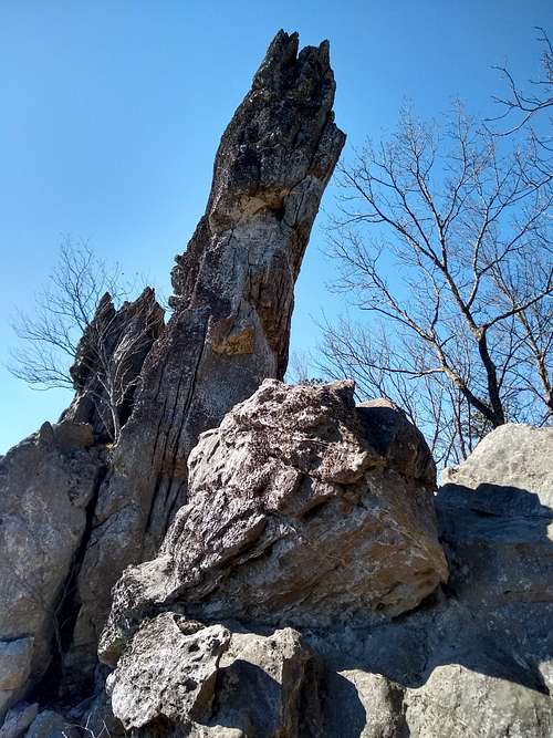
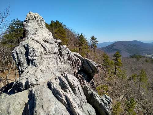
After 0.7 miles up from Lost Spectacles Gap, you surmount the crest of Cove Mountain and make a turn to the left walking along a rocky ridge. In fact, the rocks seem to increase in size as you walk, turning into quite a dental array - molars and bicuspids in this jawline leading up to the Dragon’s Tooth, with some beyond as well.
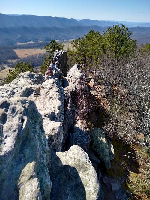
The Dragon’s Tooth itself has a 35 foot height and a slender sloping top, making it unmistakable. When I was there on a beautiful Spring day, there were a dozen people at various places in and around the tooth (great views abound here with nice stone rest spots).
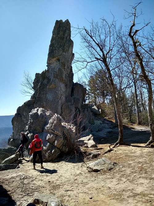
Depending on the crowd, you may have to wait your turn try for the small summit. The top of the tooth is definitely a one-at-a-time route, and the top holds two people max. But some people climb up only part way to grab a great view spot lower down on the tooth, leaving plenty of room for those going to the top. So the wait may be less than you think.
The way up starts with a class 3 climb either through a crack (to get under a boulder and then getting up and past it) on the back side of the tooth; or by stemming up it.
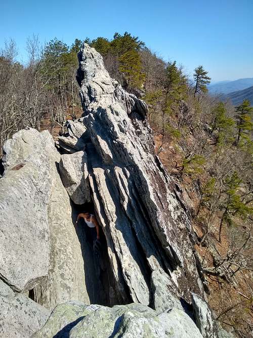
Once up and through the crack, move toward the top, where a class 3-4 section of skinny sloping rock awaits. There is exposure on either side to the tip of the tooth. It is not for everyone, but with care I was able to make my way up.
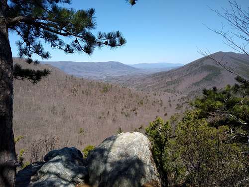
Enjoy this wonderful perch and its views to the south and west.

In fact the whole area around the tooth can serve as an informal rock clambering area.
Coming back
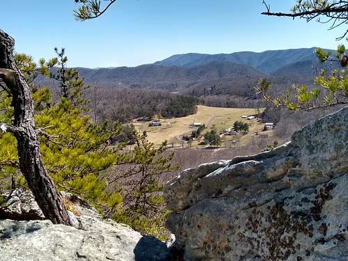
If you come back via the AT North as I did, you may be initially discouraged by the immediate uphill climb from the gap. Do not fret, a beautiful downhill ridge walk awaits, punctuated by several glorious viewpoints to the east and west. The walking is tougher and more rocky, and altogether wilder than the other option.
Return to the initial junction and quickly get back to the parking area.
Red Tape
No fees.
When to Climb
This is a quite popular hike. Go early or on a weekday.
External Links