-
 5930 Hits
-
 0% Score
-
 0 Votes
|
|
Trip Report |
|---|---|
|
|
40.61101°N / 115.44634°W |
|
|
Jul 12, 2019 |
|
|
Hiking |
|
|
Summer |
Echo Lake hike #2 - Summer 2019- Ruby Mountains Nevada
2019's epic group hike to Echo Lake would unfortunately only consist of three of us. Of the five of us last year who went on Echo Lake hike #1, only three were available to make time for Echo Lake this year. But the good news was that we'd probably be able to move faster with this being the case; plus we were taking another route that we'd decided would most likely be easier. Starting at a trailhead in Lamoille Canyon would not change, but the trailhead we'd begin on would--instead of the Lyons Canyon campground area, we'd begin at Thomas Creek camp, which was the gateway into Thomas Canyon. The two canyons are roughly parallel to each other (see image below, which you may have to click into for best detail). If you picture the number 3 laying flat on its back, this very loosely resembles the route options--the open end of the 3 is north. The top-right point is northeast, which is the entrance to Thomas Canyon. The top-middle point is the entrance of Lyons Canyon. And the top-left, or northwest, is Echo Lake. The thing is that no matter what, one must go south through either canyon, then west, then north to reach Echo Lake via these two access points. Other somewhat decent options are actually available for reaching the lake, but one way requires traversing presently restricted property, and the other involves descending a non-vertical-but-sketchy-enough cliffside.
It's important to note that a week prior to this year's hike, I had conducted reconnaissance to get a good idea of if this route was indeed better than the Lyons Canyon route. That day I hiked to the very back of Thomas Canyon, and then I hung a right, which will take you to a saddle (Saddle #1) that separates the back ends of these two canyons. This saddle is directly in front of Mt. Fitzgerald as well. Though my pack was only loaded to approximately 30 pounds, the terrain did not seem as rigorous as the Lyons route. Certainly there were steep sections, particularly at the back of the canyon on the way to Saddle #1, but it wasn't the mile or two of constantly ascending and then descending that is the Lyons route. Nonetheless it took a couple hours to get there in front of Mount Fitzgerald.
Despite the July heat, surprisingly the back end of Lyons Canyon was covered with a snow field that we would need to cross in order to reach Saddle #2. Saddle #2 is the space in the top-right of the below picture.
"We might need snowshoes," I said to the guys after getting back. "To spend all that time and effort getting that far, and to then have to posthole and risk injury would be bad."
Then we recalled crossing snow the year before after Goat Lake in Lyons Canyon. Most of what we encountered was deep snow pack, and we never postholed.
We debated as to if we should take the other way or not.
I really didn't have a great answer. The other route involved crossing a lot of snow too, just at a different angle--instead of side-hilling, we'd be taking on the slopes directly.
So despite the obvious concern, we all agreed to simply take this new route. The fallback plan would be to spend our time at Goat Lake, which would be just below this vast snowfield, if we weren't able to get to Saddle #2. I'd still bring my crampons, and Adam would later get some just prior to the hike. And Sam wasn't going to worry about it, saying that he'd simply hang back and do his own thing if we were to need crampons for any extent of the trip. Sam was clearly the most risk-averse of us three.
Wrapping up plans
We were in the final stages of planning now a week prior to the hike. We would begin in the Thomas Creek campground at approximately 7:00 a.m. on Friday. We figured we'd reach Saddle #1 in three hours with minimal breaks at a slow and steady pace. We were hoping to cross the snowfield in an hour, but the goal was ambitous considering the constant slope we'd be sidehilling on while carrying 40- to 45-pound packs. After a break on Saddle #2, we'd continue onward with sidehilling on opposite-angled slopes for at least an hour. This would bring us to the final stretch where we'd be heading north through a valley that leads to Saddle #3 and Echo Lake. We would later decide if we wanted to drop down onto that valley's floor or continue sidehilling all the way to Saddle #3--skirting along the mountainside last year had been brutal, so alternative ideas were welcome for the 2019 trek. Then once reaching Saddle #3 and taking a break, a descent of approximately 1000 feet would be below us, which would take 30 minutes to an hour or so to safely traverse.
We hoped to set up camp before nightfall that Friday, and then we'd spend all day on Saturday and Sunday at Echo Lake. The total mileage we'd hike would be approximately 12 miles after returning to the trailhead by Monday afternoon. But we all knew those miles were not going to ever be easy miles.
Gear check
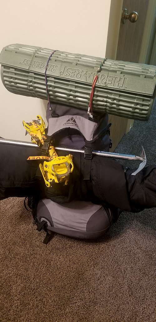
Perhaps I needed a bigger backpack, but I managed with the trusty Vaude Asymettry 30 that someone had given me for free- and brand-new -out of a garage when I was helping a man scrap an old treadmill. One thing that I wanted to make sure I did this time: Pack more food than I'd need. A mostly constant feeling of hunger accompanied me during the previous year's Echo Lake expedition, and if one of the team members had not been generous enough to fry fish for everyone, I would've been much more hungry. So the food was first on the agenda. The standard freeze-dried bags of mountain food were a must for breakfast and dinner. And the remainder would be Clif Bars, Clif energy chews, some Goos, and a large bag of cheap trailmix.
Then I decided to take an experienced friend who hiked many miles of the Appalachian Trail, and Continental Divide Trail and the Pacific Crest Trail. He said he believes in having an air sleeping pad and a foam one. So I made sure I had that taken care of.
Due to the snowfields that I saw during my recon of the area at the back end of Lyons Canyon, the ice axe and crampons had to come along.
The typical insulation was also necessary. The coat that was much too heavy, extra socks, the Under Amour 3.0 thermals that I considered emergency gear, a beanie, and then a balaclava in case of emergency as well.
Lastly would be the emergency beacon, an ACP ResQLink, which as of year 2020 is no longer in production.
As for Adam and Sam, Adam decided to bring some crampons along, though Sam did not. Otherwise, we all had the typical items for a few days in the backcountry.
Daybreak
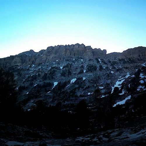
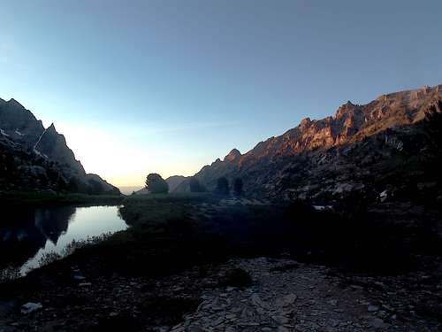
Awakened by an 05:30 alarm at Adam's house, I was grateful for the coffee and the biscuits and gravy that his family had prepared. We took our time eating while waiting on Sam to arrive. By the time we got to the trailhead, it was just 07:15 or so. The campground had many specific parking spots for cars, and then there was a trailhead parking area. This area was nearly full, and Adam had to maneuver his truck carefully to fit into a decent spot. As soon as we stepped out of the vehicle, a mountain breeze and sounds of a rushing stream accompanied us. Lamoilled Creek was nearby, and it flowed furiously with summer runoff and natural spring water, heading toward the lower end of Lamoille Canyon. As we walked on pavement from the parking area for perhaps 40 yards in order to reach the actual trailhead, nearly all the campers in their RVs and tents were still nestled into their bunks and sleeping bags under the campground's thin canopy of trees. From here we began on the trail into Thomas Canyon while steadily ascening alongside Thomas Creek. Mount Thomas towered to our left in the blue hue of a mountain dawn.
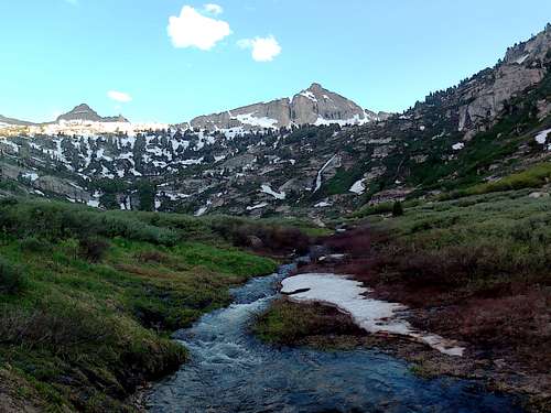
The canyon floor was still cloaked in shadows as the sky kept brightening. As we continued the ascent to finally reach a shallow high point in the trail, the gorgeous lower-south area of the canyon revealed itself, sprawled beneath two monumental sights of the Ruby Mountains -- Snow Lake Peak and Mount Fitzgerald. Beneath them was our first formidable slope awaiting us. The familiar morning-mountain coolness was getting replaced by typical mid-July warmth as we contemplated the ascent ahead of us.
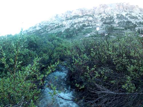
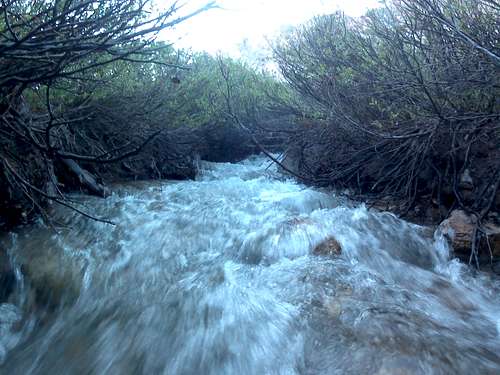
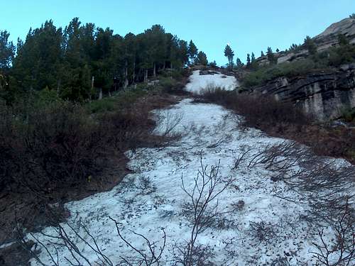
Bushwacking was inevitable at this point, and pictures couldn't even really tell the story of what we had to do. No matter what, passing through head-high brush had to happen, as did crossing a stream that was running vigorously. Getting through that would put us to the base of our first real ascent of the day. Doing my best to recall the way I'd found the past weekend, Adam and Sam followed me. It wasn't long though before we were tangled up in bushes none of us had been through before.
We of course made it through nonetheless, and so began the start to our climb into the real heights of the Ruby Mountains.
We made quick work of this first steep hill next to the column of trees visible in the above picture. Then we navigated some waist-high vegetation on a shallow hill that led to a nearly flat, plateau-like rock surface and meadow area which we crossed, to then drop down some 50 feet into a marshland of sorts. The area was perhaps a football field large, and it consisted of a group of approximately 10 to 15 small foot-deep water pools that were separated from each other. Nearby was a rushing stream that appeared as the result of a huge snowfield that was steadily melting.
“This was how I went last weekend,” I said.
“Here,” Adam said as he handed me a radio. “I’m going to go around that way.”
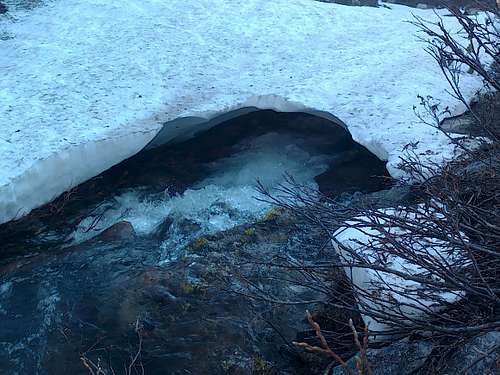
Adam wanted to check out the far side of this area where the water was coming from, where all the snow was. Sam and I weaved between some of the isolated pools in order to cross the quickly rushing water. Stepping over the 2-foot wide area of the stream was not exactly difficult, but it had to be taken seriously because it was perhaps 3-feet deep, rushing furiously, and only about 5 feet downstream was a long snow bridge. Looking into it was eerie because the rushing water was going into darkness beneath the snow. To fall and then be taken into that darkness with a 40-pound backpack on of course seemed unlikely, especially with a partner nearby to grab either of us, but it was still a thought. But one after the other, Sam and I hopped from the mushy marsh area just beneath a tree on solid ground.
We soon made contact with Adam who had made it across the swath of snow farther toward the back of the canyon. It was time to ascend to the saddle that separated the back of Thomas Canyon and the South Fork of Lamoilles Canyon. This stretch was not quite as steep as the hillside containing the column of trees, but it was perhaps 10 to 15 times as long. It would be the first major ascent of the trip that would get us more officially into what many would consider back country. We’d then be within view of the milestone we were all waiting for—the saddle that marks the end of Lamoilles Canyon's south fork.
After we drank some water and regrouped for a few minutes, Adam went back toward the end of the canyon to begin climbing up from where he’d crossed the snow. Sam and I went up approximately the way I’d gone the weekend before. Though plenty of trees were on this section up, the sun was beaming down on all of us. Sam and I had bandanas to place under our hats as drapes for neck cover. Adam wore a full-brimmed hat.
Adam and Sam each seemed to be doing well so far. I knew that Adam was the least in shape, but he was undoubtedly a trooper. Sam was a distance runner in school, and he continued to run frequently in his more adult life. Adam had not ever been much of an exercise guy despite having the mental fortitude to make it through some enduring situations while backpacking.
After five minutes of climbing, Adam chimed in on the radio.
"Where are you guys?"
"To your right somewhere."
"Am I higher up? I bet I am."
"I'm not sure," I said with a chuckle. It was typical when Adam and I hiked together that we split up and went our own ways intermittently. Historically, neither of us consistently reached a desired point faster than the other.
Sam and I stopped. We listened for Adam. He was slightly below us, and we reconvened and took a break.
"I think this is just as hard as the other way," Adam said, referring to the prior year's trek to the lake.
"You think so? I feel like it's more constantly uphill instead of those rolling inclines and declines," I said. Sam didn't seem to really have an opinion.
We kept going after a few minutes more. We stopped by a spring. Sam and I drank straight from the source. Adam didn't trust it, so he simply filled it into his bottle with a built-in LifeStraw filter system. The water had a metallic taste. Had to be all the mountain minerals, we figured. Either way, it was the last water source that we knew of until we reached Echo Lake, so we had to make sure we each had full bottles to last for the next several hours. (It wasn't until we reached the next desired point that we realized water was actually nearby on the other side.)
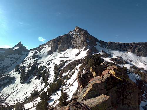
Finally we reached the saddle, providing a grand view of Mount Fitzgerald and, just beside it, Snow Lake Peak. (Snow Lake is approximately 2000 feet on the other side of the ridgeline below Snow Lake Peak, at the far end of Box Canyon, which runs from Snow Lake, past Mount Fitzgerald, then continues right, westward, until reaching the Nevadan ranches that surround the west side of this portion of the Rubies.)
In the below panoramic photo, Box Canyon runs from left to right on the other side of the visible terrain.
Risk and Reward
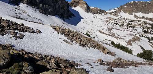
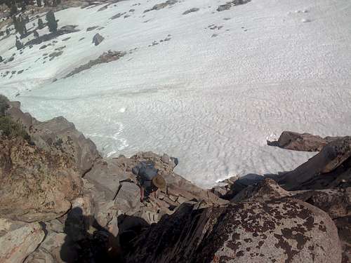
We then dropped down from the saddle to the aforementioned snow field at the end of Lyons Canyon. Quickly we realized that the slope was hazardous due to its angle. I put on my crampons while Adam and Sam felt that they weren't worried about sliding. The slope was long enough and at a steep enough angle though that falling and sliding could become a serious situation quickly. I brought the ice axe out if I need to arrest a fall of my own. In hindsite, we should've dropped down to more level ground. But none of us wanted to descend and lose elevation. I lead the way on the slope since I figured I could stomp some decent steps for Adam and Sam since they were already at a disadvantage. After only a few minutes, I heard a sliding sound, and I turn to look back toward Adam and Sam---Adam is on his way down the slope feet first, out of control. The weight of his backpack seemed to be keeping him on his back, and after approximately 40 feet of sliding, he hit a small patch of rocks that popped him up enough so he could dig his feet into the snow in order to arrest the fall. He groaned. Sam quickly rushed to him. I was working my way down as well. Adam slowly righted himself, and we all inspected him. Fortunately he had just wacked a knee and scraped the side of a shin.
"Are you sure you're all right?" Sam asked in a very concerned way.
"We'll see if anything starts feeling worse. I'm sure it'll be hurting bad pretty soon."
I knew Adam was tough, and that he'd limped all the way back from Echo Lake with a swollen knee due to hyperextension a couple years ago. He'd be fine, I told myself. Adam and Sam further descended the slope to get into more of a safety zone while I stayed up high. Despite both routes being different, each proved difficult. It was a matter of either hopping from rock to rock or postholing in random places in the softening snow. Adam and Sam now had the flatter ground to their advantage, and they advanced westward faster than I did. 40 minutes later we met at about the same time just beneath the one last step to the saddle.
This was the one last challenge: A snow slope that we had no choice but to traverse in order to reach the rocks. The field was perhaps 50 yards. We deemed it as the best option despite Adam's recent spill--to go up any other way would take more time while being comparably hazardous. So Sam went first. Then I went. Then Adam went. His knee had stiffened up some since the fall, but he said that he was doing decently with it.
Finally we'd made the saddle at the end of Lamoilles Canyon's South Fork. Of course we took a break. And then we began discussing how the route from there would be.
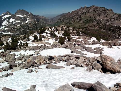
Last year we headed straight up and over the mountainside adjacent to the saddle. We were thereafter immediately met with a mile of painful sidehilling with 45-pound packs on, probably no challenge for the seasoned Himalayan adventurer, for instance, but quite problematic for our small group of mostly weekend outdoorsmen. This time, we went with the plan of doing the side-hilling minus expending a lot more energy by going over the top of anything. By heading south, away from both the saddle and the canyon's end, we stayed as level as possible with the saddle so as not to lose too much elevation, and we gradually turned west and then finally north on the rounding mountainside. The steepness definitely wasn't as steep as the route last year, so we were grateful. Finally, there we were overlooking the valley- and also looking toward the final saddle that we'd have to reach, the saddle 800 or so feet above Echo Lake.
We discussed if there might be an easier way than continuing to side-hill to get on this last saddle that overlooked Echo Lake. Inspecting the valley below with my Vortex monocular, I seemed to see a way, and either way, we hadn't explored at all down there before. Adam wanted the straightest path to the saddle, which entailed staying high on the hillside and continuing on. I knew I wasn't taking the hillside, regardless of how much more time my route would take. Sam apparently shared my sentiment, so we descended into the valley while Adam stayed high. As we broke through some more trees to get into the open, a fox scurried off quickly, denoting our entrance into a largely untouched territory.
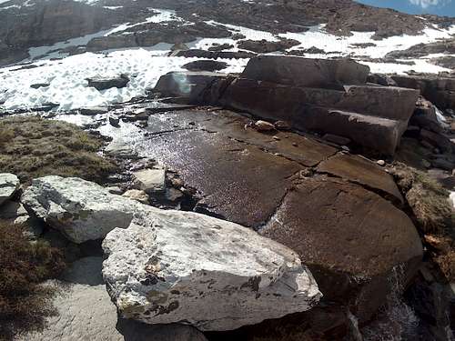
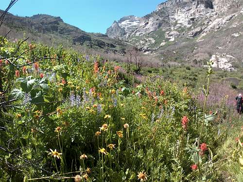
Our traverse across the valley and up to the saddle was pleasant compared to what Adam was going through on the rocks. The valley floor was a soft dirt and patches of lush, green grass. Certain formations on its west side looked like ancient ruins. Snow melt created a stream flowing over one slab of rock that looked almost like a sidewalk. (See below.)
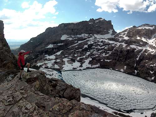
Finally, Sam and I were there on the saddle, above a still-thawing Echo Lake. The walkie-talkie bleeped. "Is it still frozen?!" Adam asked with sounds of pain in his voice.
"You're going to have to see for yourself," I replied.
Adam finally hobbled around the final bend of rocks that led onto the saddle area. He sat down for a break before finally coming the rest of the way to lay eyes on the lake below.
This was discouraging to all of us. What was thawed and aqua blue this time last year was barely penetrable this year. Adam particularly loved catch-and-release fishing. He could see big trout gliding just beneath the lake's melted outskirts. To make matters worse for getting down there, a huge snow slope covered the only area to descend, the same area we'd used last year. We realized that the only way was a hazardous one. Ideally we'd use rope, but we didn't have anything beside my thin 550 cord. With my pack off, I began descending a three-foot-wide space between the cliffside and the snow slope carefully since there actually was some solid ground there heading to the lake from the saddle. Sam and Adam stood above nervously. Sam was the most cautious of us, and as I told him and Adam that it seemed like we could get down there if we did so carefully, it was obvious that we didn't share the same opinion.
"I don't know man," he said.
"All we have to do is get from where I am to some solid ground about 30 feet down from here," I said. They couldn't see exactly what I saw, but soon enough Adam worked his way down. Then Sam. We were scrunched together and they each saw that a descent was possible, though hazardous.
"I can get out my 550 cord and belay y'all down. Then I can lower the packs."
Adam didn't seem to think that we needed to do all that. He quickly got up on the edge of the snow slope, and I quickly got on Sam's side in terms of worry.
"Dude, I don't think you need to be doing that with having a rope on at least. Let me get my rope."
"We don't need anything. Look," he said enthusiastically, as he started kicking his heels into the snow to make steps.
Sam and I were both very much on edge now though. At any given second Adam could go sliding uncontrollably down the slope, over rocks and into the freezing 29-acre lake below. And all this after he'd already gotten lucky. And we were in this situation largely because of my guidance. But Adam seemed to be making more and more progress toward the patch of ground we needed to get to until only five feet or so separated us from it. My tension eased just as Sam's voice of reason chimed in.
"I have to say that I still don't know, guys."
The look in his eyes told us that he wasn't going to come if we went. He was right to feel that way too, Adam and I realized. What fishing and exploring would we do anyway with the lake and the surrounding area so frozen still?
"How about we set up camp somewhere in the valley and sleep on it?" I offered.
We retreated back up to the saddle, each of us seemingly relieved that we weren't continuing down toward the icey lake. We hoped that the year 2020 would involve a return to alpine blue waters we'd visited the year before.
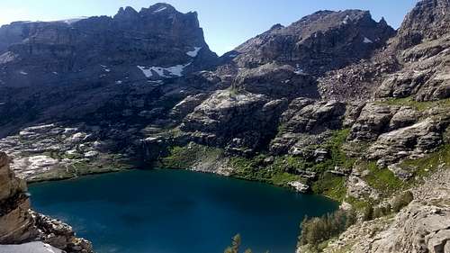
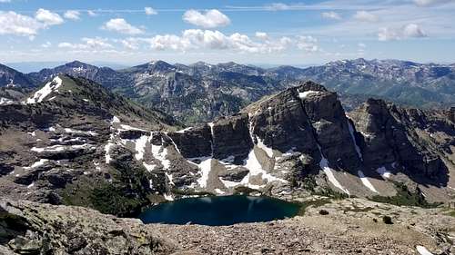
What the lake looked like a year prior from the last saddle--the south side of Echo Lake--before descending to it in early July 2018:
A view of the lake and the surrounding Rubies in 2018 up high on the north side while exploring the unofficially named "Mt. Mazama."
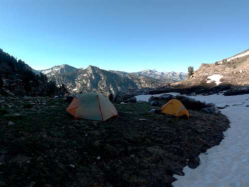
As the sun disappeared behind the mountains nearest us, we still had plenty of daylight to set up camp. We found a perfect place down in the valley that was between Echo Lake and Box Canyon. Nearby was a peaceful stream born from the snow melt. The ground was slightly moist, making our sleeping pads seem like they had a little extra cushion. Sam and I both had tents, but Adam had only brought an Outdoor Research bivy in order to keep an extra couple pounds off his pack. Luckily each of our shelters sufficed through the dry and cool night.
The New Plan
The next morning we briefly discussed plans, and we quickly agreed that Echo Lake would have to wait until another time when it was fully thawed. Sleeping on the snow didn't seem like too much fun, but more important was the hazardous entry point. Goat Lake was the new destination. It was more a small, fish-stocked pond below the second saddle at the back end of Lamoilles Canyon's south fork. Adam's knee was fine, though he said that his other knee was bothering him more than anything now. He figured it was from attempting to nurse his injured leg while hiking and putting more use through the good one. After breakfast we descended the valley just enough to find the slope that Sam and I had come down the day before. Up we went to the left, heading east.
The summer heat was quickly upon us as we ascended and began rounding the mountainside. We took numerous breaks, and we were careful to maintain a slightly ascending route. At one point as we continued turning left on one of the corners of the mountain, a Himalayan snowcock practically exploded out of a tree only 10 feet or so in front of us, triggering briefly the fight-or-flight reflex in me particuarly since I was in front at the time. Within seconds the bird was nearly out of sight as it continued on a fast glide slope down the mountain to a new shelter.
It seemed to take a couple hours to get within view of the second saddle. Before we got there, Sam and I slid down a small snow slope to water up at a pond between the saddle and Box Canyon. Adam continued onward, reaching the snow-packed saddle first and then taking a rest.
Next Sam and Adam were going one way and I was going another. It was another race to see who could reach Goat Lake first. I wanted to go the shortest distance possible to reach the lake while Sam and Adam hoped to avoid any snow slopes. They swung across the canyon's end to the east while I stayed on its west side. Their descent was much more gradual while mine took some figuring to make sure I didn't end up in the same trouble that Adam had seen the day before. Finally though I found the slope that we'd used in 2018 on the far west side of the canyon. It was a manageable, shallow slope, and the snowpack was firm. I went sliding down on my rear for a few stretches that totalled perhaps 100 yards. After that was some minor bushwacking, and soon enough I was wading in Goat Lake. It was hot, and the water felt refreshing. The radio bleeped.
"Where are you?" Adam asked.
"I'm at the lake."
"Already?"
"I found a snow slope that made it way easy. Where are y'all?"
They were still up a ways. Later the radio bleeped again.
"Hey, can you see us?" Adam asked.
I looked all around the area, and right before I gave up, I saw two tiny figures high up on top of a cliffside that overlooked this section of the canyon. I spied them as they kept making their way down through a forest area on the east side of the canyon's end.
Once we were back together, the three of us set up camp near the lake.
Shadows canvassed the canyon and night began to fall, and it became a beautiful evening. The mosquitos weren't even bad.
The Long Trek Out
Morning came at the back of Lamoilles Canyon's right fork. The time had come to focus on getting back home. We chatted along the way. The biggest difference this year was going to be the route we had to take in order to reach Thomas Canyon's camp. We realized the difference soon enough upon reaching the entrance into this right fork.
One way or another we had to take a right and head up the main canyon. Toward the bottom of the main trail in the right fork, before the stream crossing that leads to the campground, a trail of sorts veers up the side of the mountain, taking you eastward and away from the main trail. Sam and Adam stayed on this in order to round the side of the mountain. I wanted to avoid the sidehilling though, so I went low onto the flatter ground in order to head east into the main canyon while remaining on the south side of the waterfall in the area. This required me to climb a steep slope of dirt that had been burned up in the 2018 canyon fire. Just on the other side of this slope that's next to the waterfall is an old power station's foundation, according to multiple unofficial sources. It wasn't a whole lot to look at, but we all seemed to ponder the history behind its reamaining concrete walls.
From here, some old pathway existed that pioneers must've used in order to supply the power house. We meandered farther eastward for some time until it seemed to have disappeared. From there we followed the stream through more obviously incinerated forestry. Leaves were unfortunately absent, which meant continuing the hike under direct sunlight. We reached a point when we decided to cross the stream, and during the interim, Adam sat his pack down and dove into the water to cool off, with boots on and all. Sam and I followed suit. The water was as cold as I was used to, but alas, it was more refreshing than anything else could've been at the time. We continued by some type of dam area that must've been for collecting water or generating power long ago. An old rusty wheel was still attached to an axle that connected nowhere else, and the device was secured onto some seemingly handmade wall made of river rocks haphazardly slapped into concrete. We passed a family. Kids were enjoying a rope swing that was miraculously in an unburned area alongside a deep section of the creek. Then we decided to break through the brush and start walking on the road. These last miles meant more gratitude once we reached the trailhead at Thomas Creek Campground.
It was the end of our Echo Lake journey of 2019. We knew more than we did prior to it in terms of the best route to take next time.
I hope that everyone who read this took something positive away from it.


