Toggle navigation
Mountains
Routes
Images
Trip Reports
Forum
What's New
People
Areas & Ranges
Articles
Trailheads
Canyons
Huts & Campgrounds
Albums
Logistical Centers
Fact Sheets
Lists
Custom Objects
Gear
Plans & Partners
WELCOME TO SUMMITPOST
SIGN IN
REGISTER
Mount Franklin
Additional Parents
Image
Here is a map of the route...
View High-Resolution Image
Here is a map of the route...
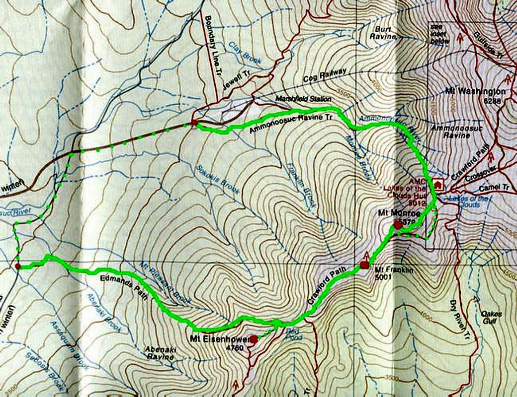
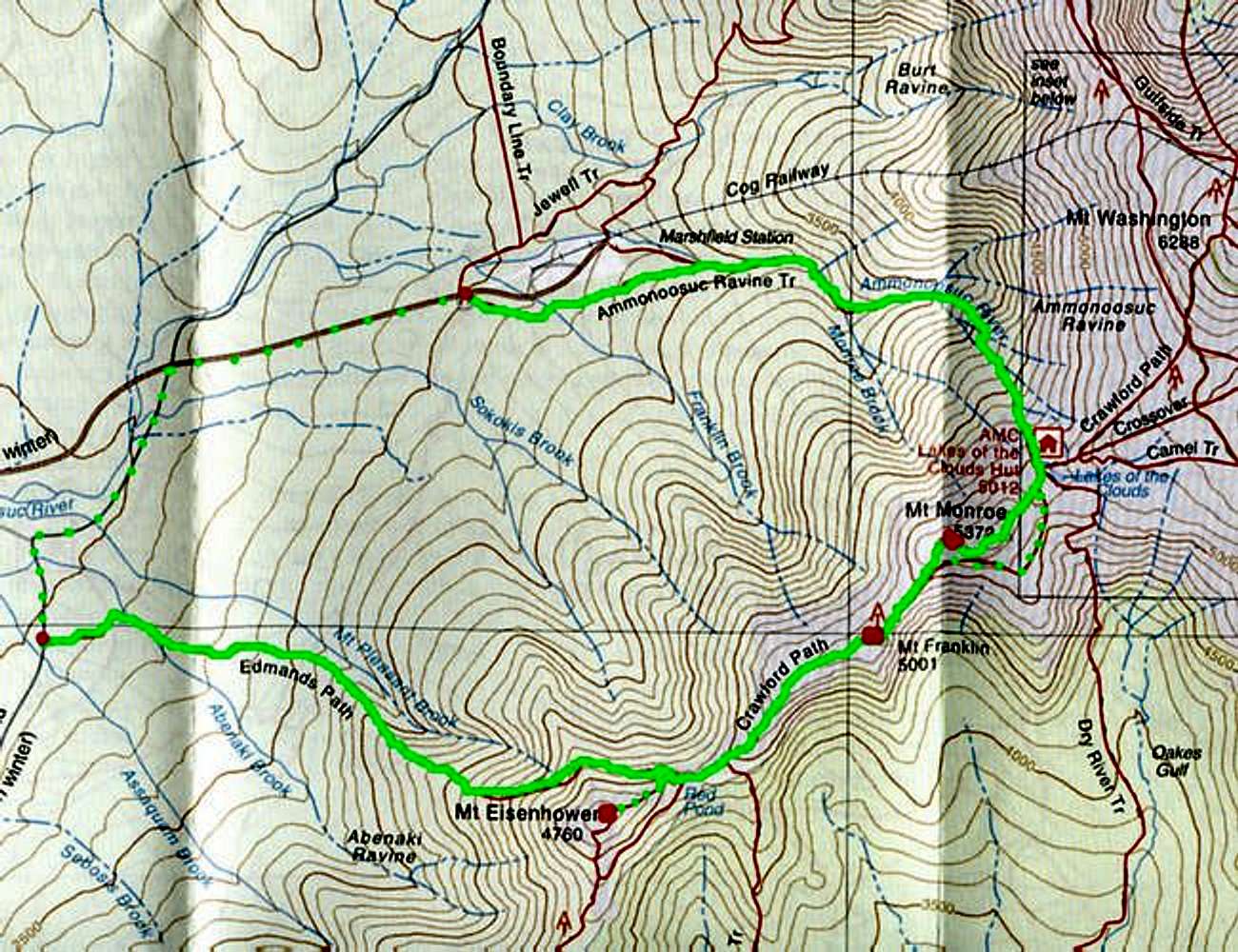
Here is a map of the route from the AMC's White Mountains maps. The green is the route with the summits marked by the red dots. The trip is a lot longer if you don't use a car at each trailhead.
« PREV
NEXT »
mtwashingtonmonroe
on
Apr 22, 2005 11:52 am
Comments & voting
Other parents
Lat/Lon:
44.24900°N / 71.331°W
Image ID:
101691
5883 Hits
71.58
% Score
4
Votes
Log in to vote
Comments
No comments posted yet.
to post!
Don't have an account?
Mount Franklin
(Mountain/Rock)
« PREV
Viewing
#9 of 12
GALLERY
NEXT »
mtwashingtonmonroe's Image Gallery
« PREV
Viewing
#834 of 1185
GALLERY
NEXT »
Ammonoosuc/ Edmands Path Loop
(Route)
Loading....
×
You need to login in order to vote!
User Name
Password
Remember me
Forgot your password?
Log me out when I close my browser.
Keep me logged in all the time.
sign in as a user
Don't have an account?
Register now for FREE
Rating available
Suggested routes for you
People who climb the same things as you
Comments Available
Create Albums
Register Here


