I am submitting this map...

I am submitting this map...
|
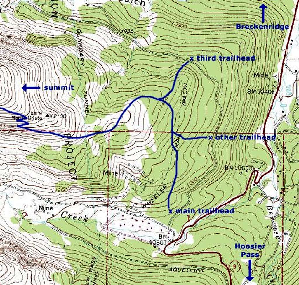
I am submitting this map to help prevent people from making the same mistake I did (starting at one trailhead and ending at another). Basically, every map I've seen of Quandary Peak is out of date. This includes the National Geographic Trails Illustrated map I used and this map. The current "main" trailhead is only 1000 ft from the first intersection you come to after exiting the highway. There is also an "other" trailhead about a half-mile down this dirt road. Both are marked with a flimsy 8.5" x 11" paper sign stapled to little posts. The first one is especially easy to miss. However there is a nice big sign at the first junction you come to after leaving the highway which tells you the "main" trailhead is only 1000 ft down the road. Unfortunately I missed this sign. I'm not sure if the "third" trailhead indicated in this map still exists because I didn't drive out there to check.
It doesn't really matter what trailhead you choose when you go up because all the trails lead to the same place. However, on your way down there are no signs or markers pointing you to the trailhead from which you started. If you follow the most obvious trail it will lead you to the "main" trailhead. There are several other trails branching off from the obvious trail, but these are unmarked and it's not clear where they lead. I wasn't paying too much attention when I hiked up the mountain because I wasn't aware I would have a problem on the way down. Since I wasn't being vigilant on my way up, I couldn't remember which trail I should take or even make a guess at what to look for. I suppose if you were very careful on the way up you could recognize the trail that would take you back to the “other” trailhead or the “third” trailhead. But if you don’t want to worry about it, I recommend parking at the “main” trailhead. |


Comments
Post a Comment