
|
|
Mountain/Rock |
|---|---|
|
|
37.79375°N / 107.64185°W |
|
|
Mountaineering |
|
|
Summer |
|
|
13066 ft / 3983 m |
|
|
Overview
Trailhead elevation: 9318 ft (Town of Silverton)
One way distance (via a 4WD road): 7 miles
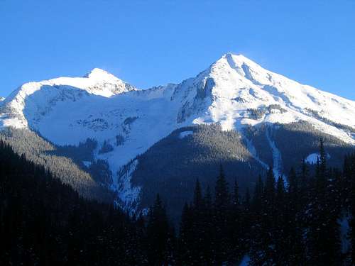
Kendall Benchmark (on the right)
Don't feel too proud when you reach the summit of this one. The town of Silverton has an annual race where the participants run to the summit of Kendall Benchmark (14 miles round trip via a 4WD road, 3748 ft elevation gain). This tradition is reported to date back to 1908 when a miner decided to run to the summit of Kendall Mountain. Another local bet that the runner could make it to the top and back in one and a half hours. He lost by just a few minutes.
Kendall Mountain complex rises directly to the southeast of the town of Silverton in the San Juan Mountains of southwestern Colorado. The complex includes at least four peaks higher than 13000 ft. The highest of these peaks is the 13451 ft Kendall Peak (not to be confused with Kendall Benchmark). Because it dominates the view from Silverton, Kendall Benchmark is the most famous of the peaks.
A 7 mile long 4 wheel drive road starts in Silverton and climbs the mountain to an elevation of about 12800 ft. From the top you will get great views of Silverton, Route 550 and other local peaks. Many people drive this road every year (You will need a high clearance 4WD vehicle. Jeep rental is available in Silverton).
 |  |  |  |  |
Getting There/Route
From Durango drive 50 miles north on Route 550 (or 60 miles south from Montrose) to the town of Silverton. Go to Main Street then turn right on 14th St. After passing the second creek, turn right and follow the road up the mountain. The road branches a few times. Drake Mountain Map mentioned above will help you find your way. At around 12800 ft the road becomes impassable for most vehicles but a trail will lead you to the summit.
 |  |  |
Red Tape
No permits required.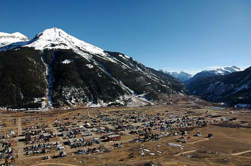
Silverton & Kendall Benchmark
When To Climb
Click to see the forecast for Silverton, CO.The road is probably closed in winter.
Camping
Available in Silverton (see www.silverton.org).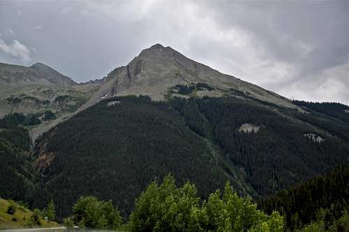
Kendall Benchmark