As a novice hiker and a wannabe mountaineer, Labor Day weekend of 2017 offered me two options: A Gannett Peak attempt or a King's Peak attempt. As many who are familiar with Gannett Peak may know, however, the route and the climb is not exactly for rookies since it involves glacier travel, plus a 20- to 25-mile hike to get there. Plus I hadn't obtained an ice axe at this point. My research of King's Peak, on the other hand, revealed that many a children have been seen crawling around at the summit with their families. Since I had two days, the 12- to 15-mile hike to the peak from the Henry's Fork trailhead became my objective for that Saturday and Sunday, 9/2 and 9/3, respectively.
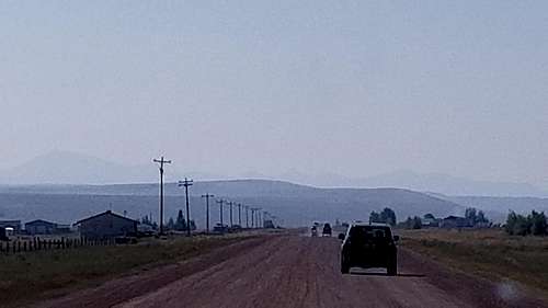
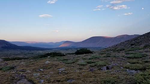
After checking my P's and Q's by making sure everything that was supposed to be in my bag was in my bag, I signed in at the register station at approximately 1:30 p.m. The southward hike began slightly uphill, a good warm-up for the miles to come. Many people were out hiking. It felt good to be in the wilderness again. My eyes scanned for any wild animals in the many surrounding thickets. The nearby river was enjoyable to hear. A refreshing piney scent of the woods reminded me both of Washington and the Wind Rivers. Every now and again came a shallow stream to cross. Given that a mile counter wasn't present on the journey, I'm not sure how long it took before I broke out of the woods to see a sweeping view of some of this high-Uinta area. This was obviously a big reason why the parking lot was so full.
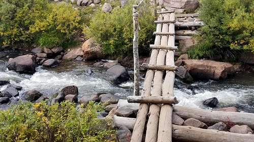
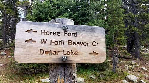
Recalling SummitPost's directions once more, after crossing the small rope bridge, I followed the sign to Dollar Lake.
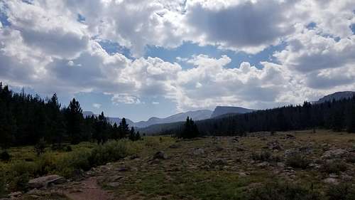
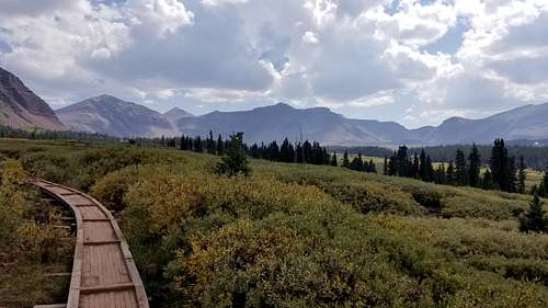
Things were going well. Plenty of of food and water on hand, and the sun's rays were lightened by cloud cover. The views became even more dramatic upon approaching a nice sturdy walkway cutting through a field of bushes.
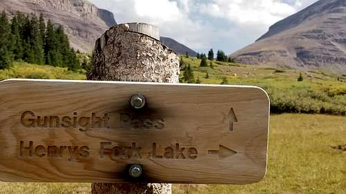
The miles seemed unnoticeable as the timeless beauty was such a distraction. Soon enough came another sign. The infamous-sounding Gunsight Pass.
The sign didn't lie. It wasn't long before I was within a stone's throw of the pass. A few people had halted cautiously, not wanting to go any farther because it was nearly 4:30 p.m. They weren't sure if there'd be decent camping areas on the other side of the pass. I knew I could always come back if nothing was over there. Darkness wouldn't fall till 8:30 p.m. or so. They set up camp by the last little pond perhaps a quarter mile before the pass, and after a quick stop refill water, the journey continued. The pass remarkably resembled an old-timey gun sight one might find on a Civil War rifle.
The trail's switchbacks made getting to the other side of the pass an elementary endeavor, a convenience after nearly 10 miles. Still, this section of trail became more rocky, so the work wasn't over. Many people I passed were returning from the summit. They all seemed very satisfied, though some seemed more worn out. Upon crossing over to the other side of the pass, a few guys were resting after their own successful summit bid. It was perhaps now after 5:00 p.m. They spoke of a shortcut, a trail directly above us to the right, or west, that was accessible with a little scrambling. Peering upwards, I saw some people there heading west on this shortcut trail. The traditional route seemed more appealing though. In the satellite image, the traditional route is the one that is visible from Gunsight Pass to Anderson Pass. Either way, one man in the group advised me to set up camp and summit the next day before I did any ascending. "You'll enjoy it more," he said. I agreed. We wished each other safe travels, and I proceeded down into Painter's Basin. Camp gave me a great view looking back toward Gunsight Pass. The ascent would be a real one, for the camping spot was near the lowest point of the trail in Painter's Basin.
![Gunsight Pass from Painter's Basin]() A view toward Gunsight Pass from camp in west side of Painter's Basin.
A view toward Gunsight Pass from camp in west side of Painter's Basin.
Though I'd opted to make a summit attempt the next day, I still did an acclimatization/exploratory hike up the trail toward Anderson's Pass. I could only imagine the view at the summit if the view was so splendid already.
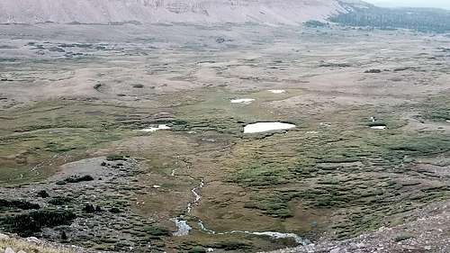
![Painter's Basin a ways above]() Painter's Basin surrounded by the high Uintas.
Painter's Basin surrounded by the high Uintas.
I took note of the trail and its inconsistency. At times it seemed to disappear, but in continuing to walk toward Anderson's Pass, it would show itself again. Perhaps this could be a challenge in the dark, but simply heading toward the right side of what I called "The Big Mountain" seemed like it could simplify navigation. After all, that was the direction to Anderson's Pass, which granted access to the north ridge to King's Peak.
Heading back down, I was surprised how high up from camp I had gone--the little blue tent was barely visible.
![Camp far below King's Peak]() Camp in Painter's Basin at bottom-middle.
Camp in Painter's Basin at bottom-middle.
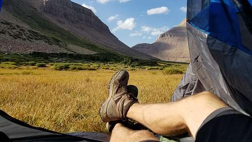
Night fell shortly after the reconnaissance hike. The alarm would go off at 4:30 a.m. I had some freeze-dried Mountain House chicken and mashed potatoes. The temperature was comfortable, and though many people were in the area camping, it was quiet out. Shortly thereafter came a good night's sleep.
The Ascent
I had pressed snooze once apparently, but then some people knocking around outside awakened me fully. It was 4:40 a.m. Would it be this warm outside the tent? Though cool, it was much warmer than I'd expected. Shorts still seemed appropriate. But either way, it would be cooler up there. This called for wool socks, a beanie cap, a light thermal top, a synthetic vest and a light windbreaker jacket. I had enough water. For food, an MRE and a Cliff Bar, though breakfast probably wouldn't happen until returning to camp. Up I went.
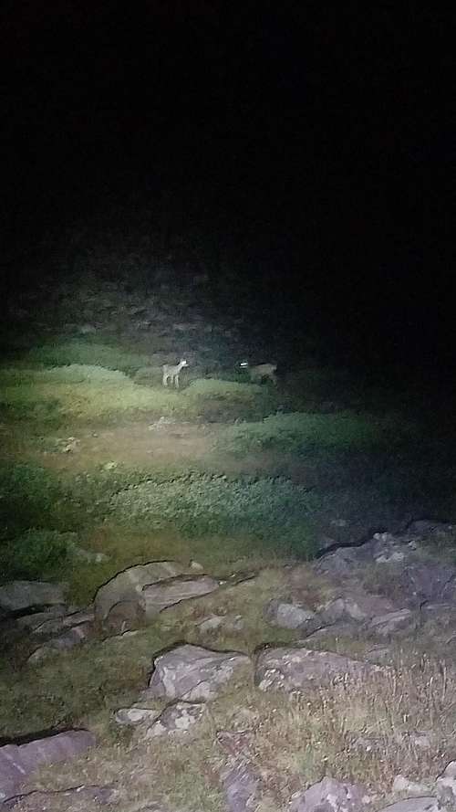
Following a stream upwards, one foot in front of the other got me on a moderate incline toward Anderson's Pass. Consciously taking full, deep breaths was necessary due to the excitement of the climb coupled with the altitude. People had made little stone piles, or cairns, that seemed to magically lead the way toward the pass and the accompanying north ridge. Admittedly, without these cairns my path would've been much more by the seat of the pants. With my headlamp and a flashlight, cairns 30 or 40 yards away were easy to spot. Occasionally I would still turn off my lights to gain better orientation with the peak. The sky was a heavy black dotted with countless stars. I felt a very light breeze occasionally. It was invigorating. The temperature during the climb was perfect at maybe 45 degrees Fahrenheit. I could hear and smell little streams of spring water trickling all around me. Then, I realized I wasn't the only one on the mountain. Two pairs of evenly spaced dots shone through the darkness. What were those? The headlamp wouldn't suffice. I turned on the flashlight on high-power.
![King's Peak deer]() Morning's greetings!
Morning's greetings!
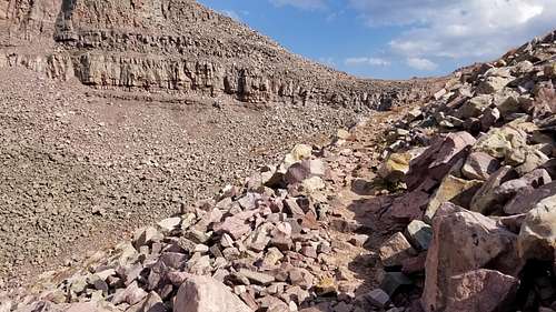
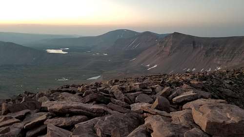
Whew! Not mountain lions, I thought. The ascent continued, and soon the everlasting north ridge was looking down at me from above. The weather was holding. The sky was completely clear. The rocks were big and easy to get around and over. This north ridge proved a deceptive incline though. Each time the summit seemed right there, I'd get there and there was more rock yet to ascend.
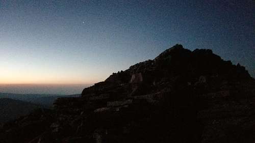
![Near King's Peak on north ridge]() On the north ridge, so seemingly close to the top.
On the north ridge, so seemingly close to the top.
Perhaps 20 minutes went by this way. One peak after another, it seemed. Was I going to make the sunset? It wasn't up yet. Wow. Talk about being up there! Looking around, all the other high peaks were below where I was grappling with this mountain now. Continuing to climb, a point seemed to appear. Still a ways to go. Up, up, up.
![King's Peak summit!]() King's Peak! The summit!
King's Peak! The summit!
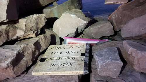
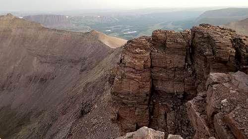
It was a first. I'd made it finally. Standing there looking all around with hardly a breeze in the sky at 13,528 feet, the air felt pure in my lungs. The sun wasn't showing yet, but enough light was there to see the vastness that is simply hard to grasp without seeing it yourself. I checked my watch. 6:30 a.m. on 9/3/2017. The horizon kept brightening. The sun seemed that it could already be up but behind cloud cover. I hiked down toward the south summit to see what was that way.
![A shot from King's Peak]() Facing south on King's Peak.
Facing south on King's Peak.
![Another view the King's Peak]() A view on the west side of the ridge.
A view on the west side of the ridge.
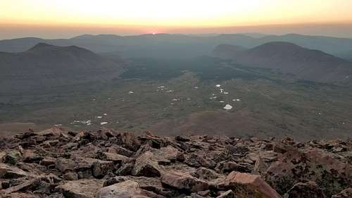
I looked back toward the horizon. All of a sudden, a concentrated point of light radiated a resplendent orange across the entire sky. I traversed back to the summit to get an official sunrise photo.
![Sunrise on King's Peak!]() A King's Peak sunrise on Labor Day Weekend, 2017, at 13,528 feet.
A King's Peak sunrise on Labor Day Weekend, 2017, at 13,528 feet.
Heading Back
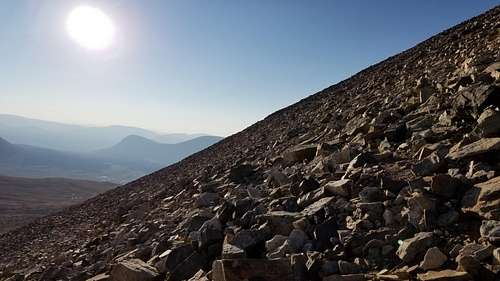
After soaking it all in for a little longer, it was time to return to regular altitudes. Getting down was simple, though always a little trickier for me. Conversations with a few people delayed the descent time, but it was still nice to rest, to exchange information, and to share the grandeur of the day. Not back to camp yet, people were coming up in droves now. Families, individuals with dogs--could the dogs scramble over the big rocks?--a grandpa and his grandchild, too. The grandpa had one arm in a sling. A couple people had practically camped on Anderson's Pass--not a bad move given the presence of little rivulets and streams coming from somewhere near the peak. Looking back up, the amount of rock caught my attention.
![King's Peak rocks]() King's Peak rocks. Pun intended.
King's Peak rocks. Pun intended.
Halfway to camp a lady was looking for a couple teenagers that were in her party. Scanning down below with my monocular yielded nothing. The lady spoke of a frightful story in which a young woman in a King's Peak group got lost in the area for two days. Fortunately these youngsters were mearly lagging behind the main party.
Finally back to camp, freeze-dried scrambled eggs and water were on the menu. In reserves for the trek back was an MRE. The accomplishment felt good, but it wasn't over. Getting beyond Gunsight Pass would be a challenge since it would mean more climbing upwards for a while. Then were the miles between there and the ride home. My feet were pretty well broken in, but the descent from the peak had made my boots feel small.
At approximately 10:30 I was on my way. Numerous people trickled into Painter's Basin as I headed out. They were all curious how the summit was.
Upon getting over Gunsight Pass, I stopped at the same stream as before to fill water. The sun was high up now, and the hot, arid feel made me glad to have mostly downhill ahead. It wasn't long before the 'ole toes were getting jammed up. I pondered if perhaps something in the mud I'd walked through had caused my boots to shrink. Regardless, trudging onward was the only way. Wincing from the discomfort of stepping downward became normal. It seemed that I went for several miles without seeing anyone. Finally came the Dollar Lake sign. I crossed the bridge I'd taken before. The end felt near, but after another mile or so I encountered a lady on her way back to the trailhead as well. "Only five more miles to go," she said. Well at least the water bottles were full, I thought.
Down went the chili and beans MRE. On went the miles of toe-jammed hiking. The going was getting tougher, though it was plenty tolerable by slowing down and stepping more lightly. Another hiker heading out with an injured knee helped to slow my pace. The man said he'd overextended himself by starting the hike at approximately the same time that I had the day before. We both slowly walked the remaining three miles while discussing why the U.S. remains a great nation--a suitable conclusion to a hike in one of the nation's great forests.
Finally in the trailhead entrance, we wished each other farewell. After getting to the vehicle, I signed out on the register log. The time was near 5:00 p.m. It had been twelve-and-a-half hours on the move. I thought about elevated feet, ice, and lots of food on the drive home.


Comments
Post a Comment