Toggle navigation
Mountains
Routes
Images
Trip Reports
Forum
What's New
People
Areas & Ranges
Articles
Trailheads
Canyons
Huts & Campgrounds
Albums
Logistical Centers
Fact Sheets
Lists
Custom Objects
Gear
Plans & Partners
WELCOME TO SUMMITPOST
SIGN IN
REGISTER
Porcupine Rim Trail
Additional Parents
Image
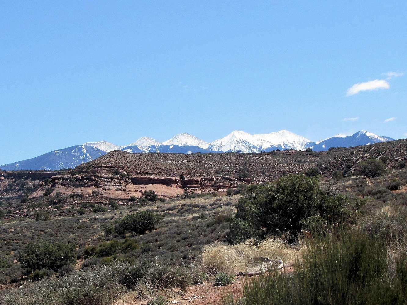
La Sal Mountains
View High-Resolution Image
La Sal Mountains
March 25, 2015 On Porcupine Rim Trail Right to left: The very tip of Manns Peak 12272 ft, Pilot Mountain 12200 ft, Green Mountain 12163 ft, Mt. Waas 12331 ft, Castle Peak 12044 ft & La Sal Peak 12001 ft
« PREV
NEXT »
nader
on
Apr 25, 2015 9:42 pm
Comments & voting
Other parents
Image Type(s):
Hiking
Image ID:
937165
869 Hits
74.01
% Score
4
Votes
Log in to vote
Comments
No comments posted yet.
to post!
Don't have an account?
Porcupine Rim Trail
(Route)
« PREV
Viewing
#37 of 41
GALLERY
NEXT »
nader's Image Gallery
« PREV
Viewing
#8925 of 15325
GALLERY
NEXT »
×
You need to login in order to vote!
User Name
Password
Remember me
Forgot your password?
Log me out when I close my browser.
Keep me logged in all the time.
sign in as a user
Don't have an account?
Register now for FREE
Rating available
Suggested routes for you
People who climb the same things as you
Comments Available
Create Albums
Register Here


