Toggle navigation
Mountains
Routes
Images
Trip Reports
Forum
What's New
People
Areas & Ranges
Articles
Trailheads
Canyons
Huts & Campgrounds
Albums
Logistical Centers
Fact Sheets
Lists
Custom Objects
Gear
Plans & Partners
WELCOME TO SUMMITPOST
SIGN IN
REGISTER
Bowl of Fire West
Additional Parents
Image
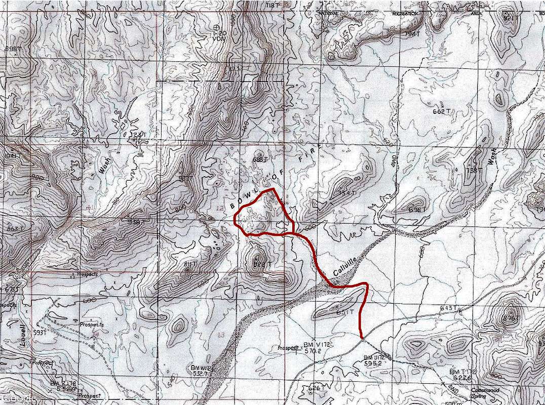
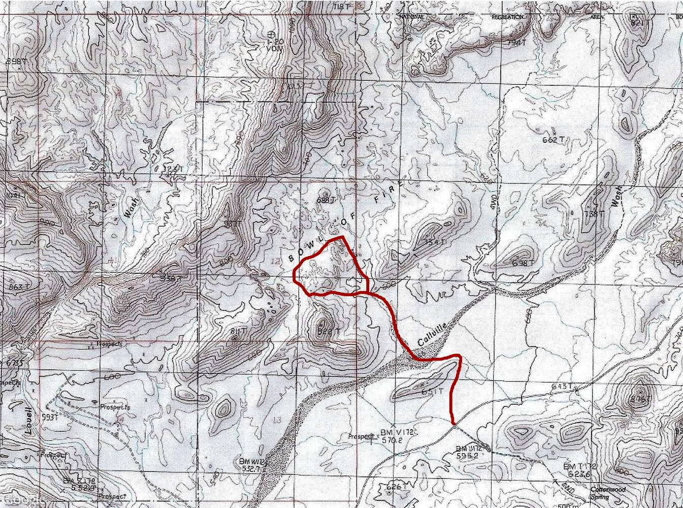
Map of my hike in Bowl of Fire
View High-Resolution Image
Map of my hike in Bowl of Fire
All elevations are in meters. Red line shows the path that I took. North Shore Road seen. Peak 822 meters is known as Murphy Peak.
« PREV
NEXT »
nader
on
Feb 11, 2014 3:46 pm
Comments & voting
Other parents
Image Type(s):
Hiking
Image ID:
886592
1961 Hits
75.81
% Score
6
Votes
Log in to vote
Comments
No comments posted yet.
to post!
Don't have an account?
Bowl of Fire West
(Trip Report)
« PREV
Viewing
#17 of 30
GALLERY
NEXT »
nader's Image Gallery
« PREV
Viewing
#4321 of 15266
GALLERY
NEXT »
×
You need to login in order to vote!
User Name
Password
Remember me
Forgot your password?
Log me out when I close my browser.
Keep me logged in all the time.
sign in as a user
Don't have an account?
Register now for FREE
Rating available
Suggested routes for you
People who climb the same things as you
Comments Available
Create Albums
Register Here


