
|
|
Mountain/Rock |
|---|---|
|
|
22.16051°S / 44.56113°W |
|
|
Hiking, Mountaineering, Sport Climbing, Scrambling |
|
|
Winter |
|
|
7218 ft / 2200 m |
|
|
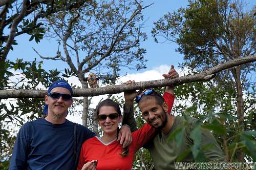
Summit!
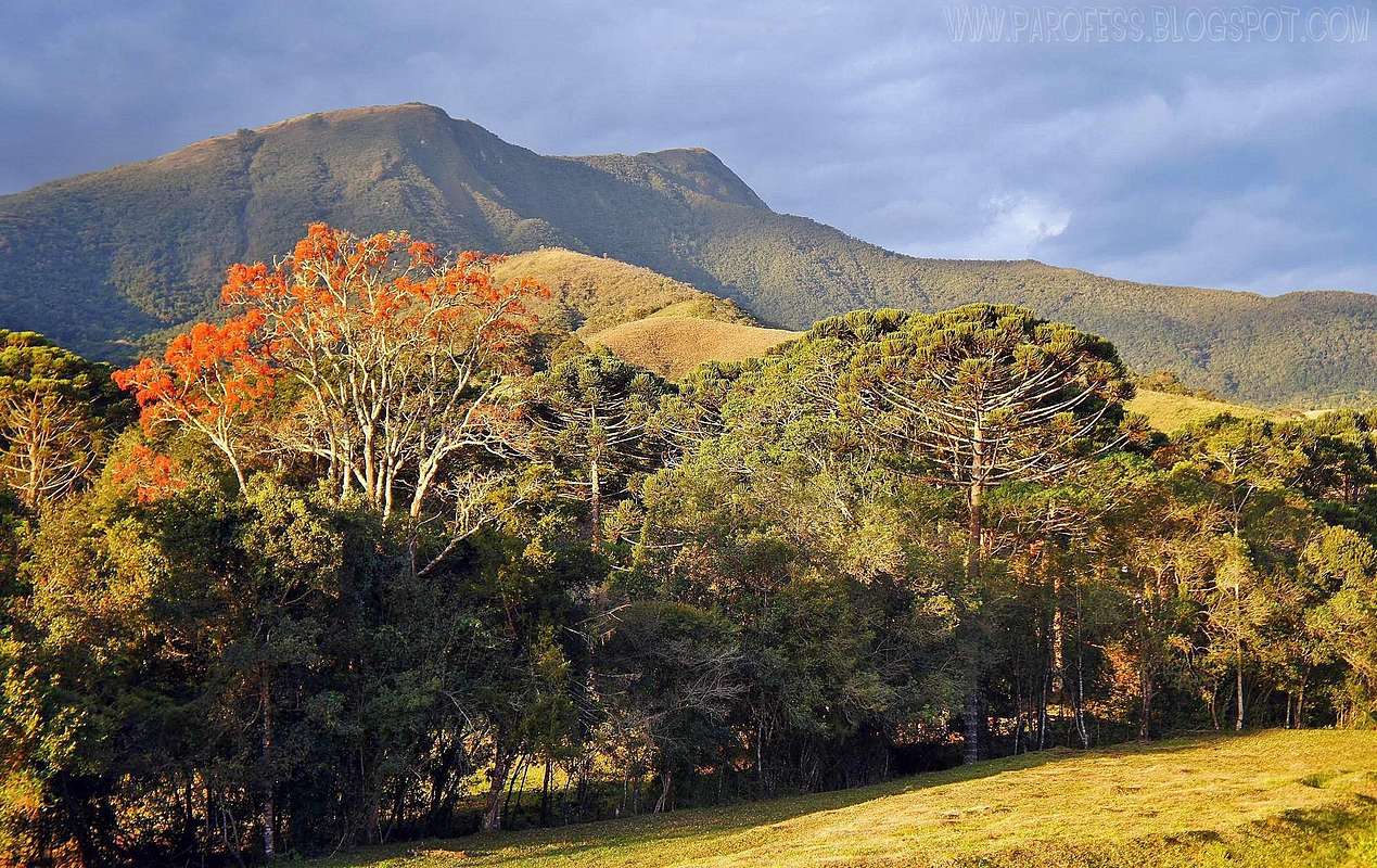
Mitra from the road.
Mitra do Bispo Peak (or Bishop's Mitre Peak) is a mountain little known, much less frequented. Searching the net for years I find one, only one report of trekking to the top of this distant mountain, and it just gave more will to do it. The will has grown since 2009 and in 2010 when I, Tacio and Victor Carvalho saw the mountain from the top of Garrafão Peak near the town of Aiuruoca. Mitra do Bispo emerges highlighting the ground like a volcano, and is easily identified pointed to dozens of miles away. The name was given to that gorgeous mountain because of its pointy shape, which reminds a little bit a Bishop's Mitre.
Later I discovered that several houses nearby had a privileged view of Mitra very close, about four miles in a straight line. Gorgeous, building up like a volcano, very near. We did not know this vision as we arrived at the little farm to spend the night it was already dark.
Maybe the fact that reach the base of this mountain is a hard work by its own did save it from the eroded more used and full of trash trails we have here. If we establish a number of brazilian mountaineers, even an fictitious number for comparison purposes only, let's say, Brazil have around 10.000 mountaineers: Probably 9.800 of them never heard of that mountain and a few more close to it. We think that in one hand, that's a good thing, but in the other hand, misinformation can stop our sport from evolving. But what a hell, nature says thank you. From that couple hundred who heard of it, we know only a few who hiked its summit, only a handful of them. Now we're part of that selected group.
Getting There


No room for fear of heights here.
Do the approach to Itamonte city, the very same one you should take to get to Itatiaia National Park. From there, ask for directions to Alagoa village. There is not a name for the road since it is a dirt road, but there is some visible signs at some points (don't worry mucha bout how to get there, just folow the kml file available here and you'll be just fine). Once you get to Alagoa again ask for directions to get to Betinho's House, everyone knows him up there. Keep on the road and after a while you'll see some farms by the foot of the peak. Approach the farm with no problems (at dry season - between late may and early september) and as soon as you get there talk to the farm caretaker, Betinho, just to let him know you'll hike the Peak (aka Pedra da Mitra Peak by locals). You don't have to pay anything, no fee at all and no money for parking the car also.
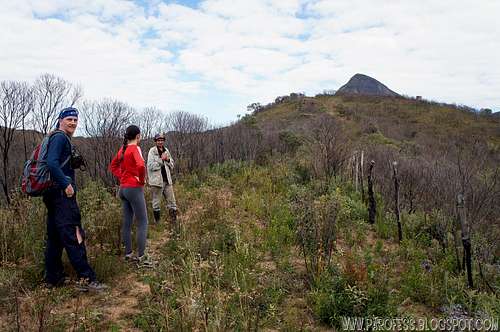
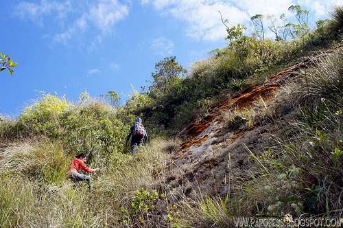
The trail is very obvious and wide opne most of the time, but in the end it vanishes a little bit, but still visible, the farm is at around 1.620m and the first part is gonna get you at the main ridge at around 1.800 m, from there just follow that same ridge all the way up to the rocky face. It is easy till that part, from now on you're in trouble. The rocky face is very steep, sometimes up to 75°. You will have to do some rock climbing with no protections at all, soloing the whole path, about 45 vertical meters (about 150 feet!) and after that you'll have to get into the woods.
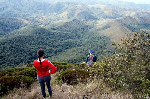
No more trails here, fight your way to the summit, there is no secret, trail, markings, just point your head up to the highest ground and fight the woods to gain some more altitude. Half an hour later you'll reach a flat ground, a little camping sight with an old dead fire circle, it fits two tents, that's it. That's the summit, check your gps and it should give you the altitude of 2.200m (7.218feet).
There is no good view from the summit, you have to get inside the smaller trails that circle around the summit to have a good look around, don't be shy, have a look.
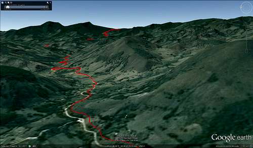
Sat view from the road
Sat view from the road 2
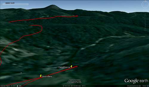
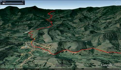
Sat view from the farm
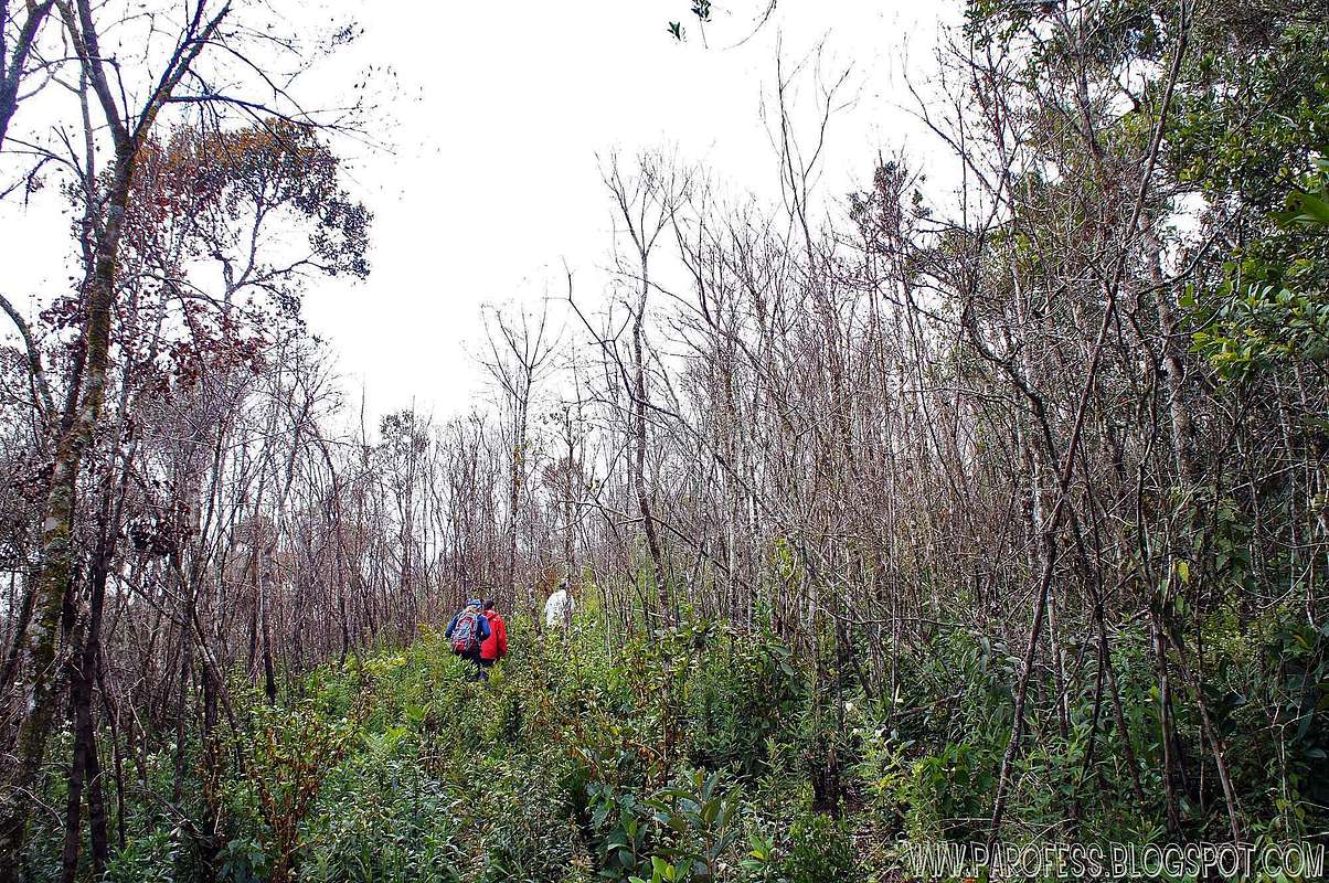
First steps

Dry bushes and Mitra
At 1800m high
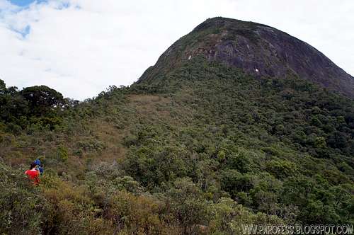
At 1950m high.
Solo climb to find a path
Looking for a safer way down
Red Tape
Parking lot at the farm;Well marked trail for 70% of the way up;
No fees at all.
What’s forbidden:
At all costs, don't make fire or deforest any places. Respect the nature and wildlife please!
Camping
Anywhere you want, even on the summit.KML for download
Be my guest, it's marked the summit, camping spot, the trail start, water points, Betinho's house, rock wall start, old bolt on the rock wall, all done by Tacio Philip.For the download, please access: http://www.4shared.com/get/8GSk3bEf/Mitra_do_Bispo_TL.html
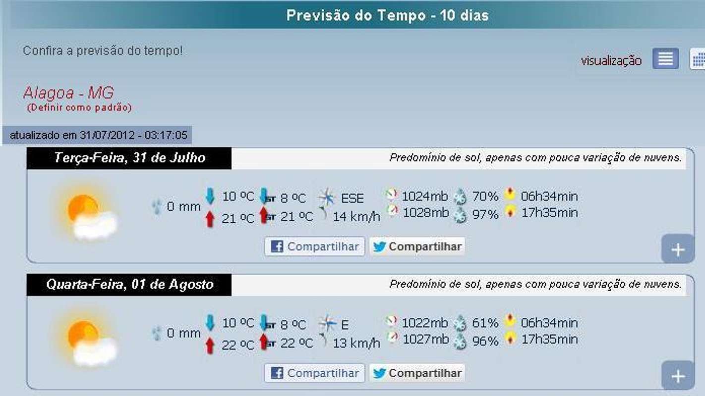
Weather Forecast
Legal Issues
To hike/ climb is a dangerous activity and requires proper equipment and clothing, the owner of this page cannot be blamed by injuries caused to anyone who read this page for its info about the mountain, and eventually got hurt by doing so with reckless behaviour or bad weather conditions.
Paulo Roberto Felipe Schmidt – AKA: PAROFES
External Links
A brazilian website to get mountains info, including gps files to download:http://www.rumos.net.br/rumos/My youtube channel: www.youtube.com/parofes - Now with 270+ videos online!
The biggest brazilian website about climbing and mountaineering, for which I'm a columnist: