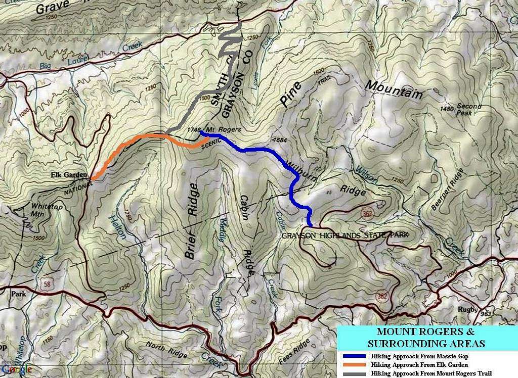
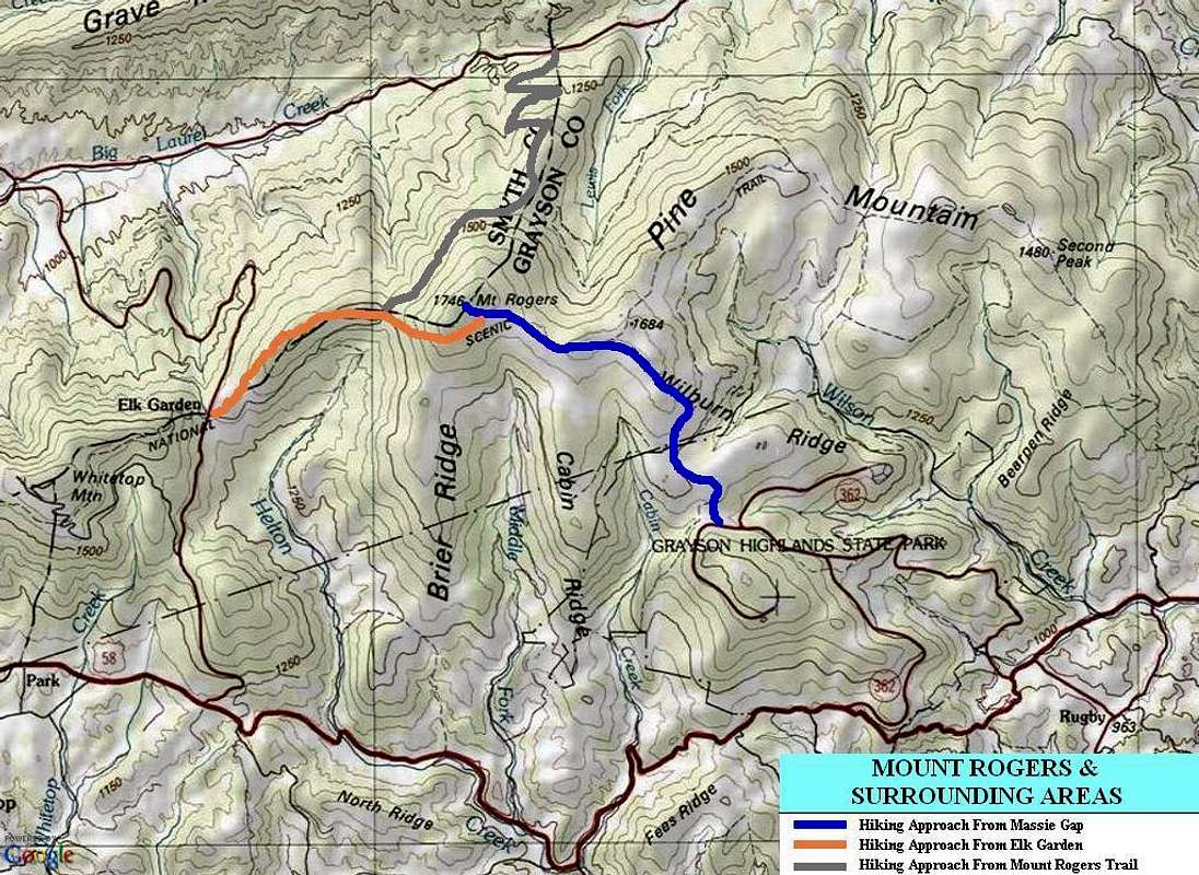
Mount Rogers - Standard Routes
A general route map showing the three most popular approaches for Mount Rogers, the highest point in Virginia.
The BLUE-colored line represents the most popular (and shortest) route, from Massie Gap/Grayson Highlands to the south.
The ORANGE-colored line represents the second-most popular and second-shortest route, from Elk Garden to the west.
The GRAY-colored line represents the third-most popular route, via Mount Rogers Trail to the north.
------------
General map created on April 20, 2013.


