
-
 70945 Hits
-
 90.48% Score
-
 32 Votes
|
|
Mountain/Rock |
|---|---|
|
|
47.81341°N / 123.23337°W |
|
|
Jefferson |
|
|
Hiking, Mountaineering |
|
|
Summer, Fall |
|
|
7788 ft / 2374 m |
|
|
Overview
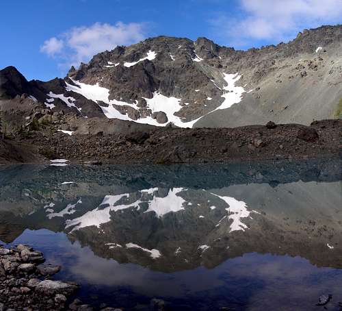 The Northeast Face Seen From Upper Royal Basin
Deception is the second highest peak in the Olympic Range, and distinctively the 17th most prominent peak in Washington State. It is primarily comprised of pillow lava which makes for overall poor climbing. Located in the "rain-shadow" of the Bailey range, Deception receives a fraction of the 200+ inches of rainfall that Mt Olympus sees every year. Furthermore the Deception group is the most rapidly rising group of peaks in the Olympic range and is also the youngest to be formed. There is a small glacier remnant high on the northwest face. The standard Royal Basin approach route passes along the top of this glacier, but crevasse danger is not a problem there. Rope and other typical glacier accessories are unnecessary, but a helmet is essential.
 The Summit And Gilhooley Tower Above The Small Glacier
Although it lacks the big glaciers of Mount Olympus and the quality technical routes of the nearby Needles group, Deception is a challenging scramble that offers one of the best views in the Olympics. Most routes are either class 3+ but can seem more difficult due to the amount of dirt and debris covering the already loose rock. As with much of the Olympics, rotten rock is a problem to consider, especially climbing out of upper Royal Basin. With all the loose rock present, one small rock can quickly turn into a mountainside of boulders rushing towards the base. For this reason it is preferable to stick to the snow when possible. It might be advantageous to plan an ascent in early summer rather than late summer or fall.
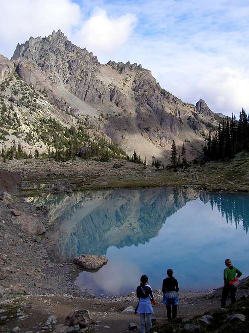
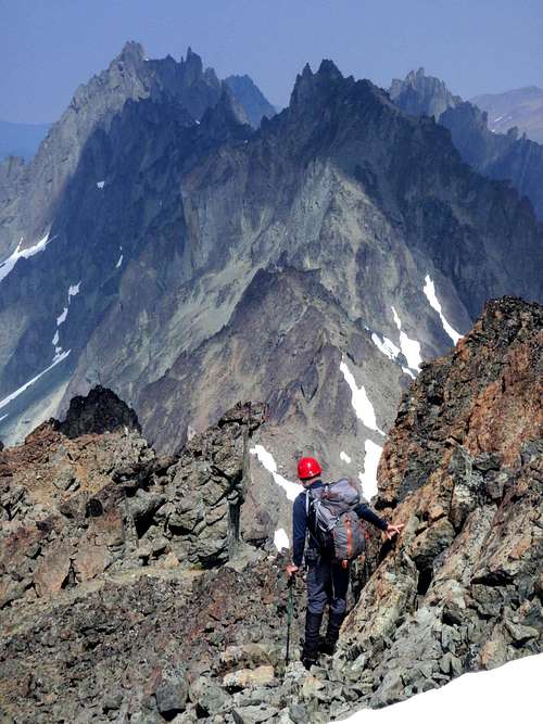
 The Southeast Face Viewed From Deception Basin
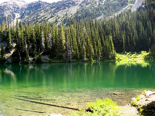
Even with the hordes of people roaming Royal Basin, Solitude can still be achieved on the climbers route as soon as you climb up towards the Martin Deception saddle. Royal Basin is a popular camping destination for a reason though. The upper basin is rugged and enchanting, a maze of tarns nestled among small moraines, with the northeast face of the mountain towering above. The view of Mount Clark from the biggest tarn is worth the effort of the hike. Next to this large tarn is a boulder the size of a house with a broad flat top. Marmots on the surrounding hills will whistle when they spot you there.
 Upper Royal Basin
Since it is unlikely that anyone would wish to attempt Mount Deception in a day (20+ miles round-trip), it is possible to add on a few side trips and make for a longer outing. A short jaunt up to Surprise Basin is sure to impress. This is the basin above upper Royal in the cirque between Martin, Johnson and Clark. For those who are undeterred by loose rock, consider climbing nearby Hal Foss Peak or Mount Mystery via neighboring Deception Basin. If you're looking for something shorter and easier, the hike up Mount Fricaba.
 The East Face Seen From Marmot Pass
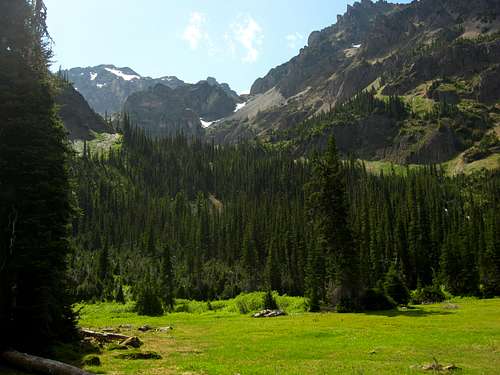
The following is a short overview of the standard route which follows along Royal Creek to Royal Basin. If you are planning a climb of Mount Deception, take the time to study Klenke's excellent route page. The trail basically contours a couple hundred feet above the Ryal Creek the entire way. After 1 mile reach a junction, take the right fork. The trail winds through beautiful open forest with scattered rhododendrons for the first couple of miles before reaching a rocky clearing at 3 miles. Here are the first views of some of the rugged peaks ahead. At 6 miles the trail opens onto lower Royal Basin where there is a meadow with camps and the rangers tent. There is a large boulder with a split through the middle known as Shelter Rock in the center of the camping complex. An outdoor toilet is around the back side.
 Near The Summit
7 miles miles from the car reach Royal Lake where there are multiple camp sites. The main trail skirts to the right side of the lake and makes its way over to the meadows of the shelter rock area and more camps. Around 8 miles the trail disintegrates in the rocks and moraines of the upper basin. From the large tarn travel southwest over moraines and or snow to reach the base of Deception. To venture further, mountaineering experience is strongly suggested. Unfortunately a number of people have been seriously injured and even killed in attempting this climb.
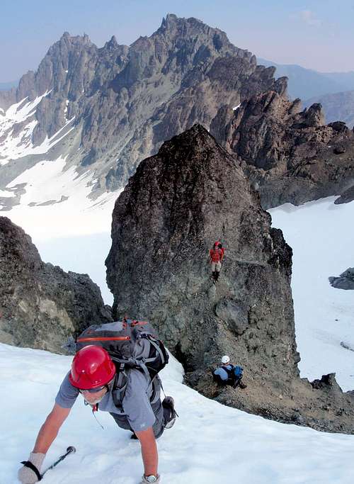 Climbing The Glacier Headwall
Ascend steep loose scree slopes on the west side of the upper basin and be careful not to send any boulders down on your climbing partners. When you reach the Deception Martin saddle descend 100 feet to the glacier and traverse westward around Gilhooley Tower and the other impeding crags. After traversing around the west side to the slopes south of Gilhooley Tower, the remainder of the route is just a walk along class 2 slopes to the summit. Summit view east. The steep dangerous slopes can be avoided on the return by passing through Surprise Basin, but that was is long, arduous and not recommended.
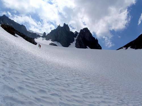 The Northwest Glacier
Getting There
Good luck finding your way through the maze of vaguely signed roads. If you own a GPS, use it. Drive highway 101 to just South of Sequim Bay State Parkand turn South on Louella road. Follow this for a mile to a "T" and turn left on Palo Alto Road. At around 6 miles from hwy 101, fork right off the paved road onto a gravel road with a sign saying Dungeness Forks Camp. Follow this up and down winding road to another fork ,around 12 miles from hwy 101, and go left. At around 17 miles reach the large parking lot of the Upper Dungeness trailhead.
Red Tape
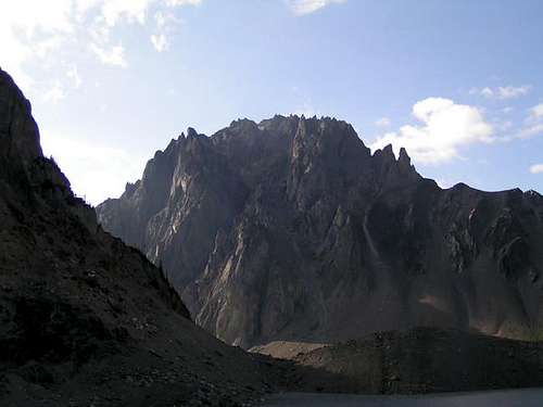
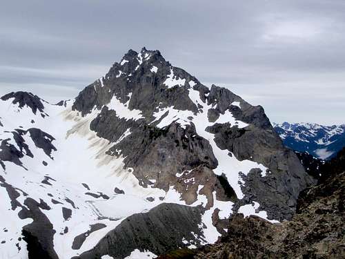 Nearby Mount Mystery
Due to high use in this area overnight camping in the basin is by reservation only from May 1st through Sept 30th. Permits are no longer self registration at the traihead and must be aquired from the ranger station. The Northwest Forest Pass is also required to park at the trailhead ($5.00 a day/$30.00 a year) and can be purchased from ranger stations also.
Bear canisters are required for all campers in Royal Basin. Loaners ($3.00 donation requested) from the National Park are available at the Wilderness Information Center in Port Angeles or at Wild Birds Unlimited in Gardiner on SR 101.
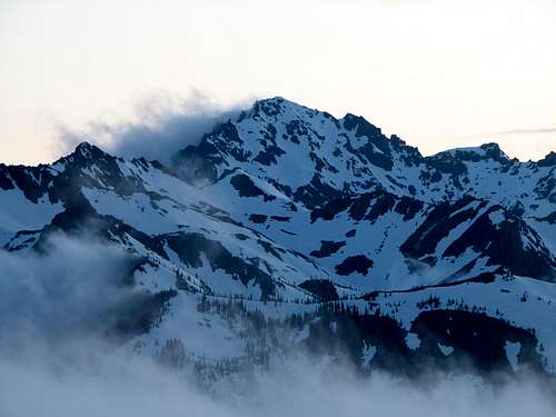
When To Climb
 Royal Lake
Early Summer is the season of choice although routes are open as soon as the Dungeness road melts out, which can be as early as the beginning of May. Due to loose rock on the mountain early July would be the best time to climb, when snow still covers most of the route but camps are mostly melted out. To avoid the hassles of overnight permits and bear cans you could potentially do this trip as a long day trip. (5,300 ft gain / 20+ miles round-trip)
Camping
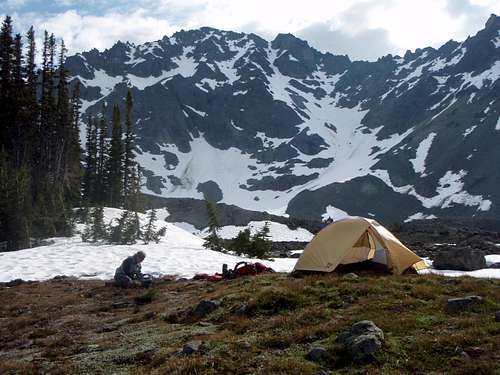 Camping In Upper Royal Basin
Campsites line the trail for the first several miles before becoming non-existent until the meadow is reached at 6 miles. Camps also surround Royal lake and are scattered around shelter rock in lower Royal Basin. The best and most beautiful camps are located in the upper basin where tarns, creeks, heather, flowers, snowfields, clusters of trees, glacial moraines and rugged peaks are everywhere.
External Trip Reports
 Royal Basin
- September 2011 Trip Report of the standard route by Ian Bentryn
- August 2011 Trip Report of the standard route by meck
- August 2010 Trip Report of the standard route by gimpilator
- July 2010 Trip Report of the standard route by rasising3hikers
- July 2010 Trip Report of the standard route by wreamer
- May 2009 Trip Report of the standard route by chimbo
- June 2008 Trip Report of the standard route by iluka
- June 2007 Trip Report of the northeast gully by Chris Willett
- April 2007 Trip Report of the northeast gully by skykilo
- August 2002 Trip Report of the standard route by Eric Hoffman