|
|
Mountain/Rock |
|---|---|
|
|
35.07510°N / 113.8978°W |
|
|
Mohave |
|
|
Hiking, Scrambling |
|
|
Spring, Summer, Fall, Winter |
|
|
8417 ft / 2566 m |
|
|
.Overview

Hualapai Peak is the highest point in the Hualapai Mountains in northwest Arizona, south of Kingman, Arizona. With a prominence of 4,447’, it is a dominating mountain and makes up one of Arizona’s famous sky islands with forests with snow and creeks and lushness rising high above the desert.
Hualapai Peak is also the highest point in Mohave County, AZ. There are multiple summits to hike or scramble in the immediate area, including Hayden Peak 8,390’, Aspen Peak 8,167’, Dean Peak 8,013’, or lesser know summits like Peak 7,745 rising just above the Ranger Station and Peak 7,740, which is just above a saddle between it and Hualapai Peak.
The Hualapai Mountain Park is a popular area for camping and recreation for residents in Las Vegas, Phoenix, and to a lesser degree from Southern California. However, it isn’t as popular as some other major spots in the area, so getting a campsite isn’t too difficult, and it isn’t terribly overcrowded.
While Hualapai Peak is easy to get to, most people will hike up to it and not go to the top. Reaching the top requires some scrambling, which isn’t terribly hard, but probably not nearly as easy for the average hiker not used to exposed Class 2 and light Class 3 hiking.
The best time to hike Hualapai Peak is probably April, May, and June, and September and October into early November.
Thanks to Scott Surgent for posting this page. I have revived content with information. He has an excellent trip report, here: https://www.surgent.net/highpoints/az/range/hualapai.html
Getting There
Hualapai Mountain Park is 11 ½ miles south of Kingman accessed via Hualapai Mountain Road. From there, the Ranger Station must be passed by in order to access the trailhead. Signs along the road lead to the “hiking trails”, where the trailhead is found at the Hualapai Mountain Park Disc Golf Course on GPS or mapping apps. There is ample parking here at the beginning of the Levi Camp Road and the East Potato Patch Trail.
Route Information
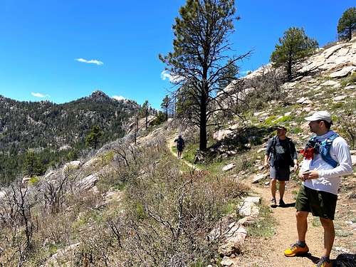
The route is fairly well-marked. The most direct way is to take the East Potato Patch Loop Trail which winds around the face of Aspen Peak before descending down towards a road leading up towards Hualapai Peak. This results in a one-way hike of approximately 4 1/2 miles and an elevation gain of 2,500’ one way. This becomes about 3,000’ round trip after going back up and over the East Potato Patch Trail.

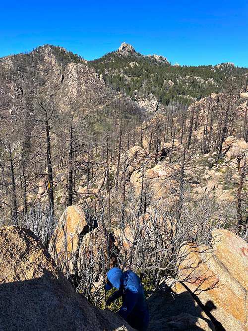
About 150’ below the summit, the road/trail ends. There is a large cairn indicating a use trail that approaches the summit rocks from the east side. The trail is narrow, but the route is obvious enough. Once at the summit rocks, the actual summit rock is reached by going to the left and then going up to the summit. It’s exposed Class 2 scrambling.
If wanting to hike other summits, Hayden Peak 8,390’ can be added by bypassing the East Potato Patch Trail and continuing north for more than half a mile and heading up the road on the left to Hayden Peak. The Aspen Peak junction is to the right just south of the road to Hayden Peak.
Peak 7740 can also be added by hiking to the left from the saddle between it and Hualapai Peak. It adds about 2/3rds of a mile and over 310’ of gain. The summit is in the middle of the massif and not at the east end.
All four of these can be hiked in over 13 miles gaining over 5,000’. However, it’s a long and hard day. Hayden Peak adds over 1,100’ of gain and Aspen Peak adds over 600’ of gain.
See Trail maps for more information.
Camping
Hualapai Mountain Park offers cabins to primitive campsites. Cabins are made by reservation from the Park website. Primitive campsites are first come, first serve.
Red Tape
Hualapai Mountain Park may close during winter storms. However, it is typically open during early spring to late fall. The Ranger Station isn’t always open, but there’s a self-pay kiosk that can be used if it isn’t open. It is $10 for day use and $30 for primitive camping. Higher rates apply for RVs and cabins.


ericnoel - Apr 21, 2007 11:16 am - Voted 10/10
TopozoneExcellent page Scott. You might wish to tweak the lat/lon as the coords are a bit off so the topozone link doesn't point to the peak.
surgent - Apr 23, 2007 2:50 pm - Hasn't voted
Thanks!They were way off. I'll check my other earlier pages to be sure the topozone coords are still accurate.
MoapaPk - May 10, 2008 11:46 pm - Voted 10/10
Get the map!...but take it with a grain of salt. At the fee booth, they will give you a map that shows a good trail to about 180' (vertical) below the top of Hualapai. You can take a horse up that far! It may be a shabby road, but it's a great trail. There was a large cairn (as of May 10/2008) marking the very obvious, not-too-brushy use trail to the top. Unfortunately, the route, as drawn in on the map, is not accurate near the top of the mountain. The last switchbacks are on the E to NE side of the peak, not the SE side as indicated, and the last scramble up the use trail is on the E and NE side of the rocky summit, not on the S side as implied by the map. HERE is a better map of the top. I'm not sure of the proper way to mount the last block -- I took the shortest, most direct approach, and after testing the hold on the granite crack, just muscled up with one hand on a faint nubbin of rock above. This route didn't seem too exposed, but did require that one have decent finger strength. To get down, I just jumped across to the lower rock. Here is the current (May 10/2008) web site for the Hualapai Mountain Park
surgent - May 20, 2008 2:15 pm - Hasn't voted
Re: Get the map!It's pretty much make your own way up once you leave the trail. Depending on the season you may end up going up different ways to avoid brush, etc. Generally, as you found out, at the very top you pretty much have to figure out the last rock slab for yourself. Most usually attack it directly via the 5-foot 'step' and the weak ledge about half-way up. Others have carefully scooted to the left with more exposure where it is apparently easier to gain the rock and the top. Some even climb the 4th/5th class routes via the S.
surgent - Apr 12, 2011 5:48 pm - Hasn't voted
Re: Yet another...I made the edit just now. Thanks for alerting me.
Matt Horbal - Aug 23, 2014 8:11 pm - Hasn't voted
Re: Yet another...The map seems to have moved again. I found it here http://www.mcparks.com/wp-content/themes/mcparks/images/hmp_trails_map_large.pdf
hgrapid - Jun 10, 2018 10:00 am - Hasn't voted
Updated map linkhttp://www.mcparks.com/wp-content/uploads/2013/06/170525-HMP-Trail-map-web.pdf