|
|
Mountain/Rock |
|---|---|
|
|
38.27583°N / 75.11667°E |
|
|
Mountaineering |
|
|
24636 ft / 7509 m |
|
|
Overview
"Easy" and popular
Muztagh Ata is one of the most popular 7000m peaks, probably only second to Pik Lenin in the neighboring country Kyrgyzstan. There are many reasons for its popularity:
- The access is very easy. In a few hours you can reach the BC from the asphalted Karakoram Highway.
- It's a reasonably priced peak. A permit costs 1080$ and you can officially share that cost with up to 12 people. It's usually not a problem to add more climbers to the permit without an extra cost.
- The mountain is located in an interesting part of the world, close to the old Silk Road and the beauty of nature is stunning.
- The main reason is probably Muztagh Ata's reputation as being the easiest 7000m peak. The normal route is easy, technically speaking and there are few objective dangers. The high altitude, the deep snow on the enormous wind-swept slopes, and the biting winds over 7000 meters still make it a hard target. The bottom line is that there's no easy peak of that altitude. In 2002, which had quite normal weather and snow conditions, a mere 18% of the attempts resulted in successful climbs.
Read more about Muztagh Ata's difficulty.
Name and location
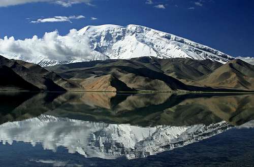
The name Muztagh Ata means Father of Ice Mountain in the local language (Uighur/Uygyr). It's easy to understand why it got its name as it really dominates its surroundings. It's not only a high peak; it's also large in terms of the circumference of the base. Its glaciated summit looms about 4 kilometres over the beautiful Subashi Valley and the deep blue Karakol Lake completes the picture.
There is debate about which range the peak belongs to. The majority seems to sort the peak under The Pamirs, but there are also advocates for including Muztagh Ata in the Kunlun Shan/Range.
The Chakragil (a.k.a. Karabekter Tagh and Kingata Shan/Feng) peaks and the peaks in the Kongur Massif (Kongur, Muztagh Ata, Koskulak etc.) are per definition two separate ranges and together you may say they have ended a bit in between the major ranges in the area. If all these peaks had to be sorted under a larger system, they should probably belong to Pamir.
Climbing History
The first recorded attempt to climb the peak dates back to 1894. It was a famous explorer and cartographer Sven Hedin who first tried to ascend on the back of a yak(!). The yak died and Hedin continued on foot towards the summit. He failed and so did other expeditions in 1900, 1904, and 1947. The last was led by famous, experienced climbers Bill Tilman and Eric Shipton. They nearly reached the summit but had to turn back due to deep snow and extreme cold. Muztagh Ata was finally climbed by a huge Soviet-China team in 1956. Beletskiy was the formal leader and they used the west ridge.
Routes, a brief
There are two routes on the western side of the peak.
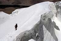
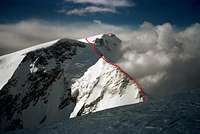
The normal route is located on the northernmost of the two snow and glacier slopes of Muztagh Ata. It's a straightforward climb without any technical section. There's an icefall in between 5500 and 6100m. There are some crevasses, but in general free of objective danger.
On the more southern slope on the peak's west side, you can find the much less used Traditional Route. It is slightly longer but equally easy. Some say the crevasse danger is lower, but as far fewer climbers use it, route finding can be a concern. It passes just under Muztagh Ata's south summit Kalaxong, therefore many use the name "Kalaxong Ridge Route". These two routes are never steep, possibly up to 40 degrees. Snowshoes or skis are recommended as you usually have to battle deep snow.
Only two other routes have been climbed. A team led by Dan Mazur reached the summit via the east ridge in the summer of 2000. Kalaxong south ridge was climbed by Alexei Gorbatenkov and Valery Shamalo in 2005.
cho_mik has made a simple Google Earth routes overview of Muztagh Ata.
Getting there - to Kashgar
Muztagh Ata is located in China’s largest province; Xinjiang, formerly known as Turkestan. It’s a desert province bordering to Pakistan, Afghanistan, Tajikistan, Kyrgyzstan, and Kazakhstan. The Kashgar Mountaineering Association (KMA) which arranges the permits has its office in Kashgar, an old trade route and oasis town on the old Silk Road. If you haven’t made a special deal with the KMA, you have to visit Kashgar to get the climbing permit and contact the liaison officer, etc. Regardless of your choice, it’s quite a long way to the peak. Below are the standard ways to reach Kashgar.
From Pakistan
Fly to Islamabad or Lahore. If the latter, Islamabad has frequent and good minibus services. Ask for DaeWoo Bus Station.
From Islamabad, the gateway to the north of Pakistan, you can fly (1h) to Gilgit, the capital of The Northern Areas in Pakistan, or you can go by bus/minibus (14-30h). There’s now a direct bus all the way from Gilgit to Kashgar/Muztagh Ata. Figure a minimum of 14h for the 700km. The road goes over one of the world’s highest border passes; the Khunjerab Pass at 4600m. The ticket is about 40$.
Pros.
It is a beautiful route on one of the most scenic roads on planet Earth.
Flights are quite cheap to Pakistan and further transport is as well.
There are no big problems with red tape.
You get some acclimatization en route.
You get excellent pre-views of Muztagh Ata when passing it on the way to Kashgar.
Cons.
Very long bus rides, or possibly long waiting times in Islamabad for the flight. The planes can only fly in good weather and are usually quite booked out.
From Kyrgyzstan
Fly to Bishkek. From here you have two alternatives – Torugurt Pass or Irkestam Pass. Count on two days to reach Kashgar.
Torugurt Pass (elevation 3752m)
From Bishkek to the Chinese border you can either go by public transport or, as most climbers do, rent a minibus or shared taxi. Some agencies may tell you; you have to use a pre-arranged vehicle, but this is not true, even if it’s much more convenient. Public transport is easy to get to Naryn, but from there to the border the service is erratic ,and sometimes hitchhiking is the only option. Many travel agencies in Bishkek can arrange the transport to the border. You must spend one night in Naryn and continue to the border the next day. A pre-arranged vehicle has to meet you on the Chinese side of the border, as you have to pass through a military zone. This service is taken care of by your organizer or KMA. The price for a ride to Kashgar can vary greatly depending on the organizer and how many people you share the ride with. If you’re alone and have the time to hang around in Bishkek and wait for a full vehicle, you can get it for a mere $40. If you are alone or in a small group, it can be up to $150/person.
Irkestam Pass (elevation 3520m)
This option is hassle-free in terms of red tape. Go by bus to Osh, a large city in the country's south. There are buses, mini-buses, and shared taxis running all the time. Count on paying $15 for a seat in a mini-bus and about the double in a shared taxi. The journey takes 12-16 hours. There’s a daily bus from Osh to Kashgar. The road is bumpy and quite a taxing ride on the Kyrgyz side, but the road condition on the Chinese side of the border is excellent and fast. 10-14h. 35-50$ if buying a direct ticket.
Pros.
Some acclimatization is on the way.
Both passes, especially Irkestam, offer great views of the Kyrgyz countryside which is scenic and interesting.
It’s a reasonably cheap way to reach Kashgar.
Cons.
You need a double entry visa for Kyrgyzstan, which can be expensive and hard to get for some nationals.
It can take some time to arrange the transport back and forth over the border.
From "inland" China
Fly to Beijing and continue on national flights to Urumqi and Kashgar. If you have the time, you can go by train between Urumqi and Kashgar. It’s a nice ride, first through the Tian Shan Mountains and later through the outskirts of the Taklamakan Desert. Tickets can be hard to get though. If you don’t book the national flights in advance, you can buy tickets at the airports. The climbing season on Muztagh Ata and the peak season for traveling to Kashgar are at the same time so you better book in advance.
Pros.
Only one visa.
No long bus rides.
If pre-arranged; by far the quickest way to reach the peak.
Cons.
Expensive to fly at least three times and sometimes you have to pay overweight, both for the international and the national flight.
You won't get any pre-acclimatization and no “sightseeing” on the way to the peak.
From Kazakhstan
Fly to Almaty. Either fly or take the bus or train to Urumqi. From there you can fly further to Kashgar.
Pros.
If flying all the way, it is a fast and convenient way to reach Kashgar.
Some beautiful traveling in the Tian Shan mountains.
Cons.
The visa for Kazakhstan can be hard and/or expensive to get. Usually, you need a letter of recommendation.
If you fly all the way, it’s expensive. If you go overland from Almaty, it’s a long ride.
From Tajikistan
At present (Sep 2006) there are talks about opening the land border from Tajikistan for third-party travelers. I’ll be back with more info when this is reality.
From Afghanistan
The border is at present closed.
From Tibet/Xizang, China
A monster journey from Lhasa in central Tibet. Count on at least a week and a bus change halfway in Ali/Shiquanhe. Long and very taxing. Long stretches of very high altitude. Some passes over 5000m.
Getting there - Kashgar to Muztagh Ata
There are two ways to get to the foot of the peak.
1. The KMA arranges the whole deal for you. (Update: See organizers further down the page).
2. You go there on your own, using public transport.
1. You’ll start early in the morning and a minibus will take you to either Karakul or Subashi. At Karakul Lake, you can sleep in a hotel or yurts, the local nomad’s semi-permanent tents. In Subashi, located another 10km up the road, you have the choice of camping or yurts. If you have chosen to stay in Karakul, a vehicle will bring you further to Subashi—travel time is about 6 hours.
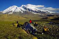
2. Public buses leave from Kashgar’s main bus station. The price is about 7-10$. About 7-8h. Tell the bus driver you would like to jump the bus in Subashi, as it’s shorter from there than from Karakul (and you don’t have to haggle with the Zhon Kun people about "fees"). You can also jump the bus close to or at the Ulugrabat Daban, the 4050m high pass close to Muztagh Ata. The walk from there is short, but route finding is trickier than from Subashi. From Subashi, there’s a walking path leading to BC. It’s easy to find and if you lose your way, just aim for the right-hand side of the first big glacier. The walk is about 3-8 hours, depending on your acclimatization, strength, how much you carry, etc.
Organizers
Over the years the situation has changed a lot. Some years it was possible to just show up in Kashgar and buy a permit and nothing else. You were 100% free to just jump on the local bus and walk into the mountain as you liked. Other years, it was really hard to get a permit at all and the whole area was under strict control and special permits just to enter the area were necessary.
At one point KMA (Kashgar Mountaineering Association) was the authority to ask, at other times you could ask any organizer (foreign or local) and at some periods of time only the XMA (Xinjiang Mountaineering Association) had the rights to issue permits.
KMA is still around, but as Blong points out it's now NOT an official association behind the name. KMA used to be a governmental organization operating under the name of Kashgar Mountaineering Association (see the Mustagh Ata main page). Now, that Association no longer exists, and companies individually apply for permits from the Chinese government. Keyoum, who used to work for Kashgar Mountaineering Association, opened the Kashgar Mountaineering Adventures company after the original KMA became defunct.
On a side note, I can mention that this company has gotten very mixed reports and, personally, I would not use their services.
As things stand today I would advise to get the latest information possible straight from either a long-time-running organizer or from the XMA directly. There are many "cowboy" organizers who have no clue about the mountain nor the rules, and they will not hesitate to rip you off.
The XMA can be hard to reach and it seems like addresses and contact numbers are changing quite often.
The last I know about are the following:
China Xinjiang Mountaineering Association
Address: 9# Guizhou Road, Urumchi, China
Phone: +86(991) 3637198
Email: keyoum@cxma.org.cn
Website: www.cxma.org.cn
Or you can try this one out:
XMA-Xinjiang Mountaineering Association
No.1 Renmin Avenue
Wulumuqi, 830002 Xingjiang
P.R. China
Tel:(86-991)382-7936
Fax:(86-991)381-0878
Contact: Mr.Jin,yinjie Mr.Du,xiaofan
If this fails you can always contact the mother organization in Beijing:
China Xinjiang Mountaineering Association
Address: 9# Guizhou Road, Urumchi, China
Phone: +86(991) 3637198
Email: keyoum@cxma.org.cn
Website: www.cxma.org.cn
Red tape
A valid visa for China is easy to get from any Chinese embassy. The exception is the one in Bishkek, Kyrgyzstan, where you need a letter of recommendation and it’ll take up to 10 days to process the application. It's better get it elsewhere.
You need a permit to climb Muztagh Ata. It’s 1080$ for a group up to 12 people. You may add more climbers to the permit but it’ll come with additional cost.
A conservation fee has to be paid for – $30/person.
The liaison officer and his costs are obligatory.
All the above can be arranged by a local or international organizer.
When to climb
Late June to mid-September. The period with the best snow conditions and the weather is usually at the end of July and the beginning of August. Going early can result in tough route finding and deep snow.
Being there late in the season; you may have to deal with fresh deep snow, or icy slopes and the crevasses are at their largest.
There is only one record of a winter ascent of Muztagh Ata.
In 2007, in January Georgian Gia Tortladze and Latvian Aigers Priedits attempted to make the first winter ascent of the peak. As far as I know, it was unsuccessful.
Camels & porters
If you have a package deal with a commercial organizer, camels will transport your gear to BC.
Those who, for one reason or the other, can't take care of their own gear further up the peak can get help. Porters carry to C1 for about $3/kg and to C2 for $6-8/kg. Make sure those who go to C2 know what they're doing and have the right clothing. I saw local porters with frostbite and snow blindness.
Some locals use yaks or donkeys for the carries to C1 and sad to say, the locals usually treat their animals like dirt and they load them with a ridiculous amount of gear.
Camping & lodging
General info
The only hotel in the area is the one at Karakol Lake. It’s badly overpriced and I have personally never heard a good word about either the personnel and food, nor the service and the rooms. You can stay in yurts in Karakol (also overpriced) and Subashi. In the little village Qortomak, an hour’s walk from BC you may stay in the local houses for a little fee.
Officially you can camp anywhere close to Muztagh Ata. The exceptions are on the west side of the Karakoram Highway, which is too close to the Tajik border (soldiers/border police on horseback will find you) and inside fenced areas. The latter includes the area close to Karakol Lake. Any other place will do. If uncertain, ask the locals.
In BC, your organizer will tell you where you can camp or if you’re there without any BC-services/on your own, you can camp anywhere you please. If uncertain, ask the BC-manager of your liaison officer.
The camps
Subashi or other areas close by
- Good acclimatization peaks all around
- A little stream with clear water
- Some very basic food to buy from the people in Subashi
- A daily bus to/from Kashgar
- Sometimes pushy local people try to sell stuff
- Watch your gear well
BC - Fresh water in a stream
- Some food for sale and meals can be bought
- Flat and good ground
- Walk up to the mast SW of BC ---> mobile phone works
- Satellite phone calls available
- Gear hire. It may take a day or two until you have the gear
- Transport to Subashi, on camel, donkey, or motorcycle. Sometimes in jeep
- Shower
- Toilet
- Sometimes you can rent a place in a tent
- Keep an eye on your gear
C1 - Running water most of the time in the low section, not in the higher
- Mobile phones work if you walk until you see Karakol Lake
- Porter service to C1 is usually $3/kg. Much less for bringing gear down to BC
C2 and C3 - No mobile phone network coverage
- No running water
- Lots of space for many tents
Mountain conditions
There are usually a lot of expeditions in BC and many of them get weather forecasts via the internet or satellite phone. The BC manager also has fresh reports from the Chinese radio weather forecasts. In general, the summer weather patterns are quite stable in the area. It’s common with 4-6 days of good weather and as many with bad. The bad weather during this season usually consists of overcast skies, some snow, and high winds on the higher reaches. Fortunately, For Muztagh Ata climbers, Kongur attracts most of the worst weather in the area and it’s a common sight to have quite nice weather on Muztagh Ata, while Kongur is completely covered in clouds.
Difficulty
As there are so many rumors about Muztagh Ata being the easiest 7000 m peak, I find it appropriate to have a special section about this.
The Normal Route and Kalaxong Ridge are not technical routes and can both be called high-altitude walking routes. The peak's access is also on the easy side and the weather is usually quite good compared with many other mountains of the same elevation.
That's the good news, but here are some things to consider before heading there bagging an "easy peak":
- NO peak over say 6000-6500m is easy. You have to acclimatize well and spend a lot of time just getting used to the lower oxygen levels. When over 7000m it's hard to breathe and your energy levels will go low quickly. Be careful with all symptoms of altitude related illnesses.
- It's cold up there. First because of the altitude itself. Count on a drop of about 7 Celsius for every 1000m ascent. On top of that, frostbite is easier to set in as your blood is getting thicker on altitude. Be careful when you choose gear for Muztagh Ata. There are many cases of frostbite every year, of which some result in amputations.
- The peak's slopes are gentle and you have to spend a long time at high altitude. You are very exposed to the high winds all the way from C2 to the summit.
- The snow can be deep on Muztagh Ata. To use skis is probably the best option. Snowshoes also work fine, but to attempt the peak without either is a very hard task. Some people do make it to the summit with only crampons (or even without), but they sometimes have to deal with meter-deep snow.
- The logistical part of a mountain of Muztagh Ata's size also makes it hard. Most teams make a lot of carries to the different camps and it's tough work on altitude.
- Many climbers have problems eating in the higher camps and this results in tiredness and the motivation can drop quickly.
- The temperatures can be very high and the sunlight strong during the day. It can be hard to rest even during the day if the temperature goes up to +40 Celsius in the tent. Sunburn is common and even sunstrokes do occur.
All the above-mentioned points apply to any mountain of Muztagh Ata's elevation, but consider all this before regarding it as a walk-over or easy peak.
Crevasses
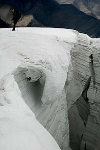
Muztagh Ata's normal route has a reputation of being free from crevasses. This is not true, even if the risk of falling into one is quite small. After leaving C1 and walking towards the icefall, there are small crevasses on the main route. In the actual icefall, there are some big ones, which can be potentially dangerous. They are usually well marked, but early in the season and after a fresh snowfall, be very careful.
The last steep hill up to C2 is probably the most dangerous part. There are some hidden underneath the snow and the "lines" of the crevasses don't follow a consistent pattern.
In the season of 2006, a team had a break at 6550m. All but the team leader walked off towards the summit. When he had finished his satellite phone call he followed. A hidden snow bridge collapsed and he fell at least 15m into a huge crevasse. He was extremely lucky and landed on a bridge. He suffered no injuries, probably thanks to the large amounts of soft snow that he fell on. On both sides of the bridge in the crevasse, he could look down into black voids.
Be careful and don't hesitate to rope up, even if most people tell you there are no crevasses.
Gear & provisions
Gear
Just a few years ago, it was impossible to find any gear in Kashgar. Now, there are some good gear shops and the KMA also has some for sale and for rent. One gear shop is located next door to Indy's Café (best coffee in Kashgar) a block off Renmin Road.
The other one is at:
N 39*27’25”7
E 75*59’40”8
Sorry, no map. Only GPS coordinates. You’re climbers! You’ll find it. :-)
Provisions
Kashgar has a lot of good supermarkets. You may not find your favorite brand, but always equivalents. Any kind of base food like noodles, rice, oats, müsli, milk powder, chocolate etc. can be found in Kashi. The price level is very low and you can buy all the expedition food here for a fraction of the price compared to back to back home. Kashgar is famous for dried fruits and nuts, so there's absolutely no reason to bring this from the other side of the world.
A world record
Muztagh Ata has a Guinness Book of Records to add to its history. In the summer of year 2000, SP-member Martin and two friends broke the world record in high-altitude cycling. Cycling at 7008m!
Tomasz Swinarski bettered that record on Pik Lenin and that in turn triggered Martin, Incrediblesnowman, and yours truly to make a try on Muztagh Ata in the summer of 2002.
There have been attempts on Cho Oyu and Everest, but those have been abandoned at an early stage./p>
An update about the record of high-altitude cycling
Bruno Sulcs from Latvia finally made the summit of Muztagh Ata with his bicycle. It was his fifth try.
Short article in English.
An article (in Latvian).
A video about the expedition.
Germans Gil Bretschneider & Peer Schepanski made it to 7211 meters and claimed a world record, not knowing about Bruno's successful summit.
Info on the Guinnes Book of Records page.
Kashgar/Kashi
Kashgar is a very interesting city that attracts a lot of tourists, foreign and Chinese every year. Its main attraction is the Sunday market which is the largest weekly market in the world with over 100,000 visitors. The town has a lot of interesting history and played an important role as a base for the Brits and the Russians during The Great Game in the of the 19th century. Both countries had consulates in Kashgar from where they schemed and planned for new strategic measures against the other party. Nowadays both consulates are converted to hotels. The Russian to Seman Hotel and the British to Qinibagh Hotel. Both are popular amongst travelers.
You can do a lot of sightseeing in the area. Silk factories, the Id Kah Mosque, the old part of Kashgar, and visits to the outskirts of the Taklamakan desert are all popular day trips. Shipton’s Arch, a stunning rock formation is another place well worth a visit.
The city may be the last outpost of civilization in this part of China, but it is well connected with a railway, long-distance buses, and an airport.
You will many times hear the name Kashi instead of Kashgar. Kashi is the city's name in Chinese, Kashgar in Uighir.
More info on Kashgar.
Zhon Kun Investment Company
A Beijing-based investment company named Zhon Kun bought the climbing rights for Muztagh Ata for 50 years ahead. They tried to promote the peak in every possible way and raised the permit prices a lot. You had no choice but to buy a full package from them and the price tag was roughly $3000.
Many climbers shunned Muztagh Ata and looked for other targets. The local operators protested a lot to the authorities and after some time it had an effect. Also, Zhon Kun had promised the Xinjiang Autonomous government to build 5-star hotels in some of the major cities, but nothing happened for years.
This was probably another reason why the local government turned against Zhon Kun and nowadays the local operators are back in business and the price has come down the standard price for a peak of Muztagh Ata’s elevation. Zhon Kun and their employees can still be seen in the area and they still have full control over the Karakol Lake area, where they charge visitors an outrageous (local standard) price for even coming near the beautiful lake. The price for staying in their hotel at the lake and eating in the restaurant is of extremely poor value.
Update 2013 10 28: I have heard many versions about how much power Zhon Kun has at present and it seems to be an ongoing power struggle between them, the local organizers, the local Tajik population, the XMA and hell knows who.
The bottom line is: It's a mess!
Maps & books
- Trailblazer´s Silk Road guide is a good alternative for planing the trip.
- For some base info and guidance for the area; try Lonely Planet's Central Asia Kit and The Karakoram books.
- Peter Hopkirk's Foreign Devils on Silk Road and The Great Game both give an interesting account on the area's history.
External Links
- Services for climbing Muztagata
The official representative of Kashgar Mountaineering Association. - A world record attempt - Muztagh Ata by bike. Summitpost member Martin is one of the persons who reached 7008m with their mountainbikes.
- A film about skiing Everest which also contains scenes from skiing on Muztagh Ata.








samh - Jan 15, 2010 12:01 pm - Voted 10/10
Skiing Everest FilmA ski descent of this peak is documented in the film "Skiing Everest" and a link might make a good addition to this page. http://www.imdb.com/title/tt1359029/
Corax - Jan 24, 2010 3:07 pm - Hasn't voted
Re: Skiing Everest FilmThanks. I'll add the link to the page.
dmiki - Jan 22, 2011 8:18 am - Voted 10/10
Broken link?http://www.cybernet1.com/himalaya/mustaghata_new.htm
Corax - Jan 22, 2011 9:15 am - Hasn't voted
Re: Broken link?Thanks Miki. I have removed the link now as it seems like the page is gone.
dmiki - Jan 22, 2011 2:14 pm - Voted 10/10
Re: Broken link?Shame. It would have been nice to check out some pics of the East ridge.
dmiki - Jan 23, 2011 12:59 am - Voted 10/10
walkie-talkiesIn his trip report, cho_mik writes about "illegal walkie-talkies". Are they still / Why were they illegal on the mountain?
Corax - Feb 12, 2011 7:26 pm - Hasn't voted
Re: walkie-talkiesI don't know. The rules are changing there so quickly, but I don't think it's a problem regardless of the rules. No one checks.
BLong - Oct 16, 2013 3:19 pm - Voted 10/10
KMAAccording to my research, the main Mustagh Ata SummitPost page has some outdated information on KMA. As I understand it, KMA used to be a governmental organization operating under the name of Kashgar Mountaineering Association (see the Mustagh Ata main page). Now, that Association no longer exists, and companies individually apply for permits from the Chinese government. Keyoum, who used to work for Kashgar Mountaineering Association, opened the Kashgar Mountaineering Adventures company after the original KMA became defunct.
Central Asia Travel - Jan 25, 2016 6:08 am - Hasn't voted
Program of ascentionMore information about ascention to Mustagh-Ata Peak is available on this link: http://www.centralasia-travel.com/en/expeditions/muztag
runout - Aug 25, 2017 2:39 pm - Hasn't voted
CoordinatesMore likely: 38°16'36.9"N 75°07'00.0"E 38.276925, 75.116668
Corax - Aug 25, 2017 2:58 pm - Hasn't voted
Re: CoordinatesThanks for letting me know. The location was really off. I put the official coordinates now. 38°16'33" 75°07'00"
Tomek D. - Aug 8, 2024 2:53 am - Hasn't voted
Muztagh Ata is open for the foreigners after COVIDHi , I'm pleased to infomr that Muztagh Ata is open for foreigners after break which last since 2019. We've climbed Muztagh Ata peak 22nd of July this year but as I know it's impossible to climb on your own. We've used service of Silk Road Expedition and we really recommend them. Excellent contact and quality of food and hospitality. If you are interested - send an email silkroad_expeditions@aliyun.com