|
|
Mountain/Rock |
|---|---|
|
|
33.90690°N / 112.1248°W |
|
|
Maricopa |
|
|
Hiking, Scrambling |
|
|
Spring, Fall, Winter |
|
|
2980 ft / 908 m |
|
|
Overview
Gavilan is really a hill, because it does not rise 1000 feet above the surrounding terrain. That is, if you remember the film about an English guy ascending a hill and descending a mountain. Locally prominent, it's a nice solid way to spend a couple of hours. Gavilan is found north of the Valley sprawl that developed in the last 10 years on the northern I-17 corridor north of the 101 loop. Anthem, the development with a "master plan", is just to the south and the newest section of it remains un-built about 1 1/2 miles to the south of Gavilan. This peak is doable year round, but not recommendable to the uninitiated in summer or when temps top 100. 115 would not be uncommon for a high temperature in the peak of summer.
Views extend from the Bradshaws in the northwest, to the Matazals in the east, to South Mountain and the Estrellas to the south, as well as the city of Phoenix, and the small hills and sprawling new city of Phoenix to the southwest. The Central Arizona Project canal (CAP) can be seen passing to the west and south. Lake Pleasant is off to the west. Because it is part of the CAP canal, it is always full or nearly so.
Sidebar: for those that don't know, the Central Arizona Canal is the legacy of Barry Goldwater. It pulls water from Lake Havasu, the most polluted of the Colorado River Lakes, and send it 361 miles across the Arizona desert to places as far away as Tucson. Apparently, if that canal ceased to deliver water, places like Tucson would be worthless. Not sure about the Valley, as it has Salt River water.
Private Property, contact landowner for permission?
Access directions removed due to a private property.Private Property, no public access without permission.
Gavilan is on private land. All around it's base, there are dirt roads built into the desert for development. Numerous "drug lord" homes have been built close to it. Currently, access seems to be an issue and the landowner has had descriptions and routes removed from websites. I have not been out here in well over a decade, but it was wide open in 2010 and 2011.
If you wish to contact the landowner, according to Maricopa County his name is Barry Witt. Mailing address is: 13236 N 7TH ST SUITE 4 BOX 535 PHOENIX AZ USA 85022
However, I do not expect access will be granted as it appears he has had the mountain removed from websites like Hikearizona.com and is requesting similar from other sites.
Routes
There is/was the option of the southwest ridge which leads up to the west ridge, but a large feature( which SPer Scott Mitchell dubbed the "monkey face") fell away during the wet winter of 2010. One thing is certain about the ridges of Gavilan, they are often loose and rotted, and recent evidence has shown that they are prone to collapse. Choose wisely, if going on more challenging routes.
Since the most recent beta I have is of the west ridge, here is a more detailed route description:
Mileage: 1.25 roundtrip
Elevation Gain: 1150'
Class III-IV if following the summit ridgeline from the high saddle, with a class II variation bipassing this to the north.
To access the west ridge, take I-17 and exit at New River Rd. Turn east towards Gavilan and turn right onto Frontage Road. After 0.3 miles, turn left onto W Meander Road (dirt). Follow this for 0.4 miles and turn right onto W Gibbons Rd, followed by a quick right onto 35th Ave. Continue on this for 0.5 miles where it turns east. Before turning back south continue straight onto a dirt drive way of an undeveloped lot. As of late 2015, there was a white for sale sign at the start. Take this to the cul-de-sac at the end.
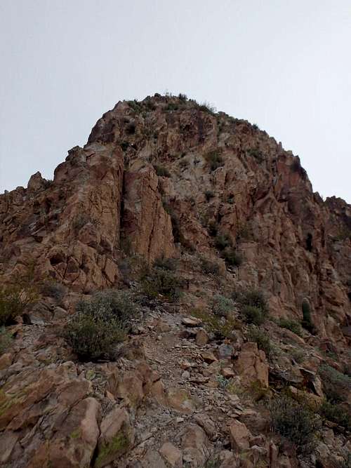
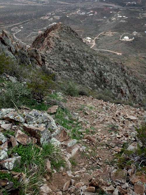
From the parking area, there is an obvious use trail that heads directly upslope, staying north of the ridgeline. After about 0.25 miles, it flattens a bit a traverses beneath the ridgeline rocks. Continue on the trail to the base of a class II gully, following this up, trying to keep with the trail. At the top of the steeper portion of the gully, the trail continues to traverse east, staying off the ridgeline up until the high saddle. From here there are two options. You can climb the class III-IV ridgeline directly. The moves are quite solid and should really not be over class III, although the exposure to the south is significant.
The easier option continues to follow the trail that skirts the ridgeline rocks, entering a loose class II gully, and following a grassy, steep ridge to the top. This gully is a bit steeper and looser than the gully lower down.
My trip report from December 2015, where I climbed the ridge and descended the class II gully: The Mountains Are Calling: Gavilan
Cautionary Notes.... and Explosions
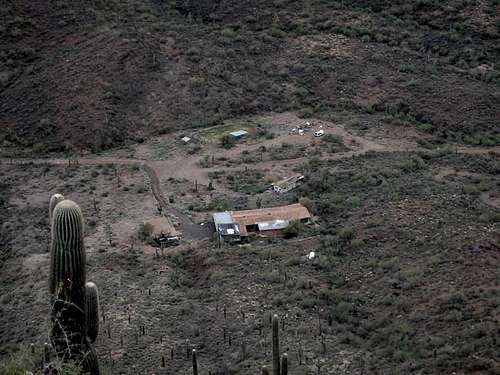
At the base of this mountain sits StarFlash Ranch, site of a famous raid in the mid 90s by the the Bureau of Alcohol, Tobacco and Firearms after owner Chuck Byers was stockpiling a large quantity of explosive, including materials to make grenades and booby traps. This was swept into the dustbin of history until November 2013 when a man trespassing on the property stepped on an explosive and lost his leg: http://www.abc15.com/news/region-northeast-valley/anthem/new-river-explosion-mcso-bomb-squad-atf-experts-investigate-property I would avoid any approaches from the south, who knows what else is buried on his property. He actually has his own website for the ranch including a Topo on the property boundaries, which I would sincerely try to avoid: http://www.starflashranch.com/topo.htmJumping cholla and other vicious cacti abound in the area. The cholla like to decay and fall all over the place, leaving land mines of thorns. I once helped pull hundreds of thorns from the paws and body of a rambunctious German Shepard who happened into a particularly bad area of them. Not a peak for a dog. At least one SP member reports seeing 3 separate diamond back rattlers on and near the hill as he made an evening summit in late April. I have not seen snakes in the area during the day in December, June or on earlier March-April spring outings.


johnrthomp3 - Mar 28, 2023 9:32 pm - Hasn't voted
Private Property?According to several posts from 2020 on the website https://themtsarecalling.com/gavilan/, this summit and the trails up it are on private property, and climbing is prohibited without permission from the owner. Too bad, it looks like a wonderful natural formation, seems a shame to not be available to the public.
Humphrey - Mar 29, 2023 7:42 am - Hasn't voted
Re: Private Property?I seem to recall inheriting this page long enough ago that I don't even remember getting it. If you look in the access section, it appears that the potential for Gavilan being private was addressed. I'll add a statement to the description about contacting the landowner.