|
|
Mountain/Rock |
|---|---|
|
|
43.16300°N / 109.641°W |
|
|
Hiking, Mountaineering, Scrambling |
|
|
Spring, Summer, Fall |
|
|
13080 ft / 3987 m |
|
|
Overview

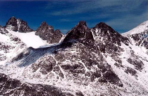
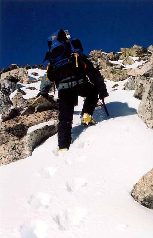
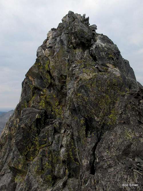
Miriam Peak is located on the west side of Bonney Pass in the beautiful Titcomb Basin of the Wind River Range. Dinwoody Glacier separates Miriam Peak from Gannett Peak, the highest peak in the state of Wyoming. It's an easy class 2 scramble from Bonney Pass to the point just below Miriam's summit. However, in order to reach the summit block you must downclimb a very narrow ridge with 1000 feet of exposure on each side. You then have to ascend an equally exposed class 4 route 25 feet up to reach the summit. It's not difficult by rock climbing standards but the exposure is extreme.
This relative easy peak could makes for an ideal acclimitization climb before climbing Gannett Peak, as an add-on to climbing Gannett, or as an alternative if the conditions for climbing Gannett are not favorable.
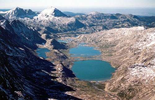
The Wind River Range is as wild and rugged as anything you may have imagined about it. In particular, the Titcomb Basin is an incredibly scenic area that is surrounded by granite peaks and spires. There are climbing opportunities that span all levels of difficulty.
Miriam Peak was named after Miriam O'Brien, a notable female climber of the 1920's and 30's, who later married Robert Underhill after which Bob's Towers are named.
Getting There
Miriam Peak is located in one of the most remote areas of the contiguous United States, in the northern Wind River Range in Wyoming. The peak straddles the boundary of the Fitzpatrick and Bridger Wilderness Areas. It is accessible via one of several trailheads.
Access from the North/East Trailhead: Cold Springs Trailhead: Ink Wells Trail - Distance: 16 miles
Access from the South Trailhead: Elhart Park Trail: Pole Creek Trail to Titcomb Basin Trail Distance: 19 miles
Located about 1 mile south and high above the upper end of Fremont Lake, this trailhead offers two large parking areas, corrals, potable water, toilet facilities and a visitor information center. The trailhead is adjacent to the Trails End Campground.
To reach the trailhead from Pinedale, WY, drive to the east side of town on Hwy 191and follow the signs to the Elkhart Ranger Station. Turn northeast onto the Fremont Lake road, passing the Pinedale Ranger District Office. Continue straight on the main road, avoid turning on to the Fremont Lake campground road, passing the National Forest boundary in about 4 miles. The road passes Halfmoon Lake and White Pine Ski Area before arriving at the trailhead, 16 miles from Pinedale. There are signs along the way.
Access from the North Trailhead: Trail Lake Ranch Trail: Glacier Trail Distance: 25 miles
Four miles east of Dubois, WY, take the dirt road south from Hwy 26 & 287. Stay left at the fork and head towards Whiskey Basin. Continue past Torey, Ring and Trail Lakes to the parking lot at the end of the road.
Red Tape
There are no permits required for backcountry travel or for overnight stays in the Wind River Range, except when crossing Indian land. Contact the Wind River Tribal Game and Fish Department at 1-307-332-7207 for access via the Cold Springs trailhead.
When To Climb
The typical climbing season is from June through September. Special winter mountaineering gear and skills are required for off-season climbing.
Camping
Bonny Pass
There are a couple of bivouac sites on Bonney Pass with rock walls for wind shelter. If there has been a recent snowfall, you may have to shovel out some snow to take advantage of the wind breaks. There is no water on the Pass, however there is usually snow year round.
Titcomb Basin (South)
There are several primative campsites along the climber's trail north of upper Titcomb Lake.
There is a public campgound at the Elkhart trailhead.
Dinwoody Glacier (North)
There are numerous places to camp in and around the tarns north of the Dinwoody Glacier. There are also a couple of good campsites north of the glacial moraine just beyond the Dinwoody Glacier, such as this one.
* Note that campfires are not permitted above treeline in the Wind River Range.
Mountain Conditions
For current conditions, contact the following ranger stations.
- Pinedale Ranger Station, 307-367-4326
- Dubois Ranger Station, 307-455-2466
Mountain Weather - Wind River Range
External Links
- City of Pinedale Website
This website contains a wealth of Information about the local area, including lodging, restaurants and things to do. - Bald Mountain Outfitters
Horse pack service - Sublette County website
This website contains a wealth of Information about the Wind River Range, with information on campsites, trailheads, ranger stations, etc. - Pinedale Ranger District
The USFS website for the Pinedale Ranger District.


