|
|
Mountain/Rock |
|---|---|
|
|
49.07639°N / 113.92778°W |
|
|
Hiking |
|
|
Summer |
|
|
7812 ft / 2381 m |
|
|
Overview
 Waterton Lakes as seen from Mt. Crandell. The lake crosses from Canada into the United States, and is the deepest in the Canadian Rockies.
Mount Crandell is located in the rugged, windswept Canadian Rocky Mountains in stunning Waterton Lakes National Park. Waterton Park, in the southwestern corner of Alberta Canada, is a non-commercialized, beautiful piece of nature often referred to as the Crown of the Continent. Home to lofty mountain peaks, crystal-clear lakes, a superb variety of plants and animals, and calm gently rolling prairies, Waterton is a nature lover’s dream-come-true.
Mount Crandell sits pretty much right in the middle of this 505 sq km (195 sq. mi) park, offering breath taking, panoramic, views in all directions. Looking to the east one sees the Lower Waterton Lake , and the famous Prince of Wales Hotel. To the north west, one may glimpse Red Rock Canyon and the surrounding peaks. To the south west one sees the Akamina Parkway winding along Cameron Creek . Most impressive is the view to the south east of the deepest lake in the Canadian Rockies, Upper Waterton Lake (148m/487 ft deep), whose southern most end crosses from Canada into the United States. On the summit of this mountain one will find a radio repeater (weather station).
The home of Mount Crandell, together with neighboring Glacier National Park, in the US state of Montana, form the world's first International Peace Park established in 1932. UNESCO has identified this area as a World Heritage Site making the joint peace park a worldwide treasure.
In the town site at Waterton Lakes there is a display including the following comment on the Canadian/US border from Sitting Bull: "The meat of the buffalo tastes the same on both sides of the border".
Getting There

East side of Mt. Crandell as seen from Vimy Peak.
More views from Vimy Peak.
(Above image is displayed from and belongs to trailpeak.com)
More views from Vimy Peak.
(Above image is displayed from and belongs to trailpeak.com)
From Calgary take Highway 2 south to Fort Macleod, then west on Highway 3 to Pincher Creek, then south again on Highway 6. The drive requires about three hours.
From Cardston take Highway 5 west, through the village of Mountain View. The drive is less than 40 minutes.
From Glacier National Park, Montana, take the Chief Mountain International Highway (closed in the winter). From the St. Mary entrance of GNP it is approximately a 1 hour drive. In the winter take Montana Highway 89 to Alberta Highway 2 to Cardston, then Highway 5 to Waterton.
Once you arrive at the Park follow the entrance parkway (Highway 5) toward the town site, which is located 8 km (4.8 miles) down the road. Enroute, you will pass Mount Crandell, which is located directly across the highway from the famous Prince of Wales Hotel, about 1 km (0.6 miles) shy of the town.
Click here for a map.
Camping
Camping is not allowed on Mount Crandell, however there is an official park designated wilderness campsite at Crandell Lake at the base of the west-side of the mountain. You should contact the park to make reservations for wilderness campsites.Additionally Parks Canada operates four campgrounds in Waterton Lakes National Park. Click here for details.
Routes

Upper Waterton Lake from Bears Hump. The big peak just left of center is Mount Cleveland.

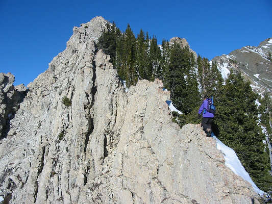
Strolling along the cockscomb.
(Above image is displayed from and belongs to sonnybou.ca)
(Above image is displayed from and belongs to sonnybou.ca)

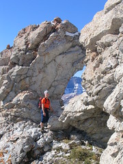
The notch in the ridge, above the cockscomb
(Above image is displayed from Flickr and belongs to Meloliz)
(Above image is displayed from Flickr and belongs to Meloliz)

Radio Repeater on the Peak.
Via Bear's Hump: Distance: 8.5 km (5 miles) round trip. Vertical Gain: 1098 m (3600 ft). Level: Strenuous, with exposure, and route finding. Park at the Bear's Hump trail directly across Highway 5 from the Prince of Wales Hotel (1 km shy of the town site). Bear’s Hump is large outcropping of weather-worn rocks on the east side of Mount Crandell. There is a well worn trail that ascends 700 ft in less than 1 mile to this outcropping. Once at the outcropping there is a faint, and much less traveled trail, that heads west and up the ridge, but soon fades away. This ridge is your guide to the peak. At times the ridge becomes a knife edge and has a section that resembles a cockscomb which is quite dangerous and difficult (class 3 with some class 4 sections). As you ascend the approximately 4 km (2.4 miles) and 3100 vertical feet from Bear’s Hump to the peak, there are numerous small cliffbands to get through.
Initially the ridge is quite steep, but the scrambling is not difficult, however about a third of the way up the steepness increases (class 4 now and then) as the ridge turns into the airy cockscomb just below the half-way point. While you climb, often look behind you to take in the stunning views of the Waterton lakes. Eventually, you come to a notch in the ridge from which point the scrambling becomes much easier, and you can quickly and safely continue to the summit. On the summit you look for the radio repeater (weather station). See pictures here, here, and here.
 | The ridge route from Bear's Hump up Mount Crandell as seen from the Waterton town site. The cockscomb is just after the highpoint on the left in the dip. Read a Trip Report. (Image to the left is displayed from and belongs to explor8ion.com) |
Back Route from Crandell Lake: Distance: 12 km (7 miles) round trip. Vertical Gain: 1000 m (3,281 ft). Level: Moderately difficult with some route-finding. Start at the parking lot for Cameron Lake along the Akamina Parkway . Follow the well maintained trail toward the lake for less than 1 mile where you will see a signpost indicating the lake is 0.4 km away. Look for a very faint trail to the north west that makes its way through the trees. Use the trail to get you started, the trail may fade away now and then forcing you to route find. Read a trip report and learn more details about this route at trailpeak.com.
Tick Ridge: The author has never used this route and only knows that it starts close to the Park Warden's Office/Maintenance Complex. It’s known to be a less difficult route than the Bear’s Hump approach. In December 2012 a couple of narrow chutes (couliour like chutes) on the east facing slopes (near tick ridge) where filled with ice. From the road the ice had a WI3 look to it, but the author can't say with any certainy their rating. Those interested in ice climbing can watch for these formations.
Weather
The summers in the Mount Crandell area are brief with some hot spells (high 35*C/94*F). Winters are long and relatively mild (high 10*C/50*F), with occasional warm spells caused by Chinook winds. This area is often one of Alberta 's warmest places in the winter, despite ample snow and temperatures that can occasionally drop as low as -40*C/-40*F.Wind is a noticeable element of this area’s climate, and shouldn’t be ignored. Gusts of over 100 km/hr (60 mph) are common, but thankful they occur mostly in the fall and winter rather than the summer. Note that gusts of over 150 km/hr (90 mph) have frequently been recorded in the area.
This area receives Alberta 's highest average annual precipitation of 1072 mm (42 inches) per year.
Red Tape
One must pay an entrance fee in order to get into Waterton Lakes Park , home of Mount Crandell. As of January 5, 2012 the Canadian dollar daily rates were $7.80 per adult or $19.60 for a family/group. Click here for the most up to date rates.Also note the park has no gas or groceries available in winter.
When traveling to Mount Crandell from Glacier National Park in the US state of Montana one must be aware of the Canada Ports of Entry operating schedules. Chief Mountain port of entry is open seasonally from May through September; and Carway/Peigan port of entry is open year round from 7:00 a.m. to 11:00 p.m.
History
Mount Crandell prior to 1914 was known as Sheep Mountain. It was renamed after the Calgary businessman Edward Henry Crandell, who was involved in an ill-fated attempt to strike it rich with oil in the area. This mountain has also been known as Black Bear Mountain.In the late 1800’s when the area of that houses Waterton Lakes was being considered for a national park, a Canadian government department stated the following about the picturesque location of Mount Crandell, "The culminating point of this range (incorrectly referring to the Wilson Range), Mount Cleveland, 10,535 feet in height is in Montana, but its most significant peak is its Canadian summit, Sheep Mountain (Mount Crandell), which though only 7,580 feet high (incorrect s/b 7812 ft), makes up what it lacks in altitude by its situation at the angle of the Waterton Lakes." Indeed the location next to Waterton Lakes makes the views from this mountain second to none.
Panoramic View From Summit
The image below is displayed from and belongs to explor8ion.comSee more photos and panoramic views here.


