|
|
Mountain/Rock |
|---|---|
|
|
52.62778°N / 4.12236°W |
|
|
Gwynedd |
|
|
Trad Climbing, Toprope, Bouldering |
|
|
Spring, Summer, Fall, Winter |
|
|
98 ft / 30 m |
|
|
Overview
Cae Du (Black Field) is one of Meirionnydd’s many hidden treasures, unknown to most of the world, but abound with riches that would make most, boulderers at least, salivate with anticipation. A far flung outpost on the area’s western coast, its interest consists of two separate rocky entities. The first is a short section of tidal crag, which nowhere exceeds more than 15 metres in height; while the second is a small quarry located above the tidal zone, which yields a handful of tricky single pitch routes. It’s the coastal crag however, which is of greatest interest, as it is home to some of the finest low to mid grade bouldering problems anywhere in Wales.  Problem 7 of Area 1 (Photo by Nanuls) Problem 7 of Area 1 (Photo by Nanuls)Unlike Snowdonia’s other bouldering spots, which by and large take the form of glacially sculpted and weathered rocks and crags, situated high in the mountain passes and exposed to the worst the Welsh climate can conjure up; Cae Du’s rock is smooth, clean and sheltered, its tidal nature cleansing it of dirt and superfluous plant life on a daily basis. The influence of the sea has led to the creation of a diverse collection of high quality problems. Most take the form of large sloping holds and ledges which require the boulderer to move delicately and agilely, harnessing the friction of the rock to prevent falls; while others are a mixture of juggy arêtes and overhangs, finger width cracks and awkward off-widths. The sea’s dominance over Cae Du has created an ever changing environment, continually shifting the level of the pebble beach, which in turn continually alters the grades of many of the area’s problems. The traditional climbing is less impressive, with only a handful of routes shared between the Quarry and the bouldering crag, the former holding the best lines. The routes on the bouldering crag are easier in nature, and are accompanied by a number of metal stakes which are often used as top-rope anchors. This combination makes the crag an ideal location for newcomers to enter the world of rock climbing, a fact not lost on the local outdoor centres who occasionally use the site.  Problem 11 of Area 4 (Photo by Nanuls) Problem 11 of Area 4 (Photo by Nanuls)All of this activity takes place against the magnificent background of Cardigan Bay which extends across most of Wales’ west coast. On a clear day one can see along its entire length, from Pen Llyn and Snowdonia to the north, to Ceredigion and Pembrokeshire in the south. The bay is an important ecological resource, and Cae Du forms part of the Pen Llyn a’r Sarnau Special Area of Conservation, an area protected under European Law for its mixture of rare sandbanks, estuaries, coastal lagoons, shallow inlet bays and offshore reefs, and is home to species such as bottlenose dolphin, otter and grey seal.  Problem 7 of Area 3 (Photo by Nanuls) Problem 7 of Area 3 (Photo by Nanuls)Towards the end of the last ice age, following the retreat of the British Ice Sheet, the bay formed part of a vast grassy plane which connected Ireland to the rest of the British Isles. The first Stone Age settlers in the area would have occupied this plane, spending their winters there, and moving to the highlands in the summer. By the Mid Holocene the sea reclaimed the bay; and all that remains of this land today are a handful of fossilised tree stumps which protrude from the area’s beaches at times of low tide. Stories of a dry Cardigan Bay are prevalent in Welsh folklore, and it is said that it was once possible to walk from Wales to Ireland by wading through the rivers that flowed there. The most famous legend is that the bay was once the location of a rich and fertile land called Cantre’r Gwaelod (The Lowland Hundred) or Maes Gwyddno (Gwyddno’s Land), which was defended from the sea by Sarn Badrig, a feature which we now know to be the remains of one of three glacial moraines which extend into the bay. There are several versions of the tale, but the one that is told today is that a prince of the realm called Seithennin, got drunk during a storm and left the sluice gates to the kingdom open, allowing the sea to overflow drowning the land and its inhabitants. Apparently, on a stormy day it is still possible to hear the bells of Cantre’r Gwaelod ringing beneath the waves. All in all Cae Du has all the ingredients to be one of Britain’s most popular bouldering venues, namely a diverse range of quality problems, an impressive setting and extremely easy access. If it weren’t for the fact that it were so remote from Snowdonia’s other bouldering locations it would be crawling with eager boulders on a daily basis. As it is however, it is visited by few, and if you choose to visit the spot the only company you are likely to encounter are seagulls, crabs and maybe the occasional outdoor centre. So I urge you to come lavish attention on this neglected little spot, and remember that when you climb here, you're not climbing on a lowly seaside crag, but on the highest rocks of a now drowned kingdom. |
Problems & Routes
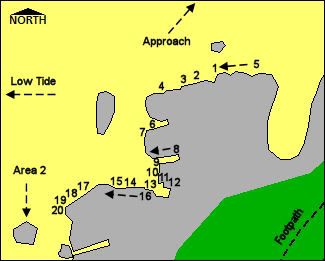
BoulderingThe bouldering crag (SH 564 055) is split into four distinct areas, separated from one another by a number of rocky spurs which jut out from the main wall. The areas are arranged from north to south, with Area 1 being the furthest north, and the first area reached on the approach from the Cae Du Campsite. The problems are spread unevenly between these four areas, with problems ranging from V0- to V7 in difficulty. In recent years boulderers in North Wales have adopted the Hueco V system for grading problems. The problems listed below have been compiled, graded and rated using a combination of different sources including Simon Panton’s superb guidebook North Wales Bouldering/Bowldro Gogledd Cymru, Terry Taylor’s excellent website www.midwalesclimbing.com and the continually updated www.ukclimbing.com. Problems are described from left to right. |
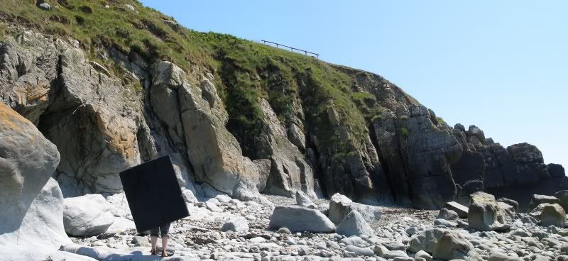

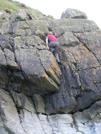 Problem 1 of Area 1 (Photo by Nanuls) |
| ||||||||||||||||||||||||||||||||||||||||||||||||||||||||||||||||||
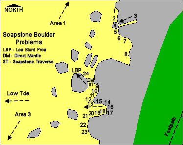
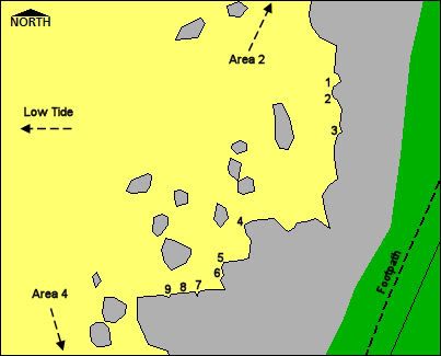
Area 2Area 2 begins at the southern side of the second slabby prominence which characterises Area 1. As with Area 1 there are around 20 problems to tax your skills, however this time the difficulty level is raised a notch with most problems ranging from V1 to V3 in difficulty. The area is also home to the Soapstone Boulder which has a number of slightly harder but very interesting problems. |
|  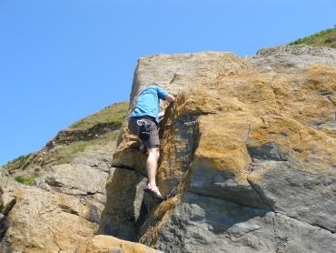 Problem 21 of Area 2 (Photo by Nanuls) | ||||||||||||||||||||||||||||||||||||||||||||||||||||||||||||||||||||||||||||||||||||

 Problems 9 to 16 of Area 2. For a clean version of the photo click HERE.  Problems 18 to 21 of Area 2. For a clean version of the photo click HERE. |
| ||||||||||||||||||||||||||||||||||||||||||||||||||||||||||||||||||||||||||||||||||||
Area 3Despite its size, Area 3 yields relatively few problems, a problem probably caused by the more gentle nature of most of its rock. This gentle nature does mean that there area number of short and easy rock climbing routes on this section of the crag, most of which have metal stakes in place for belaying. Despite the area’s dearth of bouldering problems, it’s home to Cae Du’s hardest, a couple of V7’s which should be enough to hold the interest of more able boulders. |
|  | ||||||||||||||||||||||||||||||||||||||||||||||||||||||||||||||||||
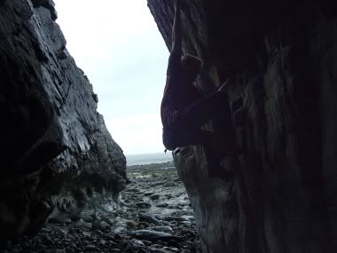
Area 4The final section of rock on the bouldering crag, Area 4 is home to around 15 problems, most of which have grades which are highly dependant on the height of the pebble beach. The area derives added interest from the presence of Ogof Owain, an angular cave which is home to a number of devious problems. |
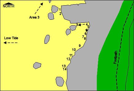 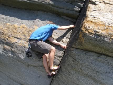 Problems 8 of Area 4 (Photo by Nanuls). |
| ||||||||||||||||||||||||||||||||||||||||||||||||||||||||||||||||||||||||||||||||||||||||||

Rock ClimbingAlthough bouldering is Cae Du's main attraction, there are a number of trad routes on the west-facing quarry walls located some 100 metres south of the campsite above the railway line (SH 567 506). The routes are described from right to left. At the right-hand end of the the open quarry is a large slab of mainly easy angled rock. As a side note there are also some short easy routes on the bouldering crags below, and are popular with outdoor centres. Many are marked with iron stakes for anchoring top ropes. |
| Out of My Mine | 24m | E1 5a |  |
| Start at the side on the easy angled slab next to a huge flake. Follow an obvious leftwards rising ramp for 5 metres, then up to the right to gain a good ledge. Tread carefully as there is not protection and continue direct to an overlap 8 metres higher. Place protection and pull up right through this to a a short slab above. Belay on an old concrete fencepost. | |||
| Mine Over Matter | 37m | HVS 4c |  |
| This rising leftwards diagonal from its lowest point to the top left makes full use of the quarry's available rock. Start 5 metres left of Out of My Mine, at the toe of the slab. Climb up and left to a short flake. Continue rising leftwards to the overlap below the short gully above the centre of the slab. Continue up and left to finish up the obvious groove on top of the slab. Again, belay on the old concrete fencepost. | |||
| Seashell Babylon | 24m | HVS 4c |  |
| From directly below the finishing groove of Mine Over Matter, climb the unprotected slab until the bottom of the groove and the first wire are reached. At no point is the climbing hard. | |||
Weather Conditions & Tide Tables
This section displays the weather forecast for Tywyn, which is located just to the south of Cae Du. This gives a pretty good indication of what the weather will be like on the crag, as both Tywyn and Cae Du sit at around sea level. As most of the routes are tidal in nature, it's important to check the tide tables before embarking on your visit to the crag. Short range predictions for Wales' ports are available on the BBC's website, Barmouth and Aberdyfi being the nearest. Longer range predictions are available on the UK Hydrographic Office's website. |
This weather forecast is generated by the Met Office Weather Widget
When To Climb & Essential Gear
 ...lest you incur the wrath of these (Both photos by Nanuls) ...lest you incur the wrath of these (Both photos by Nanuls)A good general rule of thumb for climbing in Snowdonia is when it's dry climb high, when it's not... well don't. As you can't get much closer to sea level than Cae Du, the crag makes an ideal wet weather venue. Of course it's pretty attractive place to climb when the weather's nice too. Just be sure you check the tide tables before setting out, lest you end up doing most of your bouldering underwater. You may want to avoid visiting the crag towards the end of spring/beginning of summer, as this is when seagulls nest on the cliffs and are generally at their most aggressive; there's nothing quite like an angry gull to put you off your moves. Although not essential, a bouldering mat is recommended to soften those landings, and of course, you'll also need a chalk bag and a pair of rock shoes. If attempting the trad routes on the quarry, a full rack with maybe some extra small nuts or wires is needed. |
Getting There
Cae Du is easy to reach by car. I'm not going to list every road route here so consult Google Map or an equivalent. Basically, you need to get onto the A493 coastal road. Depending on where you're coming from, you can get on the road at Dolgellau (SH 714 182 ), the Minffordd Hotel (SH 732 114), or Machynlleth (SH 744 019). Take the road to just outside Rhoselfain (SH 577 057) and turn off where the road bends sharply revealing the entrance to the Cae Du farm and campsite (SH 569 060). Drive carefully through the farm yard and park just in front of the railway bridge at the bottom of the track. There is a fee of £1 for parking, or you can camp for around £6 per person (2008). The bouldering crag is around 300m to the south and can be accessed by walking along the beach. |
Red Tape
No red tape of access issues here! For climbers, hill walkers and mountaineers, the British Mountaineering Council (BMC) runs a Regional Access Database, which holds mountain/crag specific information on matters of conservation and access, including issues such as nesting restrictions, nature designations and preferred parking. If you are in any doubt about any particular access arrangement, or need to report an incident, you should contact your local BMC Access Representative or the BMC Access Officers for Wales: Elfyn Jones. |
Camping and Accommodation
Since you have to park the car there to access the crag anyway, the obvious choice is clearly the Cae Du Campsite which offers camping at a great location for a reasonable price. Rather than list everything else, the list below should provide you with a rough guide to what's available in the area: |
Maps
|
| Navigation Maps Ordnance Survey 1:25k Explorer Series OL 23 Cadair Idris & Bala Lake/Llyn Tegid Ordnance Survey 1:50k Landranger Series 124 Porthmadog & Dolgellau Harvey Map Services 1:25k Snowdonia Cadiar Idris Harvey Map Services/BMC 1:40k British Mountain Map Snowdonia South Road Maps |
Guidebooks
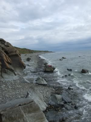 Just chillin' (Photo by Nanuls |
External Links
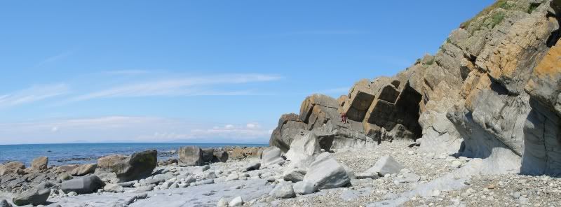
 Ogof Owain in Area 4 (Photo by Nanuls) Ogof Owain in Area 4 (Photo by Nanuls) Beware of the tide! (Photo by Nanuls) Beware of the tide! (Photo by Nanuls) Easy slab climbing in Area 3 (Photo by Nanuls) Easy slab climbing in Area 3 (Photo by Nanuls) Looking south from Area 4 (Photo by Nanuls) Looking south from Area 4 (Photo by Nanuls)Government Bodies and Official Organisations Snowdonia National Park Authority Association of National Park Authorities Royal Commission on Ancient & Historical Monuments in Wales Hiking, Climbing and Mountaineering Organisations and Companies British Mountaineering Council Plas y Brenin National Mountain Centre Weather Tourist Information North Wales Tourism Partnership Local Information from Gwynedd.com Local Information from Snowdonia Wales Net Travel Welsh Public Transport Information Accommodation Youth Hostel Association in Wales Maps and Guidebooks Cordee Travel and Adventure Sports Bookshop Wildlife and Conservation |


