
-
 8372 Hits
-
 84.82% Score
-
 19 Votes
|
|
Mountain/Rock |
|---|---|
|
|
46.74990°N / 12.76410°E |
|
|
8330 ft / 2539 m |
|
|
Overview
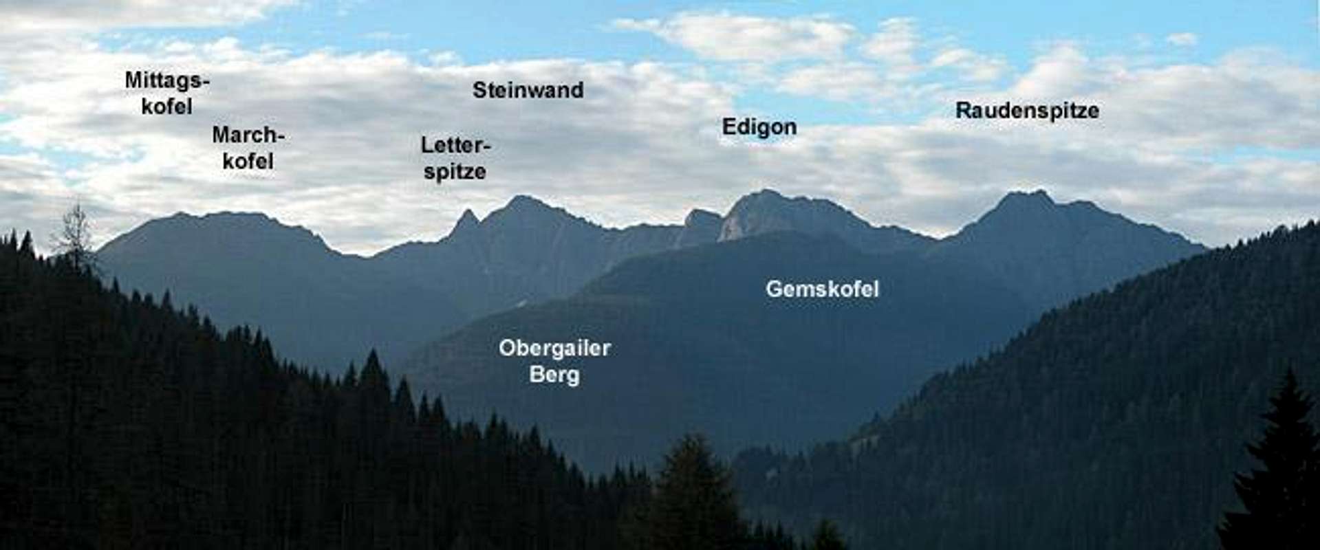
Geographical Classification: Eastern Alps > Gailtal Alps > Lienz Dolomites > Weittalspitze
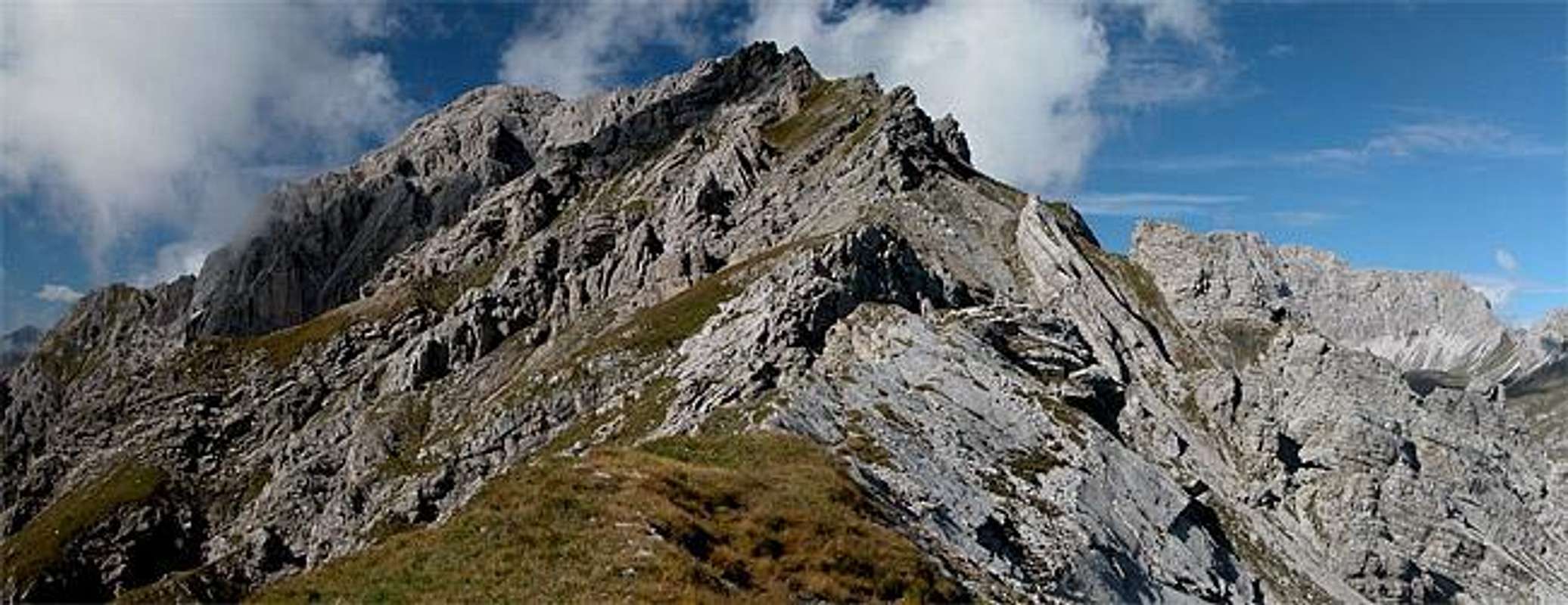
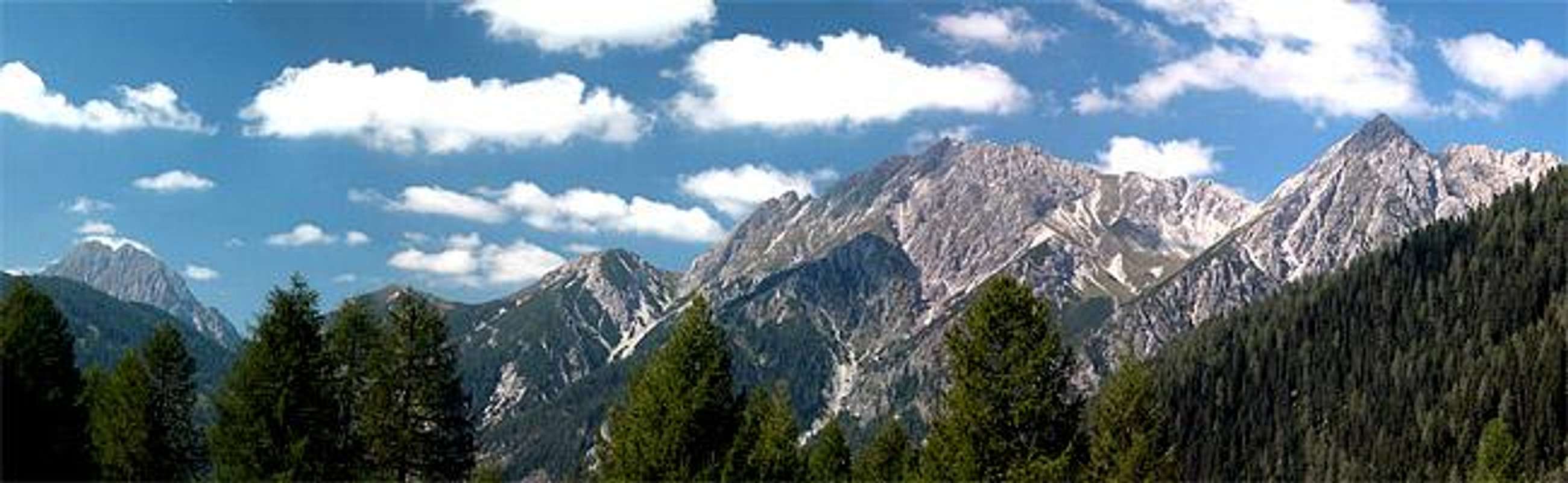
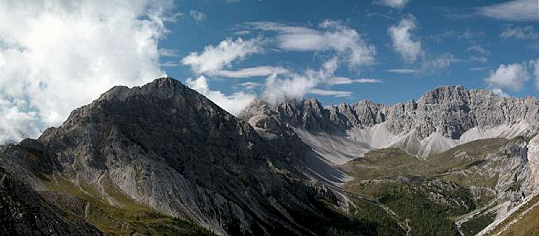
As seen from the south Weittalspitze surely deserves to be named "Spitze" which in German means something between peak and pinnacle. The mountain is located to the south of the Lienz Dolomites a small mountain group in Austria’s southern states East Tyrol and Carinthia. In fact the border between the two states runs directly over the eastern and western ridges of the mountain. Since it is located solitarily on the southern Ridge of the Lienz Dolomites it is a great lookout peak with views carrying towards the Carnic Alps Main Ridge as well as the Hohe Tauern Group.
Weittalspitze is a twin peaked limestone summit, the southern peak reaching 2503m in elevation while the slightly higher northern summit reaches 2539m. This main summit is very popular among hikers and ferrata climbers. There are four routes - two from the north, two from the south - which meet each other in passes on both sides of the summit. The final ascents along the summit ridges are far from easy but secured by fixed cables. The main danger is the gravel, which covers the rocky ascent routes. Never climb this mountain without a helmet.
The most popular ascent uses the trails across Zochenpass, one of two north-south traverses through the Lienz Dolomites. The pass itself is 2260m high and can be reached by beautiful trails which cut through the Dolomite Rock on narrow overgrown ledges. The remaining 300m of altitude are climbed using the ferrata "Allmaier Toni" along the eastern summit ridge in approximately 1h 30min. The normal ascent uses the western summit ridge. Here two trails from north and south meet at the Weittalsattel pass (2330m). The southern trail is not recommendable - too much gravel and debris - you need to be really experienced in these conditions to try this route. From Weittalsattel the remaining climb along the western ridge to the summit is rather uncomplicated.
 |  |  |  |
Getting There
Weittalspitze can be reached from two sides: from the city of Lienz in the north or from the Spa resort Tuffbad in the south. Depending on your preferred trailhead the itineraries are as follows.
From the West (Brenner Motorway A22)
Leave the Brenner Motorway near Brixen / Bressanone and follow SS49 to the east through Pustertal / Val Pusteria. To the east of Innichen / San Candido you cross the Austrian - Italian border and follow the road (now B100) to Tassenbach. For Tuffbad turn right (south-east) here onto B111, which you follow to St. Lorenzen. Here turn left onto a side road which directly leads you to Tuffbad. For Lienz and the trailhead at Lienzer Dolomiten Hütte remain on B100 until you reach the city. Here turn right, direction Tristach and cross the Drau River to its southern side. From Tristach the "Dolomitenstrasse" the road into the Lienz Dolomites, is marked by signposts. Follow this road (toll!!) until you reach Lienzer Dolomitenhütte.
From the North
There are two possible roads:
- From Kitzbühel over B108 through the Felbertauern Tunnel to Lienz, then southwest to Tassenbach and left onto B111 into Lesachtal (Tuffbad trailhead) or south to Tristach and "Dolomitenstrasse" as described above (Lienz trailhead)
- From Salzburg along motorway A10 to Spittal. Turn west on B100 to Oberdrauburg, there either south to Kötschach-Mauthen were you turn east on B111 (Tuffbad trailhead) or further on to Görtschach, where you turn south towards Lavant and on to Tristach (Lienz trailhead).
From the South (Udine)
Take Motorway A23 to the exit Camia Tolmezzo. Follow SS52 north to Tolmezzo where you turn onto SS52 bis. This leads to Plöckenpass, where it crosses the Austro-Italian border. In Austria the road turns into B100 and at Kötschach-Mauthen you can either turn east on B111 into Lesachtal Valley (Tuffbad trailhead) or go on to Oberdrauburg and west on B100 to Görtschach etc. (Lienz trailhead).
Red Tape
Dolomitenstrasse (towards Lienzer Dolomitenhütte)- is a toll road for the last 7km. So if you want to start from the north you either have to pay 5€ or start at 1050m. Aside from that the farmers request to keep your dogs on leash wherever there are sheep grazing and to close any gate along the trails.
When To Climb
The best time is late June through late September. The mountain huts are open for the same time frame. I have read a report about a winter ski tour ascent along the ferrata and downhill skiing along the normal route so this must be possible as well.
 |  |  |
Accommodation
In most of the villages of the area there is a small campground, which in most cases is associated with an inn or hotel. If you are looking for hotel rooms or apartments follow one of the links below
 |  |  |
Mountain Huts and Refuges
There are only a handfull of refuges in the Lienz Dolomites, the closest of which (to Weittalspitze) is Kerschbaumer Hütte. Hochstadelhaus is on the other side of the group but from the other two huts you can reach the base of the mountain in about two hours.
| Rifugio / Hut | Height | Open | Tel. |
| Hochstadelhaus | 1780m | mid June - end Sept. | +43 4710 2778 |
| Karlsbader Hütte | 2261m | mid June - end Sept. | +43 4876 8323 / +43 664 9759998 |
| Kerschbaumer Sutzhütte | 1902m | mid June - end Sept. | +43 4852 63374 |
| Lienzer Dolomiten Hütte | 1616m | all year (except mid Nov - mid Dec.) | +43 664 2253782 |
Weather Conditions
Weather in East Tyrol and Carinthia is much better than in the rest of the country. The mostly western winds of Europe deposit their moisture in the western and northern Alps so that only little is left. Weittalspitze is located directly on the border between the two Austrian states, so for a weather report look at one of the pages below:.
 |  |  |
Maps 'n' Books
Maps
I have been using a map by Kompass Verlag, which is very good for the hiking trails though it does not show ALL the relevant summits of the Lienz Dolomites. The group is small and at 1:50000 you cannot show all summits.
- Lienzer Dolomiten / Lesachtal
1:50000
Kompass Map WK47
Kompass Verlag
ISBN: 3-85491-053-3
Books
You’ll probably not be able to find anything on the Lienz Dolomites in a language other than German. The books I used are (only the first describes the ascents of Weittalspitze):
- Osttirol Süd
W. Mair
Rother Verlag
ISBN: 3-7633-4132-3 - German
ISBN: 3-7633-4307-5 - Italian
Good descriptions with maps covering: Defregger Berge, Villgrater Berge, Carnic Alps, Lienz Dolomites
- Gailtal – Lesachtal – Karnischer Höhenweg
Kompass Wanderbuch 982
Kompass Verlag
ISBN: 3-85491-500-4
Good Descriptions with maps and elevation profiles covering: Carnic Alps, Southern Lienz Dolomites, Gailtal Alps
External Links
- Austrian Map online
Online digital maps of Austria (OEK 50, OEK 200 and OEK 500) by the BEV (Bundesamt für Eich- und Vermessungswesen) - in German