Approach and General Information
Summit: Mt Layla
Region: Svaneti, Georgia
Height: 4008m
Date: 17/06/17
Conditions: Early Summer
Route: Normal Route
The route to Layla starts from the village of Tskhumari, about 40minutes drive from Mestia. The road to Tskhumari is (very) poor and there are no buses as far as we could establish, so you would need to either get a taxi, or take a bus to Becho on the main road and walk from there (probably around an hour).
From here there is a long trail ascending around 1900m to Layla pass. There are no opportunities to buy food along the way, so you will need to carry everything (best to buy supplies in Mestia). It is possible to rent horses from Tskhumari to carry your gear part of the way but how far they go will depend on the snow line. You will need to ask around with locals for this, who are unlikely to speak any English, so figure out the translation in advance!
The route needs minimum 3-4 days to complete, unless you are Kilian Jornet.
The Route
From the village of Tskhumari (1200masl) there are sign posts (a fairly recent initiative by the local tourist board from what we could see) directing you to Layla and Karst Cave. The route takes a fairly relentless ascent up through the forest on an established but muddy path, with the occasional view of the awe-inspiring Mount Ushba behind you. At about 2400m you reach the top of the tree line and a few shepherds’ huts. This is where some of the organised tours opt to spend the first night.
From the shepherds’ huts there is around another 700m ascent to the pass and the path gets less obvious. In our case this was a lot of snow above 2600m, so the ascent up to the pass with heavy packs made for strenuous work.
On the approach to the pass, which is visibly the lowest part of the col on the approach, the path ascends underneath a rocky ridge / cliff which is subject to heavy rock-fall, before taking a southerly bearing to the pass.
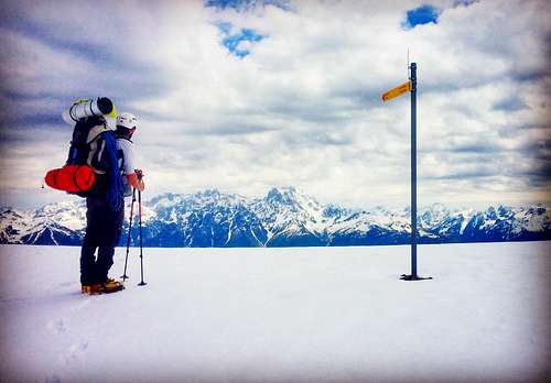
At the pass (3110m) you will find a lonely signpost (albeit not for Layla), which for us, amid the snow was not very useful beyond confirming we weren’t wildly off course.
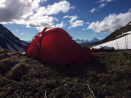
From the pass, head south traversing steadily downwards towards the glacier. After nearly 9 hours of hiking, we chose to set up camp above the glacier at about 2750m and spend the night there.
This is where the route ended for us, as when the alarm went off at 1am and the temperature was a little too warm, being the only people on the mountain and with fresh snow on the glacier we decided not to continue.
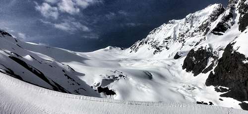
The route from here though seemed fairly straight forward according to the map; descending on to the Glacier and following it all the way to the summit.
We did toy with the idea of ascending on the moraine to the left of the glacier a little further and joining it further up, avoiding a steep looking section on the glacier, but this is not the route that is marked on the map.
View of the glacier from our camp
Essential Gear
Full gear for glacier travel: Rope, harness, helmet, crampons, ice axe etc.
Poles were very useful on the approach.
Tent, sleeping bag, cooking equipment etc.
Maps
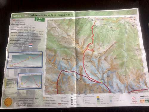
The local tourist information office in Seti Square, Mestia has a large selection of A4 maps with various hiking and mountaineering routes available for free (as below). They also have produced a mountaineering guide covering routes across Georgia, although Layla is not included in this.
General trekking maps are available from some of the gift shops in Mestia for around £6, but we felt the maps from the tourist office were sufficient.
External Links
Comments
No comments posted yet.