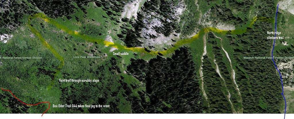
Aerial view of the faint trail described in
the topo.
After losing the trail and descending in the trees west of the typical North Ridge route, we stumbled on a faint (abandoned?) trail which cuts across a wide, grassy bench from the north ridge route, down a scrubby slope to the final switchback on the Box Elder trail to the west. It may represent a good shortcut for climbers descending to Dry Creek. The trail peters out just before reaching the Box Elder trail (making it hard to find on ascent) but it can be clearly seen on Bing's aerial view.
We did not follow the trail all the way East to where it links with the north ridge route, but in aerial views it clearly does.
