-
 17735 Hits
-
 90.48% Score
-
 32 Votes
|
|
Mountain/Rock |
|---|---|
|
|
48.83700°N / 113.696°W |
|
|
Hiking, Mountaineering, Scrambling |
|
|
Spring, Summer, Fall |
|
|
8914 ft / 2717 m |
|
|
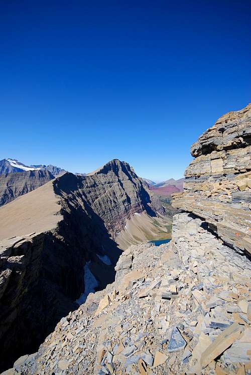
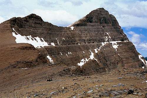
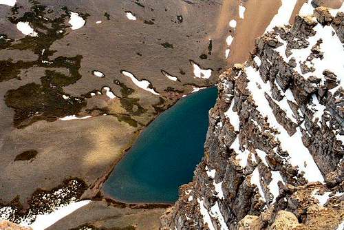
OverviewCrowfeet Mountain, a gently rounded peak when viewed from the west, vertiginous, spectacular, and anything but "gentle" from any other angle, is not usually done on its own, but almost always with Mount Henkel, and not infrequently with Apikuni Mountain (sometimes "Appekunny")—the three together forming a trio of accessible peaks in the Many Glacier Area, making for a breathtaking day of mountain vistas. And speaking of breathtaking...the east face of Crowfeet is a 2,000+ foot wall, sheer enough it will not be in the least embarrassing to have someone hold onto you as you peer down to Kennedy Lake, many, many airy feet below your perch! Crowfeet, and its two companions, are among those peaks qualifying for early season climbs, as the routes are on the south and west facing slopes, and lose their snow relatively quickly—much more so than many other GNP peaks. A nice aspect of these peaks is that the actual climb begins almost as soon as one leaves the Swiftcurrent Campground parking area—literally within the first quarter-mile.
Getting ThereCrowfeet, Henkel, and Apikuni, are located in the Many Glacier area of Glacier National Park. Access is through the Many Glacier Entrance on the east side of the park, through Babb, MT. From the west, either drive through the park over Going-to-the-Sun-Road (Logan Pass), or around the park's southern boundary on U.S. Hwy 2. The Sun Road goes left at West Glacier, while Hwy 2 continues straight on to East Glacier Park, where the choice is to either take the very winding (but with spectacular views—don't force it: relax and enjoy!) Hwy 49, or continue on Hwy 2 the few miles to Browning, at which point you'll pick up Hwy 89, heading back to St. Mary (the eastern end of the Sun Road, and eastern main entrance to GNP), then on to Babb. Babb can also be reached from Canada via Hwy 89 or 17 (Canadian Hwys 2 and 6, respectively). All GNP roads are closed in winter, with the Sun Road sometimes not opening until July (average opening is second week in June; earliest opening ever is May 16, 1987, with next earliest being May 22, 2005—weather permitting, the Park Service traditionally begins plowing each spring on the first Monday in April: it's a long, difficult, dangerous task!); the road from Babb to Many Glacier opens earlier. Don't head out early in the year (i.e., June/early July) without checking the status of these roads—it is not unusual to have repeated, sometimes lengthy, road closures due to storms, avalanches, rock slides, or all three! Anyway, once you reach the Many Glacier area, find the Swiftcurrent campground, and you're there. This link is probably self-explanatory: Map of Waterton/Glacier International Peace Park (Note that clicking on the image after it loads brings up a larger version, making it MUCH easier to read.) Current GNP Road Status and Information And finally, click here for current information, as well as easy access to some interesting photos showing the Plowing of Going-to-the-Sun Road. Route
Crowfeet Mountain is at the end of a ridge wrapping around to the northwest of Mount Henkel, and it is via this obvious and easy route that we went from one summit to the next. This link—South Couloir Route—will take you to Moni's excellent route description up the mountain. From the summit of Henkel, the route to Crowfeet is, basically, a nice ridge walk; elevation loss to the saddle is approximately a thousand feet, and with the possible exception of an airy "jump" between cliffs not far from the summit, the traverse is not at all difficult. At this (brief) point, some will feel more comfortable on a rope, others will not feel the need. Basically, this move is little more than a jump, but with exposure, so if you feel uncomfortable, by all means rope up; you can always unhitch yourself a few feet further on, then continue on through some pleasant-to-climb cliffs to the summit.
(It would be remiss to not point out that Crowfeet, and its adjoining neighbors, are also done by reversing the above ascent information—that is, from the Ptarmigan Tunnel trail, by ascending via the ridge which is accessed at the Ptarmigan Tunnel. An early start would give you a very nice day on and between Crowfeet, Henkel, then ending with Apikuni!) Red Tape, Wildlife, & Cautions Section
When To Climb, & Climbing ConsiderationsFrom late June/early July (during this time frame expect LOTS of snow in the high elevations, but as has already been pointed out, due to their geographical orientation Crowfeet, Henkel, Apikuni, may well provide some relief from this) to early fall, depending on snow conditions. Traditional climbing season in the Northern Rockies is July, August, and September—with September weather becoming progressively colder and more unstable (sometimes dramatically so: PAY ATTENTION!) as the month progresses—but does of course vary from year to year. There are occasional winter climbs in the park, but not often, and then only by well-equipped, area-wise, extremely competent individuals. Basically, most of GNP is inaccessable through the winter, and avalanche danger, to put it mildly, is extreme almost everywhere.
Because of the nature of the rock, there are special considerations regarding climbing in Glacier National Park, and grading systems unique to the Park have been developed by both J. Gordon Edwards and the Glacier Mountaineering Society. Anyone doing more than just "trail" hiking in this part of the Rockies should read the excellent and important information put together by Fred and Moni Spicker. Much—if not most—of the rock in GNP is sedimentary and rotten, and you need to know about it: Glacier National Park Rock & Grading Systems. CampingThe Many Glacier Campground (sometimes referred to as the "Swiftcurrent Campground"—$20 per day—no reservations, first come first served basis) makes for a good, quick beginning to the climb! There are numerous campgrounds available within Glacier National Park. At Many Glacier there also are cabins with and without baths, a motel and a fancy hotel. There are showers available, and a restaurant immediately off the Swiftcurrent camping area. There are also many campgrounds—USFS, KOA, and private commercial—as well as motels just outside the park on both the west and east sides.Click here for General Camping Information, and click here for Current Site Availability in specific campgrounds. There are many accomodations and campgrounds on the Blackfeet Indian Reservation, which juts against the GNP eastern border, and includes the towns of East Glacier Park, Saint Mary, Browning, and Babb. Additionally, the park has a network of Backcountry Campsites, which are pretty much a requirement for multi-day treks; some of these are by reservations, some are first come, first served. There are application and length of stay restrictions; it's important to check the above link for relevant information. Mountain Conditions/Web CamsWeather page—an overview, plus current conditions and forecast This is the New NPS Web Cam Page.
External Links/Additional Information/Items of Related Interest
In TributeOn March 1, 2011, Vernon Garner, Saintgrizzly, left us after losing a bold, inspiring fight against pancreatic cancer. Or maybe he won, for he is at last free of his pain and has "shuffle[d] off this mortal coil."Vernon was an important contributor on SummitPost, but beyond merely making good, informative pages, he actually inspired many who read his work. No one put more work into his or her pages than Vernon did, and many of those pages, especially those related to Glacier National Park, the place he loved above all others, are works of art in both the writing and layout. More than one person has wanted to visit Glacier or go back to Glacier largely due to what he shared about that magnificent place. Many people on SP counted Vernon among their friends, and many more saw him as one of the best, one of those who exemplified the spirit of this site. He was one of the best of us, he will be missed, and he will not be forgotten. As a tribute to him, Vernon's pages will remain in his name. Any member who sees a need for an addition or correction should please contact site management via the "Send PM to the Elves" feature. Rest well and climb on, Vernon. |


