
|
|
Route |
|---|---|
|
|
45.94107°N / 10.98788°E |
|
|
Spring, Summer, Fall, Winter |
|
|
Half a day |
|
|
Overview
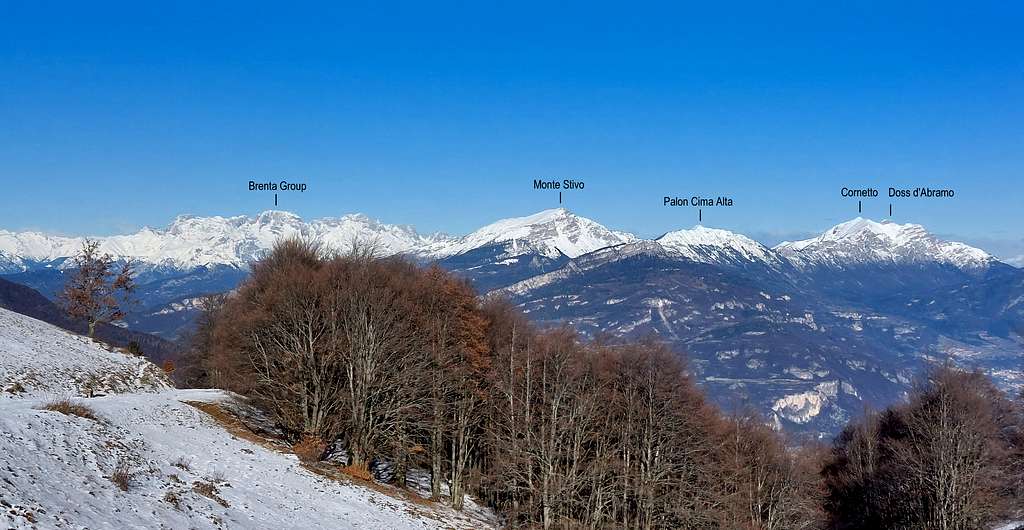
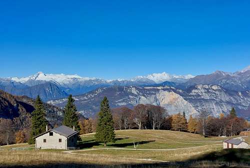
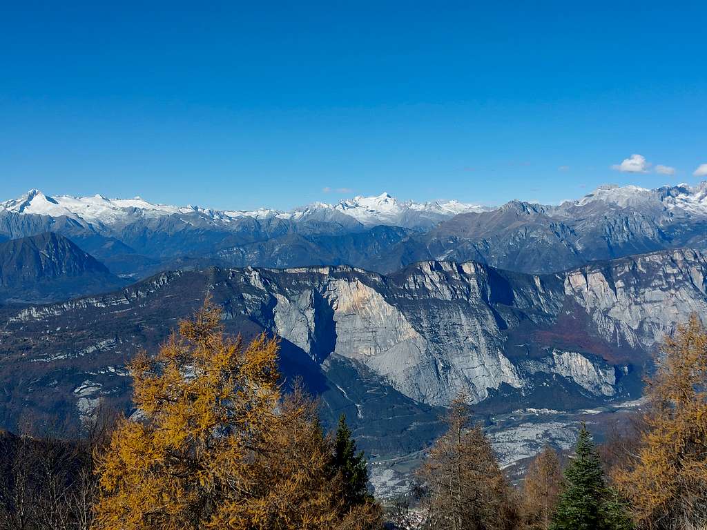
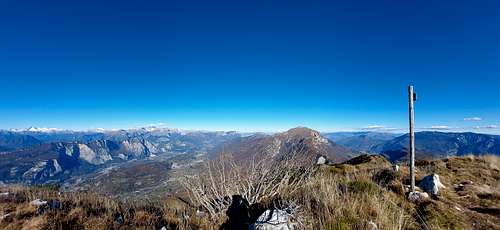
Palon Cima Alta 1916 m is a minor located in the Trentino Pre-Alps, along the Bondone-Stivo chain. It is situated to the North-East of the Garda Lake in a dominant position above the Valle del Sarca. More precisely it is interposed between the Sarca valley to the West and the Vallagarina to the East.
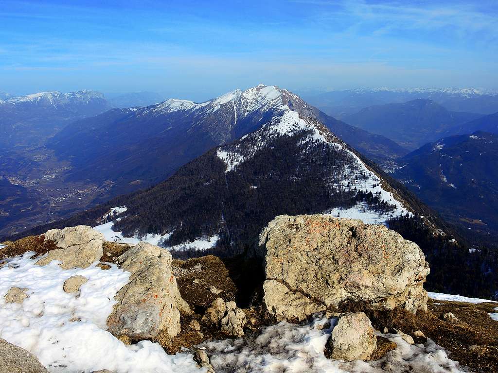
Palon Cima Alta is connected to the North to Monte Bondone by a long ridge, while to the South is connected to Monte Stivo with a shorter ridge. To the South it's facing Monte Altissimo di Nago, the Northern slopes of Monte Baldo and Garda Lake. Despite being a minor peak if compared to the nearby Monte Stivo, Palon Cima Alta deserves to be climbed being one of the most panoramic mountains in Southern Trentino. Moreover it doesn't oppose particular difficulties, but despite these features the summit is not very popular, in favor of the nearby Stivo which is more coveted also because it exceeds the altitude of 2000 meters.
Getting There
The starting point for the ascent is Malga Campo 1379 m. Malga Campo can be reached starting from Arco di Trento following the signosts to Dro, here at the crossroads take the right direction to Drena. Reached Drena, proceed for about 2 km east of the village along the provincial road to the crossroads in the locality of Casa del Luch, where a narrow asphalted road of about 5 km with numerous hairpin bends climbs north to Malga Campo di Drena 1379 m, where you leave the car.
Description
Palon Cima Alta from Malga Campo
Difficulty: EE
Difference in level: 540 m from Malga Campo
Starting point: Malga Campo parking lot 1355 m
A fine and worthwhile itinerary, leading on a panoramic summit
From Malga Campo 1355 m you briefly reach Malga Campo di Arco, then at the crossroads continue towards the NE (left) on the path n. 623 which enters the magnificent beech and larch forest.
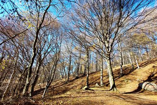
After a few zig zags that shorten the path by cutting the hairpin bends of the road, the path heads South along a long diagonal in the wood.
At the end of the crossing you exit beyond the edge of the vegetation and cross a meadow, reaching the large saddle of La Bassa Madonnina at 1684 m (signposts), located between the Monte Stivo on the right and the Palon on the left.
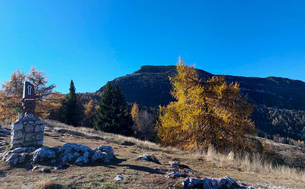
At the saddle, leave the route to Monte Stivo on the right and bear sharply to the left, continuing along the amusing ridge, without difficulty but a little exposed in some points with great view above Sarca Valley.
Continue on the ridge passing first Cima Bassa 1705 m, then Cima Alta 1846 m until you reach the Madonnina del Monte Palon and a few tens of meters beyond the Palon summit pole.
Descent: reversing the same itinerary
Essential Gear
Normal hiking gear
Red Tape
No fees no permits required
When to climb
All year round. In wintertime in the presence of snow or ice the ridge between Cima Bassa and the summit may require specific equipment (crampons and ice axe)
Where to stay
Several possibilities of accomodation in Arco, Dro, Drena and surroundings.
Bibliography and maps
Kompass 687 - 1.25.000
LagirAlpina sheet 15 - Valle del Sarca - 1:25.000