|
|
Mountain/Rock |
|---|---|
|
|
47.47220°N / 121.585°W |
|
|
King |
|
|
5454 ft / 1662 m |
|
|
Overview
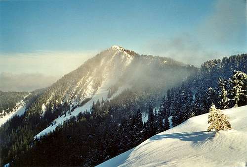
Revolution Peak is just outside North Bend Washington, above the popular Middle Fork Snoqualmie River and quite visible from I-90. Revolution Peak is number 68 on the Home Court List, the western Alpine Lakes peaks list with 500 feet of clean prominence. Revolution is a full day adventure during the winter involving hiking, snowshoeing and scrambling. The trip covers a large distance and gains lots of altitude, so start early, winter days are short in Washington. Revolution Peak can be seen from I-90, between the “Zorro Road” and Russian Butte.
Getting There
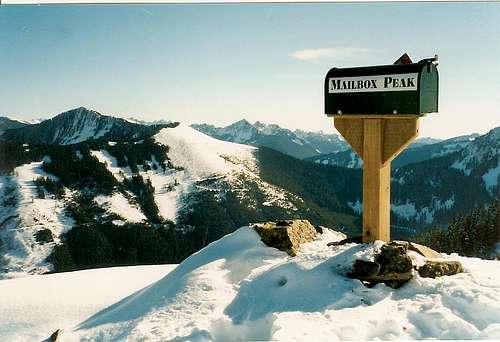
Take exit 34 off of I-90. Go north on 468th Ave for about 0.4 miles. Go right onto SE Middle Fork Road. Follow this road 2.5 miles where it will turn into gravel (3 miles from exit 34). Here, at the end of the pavement is the Mailbox Peak trailhead. Park here or continue 0.1 mile further to the blue DNR gate where there is room for about 2 cars. This gated road is the start of the route up Revolution Peak.
Red Tape
The Discover Pass is likely required at the Mailbox Peak Trailhead.
Route
The route up Revolution Peak starts with a nice 5 mile hike up the Granite Creek Trail. In 2012, about 6 miles of the Granite Creek road, from the middle fork to the turn off to Thompson Lake has been decommissioned and restored as a trail. In this case, that means that a guy with a huge track mounted backhoe dug up the entire road bed and left behind a meandering single track trail. To the sides are boulders, and lots of organic stuff pulled down from the sides such as logs, brush, ferns etc.
At 3.3 miles, you’ll cross Granite Creek and at 5 miles hit the first big old road split. Go straight, following a sign that says to Thompson Lake. Within a mile, pass that trail junction continuing up toward the ridge. A few portions of the road may be choked with Alder but people often cut it so hope for that. If it is winter, continue up wherever it looks best to obtain the ridge. If summer, maybe keep to the road as it switchbacks up. It’s not necessary to go all the way to the old cabin site on top of point 5124 but it is a neat spot to visit. From the old cabin site, travel NE along the ridge. At some point it gets cliffy so it’s necessary to down climb a bit to traverse below. Finally, re-gain the ridge and walk up the ridgeline to the summit of Revolution Peak.
Granite Creek Road
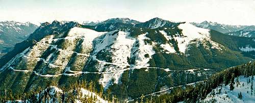
This road has a long history. For a brief time, I had responsibilities with this road working for the Washington DNR. The DNR wanted to decommission it for many years and let it become a trail. But, there were some long existing private easements on this road to reach some private land in-holdings. As long as these private interests maintained the road to forest practice standards, the easement was in place. The road also accesses the "Zorro Road". This is an infamous scar that is visible from the I-90 corridor. There have been huge attempts to repair this visual scar but nature is taking its time on this one. Learn about these restoration efforts HERE The new 2012 restoration and future inclusion on trail maps should bring the approach some interesting changes and a lot more visitors.
The Name
"We originally called this 'Comrade Peak' in keeping with the Russian theme, and in honor of the new name for the Mountaineer's 'Not So Fleet of Foot' group. But when 7 of us gathered for the climb at the Issaquaah Park & Ride and one totalitarian driver led a rebellion with 3 of our comrades to another peak in another drainage, we decided to redub this 'Revolution Peak'." -John Roper in April 1995 issue of Pack & Paddle.
External Links


JohnGilbert - Dec 9, 2012 10:20 am - Hasn't voted
Granite Creek road is now a trailIn 2012, about 6 miles of the Granite Creek road, from the middle fork to the turn off to Thompson Lake has been decommissioned and restored as a trail. In this case, that means that a guy with a huge track mounted backhoe dug up the entire road bed and left behind a meandering single track trail. To the sides are boulders, and lots of organic stuff pulled down from the sides such as logs, brush, ferns etc.
It is no yet “pristine”, but is on its way. I would now consider it a nice family hike up to the crossing of Granite Creek. The route has a gentle grade and is still passible with mountain bike, but is no longer suitable for “family biking” like it used to be.
But one thing it is now is more challenging to hike on. The hike used to be boring, but pretty effortless. You now have to pay attention as you step over rocks, small creeks and other minor stuff.
Overall, this change has made the trip up to Zorro Ridge (aka) West Revolution more interesting, but it is a long day. A group of us, keeping up a good pace with only short rest breaks took 9 hours to do the 16 miles round trip to the cabin. On our late December day that was 100% of the daylight.