


Comments
No comments posted yet.
|
|
Trip Report |
|---|---|
|
|
40.62737°N / 115.51451°W |
|
|
Aug 8, 2020 |
|
|
Mixed |
|
|
Summer |
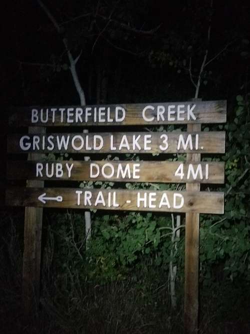
It was midnight on Saturday morning when I reached the 6600-ft high Ruby Dome trailhead in Hennen Canyon via the special-access road at the base of the mountains. One must acquire a key to the gate in order to enter. This is obtainable via the Spring Creek Association, which you can reach here: Contact for gate key.
I'd attempted two summits in the dark--Medicine Bow Peak in Wyoming and Lone Peak in Utah--this situation was most like the Lone Peak attempt where I'd felt such extreme anticipation that sleeping at the trailhead almost immediately became an afterthought. I felt very hurried.
I went up into the canyon through some basic terrain that started with a forested area and a dirt trail. Ascending with Spring Creek still in sight behind me brought back memories of climbing up many routes on the east side of White Mountain that overlooks Rock Springs, Wyoming.
The grassy, bushy hillside opened up some into a meadow. Then the trail led beneath the canopy again. After a while I estimated I'd gone two miles. Growing exhausted, I decided to simply lay down once I reached the next clearing. Despite a jacket, with a sweaty back and a breeze blowing through the canyon, I grew chilly while laying down on a rock slab. I jotted some scribbles into my trekking journal.
"01:30- Nap time on the rocks perhaps a mile from Griswold [Lake] or less. Town is visible still. Is a perfect eve with light breeze. Haven't ever bivy'd before. We'll see if I snooze for a bit."
I dozed off for perhaps a few seconds, but after 20 minutes or so, I knew that good sleep wouldn't happen. I had to move. The moon was up now. Standing up, I looked toward Ruby Dome and realized that all desire to climb had gone.
I turned down the mountain toward the trailhead. I was feeling exhausted. Bed seemed best. Feelings of being a pansy came and went.
"Next day; well, same day. I didn't snooze but for maybe a minute. Decided to turn back. Wasn't feeling it. Perhaps soon though. Hell, I could today. I could get down tonight and bivy. I don't know though."
It was 04:00 by the time I reached the house. I ate something and fell asleep soon thereafter.
At 10:30 a.m. I arose. After breakfast I realized that the hottest part of the day was coming. I was glad to be where I was versus hiking through the middle of the day as had been the case on the prior weekend when a couple buddies and I dealt with a cloudless sky under a relentless summer sun during our most recent Echo Lake expedition.
Sitting at home as the summer afternoon rolled by, another summit attempt was on my mind. The sky had remained clear all day. Ruby Dome's Mountain Forecast was still looking clear for the the night into the next several days. "Carpe Diem," I thought.
By approximately 4:00 p.m., I was focused on going back up there. I drove back. For the second time on this day I entered the trail. The sky was a solid light blue. Someone I knew was leaving. He was with his wife and some other family. They'd simply gone up to a good place where they could enjoy Butterfield Creek for a while. We went our separate ways after a quick chat.
Continuing upwards on the basic trail I passed a couple more groups on the way down.
Continuing on, I soon stood to the side so a group of four could pass. They seemed to be two clean-cut couples in their 40's. A man was leading the way down.
"I don't know if you're going to make it before dark, bro," he said.
"We'll find out. I'm not worried about it," I replied.
The convoy kept moving. A man holding the rear of the group wished me luck.
"Maybe y'all see lights up there later," I said.
"We'll be looking," he replied.
It was now approximately 7:30 p.m. The sky changed colors from blue to shades of orange. The smell of a campfire wafted through the canyon. I soon passed the area on which I'd laid down from the earlier visit. If Griswold Lake was three miles from the trailhead, then I had to be close, for I knew that I'd been hiking at a minimum of 1.5 miles per hour.
The angle of the terrain began to shallow out, and it seemed clear that I was reaching the basin area where a glacier had long ago carved out the bottom of today's Griswold Lake. A lightly forested section appeared from one side to the other in this part of the canyon. A man with a large handlebar mustache stood across the way in camouflage, seemingly taking in the evening view of town as the sun was setting. You couldn't see the sun, but the western horizon was still vivid and colorful under the deep blue sky. The lake came into view as I approached the man.
"How's it going?" I asked.
"Pretty good. How about you?"
After some more conversation, I told him my plan. He said that he'd seen a number of people go up earlier in the day, and that they didn't seem to follow much of a path. They had kind of just zig-zagged up the mountain on the left, north, side of the canyon. He and another person were camping down at the lake on its southwest side.
After getting water, I rounded the lake's north side. After 10 minutes of bushwhacking through the thicket, a clearing gave me the chance to snap a shot of Lake Griswold and the horizon down below.
The small fire that the handlebar-mustache guy and his companion had made was merely a speck on the other side of the lake now. With a little more bushwhacking, I was finally at the rocky portion of the mountain above the lake, the real beginning of the ascent, I thought to myself. The first stars and planets began to show as a slight breeze blew from the west. My headlamp helped lead the way as some simple hiking uphill and some scrambling brought me higher and higher. When the headlamp wasn't quite telling me the best way, I'd use my more powerful flashlight to better verify a feasible route.
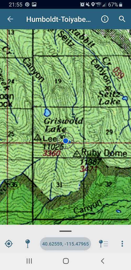
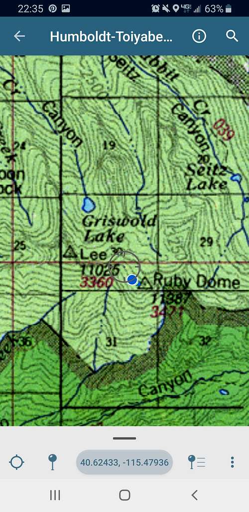
I headed toward the peak that was straight up in front of me. Soon enough I was spread-eagle while going up a 6-foot wide, maybe 50-degree scree chute. It became a priority to carefully inspect what rocks and rock wall I would use to boost myself upward. Looking behind me was perhaps 40 feet of the beige and pale-brown chute below, and then a vast darkness. Upon getting to what seemed like a stable area on one side of the chute, I took a look at my map (on the Avenza Maps app ).
I finally found relief at the top of the chute. Now standing on solid ground, Ruby Dome was still a ways away, only visible because its silhouette blacked out the stars in its massive backdrop that was the night sky.
The way to the top now involved simple rock fields that were hardly difficult to traverse. I contacted my buddy who lived in Spring Creek.
"Let me know when you're at the top and I'll go outside with the binoculars," he texted.
It now seemed especially dark and noticeably quiet as I trotted over the remaining rocks and boulders of various sizes. These did not seem like granite rocks because of their light-brown color, I thought, but they certainly weren't anything too dense. They made a sandy sound as one rock would move slightly, creaking against others during the hike over them.
The route was maybe a 1/2 to 3/4 miles between the chute I'd gone up and Ruby Dome. The angle of the slope was getting more and more shallow. Then an intensely orange light shone from the other side of the mountain. The moon was just beginning to rise. Finally, probably the biggest cairn in the Ruby Mountains.
A week ago I'd stood on a high ridgeline a mile or two east of this point between the unoficially named Mount Silliman and here.
The night was silent. Not hot or cold. The surrounding mountains were shrouded in darkness besides those closest to the rising moon. It was 23:00 hrs.
My buddy quickly saw me through his binoculars from where he lived in Spring Creek. I had my headlamp on while I was also waving my flashlight around while facing west.
"Looks like aliens from here," he said.
As I brought my camera out, I noticed a smaller cairn-like rock pile with an open side that had three containers in it. And I saw a critter move upon shining my light there. It was probably a pika home along with a register shelter, I thought. But the only portion I saw of the creature looked bigger, and it had somewhat of a white coat. All the pikas I'd seen in the Rubies were a darker color. Well, I thought, perhaps it was its underbelly that I'd caught a glimpse of. My attention then quickly went to the rapidly rising moon. With the 55-to-220mm lens on, I did my best to get its details in a picture.
Sitting there in the still of the night was relaxing.
The time was now nearing 00:00, and so what better thing to do than to have a midnight snack, I thought. With a little chill in the air now, I put on my vest and boiled water for the Bandito Scramble meal. After pouring the hot water in the packet, I held it in the belly section of my vest for the recommended time, a little trick for getting a little more cozy on a chilly evening in the mountains.
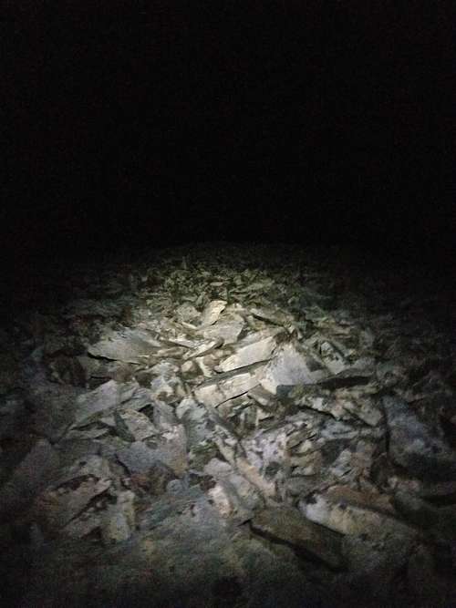
I was in no hurry after the meal. I took a lot of pictures. Most were no good like the one below. Despite many attempts to get one of those epic shots with all the stars, I couldn't figure out the settings the right way.
As I drank some hot tea, it became apparent that the critter that I thought was a pika was not a pika. I'd been sitting there while hearing a sound coming from the other side of my backpack. I stood up and tapped the pack with my foot, and a rat-like creature hurried away behind the tall cairn. It had a light color. Its tail was fluffy. It was a bushy-tailed woodrat, otherwise known as a packrat. The tail that I saw was definitely fluffier than the one in the Wikipedia article though. The one I saw looked almost exactly like this: Ruby Dome packrat
A liter or so of water was all I had now, and the days had quickly been heating up once the sun came up. Griswold Lake was at 9220' in elevation, approximately 2000' below Ruby Dome, and there was little to no water above the lake. I packed up and slowly began descending the mountainside.
During the descent I realized that a knuckle that goes west from the peak was probably the traditional route up and down since some cairns were on that side. That felt comforting. I stopped and toggled the camera setting again to attempt another cool nighttime picture.
Carefully continuing down this northwest side of the mid-mountain section, certain areas were a little tricky on the first 1000 feet down. I made it down this first leg of the descent by taking my time and sometimes finding a better way than I first thought was necessary. Then the cairns disappeared.
It was now 03:30, and I'd been completely focused on safely descending. It seemed like the mountainside wanted me to go a little south because staying just north of the lake's most northern bank possessed mostly dangerous cliffsides. Navigating the best I could did have moments when I had to be careful while working my way down levels of rock face, but the exposure wasn't too bad. It was often a matter of simply leaning in toward the rock while gripping a handhold of some sort while carefully walking diagonally down each slab. At approximately 600 feet above the lake I encountered a fault line. It was going straight up and down the mountainside. I either had to go find another way, or I could drop down into the opening in order to see what route was below it. The terrain in the fault looked a lot like the chute I'd dealt with earlier on the ascent--loose rock and maybe a 6- to 8-foot opening between the north and south sides.
I lowered myself into the gap and descended some. Without going into too much detail, I struggled to get down to a second chute that was about 10 feet below this one.
I committed to avoid any questionable areas for the rest of the descent to Griswold Lake. My water was all gone now, and the next hour or so became a tedious struggle to reach the lake via more descents over rock slabs and thickly vegetated areas. The moonlight was hardly helping, but I could tell that the sky was becoming a dark blue. As far away as the lake seemed at times, I knew that I'd get down unless the mountain had changed shape in order to trap me. Finally, with some stumbling through one of the last foliage lines above the lake, a water source could be heard trickling water nearby. I knelt down there and refilled both water bottles.
The couple guys at the lake who I'd passed on the way up were nowhere in sight. Now began the final stretch of four miles down Hennen Canyon to the trailhead. I felt good physically.
At approximately 06:00 I stopped for some pictures and a Peak Refuel, strawberry granola meal.
Soon thereafter I was passing the rocks that I'd dozed off on in the wee hours of the morning before. Nobody was coming up the trail yet. The sun came over the ridgeline just as I reached the vehicle.
"Just back to car," I messaged a friend so he didn't call a search party out. It was 07:10 on Sunday at 8/9/2020.