
-
 1634 Hits
-
 71.06% Score
-
 1 Votes
|
|
Route |
|---|---|
|
|
40.12632°N / 105.6247°W |
|
|
Summer |
|
|
Sawtooth Mountain - North Slopes
Sawtooth Mountain
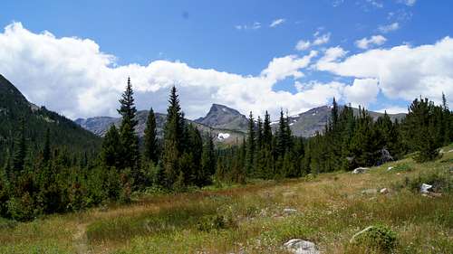
This is my first trip report, Woohoo! Sawtooth Mountain sits in the Indian Peaks Wilderness at 12,304 ft or 3750 m. I originally planned on doing the East Ridge, but missed it and by the time I realized my mistake it was easier to continue up Buchanan Pass and Summit via the North Slope. I only take pictures the way down from climbs, so I think I found the proper place to turn for the East Ridge which I'll show in some later pictures. This is a pretty easy trail and is well traveled. If you're like me and see this peak on your commute from Longmont to Boulder every day, you know that Sawtooth has a pull on you to come climb it.
Start - 8:50
Summit - 12:00
Car - 15:00
Cell Signal - Verizon, Samsung Galaxy, Signal was in and out on the summit, Not strong enough to make a call, sent a few texts out. Had 4G a few times, enough to receive some emails.
Beaver Creek Trailhead
To get to the Beaver Creek Trailhead from north or south you'll be on CO-72. If you're using google maps just type in Beaver Reservoir, and when you're driving look for signs for the Boy Scout Camp, Camp Tahosa.![Unnamed Image]()
Unnamed Image The sign for the road is CR 96. Follow the signs for the Beaver Reservoir, I think it says something like 2 miles ahead. You'll skirt around the north side of the Reservoir and go across a large concrete channel. You can't miss the trailhead and parking for the trail is off the side of the road, no parking lots.

Unnamed Image
On The Trail

Hand drawn Trail, not perfect but close to actual route
Started hiking at 8:50. Once you get trekking, you're basically going to want to stay right on all the junctions. If you're there on a weekend you'll probably see a lot of jeeps and 4-wheelers heading up 507. Some sections of 507 have large pools of standing water, there are always little side trails around. About 1.5 miles into the hike up the road you'll come to a hiker/skier only section, continue straight. ![Unnamed Image]()
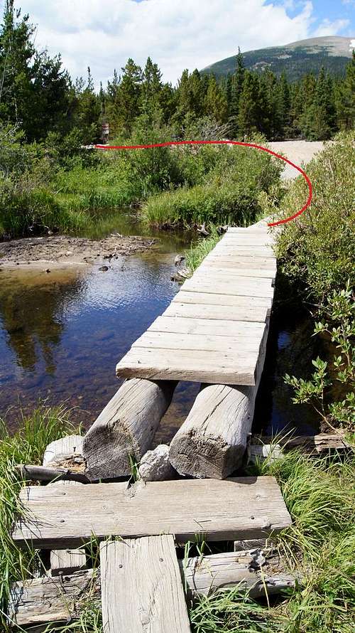
Hiker/Skier Trail SignThis saves you about 0.6 miles compared to continuing on 507. Once you meet back up with the road, follow the signs for Buchanan Pass Trail. You'll come to a nice little pond area, good place to pop the boots off and have a quick snack. Cross the wooden foot bridges then head to your left and you'll see the signs for the Coney Flats Trailhead. A little bit up the trail you'll see a post at a trail fork, stay to your right again. I believe going left takes you to on the Coney Creek Trail to Coney Lake.
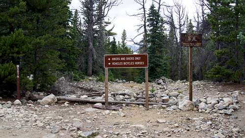
Hiker/Skier Trail Sign
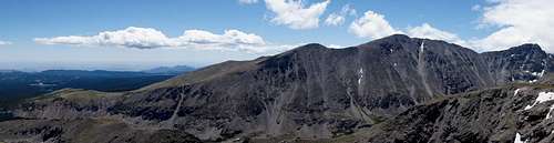
East Ridge Route (Class III)
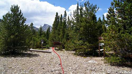
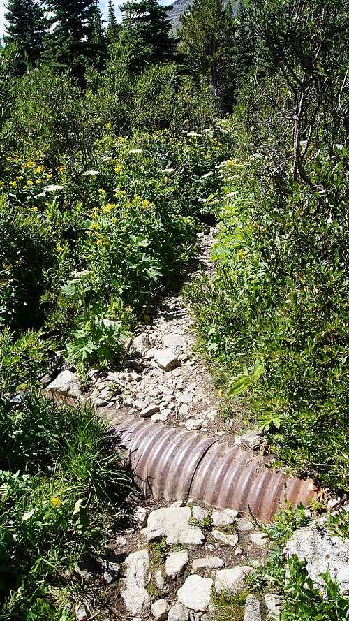
Maybe a mile or more after the fork you'll hike over 2 metal drainage pipes, I think that is a good indication that you're coming up on the turn for the East Ridge. ![Unnamed Image]()
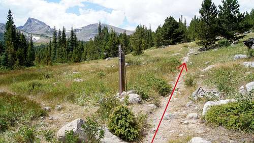
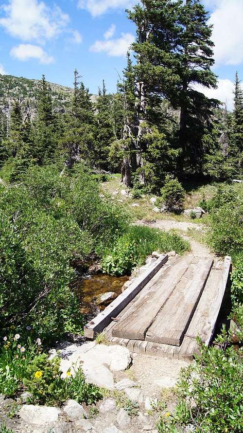
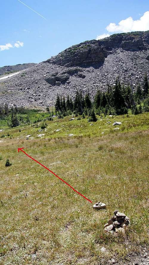
Almost at the turn My guidebook says somewhere around 10,400 feet is where you're going to head off trail to get on the East Ridge. I found a Cairn in an open section that seemed like a good, minimum bushwhacking, section to head off trail. It was beginning to be overgrown so I added a few rocks and did a double small cairn to the left pointing to the ridge, (that might be a New Mexico backcountry thing using double cairns for directions). So keep your eye out on the left side of the trail if you want the East Ridge. If you cross a small wooden footbridge, you've gone too far.
Almost at the turn
Gone too far for East Ridge
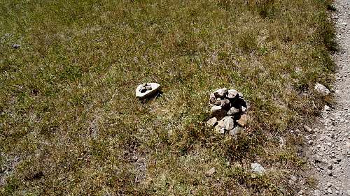
East Ridge Cairns
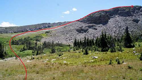
North Slopes Route (Class II)
For the North Ridge, just keep heading up Buchanan Pass Trail. At the top of the pass is a large cairn, that's about where I turned to head up the North Ridge. ![Unnamed Image]()
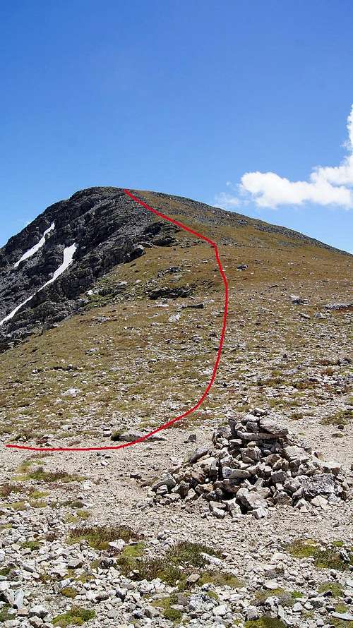
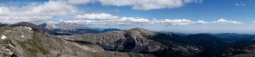
North Slope I found a few sections that seemed trail-like but nothing distinct the entire way, so I tried to keep off the plant life as much as possible and stick to rock hopping. From there, just keep heading up the ridge and you'll be sitting on top of one of the coolest looking mountains in CO. I summited around 12:00. My understanding the North Slope is also the common descent route if you're coming from the East Ridge or South Face. On the way back down you'll see the sign for the Hiker Thru Section, rule of thumb keep to the left on the way back. Round Trip, the North Ridge is about 13.4 miles and gives you 3,110 ft of elevation gain.
North Slope
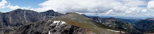
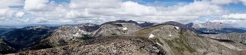
Summit View Pano
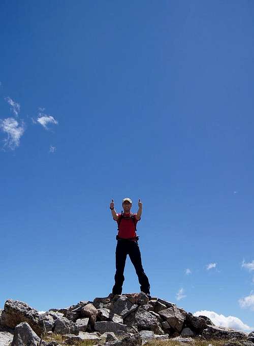
Ultra Cheesy Sawtooth Summit Pic!