Scenic Flight, Chicago-Las Vegas, February 2022

Scenic Flight, Chicago-Las Vegas, February 2022

Page Type Page Type: Custom Object
Location Lat/Lon: 38.81583°N / 107.06002°W
Additional Information Object Type: Custom Object

Overview

Several times a year, for hiking purposes, I fly from the Midwest to the western parts of United States. When weather is clear, I enjoy looking out the plane window to find places that I have visited or seen on maps. My most recent flights from Chicago to Las Vegas and back happened on two such wonderfully sunny days. I will provide here pictures that I took sequentially during my flights.


The Midwest (Chicago to the Rocky Mountains) is painfully long, flat and featureless therefore, most of the pictures were taken west of the mountains. 


Chicago to Las Vegas, February 5, 2022

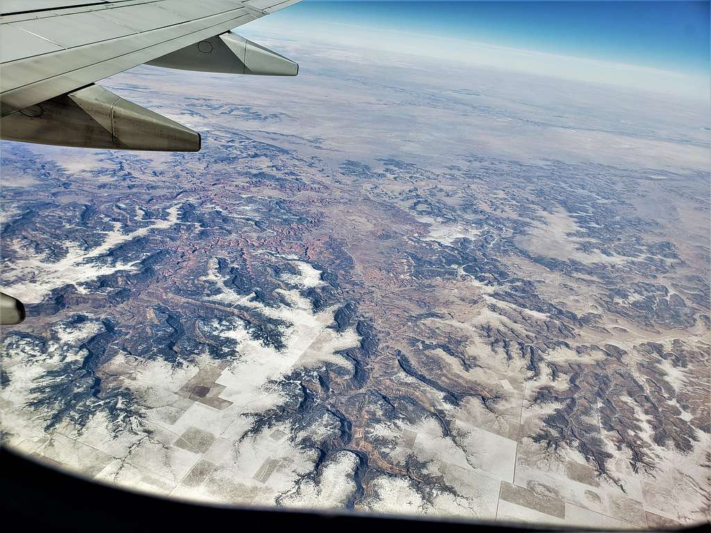
Comanche National Grassland (Colorado).


Comanche National Grassland, Colorado


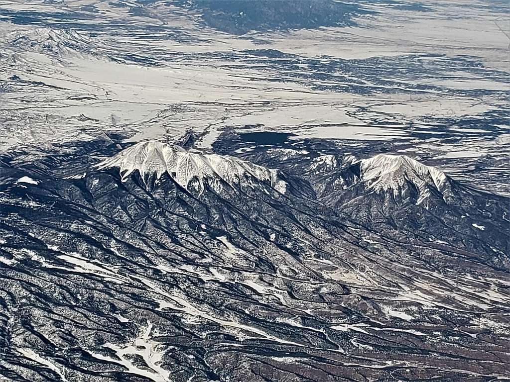
East and West Spanish Peaks (Colorado).


East & West Spanish Peaks


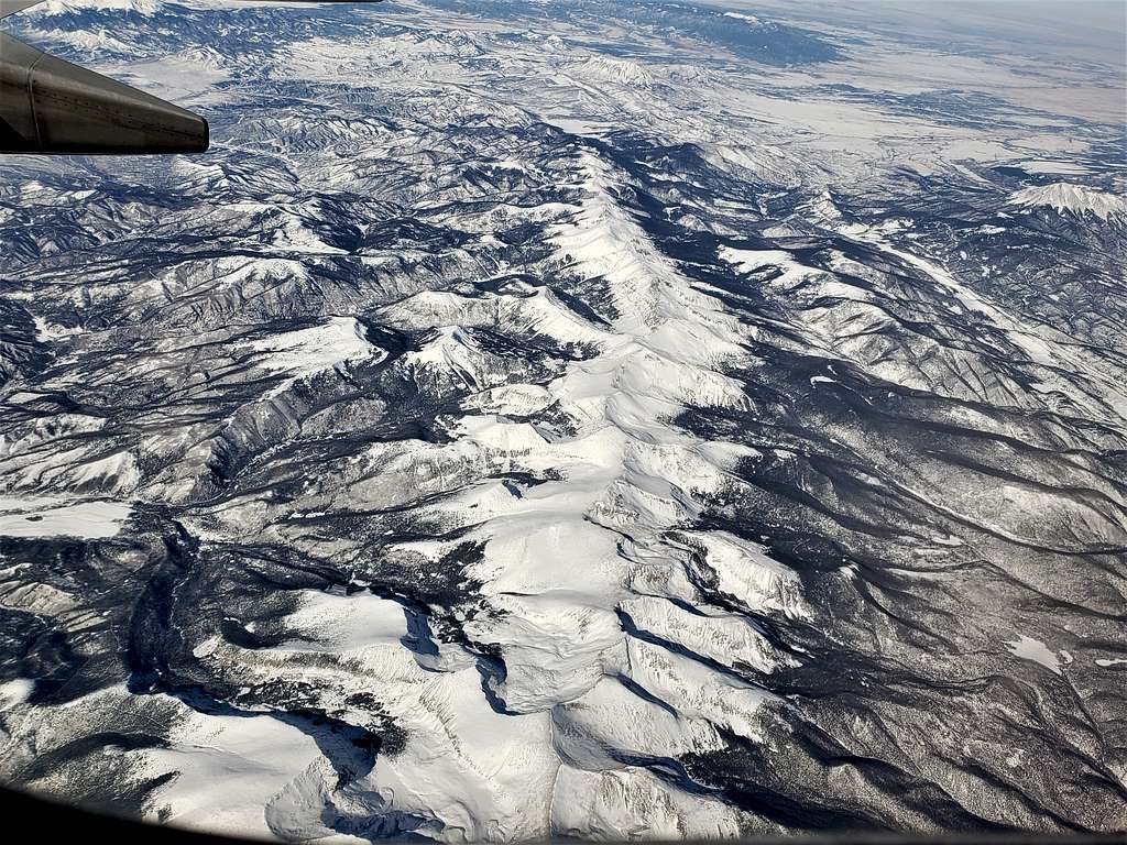
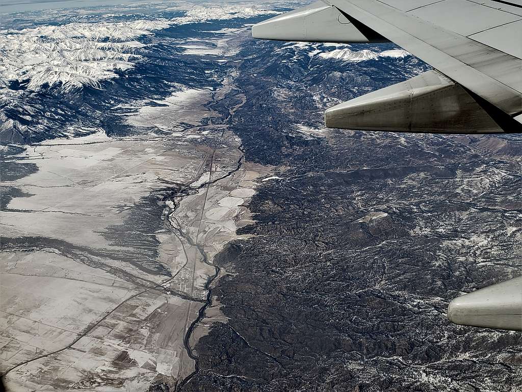
Southern Sangre de Cristo Mountains, Beaubien Peak at the low end of the picture (Colorado).


Beaubien Peak and the southern Sangre de Cristo Mountains


Blanca Peak and the northern Sangre de Cristo Mountains plus The Great Sand Dunes (Colorado).


Blanca Peak, Sangre de Cristos and The Great Sand Dunes


Ship Rock (New Mexico).


Ship Rock, New Mexico


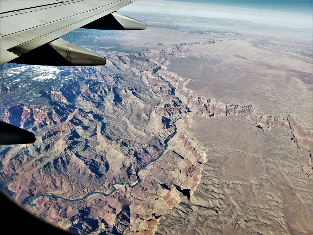
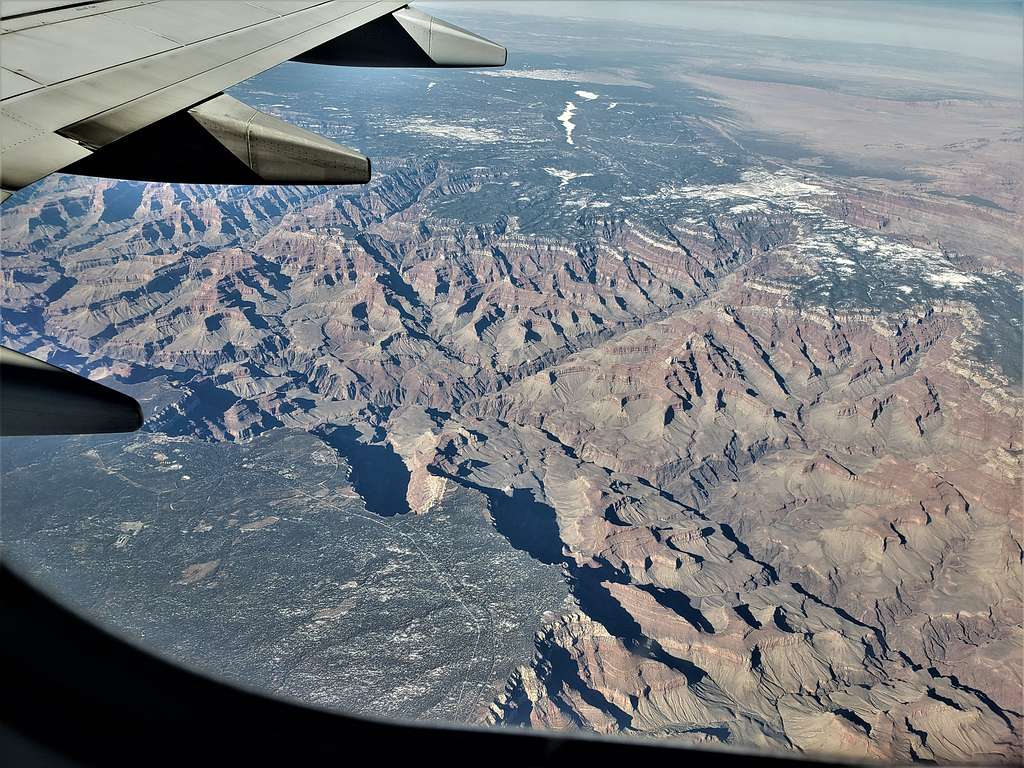
Grand Canyon, Junction of Colorado River and Little Colorado River (Arizona).


Grand Canyon, Junction of Colorado & Little Colorado Rivers


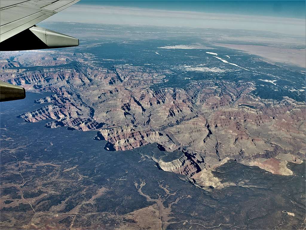
Grand Canyon, Unkar Creek Rapids area (Arizona).


Grand Canyon, Unkar Creek Rapids area


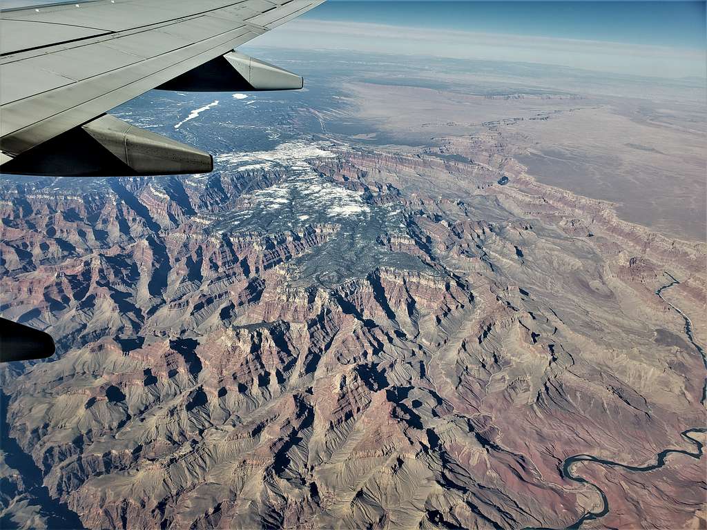
Grand Canyon, Grand Canyon Village on the left, Yaki Point middle (Arizona).


Grand Canyon, Grand Canyon Village on the left, Yaki Point middle


Grand Canyon, Pima Point & Hermit’s Rest on the right (Arizona).


Grand Canyon, Pima Point & Hermit’s Rest on the right


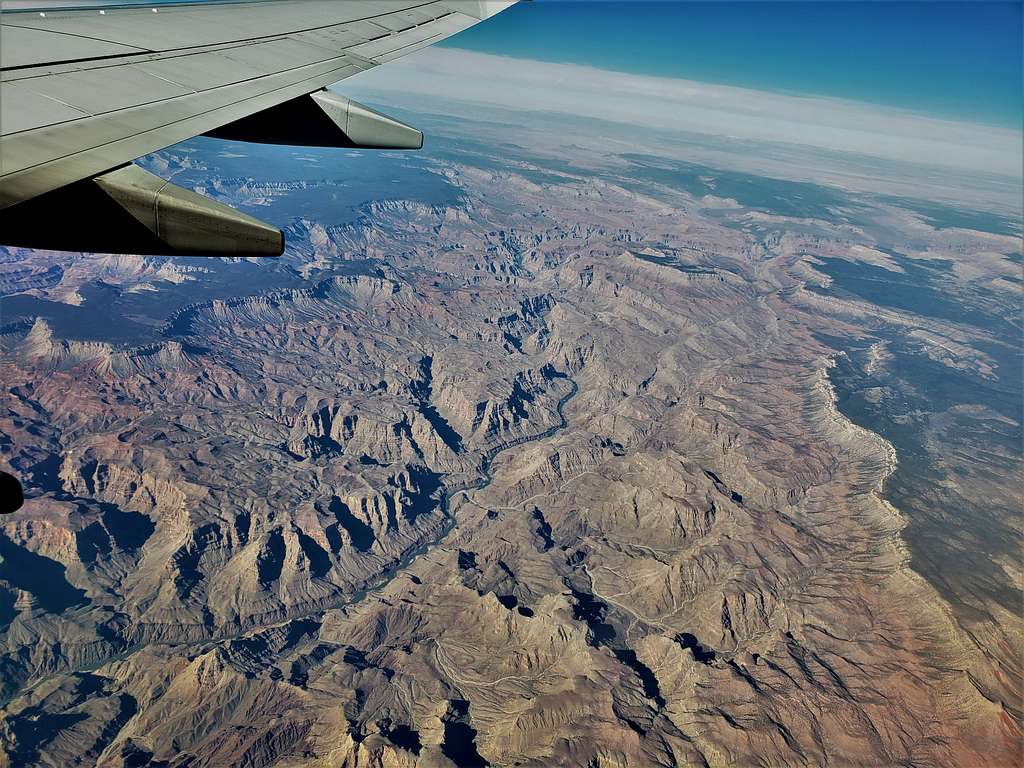
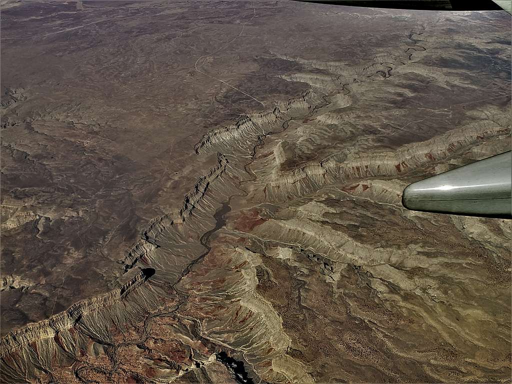
Grand Canyon, Wide Island/220 Mile Canyon area (Arizona).


Grand Canyon, Wide Island, 220 Mile Canyon area


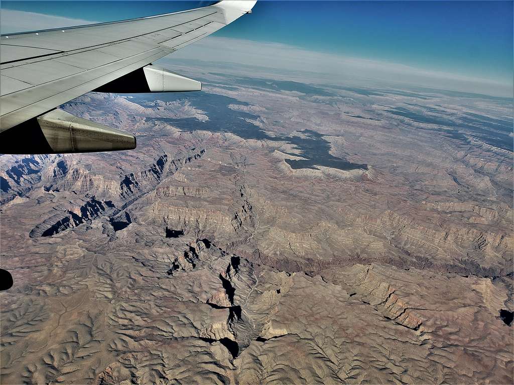
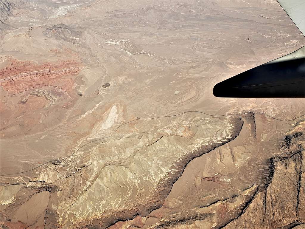
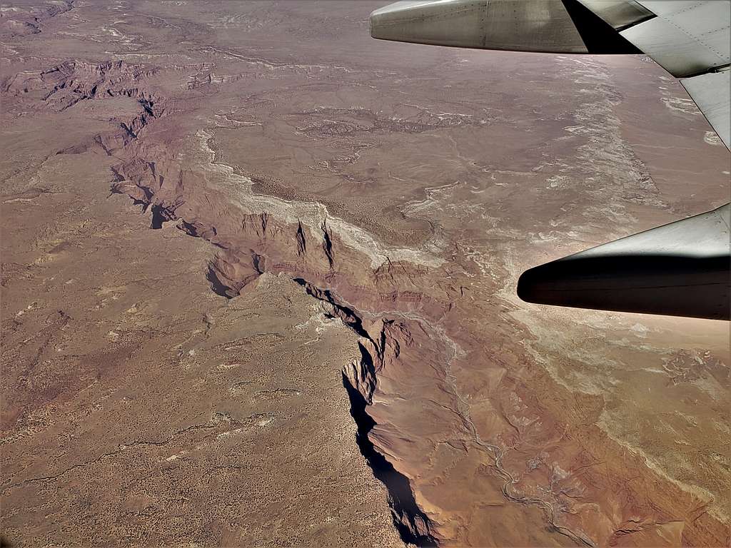
Grand Canyon, Gneiss & Bridge Canyon/Hualapai Indian Reservation area (Arizona).


Grand Canyon, Gneiss & Bridge Canyon, Hualapai Indian Reservation area


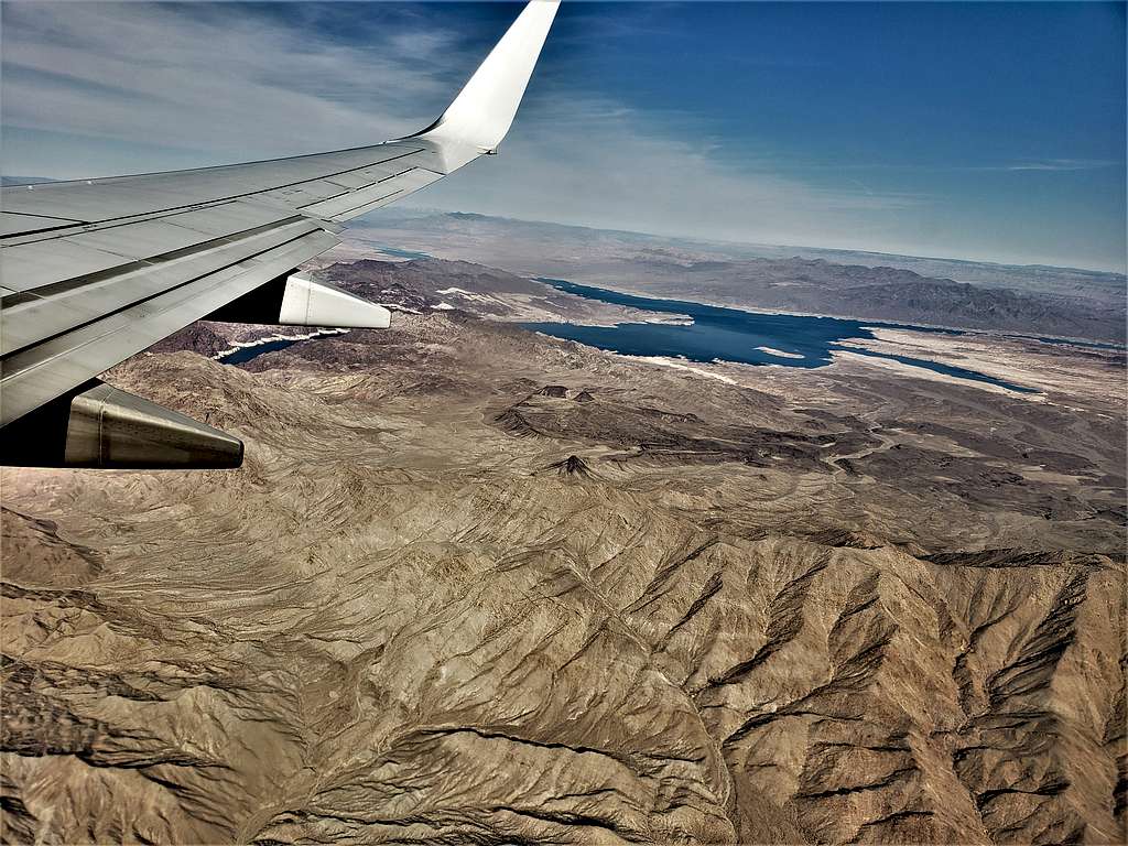
Lake Mead and north ridge of Mt. Wilson (Arizona).


Lake Mead and north ridge of Mt. Wilson


Las Vegas to Chicago, February 12, 2022

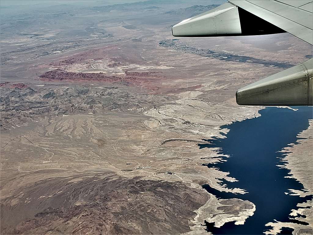
Shortly after taking off from Las Vegas, Northshore Drive came to view. I could see Northshore Summit Trailhead, Northshore Peak, Razorback Ridge and Bowl of Fire (Nevada).


Northshore Peak, Razorback Ridge and Bowl of Fire plus North Shore Dr.


Overton Arm of Lake Mead with the red colored Valley of Fire (Nevada).


Overton Arm of Lake Mead with the red colored Valley of Fire


Snake Gulch, a north-south running gulch on the north side of Grand Canyon (Arizona).


Snake Gulch, a north-south running gulch on the north side of Grand Canyon


Paria Canyon (Arizona).


Paria Canyon
Paria Canyon


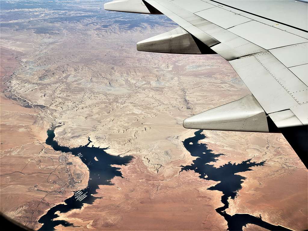
Wahweap Marina, Lake Powell (Arizona).


Wahweap Marina, Lake Powell


Padre and Last Chance Bay plus Kane Peninsula, Lake Powell (Utah).


Padre and Last Chance Bay plus Kane Peninsula, Lake Powell


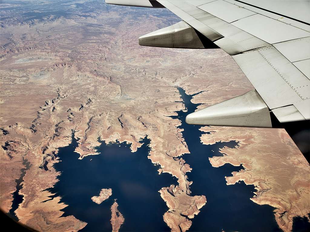
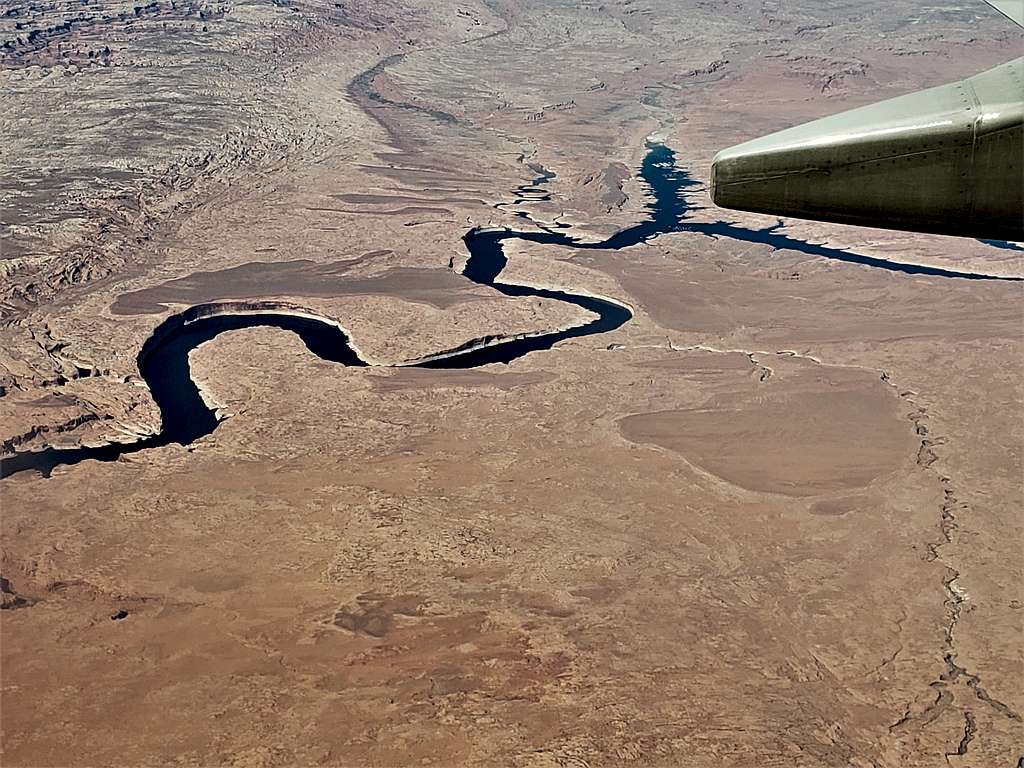
Last Chance and Rock Creek Bay, Lake Powell (Utah).


Last Chance and Rock Creek Bay, Lake Powell


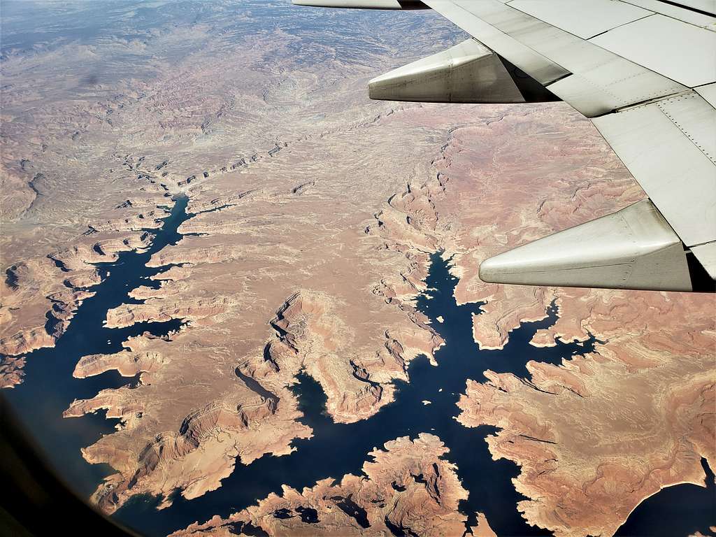
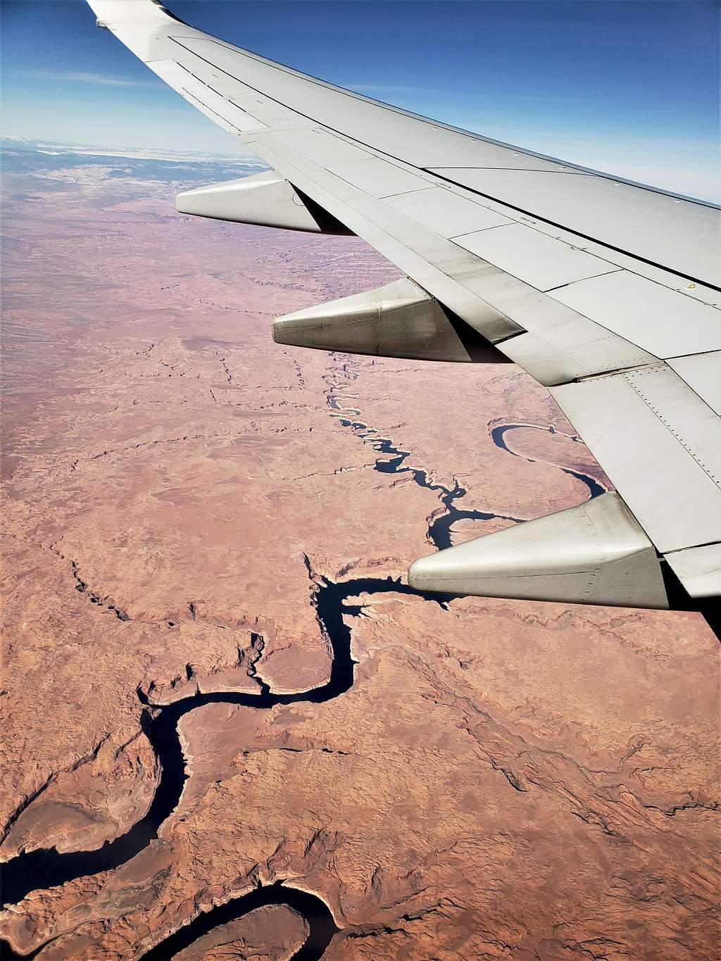
Colorado & San Juan River junction just outside the left lower corner, Lake Powell (Utah).


Colorado & San Juan River junction (left lower corner), Lake Powell


Bullfrog Marina, Lake Powell (Utah).


Bullfrog Marina, Lake Powell


Red Canyon, Mt. Ellen Peak and Mt. Pennell of Henry Mountains plus Lake Powell (Utah).


Red Canyon, Mt. Ellen Peak and Mt. Pennell of Henry Mountains plus Lake Powell


Arch Canyon (Utah).


Arch Canyon, Utah
Arch Canyon, Utah


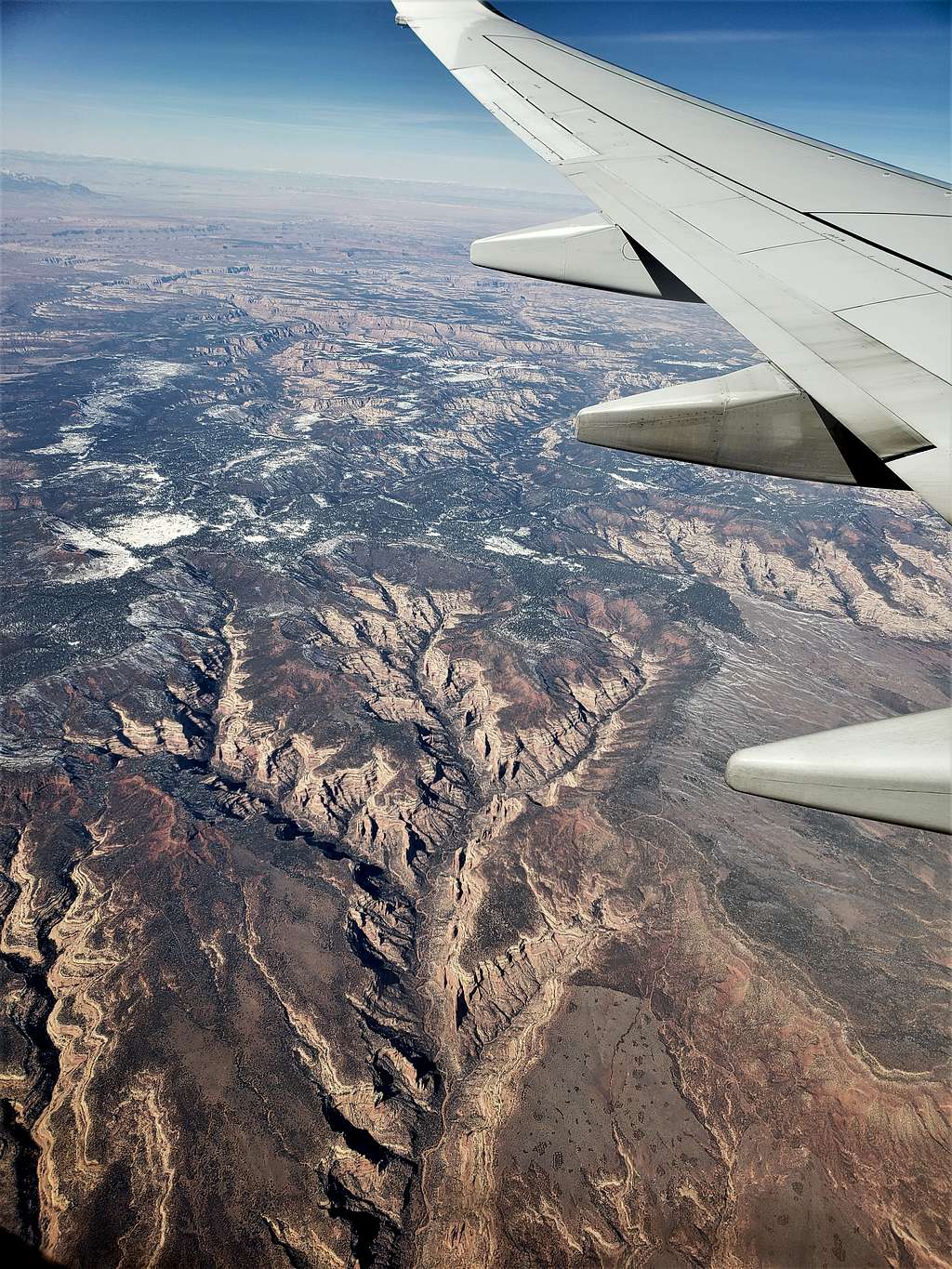
Hammond Canyon (Utah).


Hammond Canyon, Utah


Abajo Mountains and Route 191 (Utah).


Abajo Mountains and Route 191


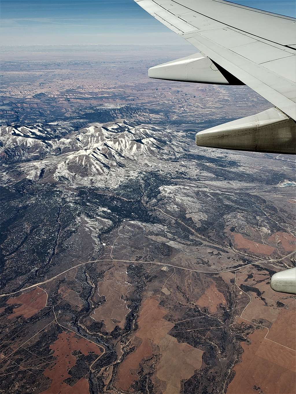
La Sal Mountains (Utah).


La Sal Mountains
La Sal Mountains


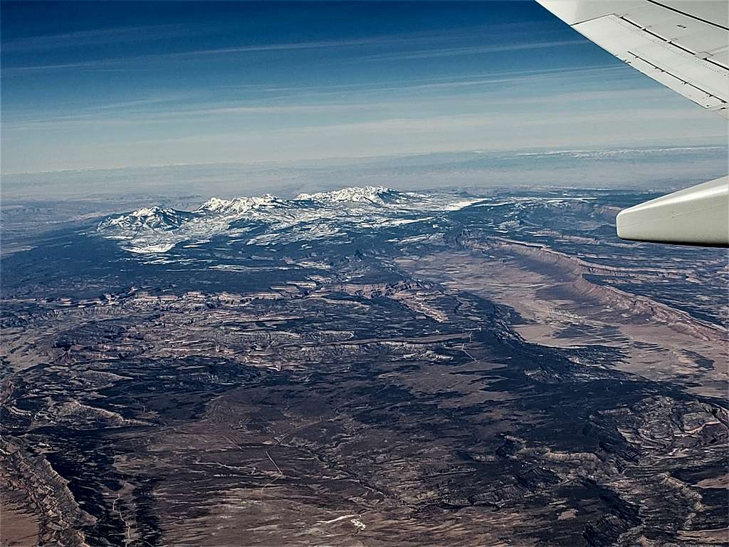
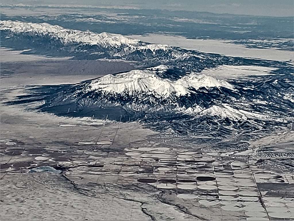
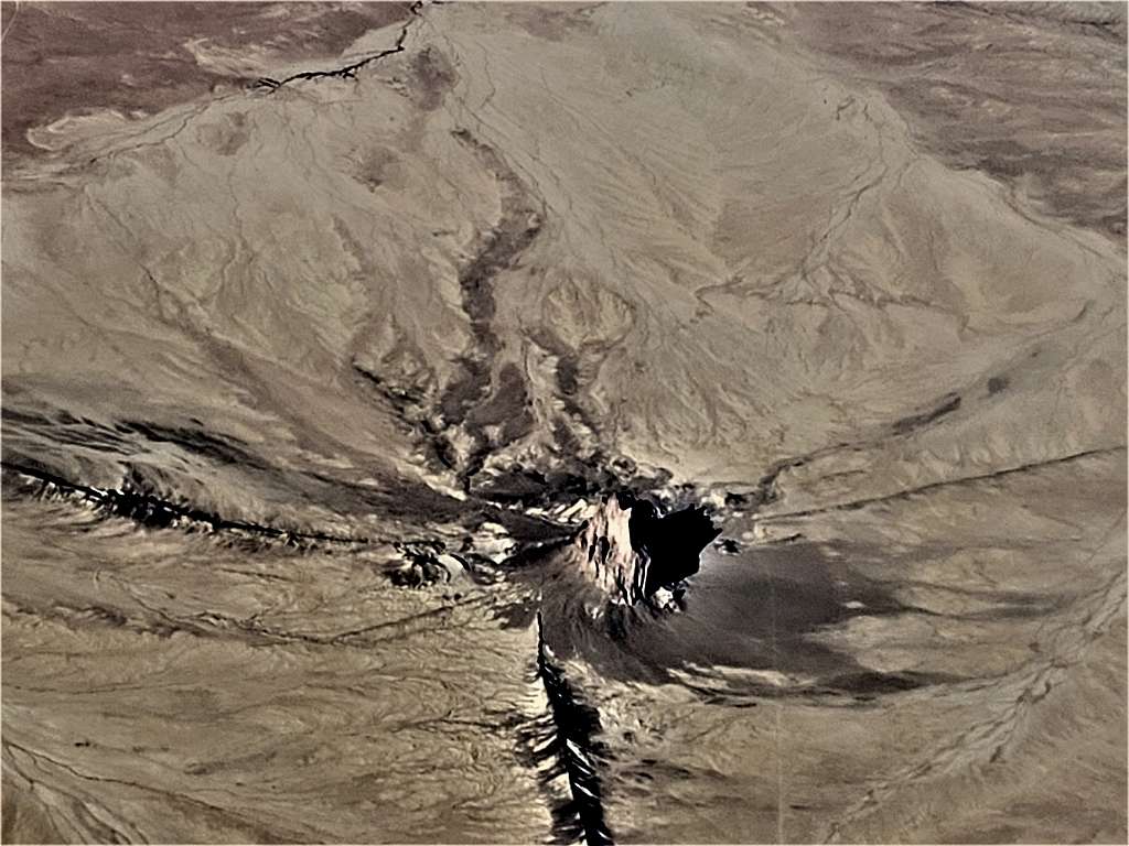
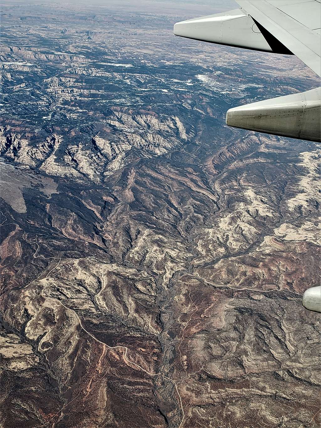
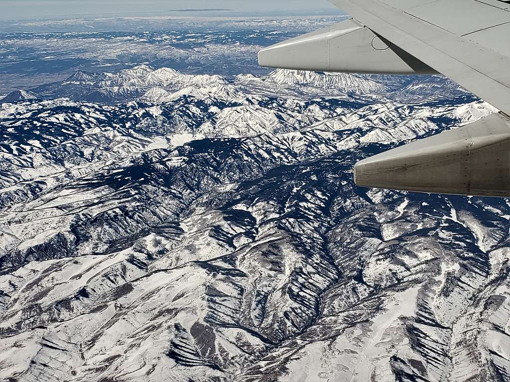
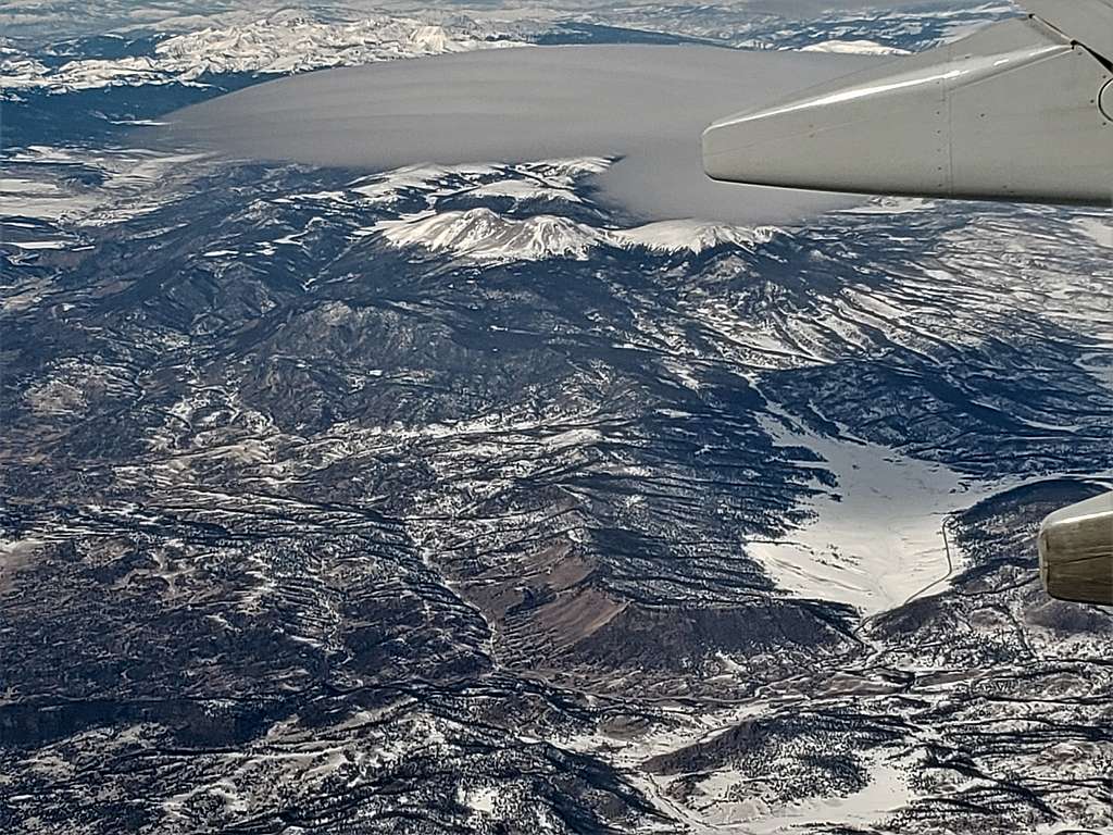
Uncompahgre Plateau and Horsefly Canyon (Colorado).


Uncompahgre Plateau and Horsefly Canyon


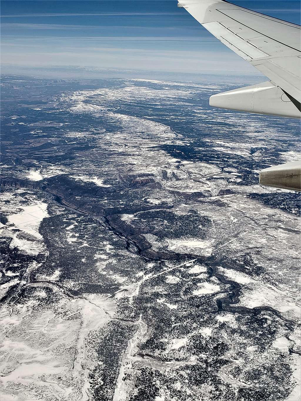
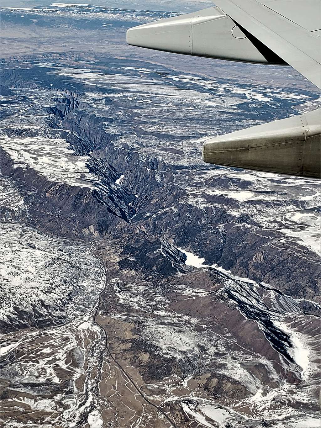
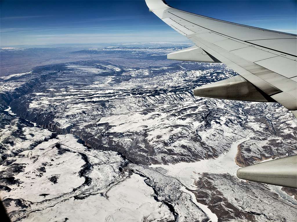
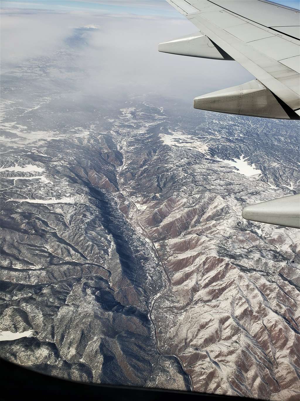
Black Canyon of the Gunnison River (Colorado).


Black Canyon of the Gunnison River


Black Canyon of the Gunnison River


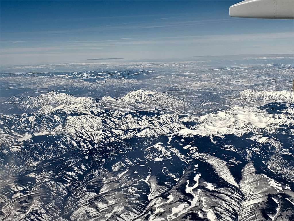
Western edge of the Elk Mountains of Colorado. Landsend Peak, Coal Mountain, Sheep Mountain South, Tater Heap etc. (Colorado).


Landsend Peak, Coal Mountain, Sheep Mountain South, Tater Heap etc.


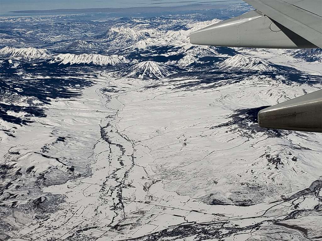
Mt. Gunnison (Colorado).


Mt. Gunnison
Mt. Gunnison


Anthracite Ridge, Carbon Peak, Whetstone Mountain, Mt. Axtell… (Colorado).


Anthracite Ridge, Carbon Peak, Whetstone Mountain, Mt. Axtell


Mt. Crested Butte in the center of the picture. Capitol Peak/Snowmass Mountain top of the picture (Colorado).


Mt. Crested Butte in the center of the picture. Capitol Peak & Snowmass Mtn. on top of the picture


Broncho & Henry Mountains lower part of the picture (Colorado).


Broncho & Henry Mountains lower part of the picture


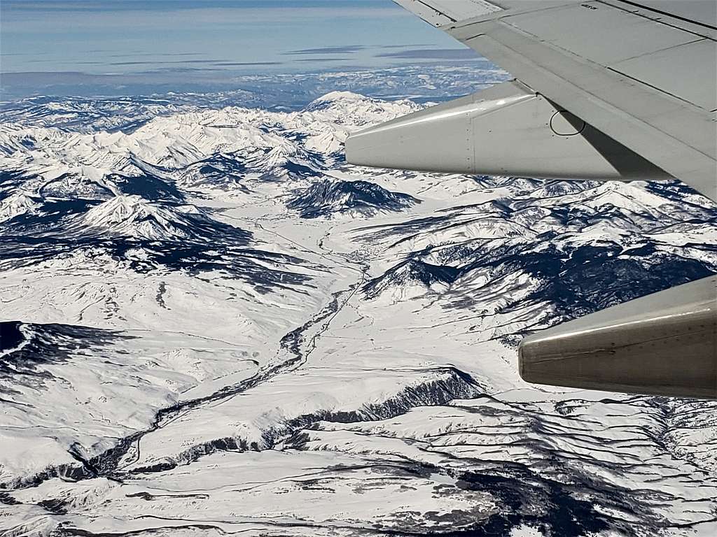
Mt. Helmers, Fitzpatrick Peak, Fairview Peak…(Colorado).


Mt. Helmers, Fitzpatrick Peak, Fairview Peak


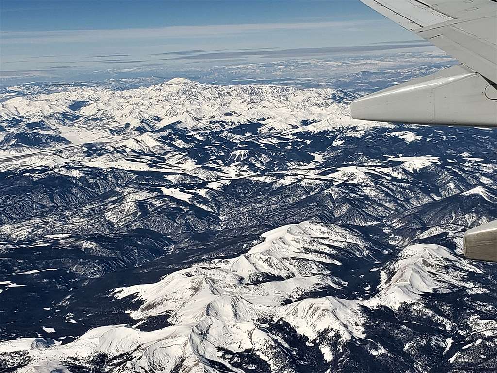
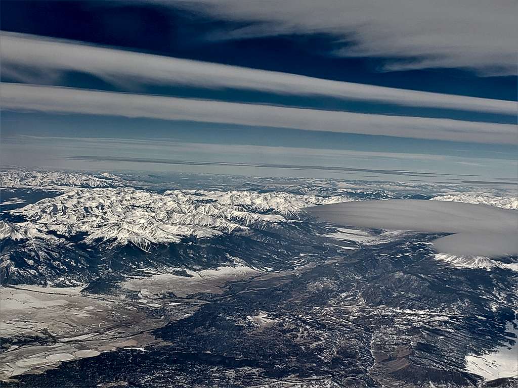
Mt. Antero, Mt. Princeton, Mt. Yale…(Colorado).


Mt. Antero, Mt. Princeton, Mt. Yale


Town of Buena Vista, Arkansas River and the Sawatch Mountains (Colorado).


Town of Buena Vista, Arkansas River and the Sawatch Mountains


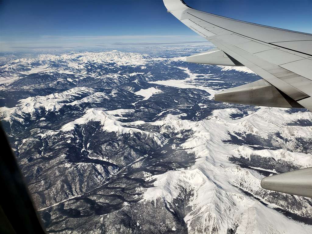
Buffalo Peaks (Colorado).


Buffalo Peaks
Buffalo Peaks


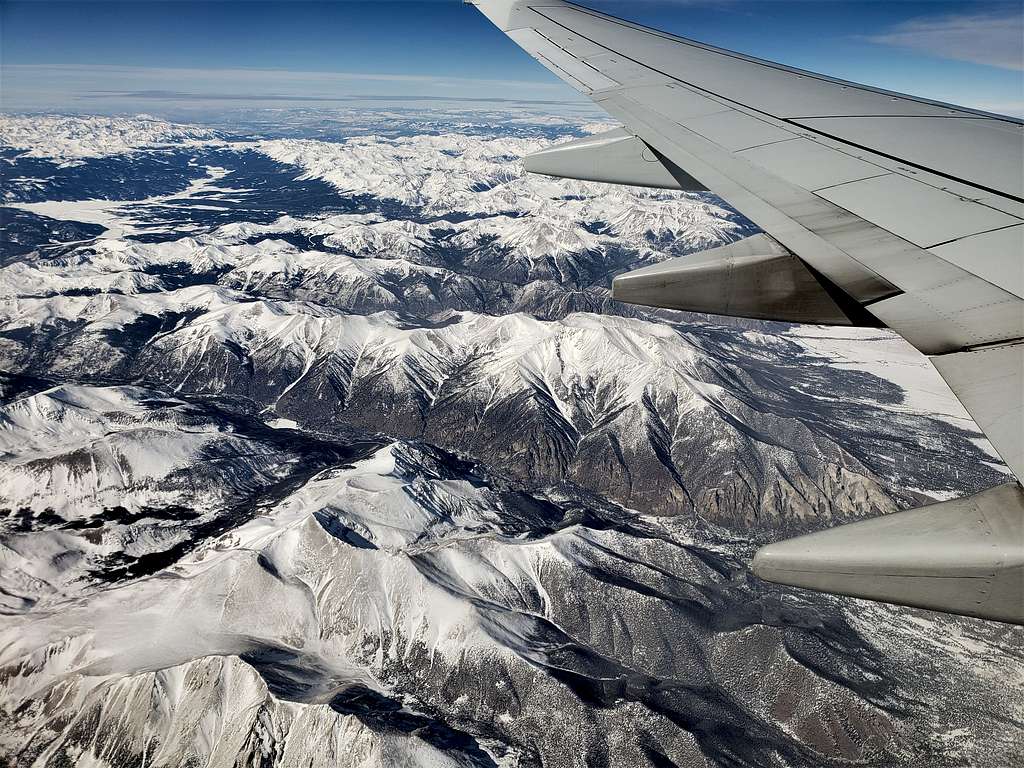
A look back at the Sawatch and Elk Mountains plus Arkansas River valley (Colorado).


A look back at the Sawatch and Elk Mountains plus Arkansas River valley


South Park Plateau (Colorado).


South Park Plateau
South Park Plateau


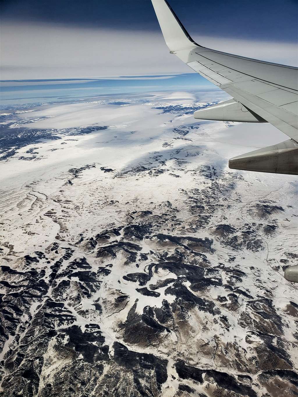
Route 24 to the west of Colorado Springs (Colorado).


Route 24 to the west of Colorado Springs


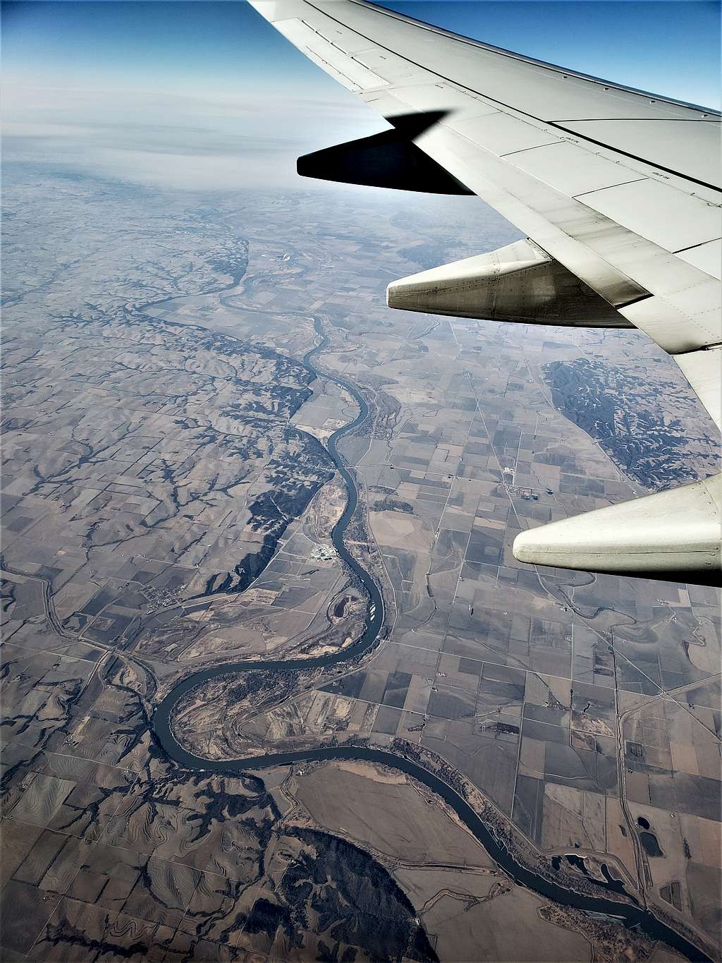
Missouri River just south of the town of Rock Port (Missouri).


Missouri River just south of the town of Rock Port


Mississippi River was hidden under clouds.


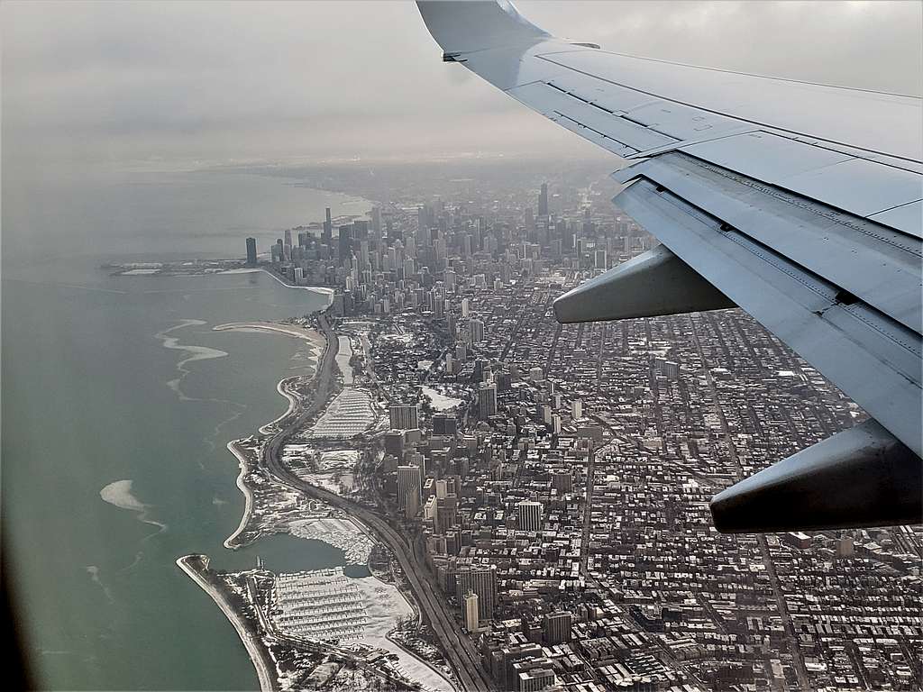
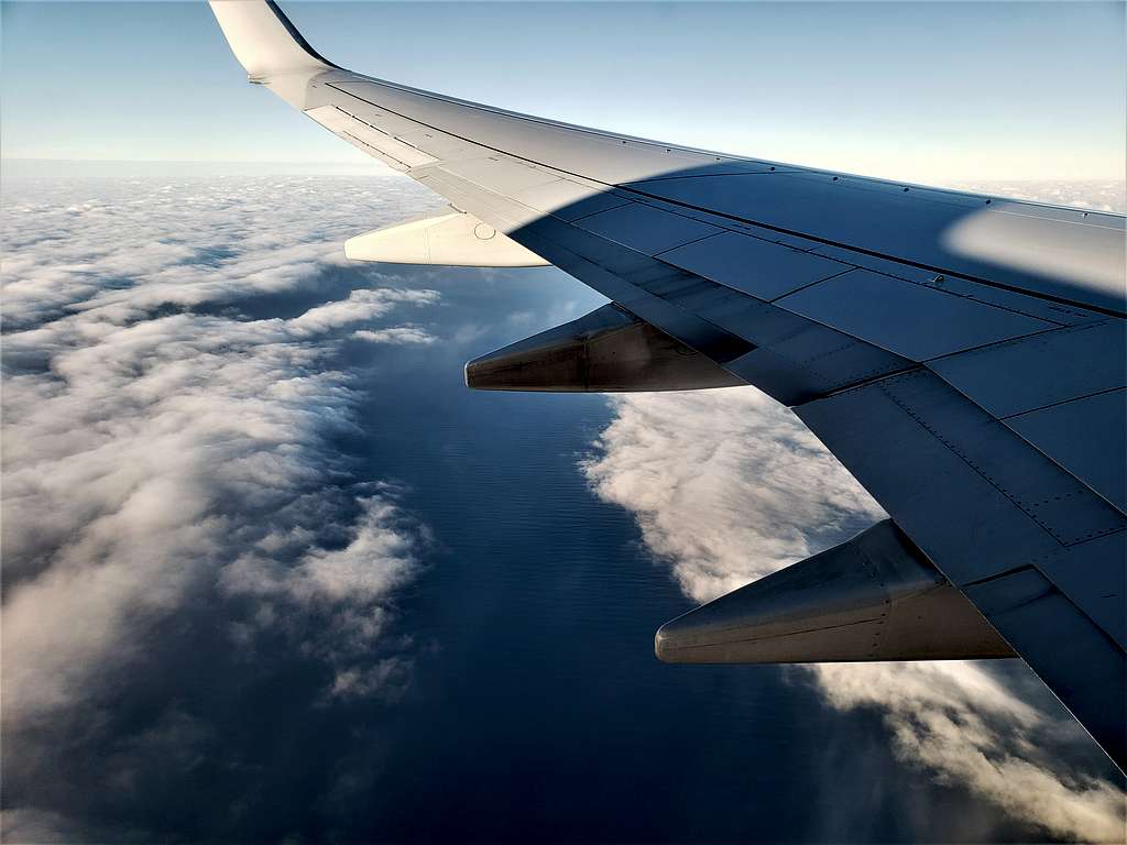
Making a U-turn over Lake Michigan (Illinois)


Making a U-turn over Lake Michigan


Lake Michigan and Downtown Chicago before landing (Illinois).


Lake Michigan and Downtown Chicago before landing