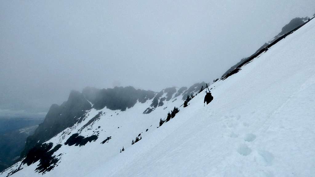
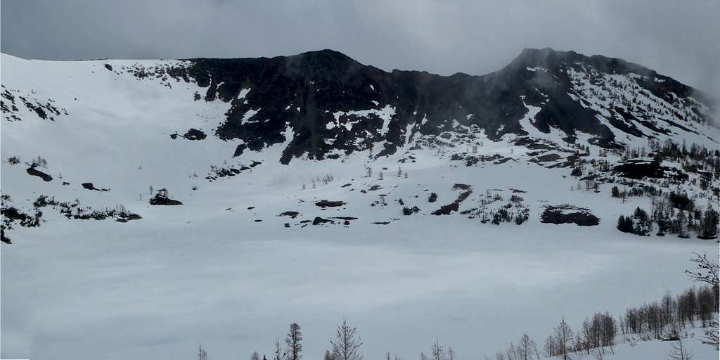
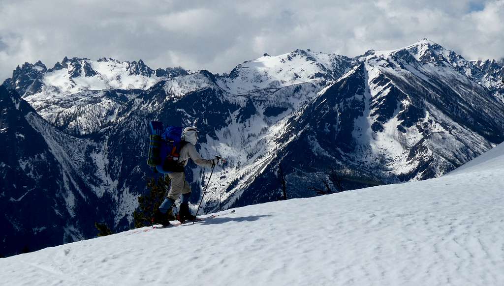
“This makes me feel sick to my stomach” my good friend Steve Hinkle said, as we stood on the ridge between Mule and Brule Creeks. What was making him sick was concern, pure and simple, about the long continuous cornices hanging over the east side of the ridge, and the fact that the day was quite hot and sunny. And our intended skiing route would take us right under those cornices.
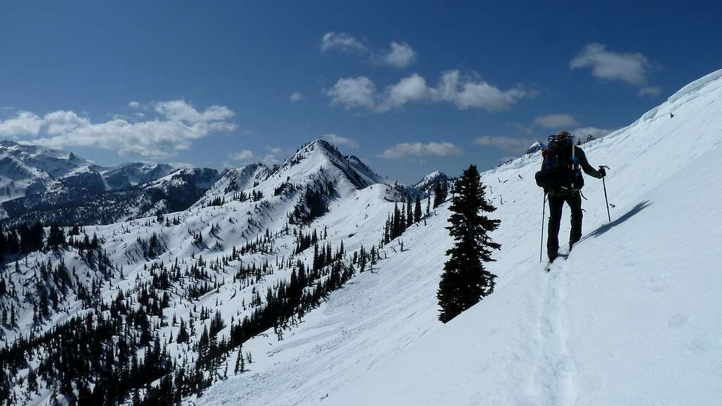
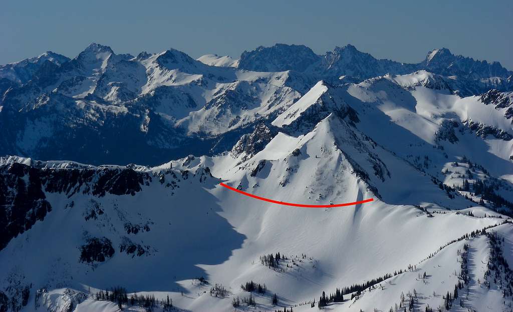
2019 scouting of the Mule-Brule ridge
A few years prior, we had explored this far and indeed skied under those cornices, but back then when we traversed the mountainside we hit it in early morning and it was considerably colder. So the cornices did not seem as threatening back then as they did today. Over the years we had both promised our wives many times that we would not take unreasonable risks on these ski trips. This looked unreasonable.
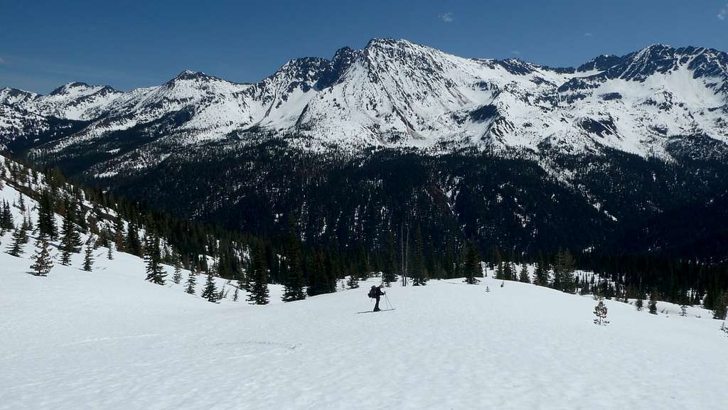
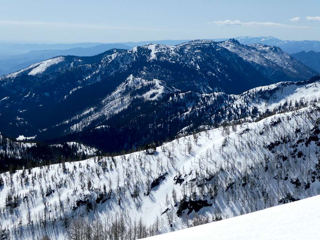
We set down our packs to think about it. We were on the ridge between points 6172 and 5984. The previous exploration we had skied north to point 5984 to access a cornice-free ramp down onto the east side of the ridge, then skied back south under the frozen cornices. This time our concerns prompted us to do a short bit of exploring: was there another way? Surprisingly, just to the south where the ridge top runs into the base of point 6172 we found an unexpected and cornice-free easy way down. The skis went back on and we enjoyed a great downhill run around the corner into the Wild Horse Creek valley. We landed on a mountainside shelf at 5200 feet, perfect for camp, with flowing water and great views of Chiwaukum and Snowgrass Mountains. The relief we felt combined with this finding this spot was too good to resist so we quit early and spent the afternoon lounging in the sun.
Dropping toward camp 2. Chiwaukum & Snowgrass Mountains across the valley
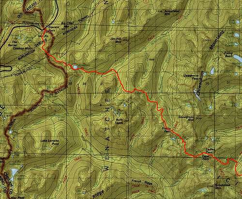
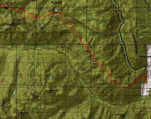
Stevens Pass to Leavenworth map 1Stevens Pass to Leavenworth map 2
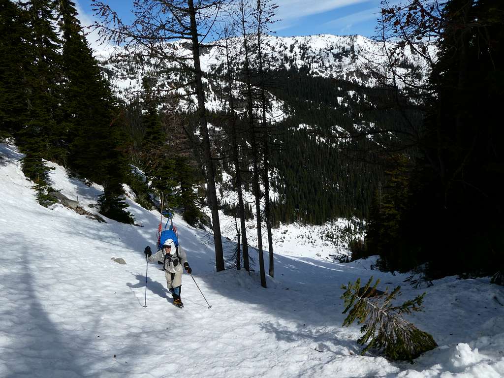
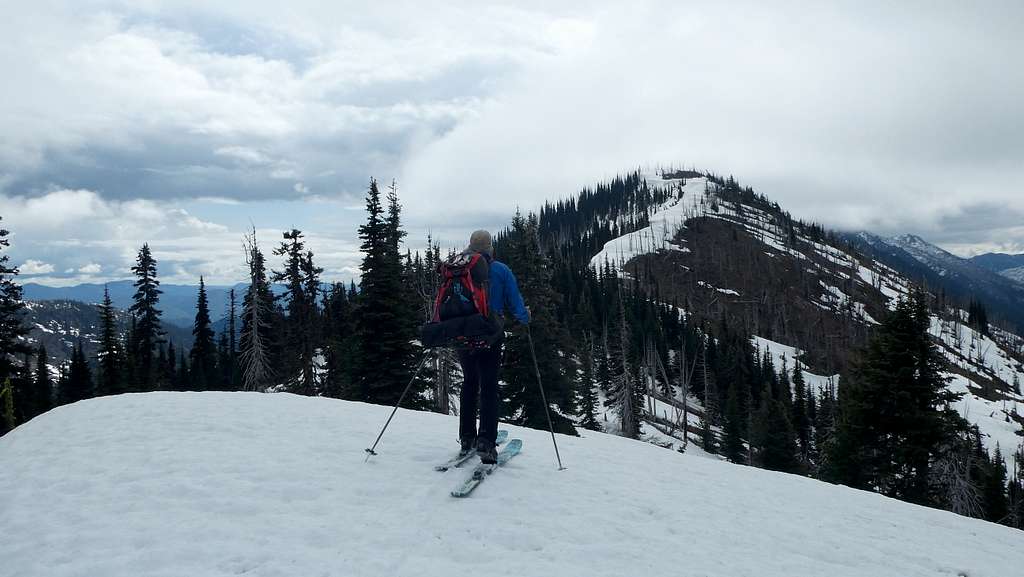
This was day two, with another week to go, of a ski traverse we had been planning and scouting for quite a few years. The idea of skiing deep into and through the Alpine Lakes Wilderness from Stevens Pass to Leavenworth took hold in my imagination many years ago, and I eventually got Steve hooked on the idea. There were quite a few scouting trips over the years, skiing portions of the proposed route. A few photos in this trip report are from those previous explorations to help illustrate the terrain. Finally in the first week of May 2023 we skied and climbed through the entire thing over a nine day period. The route proved challenging, with the use of crampons and step-kicking in some key sections putting the mountaineering into ski mountaineering. Avalanche danger was occasionally a concern, and we saw recent huge slides. There were many glorious long downhill ski runs on untracked mountainsides from above timberline down into forest. More importantly, the trip took us through stunning and remote mountainous country, feeling like winter wilderness at its best. I believe no one has ever skied this route before, and we saw no one and no other ski or snowshoe tracks anywhere beyond the few miles at either end.
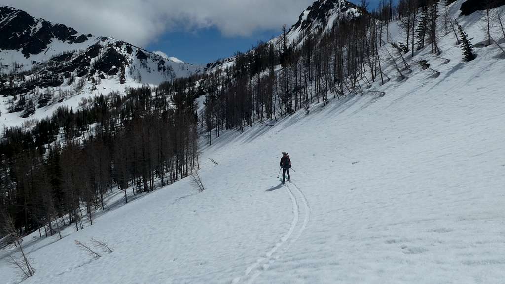
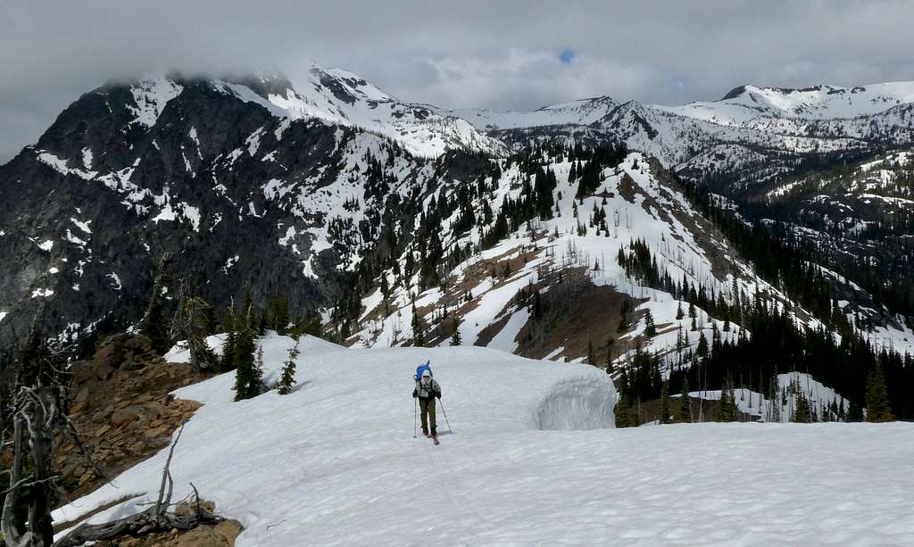
After our idyllic camp above the Wild Horse Creek valley, we traversed mountainsides to the southeast to get to Frosty Pass. We stayed level where possible, otherwise rising and descending where needed, eventually arriving at Lake Mary for another camp. Weather predictions indicated a substantial storm was due that night and the next day, so we dug in and prepared to stay put for a day and wait it out. The storm arrived and passed, but the overall weather patterns had now shifted to much colder. This presented some challenges to our continued travel: reduced visibility and icier snow. We skied up toward Upper Florence Lake then switched to crampons to climb through steep and icy terrain. Although we both prefer skiing, crampons turned out to be crucial for much of this day as we traveled over Ladies Pass through cold and stormy conditions. The colder conditions actually worked in our favor, as the recent warm weather had been softening snow slopes - now they were freezing up and stabilizing. As such, we could work our way across the north face of Cape Horn with greater confidence.
Crossing the north face of Cape Horn
North face of Cape Horn. Crampon route marked. Photo taken on another ski trip many years prior.
It was a huge relief to make the notch above Lake Edna, where the skis went back on and we enjoyed the privilege of fantastic downhill skiing, carving turns through perfectly spaced trees. Approaching Index Creek, we had to briefly switch to boot travel, but we were soon back on skis and got to a scenic camp at the head of Index Creek. This day had been the technical crux of the route, so camp felt especially relaxed.
Cramponing up out of the Index Creek valley
From there, we cramponed up the margin of an open avalanche zone, the snow a mess of ice blocks from earlier slides. At the top, about 5800 feet, the way opened up perfectly, allowing open meadow skiing back around north until forest closed in again, and we turned east. Ascending on skins and a short bit of cramponing, we crossed the ridge at 6640.
Descent into the Painter Creek valley
Gravity once again became our friend and we flew on down into the Painter Creek valley and the meadows east of Carter Lake for another camp. Continuing east, another steep crampon ascent took us back to altitude above Lake Augusta cresting the ridge at 7250, the high point of the entire traverse. The ski down was another visit to heaven, down through the austere beauty of the Augusta basin.
Augusta Lake
Upon turning to descend steeply into Cabin Creek, heaven turned to hell. We had to down-climb short cliff sections, and much rotten soggy and partly melted snow was underfoot. Sometimes this crunchy snow was hollow underneath, suspended above rocks or logs, creating a genuine danger of a fall through and injury. Adding to our misery, right in the middle of this harrowing descent, the storm that had been threatening all day hit, dropping mixes of rain and hail. But, perseverance paid off and soon we were camped in the small flat basin at approximately 5400 feet, and we dried our gear out as best as we could.
Photo taken on an earlier ski trip. Icicle Ridge viewed from ridge above Lake Augusta
At long last, we ascended up onto Icicle Ridge, gaining the crest at 6000 feet, and turned eastbound. This section of the ridge is quite sharp, and probably due to recent sudden warming the only skiable snow left on the first part of the ridge was a snow cockscomb of drift build-up.
West end of Icicle RidgeSkiing the crest of Icicle Ridge
Farther east the ridge broadened and became snowier, allowing more route latitude. At this point we finally began getting better weather, and the views in all directions were spectacular. The Stuart Range and Cashmere Mountain were up close and dramatic; in the distance to the north was a sea of snowy peaks and massive Glacier Peak.
Skiing Icicle Ridge
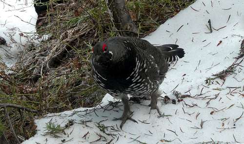
For a day and a half we skied eastbound, then Leavenworth came into view, more than a mile in altitude below us. We began the final descent toward town, at first enjoying more dream-like skiing, then dealing with increasingly rotten and thinning snow. Just as we switched to walking and started to follow the partly melted out trail down, an aggressive Spruce Grouse blocked the trail, attacking us by flapping his wings against our legs and pecking at our gaiters. Steve couldn’t stop laughing, as he recalled “None shall pass!” from Monty Python and The Holy Grail. The bird even looked like the Black Night. We did not have to hack off any limbs to get by however; after some negotiations the grouse ceased his efforts, going off to hopefully find an actual rival to confront.
None shall pass!
We continued down the summer hiking trail, and eventually encountered the first people since leaving Stevens Pass. They were enjoying summer-like conditions hiking the lower snow-free trail, so they had differing reactions to seeing a couple of guys with skis sticking up from their packs. One guy asked incredulously, Did you find any snow? Steve and I could not help but burst into laughter. Another guy who actually knew the backcountry and understood that skiing was still possible up high asked if beer was next, and amazingly, he later met us at the trailhead and offered us a cold one!
This trip reminded us that even though wilderness is sometimes more crowded than ever, hidden gems are there to discover. The wild in wilderness has not vanished. With map study, determined exploration, and reading of info from other wilderness travelers, fantastic adventures and new routes can still be found, right here, right now, in the North Cascades.


Comments
Post a Comment