
|
|
Mountain/Rock |
|---|---|
|
|
36.79958°N / 80.12088°W |
|
|
Patrick |
|
|
Hiking |
|
|
Spring, Summer, Fall, Winter |
|
|
1390 ft / 424 m |
|
|
Overview
Stuarts Knob is a minor summit even among the relatively low-profile hills around it. The only reason I even noticed it is that it's obviousfrom the lakeside below the cabin where my wife and I stayed in Fairy Stone State Park.
It's an attractive enough little mountain, but at less than 1400 feet above sea level it's really just an Appalachian foothill to the much
higher summits just a few miles to the west. But I got out the park trail map and noted that there were a couple of trails that take you
almost to the top and decided to hike up there and see what it was like.
What I found was a series of well maintained trails that were dotted with historical markers and discovered that the area had been
ecologically raped and exploited in the recent past. Go back less than 100 years and you'd hardly have recognized the profile of this little
mountaintop. It underwent a long period (in human terms) of exploitation that denuded it of trees and forest cover and then was heavily mined
for the rich iron deposits that lay actually on its flanks and then below its surface. By the late 1800s the forests were utterly gone, and
by 1920 the iron deposits had played out. Even the town that once lay at its foot vanished once the capitalists and industrialists had had their
way with the place.
By the 1930s the land had been allowed to lay as the humans had left it. Enter the Civilian Conservation Corps
who chose it as a spot to begin the effort at rehabilitation and the site of a new state park of Virginia. Erosion was mitigated, mines were
sealed up, trails were laid down, trees were encouraged to regenerate.
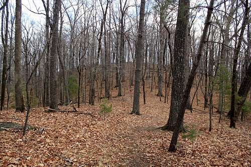
Today, walking the slopes of this hill you would be hard pressed to understand the extent of the destruction that had once laid waste to its
environs. Beneath the canopy of a vast hardwood forest you can find places where colliers had once felled and carbonized the trees to make
charcoal. One can spot the massive grooves where the earth was moved in vast amounts in the practice of surface mining to get at the iron almost
at the top of the ground. And there are sealed mine entrances to mark the places where men and machines once combined to shear out the guts of
the little mountain.
Mother Nature can recover if she is allowed to heal. But only if.
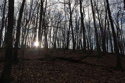
Sunrise
Getting There
From I-81 near Roanoke, take Route 581 to Route 220 South to Route 57 West to Route 346 North (Fairystone Lake Drive).
From I-77 near Hillsville, take Route 58 East to Route 8 North to Route 57 East to Route 346 North (Fairystone Lake Drive).From Greensboro, take Route 220 North to Route 220 North bypass at Martinsville, then Route 57 West to Route 346 North (Fairystone Lake Drive).
From Richmond, take Route 360 West to Route 58 West to Route 220 North Bypass at Martinsville to Route 57 West to Route 346 North (Fairystone Lake Drive)
CCC Engineering
Red Tape
None.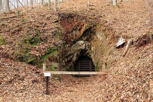
Old Iron Mines.
When to Climb
All year.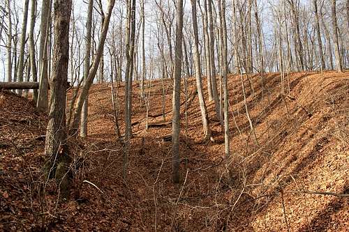
Surface Mining.