
-
 2470 Hits
-
 0% Score
-
 0 Votes
|
|
Custom Object |
|---|---|
|
|
test |
North Circle Route
| North Circle Route | From: | To: | Distance |
|---|---|---|---|
| Day One | Many Glacier | Cosley Lake | 14 miles |
| Day Two | Cosley Lake | Goat Haunt | 19 miles |
| Day Three | Goat Haunt | Fifty Mountain Camp | 10 miles |
| Day Four | Fifty Mountain Camp | Granite Park | 13 miles |
| Day Five | Granite Park | Many Glacier | 9 miles |
South Circle Route
| South Circle Route | From: | To: | Distance |
|---|---|---|---|
| Day One | Lake McDonald | Sperry Chalets | 6.5 miles |
| Day Two | Sperry Chalet | Sun Point | 18 miles |
| Day Three | Sun Point | Many Glacier | 16 miles |
| Day Four | Many Glacier | Granite Park | 9 miles |
| Day Five | Granite Park | Packer's Roost | 8 miles |
Inside Route
| Inside Trail Route | From: | To: | Distance |
|---|---|---|---|
| Day One | Two Medicine | Cut Bank | 17 miles |
| Day Two | Cut Bank | Red Eagle | 16 miles |
| Day Three | Eed Eagle | St. Mary's | 7.5 miles |
photos and links


links
Ahern Peak ,Allen Mountain ,
Bullhead Point ,
Crowfeet Mountain ,
Mount Cleveland ,
The Garden Wall,
Mount Grinnell ,
Goat Haunt Mountain ,
Mountain Gould
Heavens Peak
Mount Henkel
Iceberg Peak ,
Mount Merritt ,
Swiftcurrent Mountain
and Mount Wilbur .
table
| RANK | SUMMIT | ELEVATION | LOCATION |
|---|---|---|---|
| 1 | Peak | 11' | ST |
| 2 | Mountain | 10' | ST |
| 3 | Peaks | 103' | CD |
| 4 | summit | 10' | CD |
| 5 | Mountain | 12' | ST |
| 6 | Peak | 13' | ST |
| 7 | Peak | 173' | ST |
| 8 | Peak | 112' | ST |
| 9 | Peak | 18' | ST |
| 10 | Peak * | 10' | ST |
| 11 | Peak | 160' | ST |
| 12 | Peak | 16' | ST |
| 13 | Peak | 12' | ST |
| 14 | Peak | 108' | ST |
table 2
| Name | Elevation | Latitude | Longitude |
|---|---|---|---|
| 8,900' to 8,999' | |||
| Gem Lake Peak (point 8,992) | 8,992' | 45.89583 N | 114.27277 W |
| Castle Crag | 8,984' | 46.33072 N | 114.37165 W |
| West Camas Peak (point 8934) | 8,934' | 46.16494 N | 114.32558 W |
| Canyon Lake - West (point 8922) | 8,922' | 45.85923 N | 114.44761 W |
| Point 8909 | 8,874' | 46.17359 N | 114.21604 W |
| East Camas Peak (point 8905) | 8,905' | 46.16327 N | 114.31674 W |
| 8,800' to 8,899' | |||
| Gash Point | 8,886' | 46.43347 N | 114.31955 W |
| Pyramid Buttes | 8,869' | 46.62829 N | 114.25799 W |
| Disappointment Peak (point 8865) | 8,865' | 46.51202 N | 114.28564 W |
| Bass Peak | 8,855' | 46.57783 N | 114.31749 W |
| Bear Lake - North (point 8839) | 8,839' | 46.44679 N | 114.34578 W |
| Boulder Lake - NW (point 8832) | 8,832' | 45.86691 N | 114.40383 W |
| Piquett Mountain | 8,831' | 45.73194 N | 114.19013 W |
| Sugar Point (point 8820) | 8,820' | 45.94295 N | 114.28406 W |
| Ranger Peak | 8,817' | 46.50236 N | 114.39909 W |
| Hauf Peak (point 8807) | 8,807' | 46.29387 N | 114.31351 W |
| 8,700' to 8,799' | |||
| Vance Mountain (Idaho) | 8,793' | 45.91215 N | 114.49207 W |
| Sky Pilot | 8,792' | 46.43690 N | 114.36750 W |
| Soda Springs Peak - West (point 8787) | 8,787' | 45.83119 N | 114.42847 W |
| Triple Creek Peak - Idaho (point 8785) | 8,785' | 45.96729 N | 114.40275 W |
| Watchtower Peak | 8,780' | 45.82983 N | 114.51052 W |
| Lake Lomo - West (point 8774) | 8,774' | 46.24607 N | 114.39239 W |
| Kidney Lake Peak (point 8766) | 8,766' | 46.45366 N | 114.29864 W |
| Soda Springs Peak - East (point 8740) | 8,740' | 45.82561 N | 114.41103 W |
| Lookout Lake - East (point 8740) | 8,740' | 46.06995 N | 114.44155 W |
| High Lake Peak - South (point 8717) | 8,717' | 46.24016 N | 114.36673W |
| Little Rock Creek Lake - West (point 8712) | 8,712' | 46.02360 N | 114.36989 W |
| Stormy Pass - NE (point 8702) | 8,702' | 46.51038 N | 114.34738 W |
| 8,600' to 8,699' | |||
| Downing Mountain | 8,690' | 46.23330 N | 114.29975 W |
| Bass Peak - West (point 8687) | 8,687' | 46.57573 N | 114.32880 W |
| Romney Ridge Highpoint | 8,685' | 46.25508 N | 114.32745 W |
| Printz Ridge - West (point 8663) | 8,663' | 46.29163 N | 114.38330 W |
| West Sheafman Peak (point 8652) | 8,652' | 46.33758 N | 114.33979 W |
| Mill Point West (point 8650) | 8,650' | 46.29173 N | 114.29375 W |
| East Sheafman Peak (point 8650) | 8,650' | 46.33782 N | 114.32460 W |
| Blodgett Mountain | 8,647' | 46.27328 N | 114.46398 W |
| Shephard Peak (point 8641) | 8,641' | 45.80452 N | 114.51184 W |
| Capitan Creek - South (point 8636) | 8,636' | 45.97809 N | 114.41104 W |
| Two Lakes - West (point 8628) | 8,628' | 46.40323 N | 114.39889 W |
| Stingray Lake - East - Idaho (point 8624) | 8,624' | 45.98322 N | 114.53129 W |
| Hidden Lake Peak (point 8618) | 8,618' | 46.46116 N | 114.32088 W |
| Glen Lake - NW (point 8608) | 8,608' | 46.46061 N | 114.29978 W |
| El Capitan - South (point 8605) | 8,605' | 45.99033 N | 114.39588 W |
| One Horse Peak (point 8605) | 8,605' | 46.67059 N | 114.18969 W |
| Big Grizzly Peak (point 8601) | 8,601' | 46.03054 N | 114.47943 W |
| 8,500' to 8,599' | |||
| Sears Lake - SE (point 8587) | 8,587' | 46.29360 N | 114.36229 W |
| Wyant Peak (point 8578) | 8,578' | 46.23973 N | 114.33630 W |
| Downing Mountain - West (point 8573) | 8,573' | 46.23695 N | 114.32229 W |
| Tin Cup Pass - NE (point 8570) | 8,570' | 45.95334 N | 114.40849 W |
| Big Creek Lake Peak - W (point 8570) | 8,570' | 46.48852 N | 114.39991 W |
| Tin Cup Pass - South (point 8546) | 8,546' | 45.93324 N | 114.42729 W |
| Stingray Lake - NE - Idaho (point 8536) | 8,536' | 45.99672 N | 114.52018 W |
| South Kootenai Lake - S (point 8535) | 8,535' | 46.52213 N | 114.32731 W |
| Bass Lake - South (point 8533) | 8,533' | 46.58079 N | 114.28274 W |
| North Lost Horse Peak (point 8528) | 8,528' | 46.16699 N | 114.39969 W |
| Lappi Peak (point 8524) | 8,524' | 46.57027 N | 114.25305 W |
| Brushy Fork Lake - SE - Idaho (point 8524) | 8,524' | 45.97627 N | 114.58417 W |
| Lake Capitan - South | 8,523' | 45.99222 N | 114.47526 W |
| Totem Peak | 8,521' | 46.37379 N | 114.39226 W |
| Como Point - Point 8517 | 8,517' | 46.00786 N | 114.31669 W |
| Goat Mountain Highpoint (point 8505) | 8,505' | 46.21400 N | 114.41974 W |
| Nipple Knobb - Idaho | 8,505' | 45.99481 N | 114.56833 W |
HTML Practice
| Glacier Park Summits | |||
|---|---|---|---|
 |  Heavy Runner Mountain | 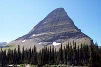 Glacier |  |
HTML Practice
| Boca Negra Canyon Petroglyphs | |||
|---|---|---|---|
 |  Spiral Petroglyph |  Petroglyphs |  |
expanded x2 w/ space
| Rank | Summit Name | Elevation in Feet | Lookout on Summit | Rank | Summit Name | Elevation in Feet | Lookout on Summit | |
|---|---|---|---|---|---|---|---|---|
| 1 | McGuire Mountain | 6991 | Yes | 43 | Pleasant Valley Mountain | 5690 | No | |
| 2 | Sutton Mountain | 6872 | No | 44 | Lion Mountain | 5685 | No | |
| 3 | Blacktail Mountain | 6757 | Yes | 45 | Skillet Mountain | 5650 | No | |
| 4 | Meadow Peak | 6709 | Yes | 46 | Ketowke Mountain | 5635 | No | |
| 5 | Lydia Mountain | 6703 | No | 47 | Beartrap Mountain | 5624 | Yes | |
| 6 | Little Sutton Mountain | 6654 | No | 48 | Martin Divide | 5604 | Yes | |
| 7 | Elk Mountain | 6587 | Yes | 49 | Satire Mountain | 5595 | Yes | |
| 8 | Elk Divide | 6581 | Yes | 50 | Mineral Mountain | 5588 | No | |
| 9 | Calx Mountain | 6550 | Yes | 51 | Paul Mountain | 5553 | No | |
| 10 | Pinehill | 6410 | Yes | 52 | Wolf Peak | 5553 | Yes | |
| 11 | Mount Swaney | 6349 | Yes | 53 | Sunday Mountain | 5485 | Yes | |
| 12 | Bold Peak | 6339 | Yes | 54 | Grubb Mountain | 5455 | No | |
| 13 | Pinkham Mountain | 6322 | Yes | 55 | Hornet Ridge | 5452 | Yes | |
| 14 | Bar Z Peak | 6304 | Yes | 56 | Helmer Mountain | 5438 | No | |
| 15 | Ashley Mountain | 6297 | Yes | 57 | Boorman Peak | 5432 | No | |
| 16 | Haskill Mountain | 6290 | Yes | 58 | Sugarloaf Mountain | 5432 | Yes | |
| 17 | Castle Rock | 6242 | Yes | 59 | Cripple Horse Mountain | 5422 | No | |
| 18 | Warex Peak | 6242 | Yes | 60 | Adams Mountain | 5380 | No | |
| 19 | McGovern Mountain | 6235 | Yes | 61 | Snell Mountain | 5341 | No | |
| 20 | Sheppard Mountain | 6216 | No | 62 | Tally Mountain | 5325 | No | |
| 21 | Mount Conner | 6211 | No | 63 | Keith Mountain | 5300 | No | |
| 22 | Inch Mountain | 6210 | No | 64 | Hog Heaven | 5277 | Yes | |
| 23 | Dunsire Point | 6181 | No | 65 | McGregor Peak | 5213 | Yes | |
| 24 | Fox Mountain | 6163 | No | 66 | Swamp Mountain | 4993 | Yes | |
| 25 | Ingalls Mountain | 6125 | Yes | 67 | Horse Hill | 4963 | Yes | |
| 26 | Kerr Mountain | 6121 | Yes | 68 | Riverview Mountain | 4941 | Yes | |
| 27 | Wolf Mountain | 6104 | No | 69 | Baldy Mountain | 4868 | No | |
| 28 | Davis Mountain | 6051 | Yes | 70 | Edna Mountain | 4605 | Yes | |
| 29 | Huckleberry Mountain | 6045 | No | 71 | Surprise Hill | 4550 | Yes | |
| 30 | Sanders Mountain | 6019 | Yes | 72 | Virginia Hill | 4528 | Yes | |
| 31 | Johnson Peak | 6009 | Yes | 73 | Redemption Hill | 4445 | No | |
| 32 | Richards Mountain | 6005 | Yes | 74 | Hubbard Mountain | 4351 | Yes | |
| 33 | Boundary Mountain | 5955 | Yes | 75 | Pilot Knob | 4264 | Yes | |
| 34 | Warland Peak | 5950 | Yes | 76 | Lightening Peak | 4124 | Yes | |
| 35 | Reid Divide | 5928 | Yes | 77 | Black Butte | 4064 | Yes | |
| 36 | Ellsworth Mountain | 5917 | No | 78 | Ant Hill | 3845 | Yes | |
| 37 | Teepee Mountain | 5850 | No | 79 | Roberts | 3790 | Yes | |
| 38 | Stenerson Mountain | 5828 | No | 80 | Mount Johns Angel | 3670 | No | |
| 39 | Mount Sterling | 5774 | No | 81 | Gopher Hill | 3523 | Yes | |
| 40 | Weigel Mountain | 5765 | Yes | 82 | Angel Point | 3000 | Yes | |
| 41 | Dunn Peak | 5762 | No | 83 | Mountain Meadow | ???? | Yes | |
| 42 | Sheep Mountain | 5761 | Yes |
Apgar
| Rank | Summit Name | Elevation in Feet |
|---|---|---|
| 1 | Point 6651 | 6651 |
| 2 | Huckleberry Mountain | 6593 |
| 3 | Point 6405 | 6405 |
| 4 | Point 6309 | 6309 |
| 5 | Point 6304 | 6304 |
| 6 | Point 5274 | 5274 |
| 7 | Point 5274 | 5274 |
| 8 | Apgar Lookout | 5236 |
| 9 | Point 4320 | 4320 |
cabin
| Name | Description | Maximum Group size |
|---|---|---|
| Schnaus Cabin | The property the Schnaus cabin sits on was originally patented to Hollis DeFord in 1917, and approximately every 20 years it changed hands until Alfred and Irene Schnaus bought the cabin in 1971. In 1979 Irene made a Gift Deed of the cabin to the Nature Conservancy, from whom it was later purchased by the Forest Service. | 4 |
| Owl Packer Camp | Owl Creek Packer Camp is a major and highly developed stock trailhead providing access to the Swan Front and BMWC. The trailhead includes corrals that are reserved either by the month or for the entire summer and fall season by commercial outfitters operating in the BMWC. For the unguided public there are a variety of non-fee facilities to accomodate the backcountry stock user including: free standing combination feed bunks/hitchracks, water and stock water troughs, unloading ramps, campsites, toilets, and ample parking to accomodate stock trailers or trucks. The cabin was relocated to this site in the early 1960's and is a rustic 16x20' one room cabin. As stock use is an integral part of the camp, this is one of two facilities on forest where they are welcome. | 2 |
| Rover Cabin | The Rover Cabin was purchased by the Forest Service in 1992 from Ronald and D’Ann Wilhelm in accordance with the Wild and Scenic Rivers Act. | 6 |
Jewel Trails
| From/To | Total Distance (Mi.) | Elevation Gain (Ft.) | Elevation Loss (Ft.) | Difficulty Rating (Relative) | |
|---|---|---|---|---|---|
| 717 & 7 | Camp Misery Trailhead to Birch Lake | 3.0 | 610 | -160 | Moderate |
| 8 / 68 & 7 / 392 | Camp Misery Trailhead to Picnic Lakes | 2.5 | 1778 | -588 | Strenuous |
| 8 & 721 | Camp Misery Trailhead to Twin Lakes | 2.5 | 770 | -200 | Moderate |
| 719 | Black Lake to Jewel Basin | 0.5 | 240 | -320 | Easy |
| 719 | Jewel Basin to Blackfoot Lake | 1.6 | 0 | -440 | Easy |
| 8 / 7 & 55 | Camp Misery Trailhead to Clayton Lake | 6.2 | 0 | -770 | Strenuous |
| 420 | Rd. 1633 to Clayton Lake | 2.3 | 1420 | 0 | Moderate |
| 717 | Camp Misery Trailhead to Mount Aeneas | 3.0 | 1778 | 0 | Strenuous |
| 717 | Mount Aeneas to Picnic Lakes | 1.2 | 0 | -888 | Moderate |
| 8/7 & 723 | Camp Misery Trailhead to Wildcat Lake | 4.3 | 850 | -360 | Moderate |
| 717 & 7 | Camp Misery Trailhead to Crater Lake | 5.3 | 610 | -560 | Moderate |
| 64 & 7 & 722 | Wheeler Creek Tailhead to Big Hawk Lakes | 5.6 | 1000 | -250 | Strenuous |
| 717 & 7 & 722 | Camp Miery Trailhead to Big Hawk Lakes | 9.0 | 610 | -838 | Strenuous |