
-
 4058 Hits
-
 81.18% Score
-
 13 Votes
|
|
Canyon |
|---|---|
|
|
36.87127°N / 81.97872°W |
|
|
Hiking |
|
|
Spring, Summer, Fall |
|
|
Overview
You ever hear about something you have never heard of before, and figure it can’t be that great because you would’ve heard about it before now? That was me when an internet link of the Virginia Bucket List Hikes included ‘The Channels’. Supposedly this was a maze-like complex of sandstone slot canyons that sit high on a ridge in Virginia’s mountains. Maps label the area as ‘The Great Channels of Virginia’. I mentally snorted, but gave the hike a chance because of past success with this quite good bucket list. I was prepared to be disappointed. But guess what – they are exactly as advertised, and fully deserving of the title ‘Great Channels’.
Getting There
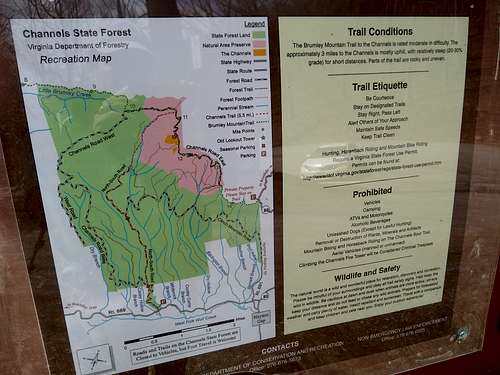
The start of the hike is on Virginia Route 80 at Hayters Gap in the midst of the long bulk of Clinch Mountain. The gap is north of the hamlet also called Hayters Gap, and south of another small village called Elk Garden. Hayters is pronounced ‘HY-ters’ by locals.
As it approaches the ridge, Route 80 becomes a very twisty paved steep mountain road and it will take you longer than you think to reach the gap. The north side road to the gap is more precarious (still paved but seems skinnier due to drop-offs on the sides of the road).
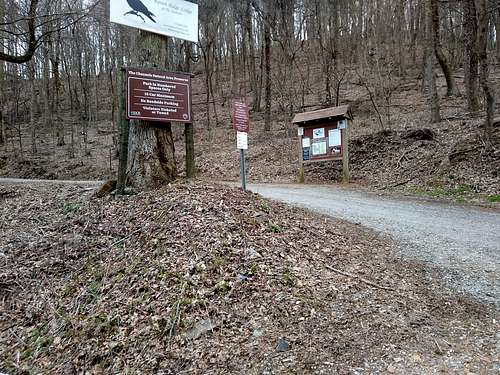
Note that there are only 10 spots at the trailhead parking – and no legal parking spots exist nearby, and anything parked on the skinny road will be towed. This is good news though (provided you get a spot) because this also limits the number of people that you will be sharing the trail with.
Approach
Besides the 10 car limit at the parking area, the other thing that limits the crowds to The Channels is a 3 mile approach one way from the gap, with 1600 feet of elevation gain.
Yes, to get to this slot canyon maze you first have to climb a mountain, Middle Knob on the vast Clinch Mountain ridgeline. The Channels lie just below the summit.
But the trail is nearly entirely existing roadbed. First gravel (roadbed still serves as road for a few private holdings in the first mile or so, so stay on the road). The road/trail transitions to rocky clay, then finally sandy rock as you reach the top. Walking is steep in places but good footing makes it is easy to hit a stride.
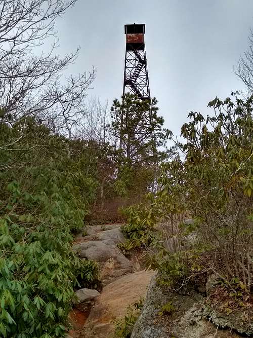
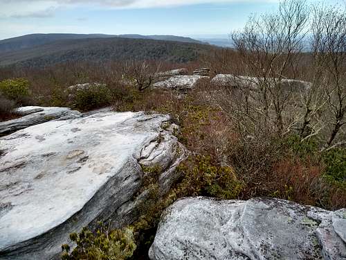
Reaching the summit of Middle Knob, you will be greeted by a tall decommissioned fire tower (with two flights of stairs removed so not accessible).
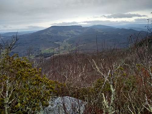
The rock summit has some killer views.
But you are not here for the summit. No one will ever hear of ‘The Great Middle Knob of Virginia’. You are here to see The Great Channels. Proceed under the legs of the tower where small arrows will direct you into the start of the Channels experience.
The Channels - Minotaur Not Included
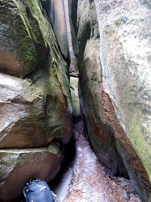
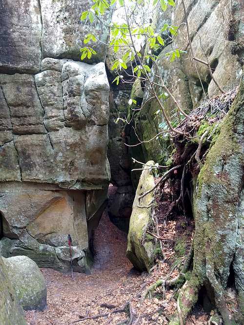
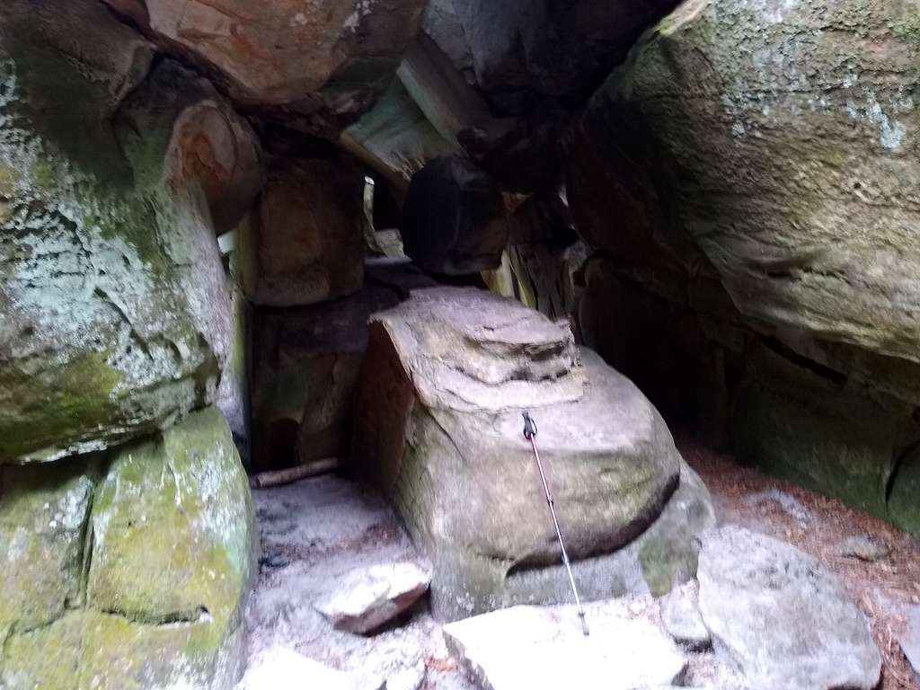
The Channels seem like someone slammed a thick tablet of 400 Million year old sandstone against the west side of the Middle Knob summit, where it fractured on both the uphill/downhill axis and perpendicularly along the contour lines of elevation. The effect is a large number of squarish blocks with fractures between some of them that sometimes, and sometimes not, allow easy passage – or none at all.
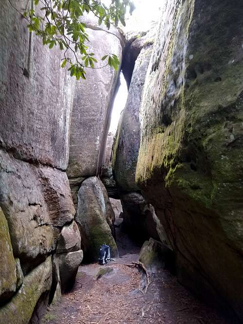
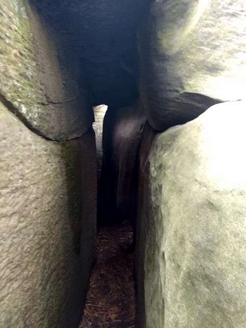
Water and wind has shaped the sandstone into a network of ‘slot canyons’, though the grey rock is tinged green a deep green in most places. It really is a maze of corridors and dead ends, with fun and not so fun obstacles – about 20 acres in size. If I had brought my kids here, they would have never have wanted to leave.
When I first went in, I tried to quickly get a sense of the borders of the area, and was surprised how it seems to go on and on, larger than I expected.
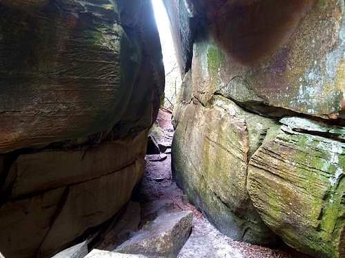
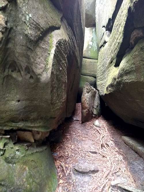
Trees and Rhododendrons that snake into the maze and surround the area give the complex a ‘Lost Temple’ vibe.
The latest scientific thought is that the fractures were caused by permafrost and ice expansion during the last ice age.
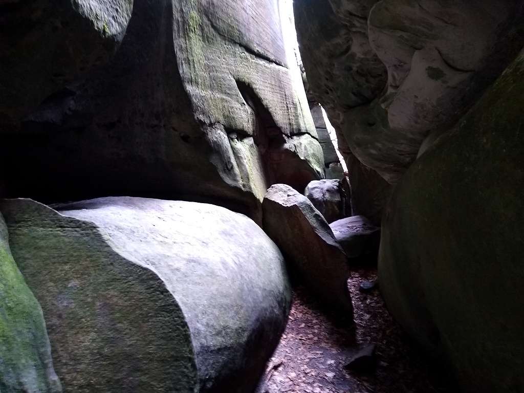
Climbing up to the top of the formations is possible in places, but from the top you do not get much sense of the area – simply seeing stone blobs suspended in a soup of vegetation.
I took dozens of pictures, but am posting only a few to give you a taste of this place.
I am calling this a canyon – but this is a truly unique and amazing place – the only near comparison I have experienced is the Joint Trail in Canyonlands National park.
Enjoy!
External Links