Bitterroot First Ascent Expedition
Trip Report By: James (Jim) Den Uyl
During June of 2017 I successfully completed four solo first ascents in the Bitterroot range of Montana and Idaho. These were the only first ascents ever recorded by someone with arthritis, and marked a high point of my adventuring career. The success of this trip will be used to raise awareness of juvenile arthritis and to provide hope for those suffering with the disease that great heights, physical and metaphorical, are still attainable. Below I have outlined my preparation and execution of the trip.
I spent a rainy day in my hometown in Michigan, far away from any mountains, scavenging the internet for interesting unclimbed peaks. With plenty of searching I came across an area on the Montana/Idaho border with a number of options for first ascents. By studying online topographical and satellite maps I planned a feasible route to approach the area. I researched nearby peaks, which were rated as a class three climb, which I had previously done with ease, and looked for any imagery from aerial surveys to the area. The closest trailhead was just northwest of Darby, Montana at Lake Como Recreation Area. I planned to park here and journey into the wilderness area for 5 days. I had an emergency contact ready to call for help if I was not back by the sixth day. Below is the account of my trip and the challenges I faced.
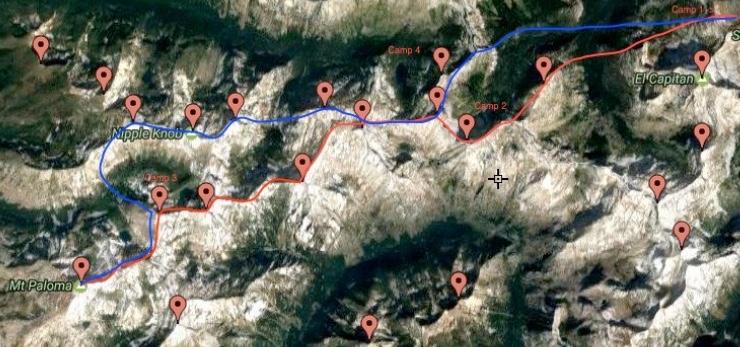
My initial route I planned to follow: Trip out (east to west) in red, return trip in blue
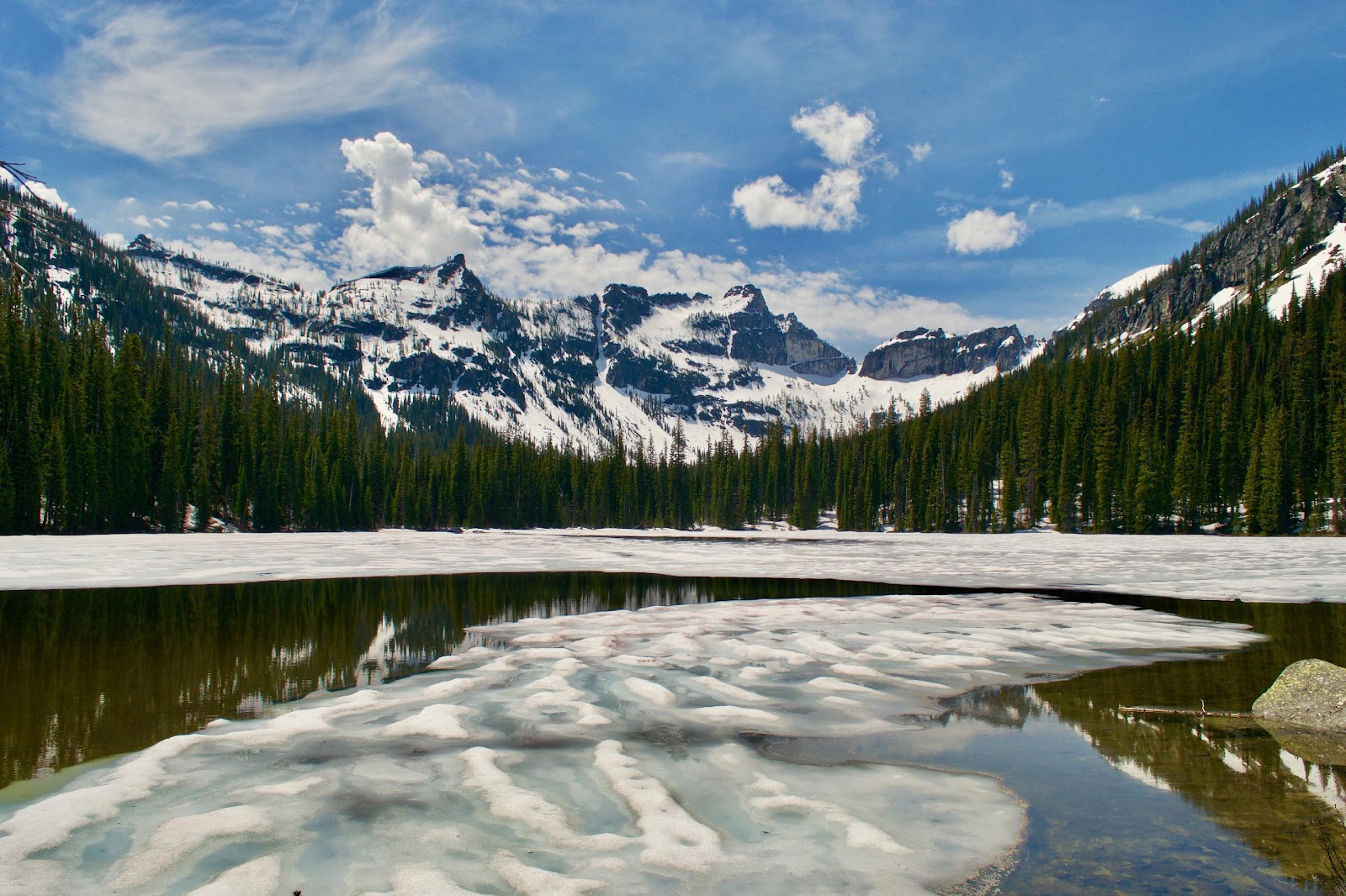
Sunday
I arrived at the Lake Como trailhead late Sunday May, 28 2017 and camped there waiting for the morning.
Monday
I quickly discovered that although my topographic maps had the correct topographical lines, they did not accurately place trails where they were in reality. To find the correct trailhead, follow the Lake Como Recreation road past the boat launch on the south side of the lake and take that road until it deadends at the wilderness boundary. There will be a sign for Little Rock Creek Trail, that is the one you want. My path however took me bushwhacking uphill for further than I’d like to recall until I found that trail.
After that detour the hiking was pretty straightforward. I lost sight of the trail where the snow began to cover the ground around Little Rock Creek Lake and I camped not too long after that. The snow slowed me down considerably as it was quite soft and covered obstacles while I was already worn out from bushwhacking.
Tuesday
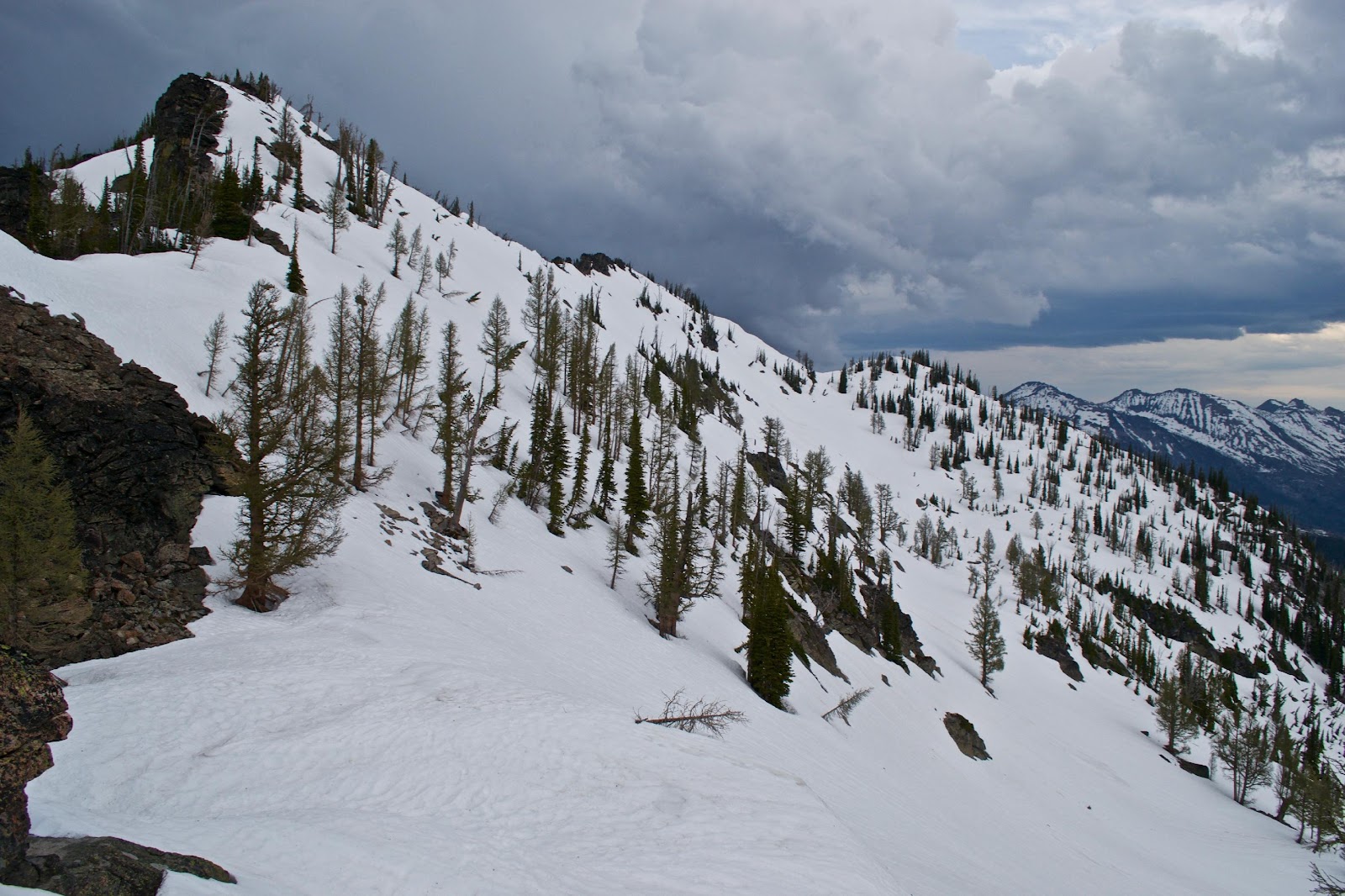
In the early afternoon I reached the base of El Capitan where I saw only a few viable routes up to the ridge where I would cross into the drainage where my target mountains lie. The ridge was on the right/north side of El Capitan. Purchase on the ridge was gained via two steep snow chutes and a steep snow exit (50-80 degrees). An ice axe was extremely helpful; crampons would have helped even more. I witnessed two ice dam breakages high on the east side of El Capitan. I would recommend not crossing too close to the east face when melting snow conditions occur.
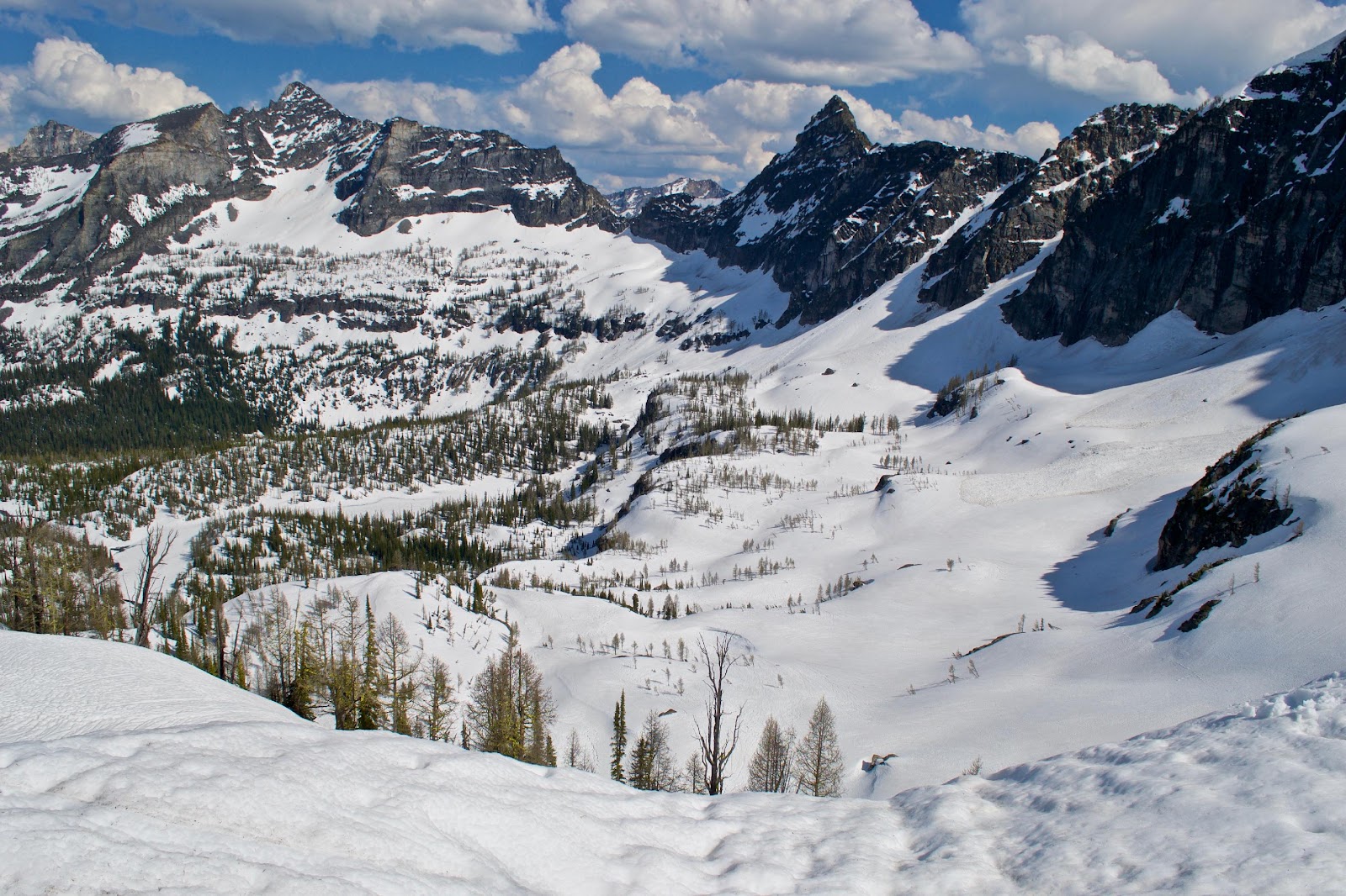
^A nice view while nearing the ridge to the north of El Capitan
Descending the otherside of the ridge was straightforward. The descent steepens as the snow melted, maxing out at about what felt like a 50 degree slope all along that whole mountainside (the only way up or down). There was plenty of vegetation to grab, but snow patches made it tricky.
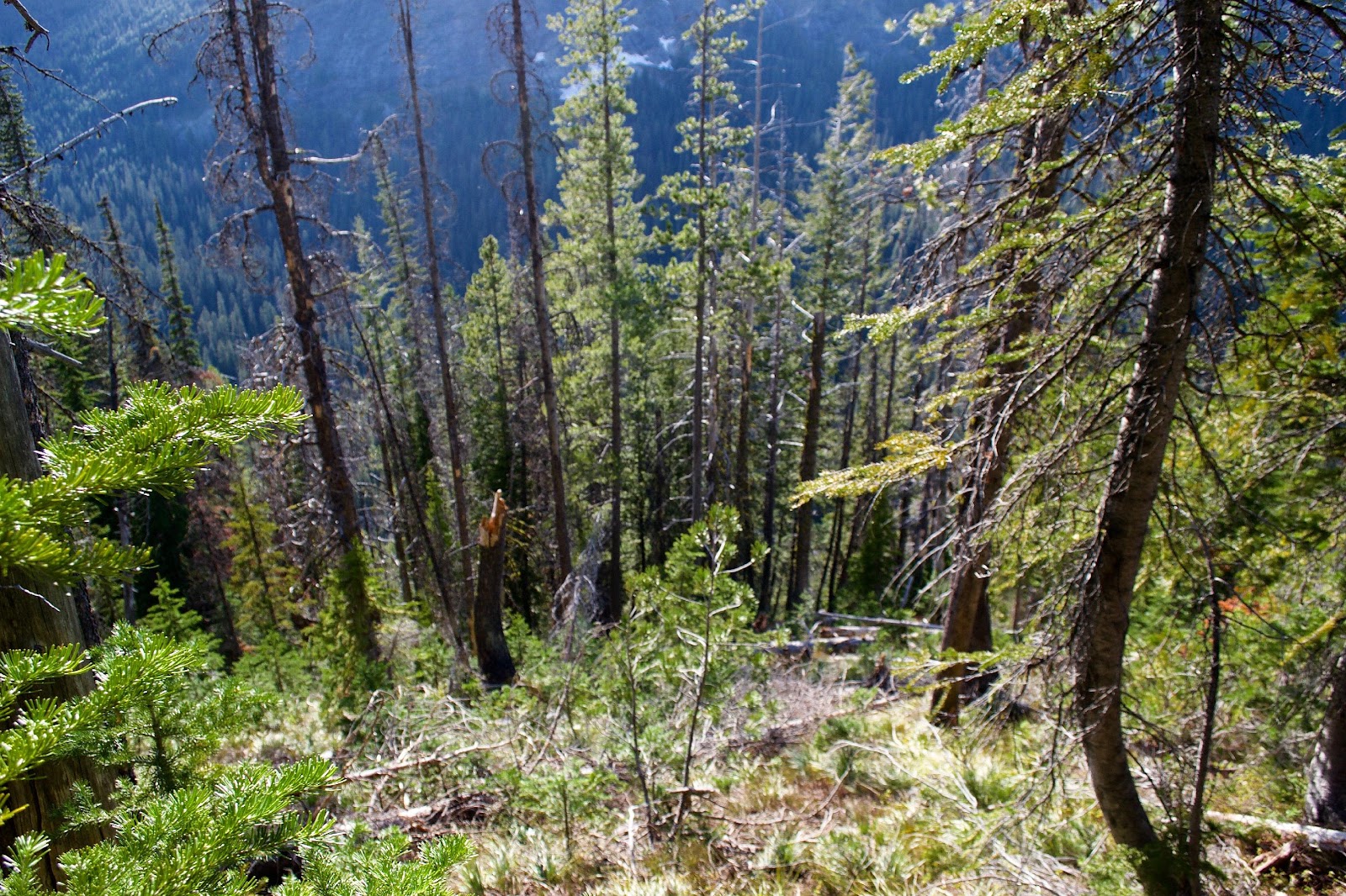
^A steep Descent
Reaching Captain creek at the bottom of the valley I realized this is a difficult crossing. I used paracord as a handrail to cross a log spanning the creek, but this was still shaky and with all the melting snow the creek was swollen and impossible to swim or wade safely. This is a dangerous crossing, at least during snowmelt season. I camped nearby the creek.
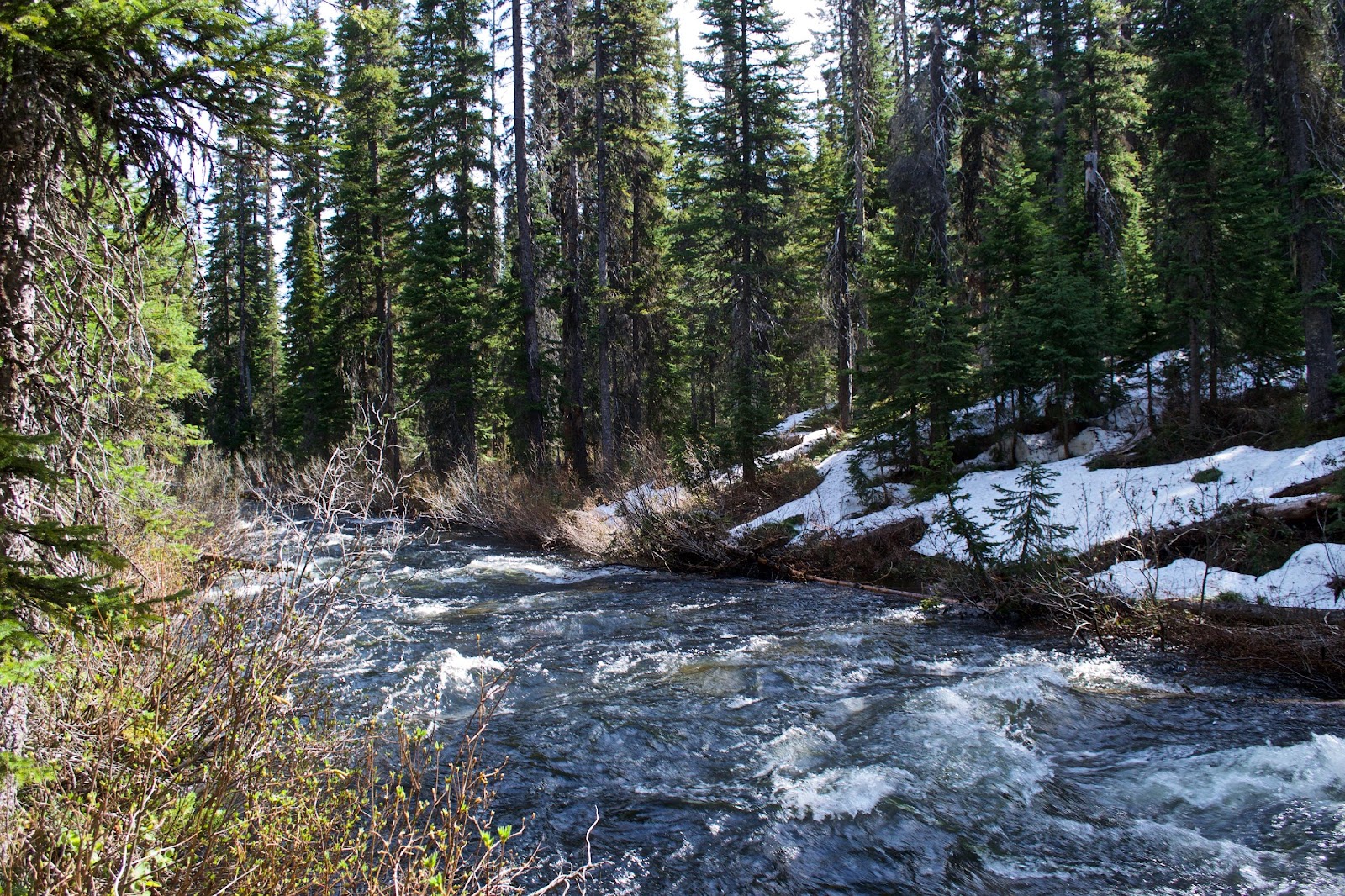
^A difficult crossing for Captain Creek
Wednesday
I followed a stream up to Lake Capitan. I found a trail along the way, but lost it when the snow covered the ground again. This trail was obviously man-mad, and sped up travel. I don’t know where it was leading to/from. Due to my slower than expected travel to get here I decided to aim for an easier peak first, and ditched my initially planned path.
I attempted a summit of Peak 8409 from the north pass, but a false summit deceived me into thinking I had enough daylight. The ridge to see the true summit was easily attained however. Meanwhile thunderstorms rolled in and I was forced to give up my pursuit of Peak 8409. I would not recommend this peak in late spring conditions unless you had a team prepared for mixed climbing while roped up.
As a consolation, I summitted an easier peak that is just north of Peak 8409. This peak was at 8280 ft and I named it Dawning Peak.
^Dawning Peak on the left. Standing on top of this alone was an amazing moment.
This was my first-first ascent and even though it wasn’t a peak I had planned on climbing, it was awesome. I camped at the base of it where I had left my camping gear earlier.
Thursday
It rained all night and into the morning. I delayed further summit attempts due to lightning. During a break in the storm I attempted a summit on Peak 8340. Soon the fog/clouds rolled in, but I still gained the summit and named it Sisyphean Peak. This was a fairly simple steep snow climb. Under unstable snow conditions an ice axe is required.
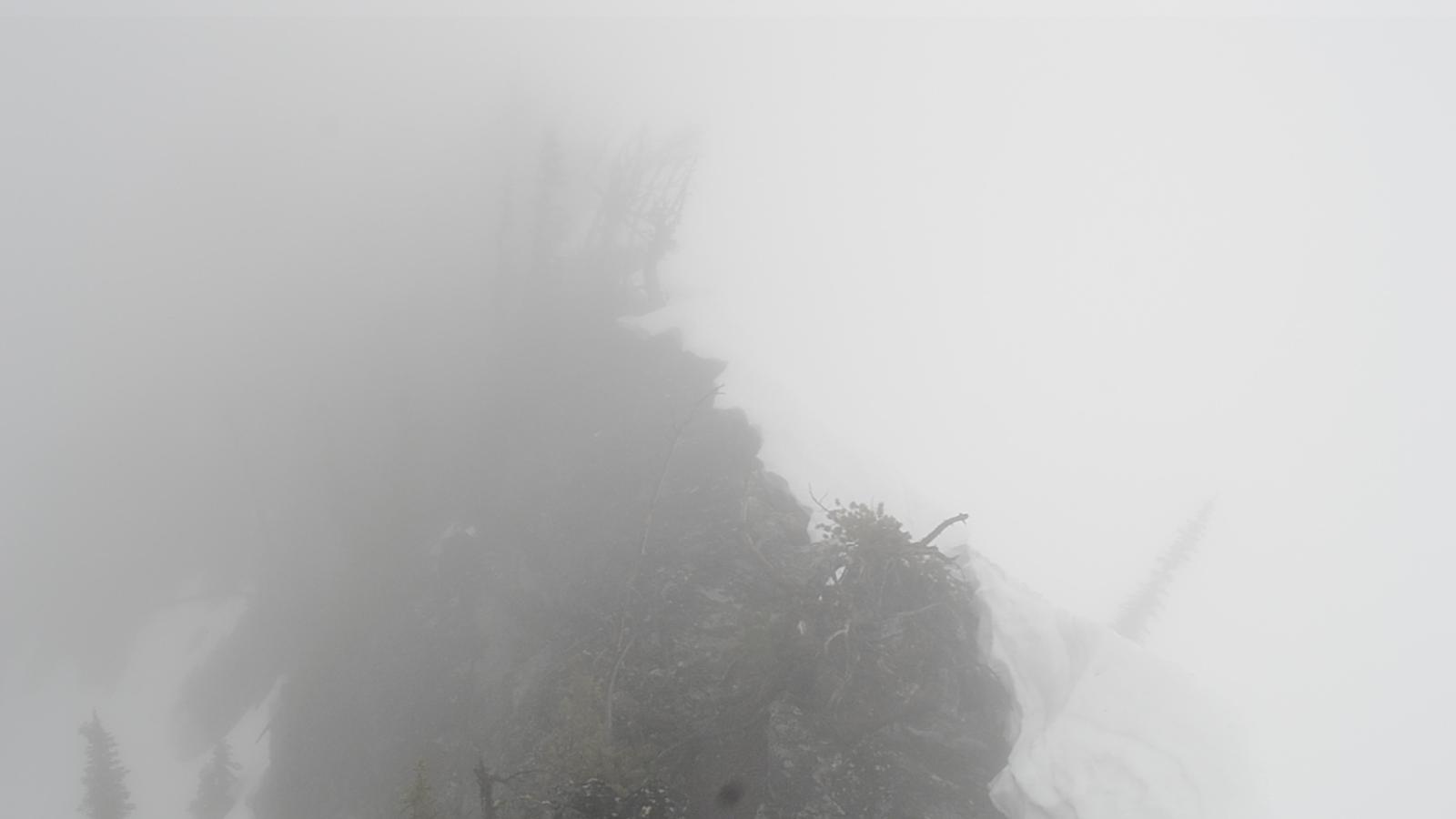
^The view from Sisyphean Peak.
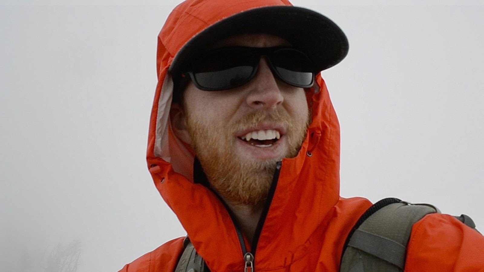
^Self-portrait on top of Sisyphean Peak
Due to more approaching lighting and thunder I descended back to camp. With only a day and a half to reach my trailhead and inform my emergency contact I was safe and not to send help, I had to return to Lake Como. The journey back was unbelievably wet and cold compared to the previous days. Again, the creek crossing was dangerous and the hill up to El Capitan was very steep. I camped at the base of the ridge back to Little Rock Creek drainage.
Friday
The ridge to the north of El Capitan was easier summiting from the west side, especially from a more northerly angle. After I descended the east side of the ridge I was set close to another unclimbed peak at elevation 8490ft. I had enough time at this point so I climbed back up the somewhat steep snow on the east face of Peak 8490 until gaining the northern ridge and summitted without too much trouble. I call this Taxwil Mountain (Taxwil is the local Nez Perce word for snow crust). About 50 yards to the northwest was another peak, which I also summitted by crossing a short ridge. I call this Pika Peak, since there was a pika on the summit. This summit was at 8453ft.
I continued back towards Lake Como via a more northerly route down to a few frozen lakes at the base of El Capitan. This wasn’t any easier than the way I had come, which was directly up the snow chutes. I think the best way to tackle this ridge is to look at the snow/rock conditions when your party is here as they probably change often.
From here I eventually found the trail and descended to my car at Lake Como. I had made four first ascents, but hadn’t made it nearly as far as I had planned within the time I allowed myself. My final route looked like this…
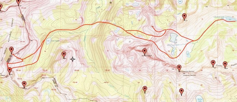
^My final path through the wilderness (I traveled east to west and then back east)
This trip was an amazing experience. I would love to make another journey back to this area with a team prepared for roped climbing in either the early spring or late summer. The snow conditions I encountered made certain aspects of the approach and climb difficult, and I believe with either consistent snowpack or bare rock the trip would go a lot smoother. I would also allot much more time with the difficulty of the approach encountered. The number of peaks in the area was also very exciting, and are a justification for additional time in themselves.
^Looking at unnamed mountains from Lake Capitan
Standing alone on top of unnamed peaks is one of the highlights of my life, and I now have the opportunity to show others growing up with arthritis that dreams are still attainable, and to never, ever, give up hope.

Comments
Post a Comment