Toggle navigation
Mountains
Routes
Images
Trip Reports
Forum
What's New
People
Areas & Ranges
Articles
Trailheads
Canyons
Huts & Campgrounds
Albums
Logistical Centers
Fact Sheets
Lists
Custom Objects
Gear
Plans & Partners
WELCOME TO SUMMITPOST
SIGN IN
REGISTER
Timassinine Point 1840+ (Moroccan Atlas)
Additional Parents
Image
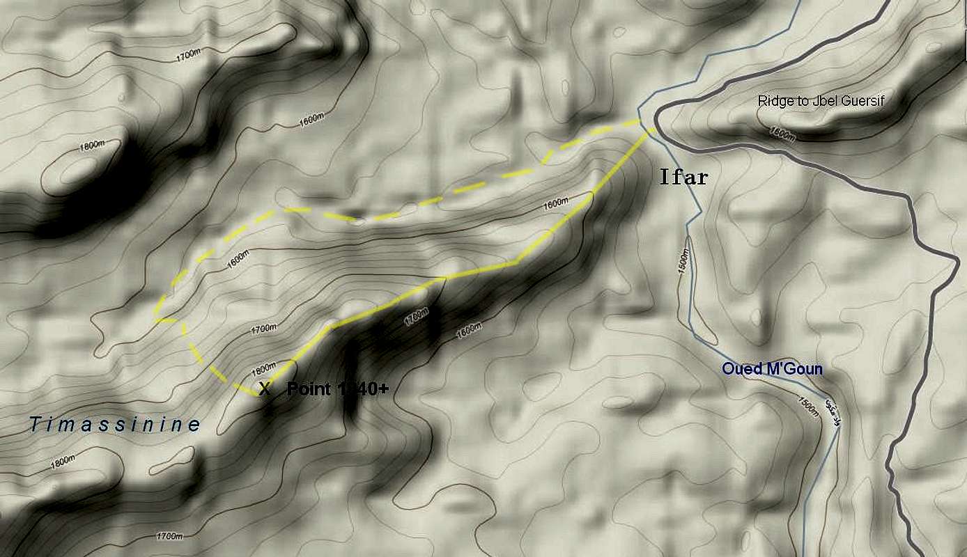
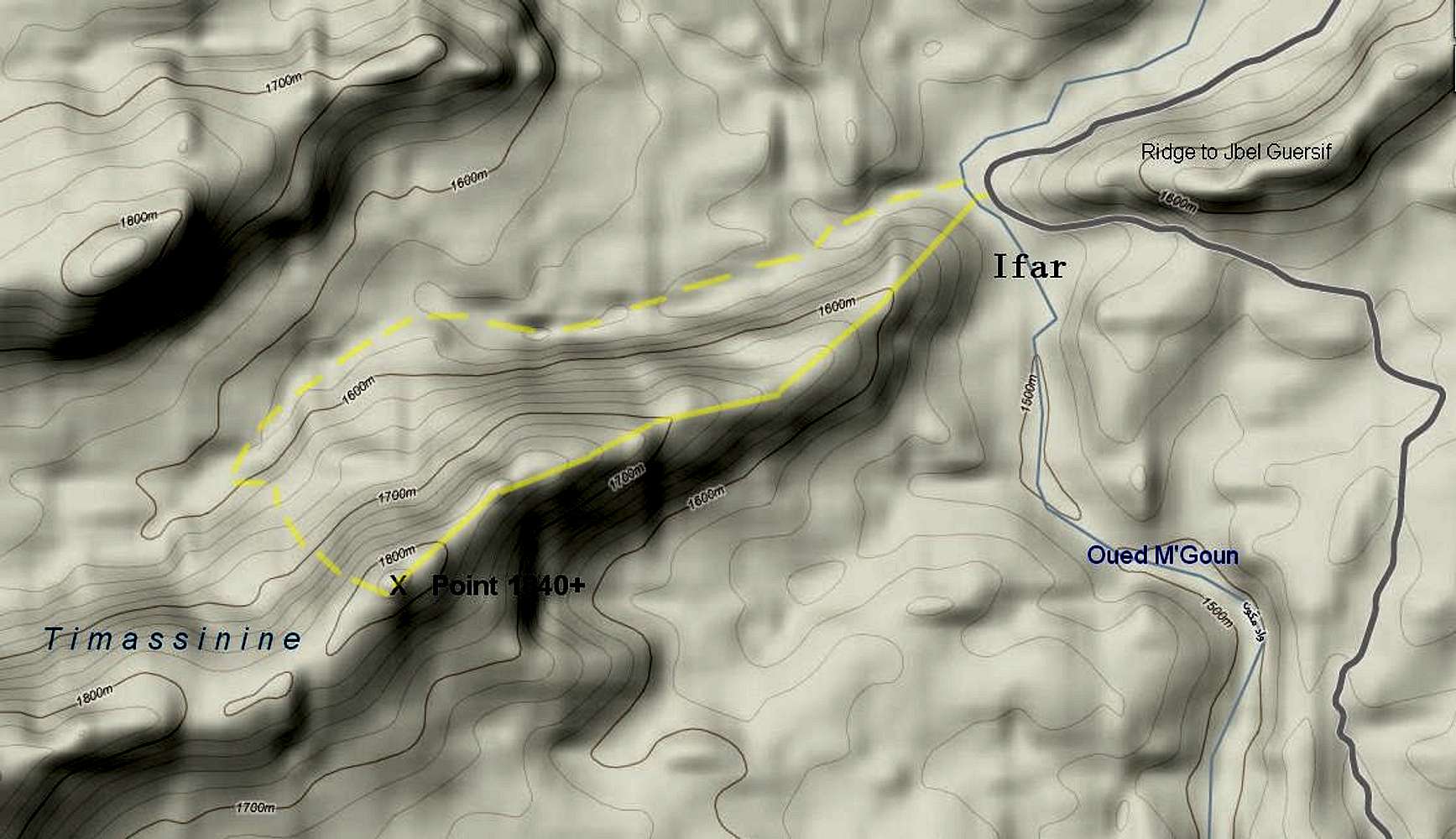
Timassinine Routes
View High-Resolution Image
Timassinine Routes
Solid Line: Basic ridge route to Point 1840+. Dashed line: Alternative route via wash.
« PREV
NEXT »
chugach mtn boy
on
May 14, 2012 1:59 am
Comments & voting
Other parents
Lat/Lon:
31.32607°N / 6.18839°W
Image Type(s):
Topo/Diagram
Image ID:
789947
845 Hits
72.08
% Score
2
Votes
Log in to vote
Comments
No comments posted yet.
to post!
Don't have an account?
Timassinine Point 1840+ (Moroccan Atlas)
(Mountain/Rock)
« PREV
Viewing
#13 of 13
GALLERY
You are at
the Last
Image
chugach mtn boy's Image Gallery
« PREV
Viewing
#664 of 713
GALLERY
NEXT »
×
You need to login in order to vote!
User Name
Password
Remember me
Forgot your password?
Log me out when I close my browser.
Keep me logged in all the time.
sign in as a user
Don't have an account?
Register now for FREE
Rating available
Suggested routes for you
People who climb the same things as you
Comments Available
Create Albums
Register Here


