-
 45047 Hits
-
 94.73% Score
-
 49 Votes
|
|
Area/Range |
|---|---|
|
|
Hiking, Mountaineering, Trad Climbing, Toprope, Bouldering, Scrambling, Skiing |
|
|
Spring, Summer, Fall, Winter |
|
|
12173 ft / 3710 m |
|
|
Overview
The Tushars are a volcanic mountain range in west-central Utah. They are the third highest range in Utah, behind the Uinta Mountains and the La Sal Mountains. The Tushars are usually not rugged, but they are often steep.
These peaks are among the easiest 12,000 foot peaks in Utah, Delano Peak is the only 12,000 foot peak in Utah that makes a reasonable one day ascent in mid-winter (most 12,000 foot peaks in Utah take several days to over a week in mid-winter).
Delano Peak is the highest peak in the range, but Mount Belknap, the second highest peak in the range, as well as Mount Baldy are probably the most impressive of the summits. The range is crossed by high roads, including Utah’s highest road at 11,676 feet elevation (Brigham Peak), so access is easy.
Utah's 12,000+ Foot Peaks With 200+ Feet Prominence
Utah's 12,000+ Foot Peaks With 300+ Feet Prominence
Access and Road Conditions
Highway 153 is the major road that crosses this mountain range. This road can be found by driving down the small main street of Beaver Utah to where a well visible sign points out the major turn up this road. Thanks to Eagle Point this road is plowed, during the daytime only, 22 miles (to Puffer Lake) during the winter months.
Introduction to Hiking and Climbing
The Tushars have many different mountain climbs, from rough scrambles to hikes with trails. The theme of the routes, however, is non-technical. There are very few suitable technical routes here, due to the crumbly nature of the rock, and the lack of cliffs in general. Most of the peaks in the Flat Tops are rounded and gentle, and can be steep, but usually not rugged. There are some nice extended backpacking trips, such as in the Blue Lake area south of Baldy and Belknap.
Delano Peak is by far the most popular ascent, followed by Mount Holly, Mount Belknap, and then Baldy Peak. The rest of the peaks seem to be seldom visited and receive very little attention.
Other popular activities in the range include hunting and fishing. Horseback riding is popular as well.
See the individual mountain pages for much more information on the peaks.
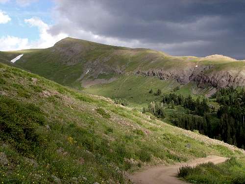
 Delano Peak in late August. This is the most popular peak in the range, but it isn't as steep or rugged as the other high elevation peaks in the Tushars.
Red Tape
Although thankfully most of the mountain range is untouched by red tape...there are still a few places where restrictions apply.
NO Camping and/or picnicking in the Merchant Valley.
NO Skiing Eagle Point (open or closed) without a day ticket.
NO Dirtbikes, ATV's ect....are allowed off-trail.
NO Camping in one place for more than 16 days.
The cabins around Puffer Lake are private property
Weather, Climate, and Seasons
The Tushar Mountains receive quite a bit of snow, about 450 inches on an average year. The normal hiking season for most climbers is from late June through early October. During the winter peaks such as Mount Baldy as well as Belknap are much harder to approach. However since highway 153 is plowed 22 miles in, peaks such as Delano, Holly, City Creek Peak, Lake Peak and Brigham are some winter favorites among climbers.
TUSHAR MOUNTAINS WEATHER FORECAST
Below is the climate summary for nearby Eagle Point Ski Resort at 10,450 feet elevation, and near the trailheads. These are all averages, so expect more variation, but this will give you a good idea about the climate at higher elevations in the area. *National Weather Service Data.
| MONTH | HIGH | LOW | PRECIP (in) | SNOWFALL (in) |
| JAN | 26 | 1 | 5.51 | 69.9 |
| FEB | 29 | 4 | 4.31 | 61.5 |
| MAR | 34 | 7 | 4.55 | 64.9 |
| APR | 43 | 14 | 3.88 | 45.7 |
| MAY | 52 | 21 | 3.65 | 23.6 |
| JUN | 63 | 30 | 1.19 | 3.0 |
| JUL | 69 | 38 | 2.38 | 0 |
| AUG | 67 | 36 | 2.92 | 0 |
| SEP | 61 | 28 | 2.11 | 4.8 |
| OCT | 50 | 19 | 1.73 | 17.6 |
| NOV | 36 | 9 | 2.57 | 35.2 |
| DEC | 27 | 3 | 3.66 | 48.8 |
Camping
Finding good campsites is not a problem in the Tushars, even on summer weekends. There are National Forest Campgrounds available such as Little Reservoir, Mahogany Cove and at Puffer Lake, but even then you don’t need a reservation on weekends. There are many primitive campsites available throughout the range. Please keep in mind that camping in the Merchant Creek Valley is not allowed (at least near the highway). Also, the Cottonwood Creek Campground is closed permanently.


vanman798 - Sep 19, 2024 4:09 pm - Hasn't voted
I think there is a higher roadThe page states, "The range is crossed by high roads, including Utah’s highest road at 11,500 feet elevation, so access is easy." I believe the road to Mount Brigham, is at 11,676 feet, making it the highest in Utah.
Scott - Oct 3, 2024 8:59 pm - Hasn't voted
Re: I think there is a higher roadI'm not familiar with that road, but can pick it up on Cal Topo and Sat. I can add the info. Is it open to the public?