
Comments
No comments posted yet.
|
|
Trip Report |
|---|---|
|
|
46.53022°N / 10.07277°E |
|
|
Download GPX » View Route on Map |
|
|
Jul 18, 2015 |
|
|
Hiking, Mountaineering, Scrambling |
|
|
Summer |
My summer vacation for 2015 went to the Alps, again, and part of it was spent in the town of Livigno in northern Italy. In the winter Livigno is a major skiing town that in the summer takes good advantage of the skilifts for hiking and especially mountainbiking (MTB). Many of the hiking trails have thus been optimized for MTB and the trails and surrounding scenery are great.
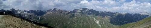
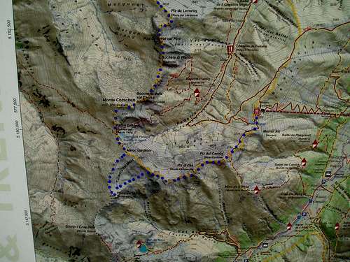
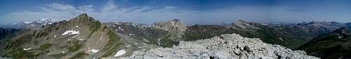
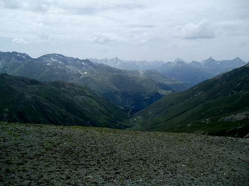
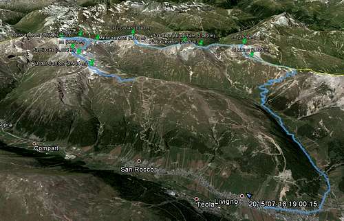
On one MTB trip I had taken the Carosello 3000 lift up from Livigno to the mountain ridge west of the town. From the ridge you have a great view of the next valley, Val Federia, the valley floor lying some 800 meters lower. When enjoying the view I noticed the row of mountains that surrounded Val Fedaria and wondered, if it was possible to hike/scramble around to all these, and thus more or less possible to walk all the way around Val Fedaria. My map (a somewhat crude hiking/MTB map that they sell in shops in Livigno) showed only trails on a very little part of the route, but from my viewpoint on the ridge it looked doable.I raced down into Val Fedaria on my MTB (great fun!) and later in the day studied better online maps (Livigno is on the border to Switzerland, and they have excellent online maps, https://map.geo.admin.ch, that also covers a part of the surrounding countries) and Google Earth and assessed that it should be possible to complete the trip. A trip that would cover 25-30 km's and cross up to 10+ summits with some of them just above the 3,000 m mark. Only one of them, Piz Cocian / Monte Cotschen, has a summitpost page. After doing the trip I decided to call it the "Val Federia Circuit" - but since I cheated and took the lift and didn't hike the full loop, maybe a more correct name would be "Val Federia Half Circuit"
The area is located on the Italian/Swiss border, so many of the mountains have two names. In the description I have used the one that is shown on the maps you can buy in Livigno – so I would assume these are the
Italian ones.
I packed a small backpack and hiked down to the Carosellolift so I was ready when it opened 8:30. There were obviously some mechanicalproblems with the lift this morning, so it was stop'n'go several times on theway up, and the trip ended up taking half an hour, where it usually only takes10-15 minutes. Still for only 10 euro it saved me from around 900 boring heightmeters up skiing slopes. But if you want to do the whole Val Fedaria loop, youshould off course not cheat and take this shortcut. Another disadvantage in taking the liftis that it doesn't open until 8:30, so a really early start is not possible.
The weather was great this morning with an almost clear bluesky, so during the lift ride it was just a matter of enjoying the view and acouple of marmots roaming the ski-slopes below the lift.
I was well aware that I had a long day with a lot of mountainsummits ahead of me, so I started out in a quite fast pace. First stop was Pizdal Canton (2,904 m). There was a goodkm or so on dirt road to the foot of the summit, and then 100 vertical metersup the mountain's north side. The first half was easy as there were some tracksof machines (guess they might be building yet another lift station here?),while the second half consisted of loose stones and loose gravel.
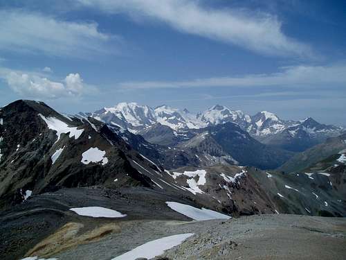
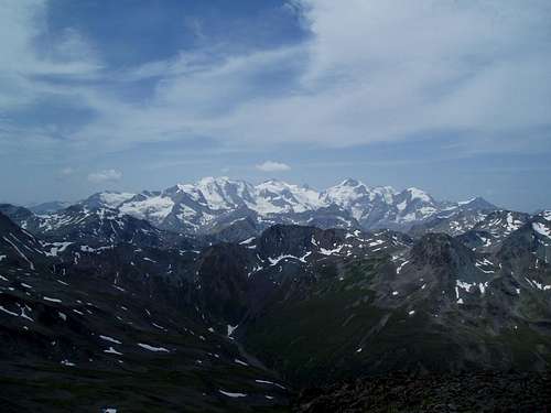
From the summit of Cantonthere was an excellent view of the Fedaria valley and the surrounding peaksthat lay ahead of me. Further away I could start to see some of the highermountains in the Bernina group.
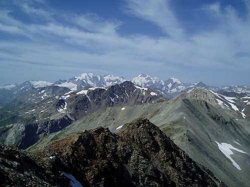
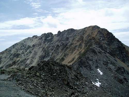
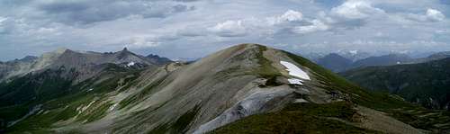
The next mountain was Piz di Ges (3,004 m) - this would be thefirst 3,000 m summit this day. The trip down from Canton was quite easy – mostly just loosedirt or a few rocks - while there were some simple scrambling (UIAA I) up to thesummit of Ges. The view towards the Bernina group just got better and better, asI ascended the northeast ridge of Ges.
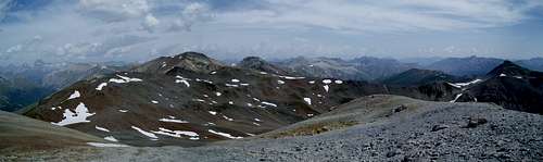
The marked hiking trails had ended at the foot of Canton and it would beanother 4-5 hours, until I would reach any marked routes again. There weren'teven any cairns along the ridge but on most ofthe summits there were small cairnsor piles of rocks that showed, I was not the first one to get there.
The Italians and Swiss had been too lazy to name the third summit(2,798 m)of the day. Maybe because it only rose some 50 meters above thesurroundings. There were no technical challenges in getting to the summitbesides a little block field.
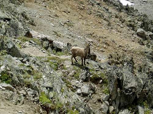
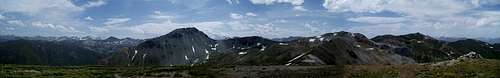
The fourth summit, Palon dal Mont (3,024 m), was somewhatharder for three reasons: (A) There was quite a distance to the foot of thesummit across the upper part of the Tucarela dal Mónt valley, (B) the routecrossed what seemed like an endless row of block fields mixed with a few snowfields and (C) the last 60-70 vertical meters up to the summit went through veryloose sand and gravel. On the positive side I found water along the way (Thiswas the only time during the whole trip along the mountain ridges that I foundrunning water), I spotted a mountain goat (ibex) and last but not least theview towards the Bernina group was perfect.
When hiking from unnamed"2.798" and Palon dal MontI tried to save some height and thus ended up crossing a lot of block fields.It might be easier just to directly between the two summits, or follow theridge all the way. The first will cost you 60-70 height meter but is around 400 m shorter. The secondwill cost you 80 height meter a be around 300 m longer compared to my route. Lastly, youcan also just choose to skip Palon dal Montsince it is not even located on the Val Fedaria rim …
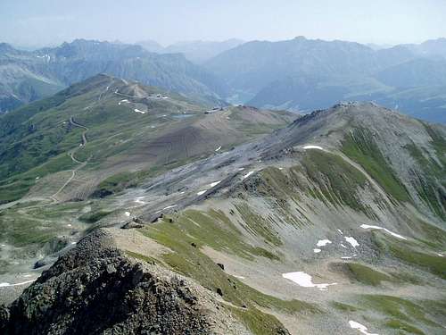
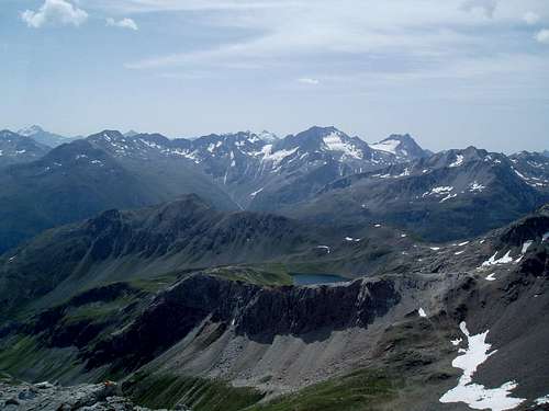
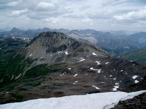
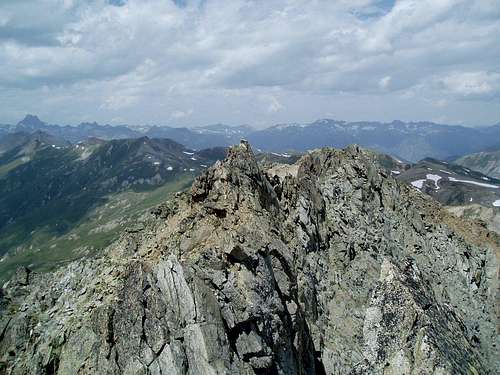
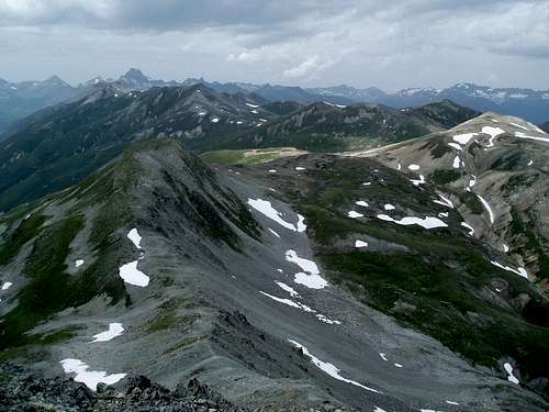
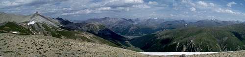
The fifth and sixth summits were yet another unnamed peak (2,998 m) and Matoc dal Mont (approximately 2,980 m). The unnamed peakwas simple, as I could just follow a broad ridge all the way up, while it was abit trickier to get over to Matoc, since I decided to leave the ridge to avoidhiking too much up and down but instead I had to traverse yet another blockfield. Possibly I should have just stayed on the ridge.The Tucarela dal Móntvalley with unnamed peak "2,998" m and Matoc dal Mont seen from thesummit of Palon dal Mont.
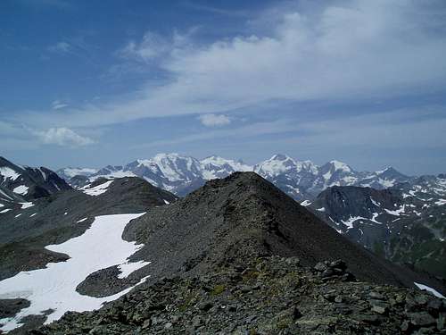
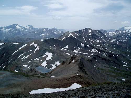
Unnamed peak "2,998" seen from Matoc dal Mont. I ended up traversing the slope on the side facing the snow field and that was rather crappy.
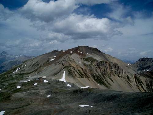
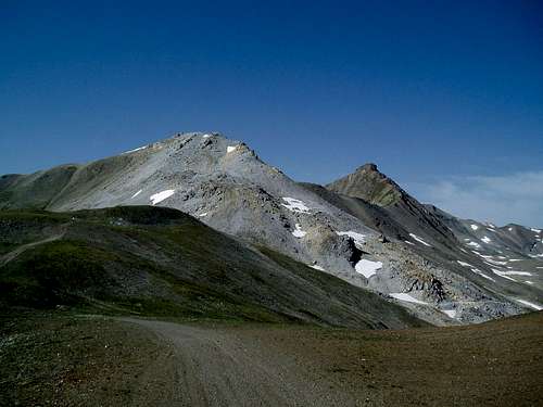
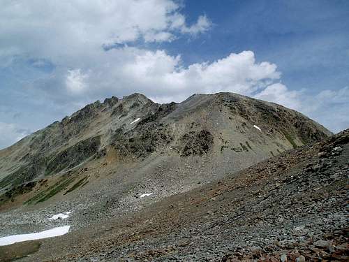
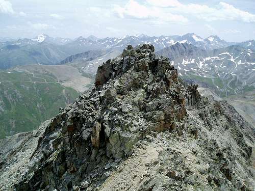
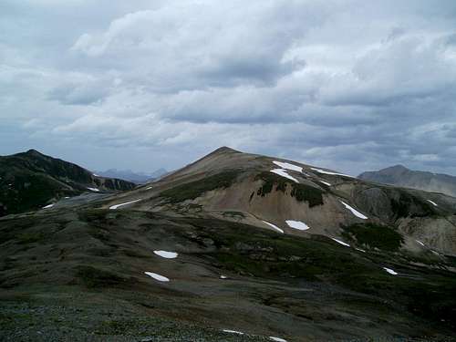
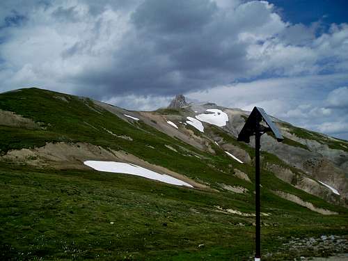
Piz Cocian seen from Matoc dal Mont
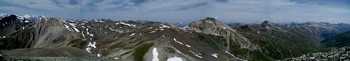
The seventh peak, Piz Cocian (3,103 m), was the highestof the day. From Matoc it went gently down to a small pass, where I found a closedup building, probably an old military structure, since I was walking exactly onthe Italian/Swiss border. From the pass there were 200 vertical meters to the summit.The first third was a large block field, the middle third (the best part) wassimple scrambling along the south ridge and the last third more block fieldsand loose ground. I hit the summit just around noon, and I had 3 hours and 7summits behind me already. I therefore dug the food out of the pack andmade a break for 15-20 minutes. I did not see many animals this day, but duringmy lunch break 4-5 swifts? were cruising around the summit.
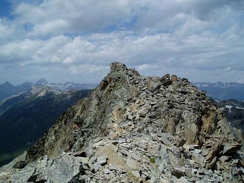
The eighth summit, Piza da la Val dal Forn (3,069 m), was by far themost technical of the day. At first I had to descend 200 vertical meters downfrom Cocian. I tried to follow the northwest ridge, but when it got too steep,I switched to the north face. Here I found a lot of loose scree/loose stones,but it made for a quick descend. Next up was approx. a 1 km traverse across a blockfield below a small mountain ridge. It might have been easier to just followthe ridge? And finally there were 200 vertical meters to the summit of Val dal Forn.
The first half (as usual by this stage) went up through blockfields and loose sand, while the second half finally provided some morechallenging scrambling (UIAA I-II) along the south ridge. Technically it wasnot particularly difficult and the rock was for once mostly good, but it wassomewhat exposed on both sides which sparked a little adrenaline. I reached afalse summit, and from here I could spot the true summit 50 meters further ahead.
In the morning the sky had been almost cloudless, but duringthe day more and more clouds had moved in, and especially to the north it wasstarting to look dark. I therefore only stayed on the summit for a short while inorder not to be too exposed, if the weather turned worse.
The ninth summit, Piza da Leveron (approximately 2,945 m), was actually justa small knoll on the descend from Forn. The descend from Forn offered more scrambling,but it was easier than the climb up. The biggest challenge was almost that the mountaingoats had made the face of the mountain very slippery, since they had knockedso many stones away that only rock faces with a little sand on top was left. I thereforestayed near the north ridge, where the rocks were more intact.
On the way down from Leveron I met the first hikers thisday; two women who had hiked up from Livigno. So if you prefer solitude in themountains, this route is a good option!
The tenth and eleventh summits were yet an unnamed peak "2,917"and Al Matoc (2,823 m).The trip down from Leveron at first went steeply down through a block field(last one of the day, finally!), but then the terrain levelled out and the two peakswere either covered by grass or open sand surfaces. The view, however, wasstill brilliant against deep valleys on the Swiss side of the border and multi-coloredhillsides on the Italian side.
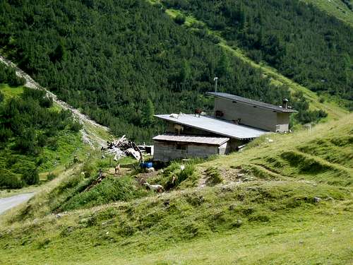
From the last summit it was smooth cruising down to a pass(Bocheta da Casciana) with yet another military building. From the pass it waspossible to follow a good hiking trail down past the Casciana refuge (closeduntil August) and into Val Fedaria. I had originally aimed at bagging 2-3 summitsmore, but the detour to Palon dal Monthad taken too long, clouds were still rolling in and finally I must admit thatby now my legs were getting tired. Furthermore, even following the trail intothe valley, it would still be almost 2 hours to Livigno. So, after I quickevaluation, mind+legs beated ambition.
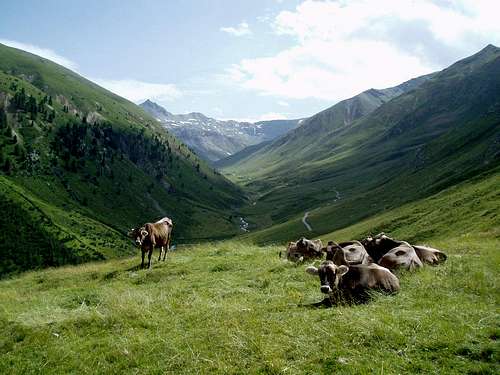
I descended on a steep trail down past the Casciana refugeand to the floor of the Fedaria valley. On the way I passed a women collectingberries, cows enjoying the view and goats doing what goats do.
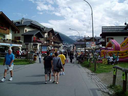
The trip back to Livigno first went along a small stream ona good hiking path, and then all the way through the centre of Livigno. This lateSaturday afternoon Livogno was packed with tourists. Undeniably something differentthan the desolate mountains just 5 km's away.
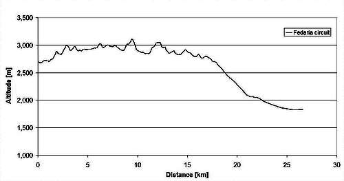
Back at the apartment my GPS said: 8 hours, 27.5 km's, 1,440 verticalmeters up and 2,320 metersdown. I guess an average speed of 3.5 km/hour including breaks is quite ok sinceabout 1/2 of the trip was outside the trails. The circuit was clearly one ofthe best hikes this summer and can be recommended if you want to something different than just strolling around near the lifts and cable cars.