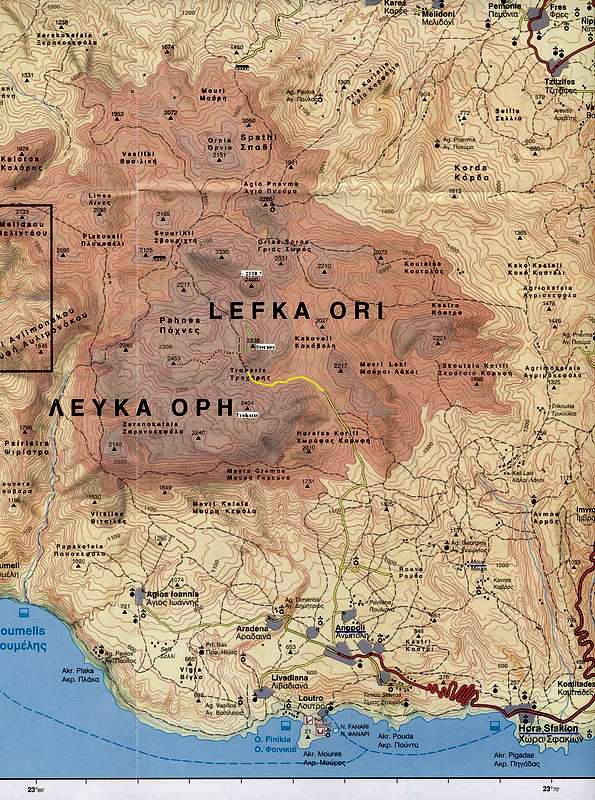
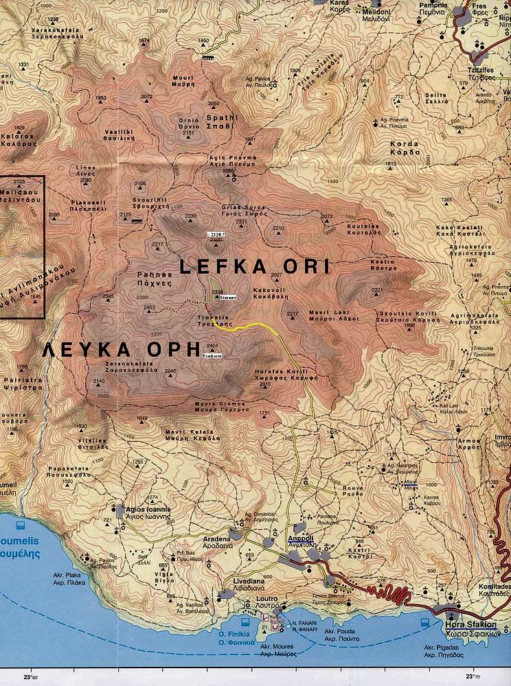
I found this map
here. Unfortunately I did not have it with me on the trip. The one I had was inaccurate and confusing, especially with the course of the gravel road and the place where it ends. In effect I ended up climbing Sternes instead of Troharis in the fog.
Yellow - gravel road (asphalt ends just north of Anopoli). Red - path marked red, probably continues further north. Brown - cairned path. Green - my route to Sternes and further, in search for 'the summit of Troharis' in the fog; unmarked. According to the map I had, the end of the road was SSW of Troharis. Town and village names underlined in blue are mentioned in the trip report.
I made the corrections according to the 1:25000 map I bought later.


