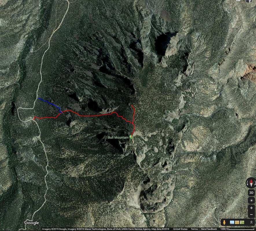
The red line depicts the route I took, from the pulloff just after the road rounded a hilltop. The blue line represents another route possible from a cattle guard crossed earlier.


