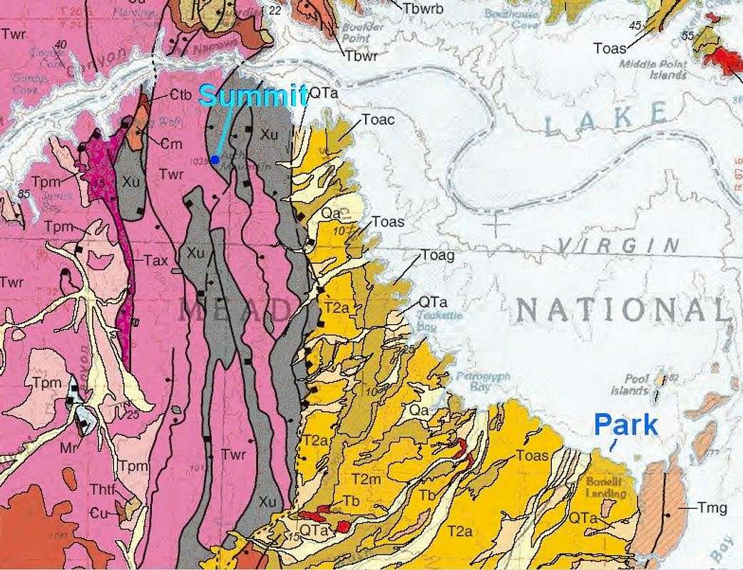
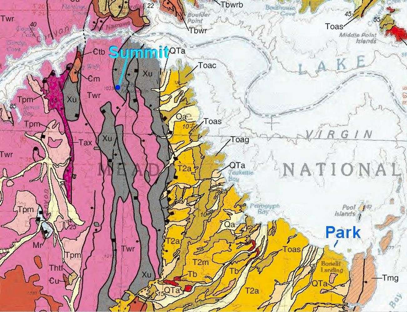
The Twr (pink) designates the Miocene Wilson Ridge Intrusives (granites to basalts). The Xu (gray) consists of gneisses. The Toag (brown) is made of gypsiferous sediments, manifest as cliffs at lake level.
Correlate place names with the 100k Topo given in the same article.
From:
Beard, L.S. et al. (2007) Preliminary Geologic Map of the Lake Mead 30’ x 60’ Quadrangle, Clark County, Nevada, and Mohave County, Arizona. USGS Open-File Report 2007-1010. (available online at the
USGS Publications Warehouse.)


