Toggle navigation
Mountains
Routes
Images
Trip Reports
Forum
What's New
People
Areas & Ranges
Articles
Trailheads
Canyons
Huts & Campgrounds
Albums
Logistical Centers
Fact Sheets
Lists
Custom Objects
Gear
Plans & Partners
WELCOME TO SUMMITPOST
SIGN IN
REGISTER
Druid Peak
Additional Parents
Image
Area Map
View High-Resolution Image
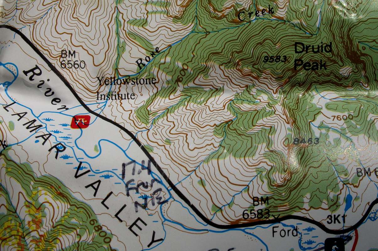
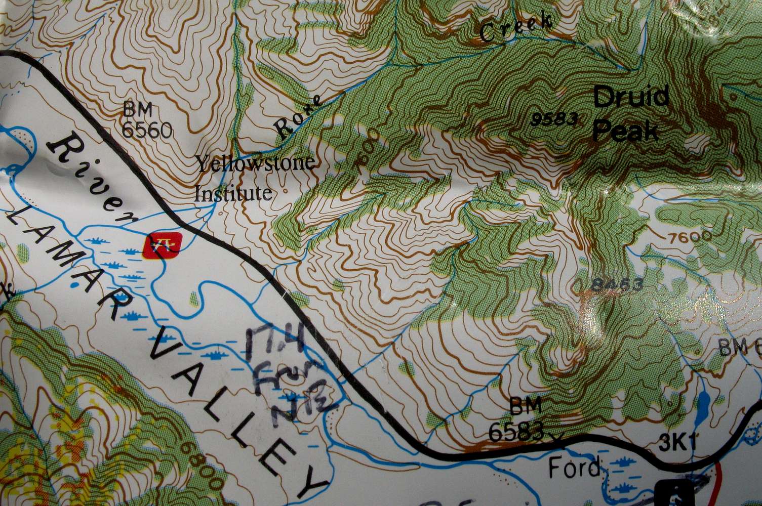
Area Map
Shows the southwest slopes route for Druid Peak, and the potential south slopes route as well. This image is a portion of my Earthwalk Press Yellowstone National Park map. The contour intervals are 80'.
« PREV
NEXT »
Bob Sihler
on
Aug 12, 2010 9:52 pm
Comments & voting
Other parents
Image Type(s):
Topo/Diagram
Image ID:
648500
2204 Hits
73.06
% Score
3
Votes
Log in to vote
Comments
No comments posted yet.
to post!
Don't have an account?
Druid Peak
(Mountain/Rock)
« PREV
Viewing
#16 of 17
GALLERY
NEXT »
Bob Sihler's Image Gallery
« PREV
Viewing
#4148 of 6982
GALLERY
NEXT »
×
You need to login in order to vote!
User Name
Password
Remember me
Forgot your password?
Log me out when I close my browser.
Keep me logged in all the time.
sign in as a user
Don't have an account?
Register now for FREE
Rating available
Suggested routes for you
People who climb the same things as you
Comments Available
Create Albums
Register Here


