
-
 23924 Hits
-
 83.1% Score
-
 16 Votes
|
|
Mountain/Rock |
|---|---|
|
|
50.11435°N / 123.22093°W |
|
|
Scrambling |
|
|
Summer |
|
|
7260 ft / 2213 m |
|
|
Overview
Brandywine Mountain is about the easiest scramble you'll find in the Lower Mainland BC. Relative is the operative term, because it's still not easy, but compared to the jagged, icy, and imposing peaks surrounding the mountain, it is very accessible. The Brandywine Meadows are a reward in and of themselves, but for those with the energy and ambition, the summit of Brandywine lies 2,100 feet above on largely good cross-country terrain. Once past the col, the climb is a delightful mixture of heather trails and snow slopes leading to amazing views of Garibaldi Provincial Park and the Whistler area. Note: All photos taken on this day were obscured by widespread wildfires. Views should be better than this on a clear day.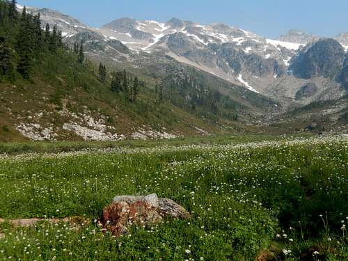
Beautiful Brandywine Meadows
Getting There
All directions are for the upper parking lot. The lower lot is easier to access with 2WD vehicles, but the climb is much less enjoyable. The access road will help to determine your success on this excursion. Bring a 4-wheel high clearance vehicle to park at the upper parking lot. Doing this shaves off over 1,000 feet of elevation gain through some the of most slippery, dangerous forest you can imagine. You don't want to be sliding down this section after being exhausted on the mountain. Driving north on BC-99 from Vancouver, find the Callaghan Valley Road north of Brandywine Falls Provincial Park and turn left. Take the quick left on the Brandywine Meadows road, and follow 2.9 miles to a three-way fork. Take the middle road, BR10, for another 1.3 miles and head right at a fork which indicates that the trailhead parking lot is 2 km to the left (this is to the lower parking area). Head up the extremely steep, rocky, and dusty road, passing at least 10 nasty water bars. Take this road to the end. This is a hard road. Do not bring low-clearance vehicles. Park the car in the very generous parking lot, elevation 4,337 feet.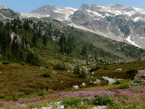
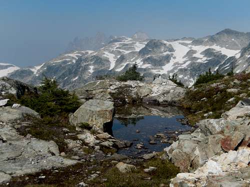
Brandywine Meadows
The heather ramp up Brandywine
Route
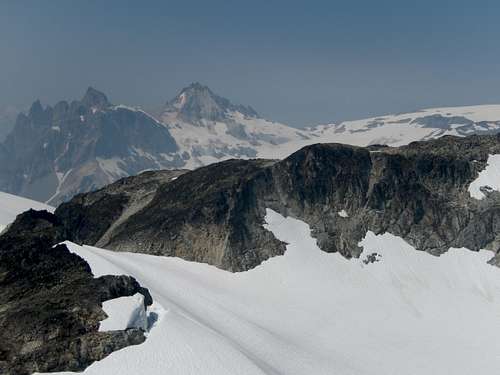
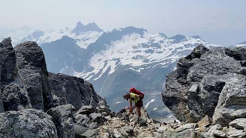
In high summer season, apply the DEET here. The lush meadows are only a short 500 feet above, and the flies will attack you immediately outside the car. Hike the very good trail about 1/2 mile and reach the open meadows. They are lush, coursing with numerous braided streams, and a worthy destination just by themselves. Take the trail to the head of the valley about 100 yards south of a semi-permanent snowfield. Find a good boot path heading NW on a heather ramp on the other side of the creek and start climbing straight up. Gain the SW Col of Brandywine (6,348 feet). Go over the col, and find a trail of loose rock heading up the climber's left side of the ridge. Climb about 300 feet to the top of the ridge, and find a delightful heather trail staying on top of the ridge. At points, it will be easier to walk at the top margin of the glacier and regain the ridge when down climbing is necessary. And what a view! The spires of Mt. Fee rise dramatically to your SW. Black Tusk and Garibaldi are to your SE. The Whistler area is to your north. The Tantalus Range is to your south.Follow the ridge up rock and snow. At first, the ascent looks steep (snow and rock, seemingly blocked by a gendarme), but the angle lays back, and the gendarme is nothing at all. Climb the final snow slope to sharp rock blocks, and climb another 300 feet to the summit at 7,260 feet.
Trip Stats: Elevation gain, about 3100 feet with ups and downs. Distance, about 7 miles roundtrip. Difficulty, Class 2.
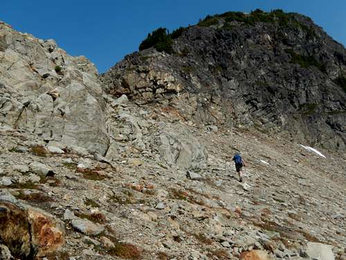
Climbing to the SW Col
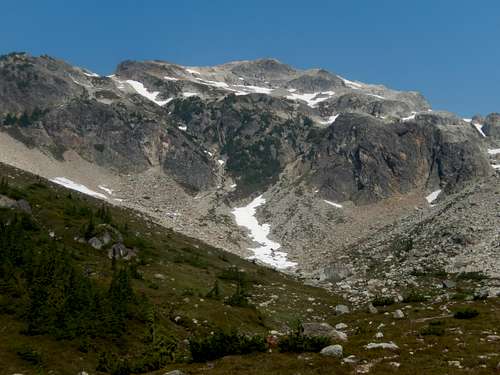
Views from SW Col, Brandywine Mountain
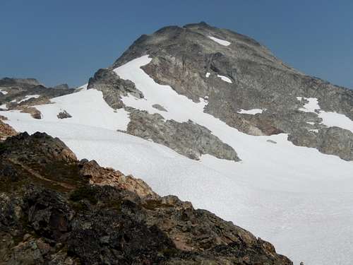
Summit of Brandywine from Glacier
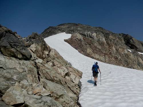
Climbing the West Ridge of Brandywine
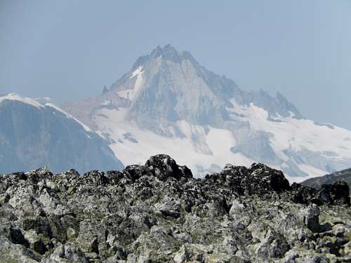
Smokey Ridge Views of Mt. Cayley from Brandywine Mountain
Summit Views on Brandywine Mountain
When to Climb
Summer is best for wildflowers and weather. Spring is a possible season for those accustomed and comfortable on snow. Fall would be delightful without the bugs, and there should still be abundant water.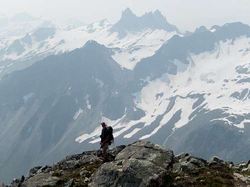
Views on Brandywine Mountain
Downclimbing from Brandywine Mountain